111582152670

Mungili Rock Holes
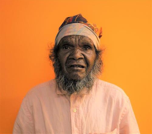
“Mungili rock hole, big rock hole, big country. I never see that place. My mother born, her and grandmother walk through there, they tell me story. Mother born there in the Country Mungili, walking through the bush. There is a camping spot, camping in bush – bush, bush, bush [points at painting] this is the lake Country and goes through there.”
– Matthew Mintern Smith
Mungilli is a small outstation community located just off the Eagle Highway in Western Australia, approximately 430 kilometres north east of Wiluna and 250 kilometres north of Warburton. Matthew grew up near Mungilli, and as such it forms a significant part of his ‘ngurra’ (home Country, camp).This work depicts a rock hole within Matthew’s ngurra (home Country, camp), typically Matthew depicts this site with a central large circular form, surrounded by satellite circles for water bodies.
During the pujiman (traditional, desert dwelling) period, knowledge of water sources was critical for survival, and today Martu Country is still defined in terms of the location and type of water. Each of the hundreds of claypans, rockholes, waterholes, soaks and springs found in the Martu desert homelands is known through real life experience and the recounting of Jukurrpa (Dreaming) narratives by name, location, quality and seasonal availability. This encyclopedic knowledge extends even to the nature and movement of arterial waterways, and sustained Martu as they travelled across their Country, hunting and gathering, visiting family, and fulfilling ceremonial obligations. They would traverse very large distances annually, visiting specific areas in the dry and wet season depending on the availability of water and the corresponding cycles of plant and animal life on which hunting and gathering bush tucker was reliant.