111581836564


Kulyakartu

“My Country, Kulyakartu. I grew up there, from little boy to big boy grew up there.”

 – Muuki Taylor

This painting depicts Kulyakartu, Muuki’s ngurra (home Country, camp). Kulyakartu is located in the far north of the Martu homelands, near the Percival Lakes region of Western Australia’s Great Sandy Desert. Muuki has extensive knowledge of the Country in this region, where he grew up living traditionally during the pujiman (traditional, desert dwelling) days with his family. Kulyakartu is mostly grass Country where there is very good hunting. In particular parnajarrpa (goanna), wild cats, and lunki (witchetty grub) are found in abundance here. There is no permanent water source in Kulyakartu, so Muuki’s family would walk here annually following the wantajarra (wet season). During the yalijarra (hot, dry season) they would head south again to more permanent water.

Muuki paints Kulyakartu in all its different seasonal stages. Often visible in his work is the patchwork nature of regrowth subsequent to the practice of waru (fire) burning that assists with hunting, regenerates growth, and encourages greater diversity in plant and animal life. This mosaic patterning is aligned with the five distinct Martu cyclical phases of burning and regrowth. First is nyurnma (freshly burnt Country) when Muuki is “making waru”. Following nyurnma are the rains and subsequent waru-waru, when young, bright green plants start to grow. Nyukura occurs between one and three years after burning, when plants have matured and are fruiting and seeding. Manguu is “when him finished”, four to six years post burning, and when spinifex has matured to the point that it can be burned once again. Finally, kunarka signifies the time when spinifex and other plant species have become old growth, and pose a risk of destructive bushfires.

111581836562


Untitled

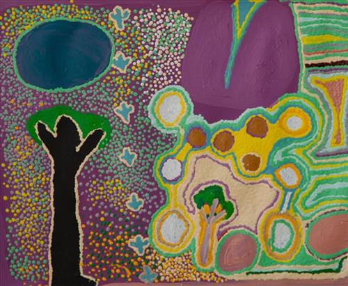
This canvas was painted as part of the Martumili Kuulkaja (Martu Schools) exhibition, a project designed to engage and celebrate the schools of the remote Martu communities.


This painting portrays physical elements of Martu Country, such as the dominant tali (sandhills), warta (trees, vegetation), and water sources. Rock holes, waterholes, soaks and springs were all extremely important sites for Martu people during the pujiman (nomadic bush) era, with many important jukurrpa (dreamtime stories) chronicling the creation of these landmarks. In the past the Martu lived nomadically, moving from water source to water source, and hunting and gathering bush tucker as they went. They would traverse very large distances annually, visiting specific areas in the dry and wet season depending on the availability of water. As they travelled and hunted they would also burn areas of country creating a larger diversity of plant and animal life.

111581836417


Karlamilyi

“Karlamily after the rain; nice green grass beautiful flowers, smell of the rain hitting the red dirt, I miss going back. I grew up hunting there. When the river runs that’s when the fish come, once a year, cyclone time. In the river there’s a big pool and big dead gum tree, we swing rope from there to the pool and from the rocks to the deep pool.”

– Ignatius Taylor

111581836649


Untitled

This work portrays an area known intimately to the artist, painted here in exquisite detail from memory. During the pujiman (traditional, desert dwelling) era one’s survival depended on their intimate knowledge of the location of resources; thus physical elements of Country, such as sources of kapi (water), tali (sandhills), and different varieties of warta (trees, vegetation) were carefully observed and remembered. Today, this relationship with Country remains equally strong, despite the movement of Martu out of the desert and into remote Aboriginal Communities, towns and cities.

Also visible may be traces of life cycles based around kalyu (rain, water) and waru (fire). A thousands of year old practice, fire burning continues to be carried out as both an aid for hunting and a means of land management today. As the Martu travelled and hunted they would burn tracts of land, ensuring plant and animal biodiversity and reducing the risk of unmanageable, spontaneous bush fires. The patchwork nature of regrowth is visible in many landscape works, with each of the five distinctive phases of fire burning visually described with respect to the cycle of burning and regrowth.  

Finally, metaphysical information relating to a location may also be recorded; Jukurrpa (Dreaming) narratives chronicle the creation of physical landmarks, and can be referenced through depictions of ceremonial sites, songlines, and markers left in the land. 

111581836648


Untitled

“When Martu paint, it’s like a map. Martu draw story on the ground and on the canvas, and all the circle and line there are the hunting areas and different waters and tracks where people used to walk, and [some you] can’t cross, like boundaries. So nowadays you see a colourful painting and wonder what it is, but that’s how Martu tell story long ago. It’s not just a lovely painting, it’s a story and a songline and a history and everything that goes with it.” 

– Ngalangka Nola Taylor and Joshua Booth

This work portrays an area of Country that can be interpreted in multiple ways. Firstly, the image may be read as an aerial representation of a particular location known to the artist- either land that they or their family travelled, from the pujiman (traditional, desert dwelling) era to now. During the pujiman period, Martu would traverse very large distances annually in small family groups, moving seasonally from water source to water source, and hunting and gathering bush tucker as they went. At this time, one’s survival depended on their intimate knowledge of the location of resources; thus physical elements of Country, such as sources of kapi (water), tali (sandhills), different varieties of warta (trees, vegetation), ngarrini (camps), and jina (tracks) are typically recorded with the use of a use of a system of iconographic forms universally shared across the desert. 

An additional layer of meaning in the work relates to more intangible concepts; life cycles based around kalyu (rain, water) and waru (fire) are also often evident. A thousands of year old practice, fire burning continues to be carried out as both an aid for hunting and a means of land management today. As the Martu travelled and hunted they would burn tracts of land, ensuring plant and animal biodiversity and reducing the risk of unmanageable, spontaneous bush fires. The patchwork nature of regrowth is evident in many landscape works, with each of the five distinctive phases of fire burning visually described with respect to the cycle of burning and regrowth.  

Finally, metaphysical information relating to a location may also be recorded; Jukurrpa (Dreaming) narratives chronicle the creation of physical landmarks, and can be referenced through depictions of ceremonial sites, songlines, and markers left in the land. Very often, however, information relating to Jukurrpa is censored by omission, or alternatively painted over with dotted patterns.

111581836647


Tiyu Rockhole

“Tiyu rockhole in the middle here. Warta (vegetation, tree) there, in the parna (ground, earth).”

– Ngarga Thelma Judson


Tiyu is a rockhole in the sandy Country of the Percival Lakes region that forms part of Ngarga’s ngurra (home Country, camp). The rockhole is surrounded by a number of claypans that fill during the wantajarra (wet season).

The Percival Lakes form a string of ephemeral salt lakes in the north of Western Australia, extending across a distance of 350km. They lie at the southern region of the Great Sandy Desert and east of the Karlamilyi (Rudall River) region. The Canning Stock Route runs in close proximity to some of the lakes, and crosses the salt pan of Tobin Lake near the eastern end.

This region was formed by Wirnpa, one of the most powerful of the ancestral jila (snake) men and the last to travel the desert during the Jukurrpa (Dreaming). Wirnpa is a rainmaking jila who lived and hunted in the Percival Lakes area. His travels are described in the songs and stories of many language groups across the Western Desert, even those far removed from his home site. In his epic travels, Wirnpa met and feasted with many other ancestral beings, exchanged ceremonial objects, and created a series of different laws and ceremonies. When he finally returned home, he searched for his many children only to discover that they had already died. They had laid down and become the salt springs of the Percival Lakes. Wirnpa wept for his children before himself transforming into a snake and entering the soak where he still resides.

111581836644


Untitled

“When Martu paint, it’s like a map. Martu draw story on the ground and on the canvas, and all the circle and line there are the hunting areas and different waters and tracks where people used to walk, and [some you] can’t cross, like boundaries. So nowadays you see a colourful painting and wonder what it is, but that’s how Martu tell story long ago. It’s not just a lovely painting, it’s a story and a songline and a history and everything that goes with it.” 

– Ngalangka Nola Taylor and Joshua Booth

This work portrays an area of Country that can be interpreted in multiple ways. Firstly, the image may be read as an aerial representation of a particular location known to the artist- either land that they or their family travelled, from the pujiman (traditional, desert dwelling) era to now. During the pujiman period, Martu would traverse very large distances annually in small family groups, moving seasonally from water source to water source, and hunting and gathering bush tucker as they went. At this time, one’s survival depended on their intimate knowledge of the location of resources; thus physical elements of Country, such as sources of kapi (water), tali (sandhills), different varieties of warta (trees, vegetation), ngarrini (camps), and jina (tracks) are typically recorded with the use of a use of a system of iconographic forms universally shared across the desert. 

An additional layer of meaning in the work relates to more intangible concepts; life cycles based around kalyu (rain, water) and waru (fire) are also often evident. A thousands of year old practice, fire burning continues to be carried out as both an aid for hunting and a means of land management today. As the Martu travelled and hunted they would burn tracts of land, ensuring plant and animal biodiversity and reducing the risk of unmanageable, spontaneous bush fires. The patchwork nature of regrowth is evident in many landscape works, with each of the five distinctive phases of fire burning visually described with respect to the cycle of burning and regrowth.  

Finally, metaphysical information relating to a location may also be recorded; jukurrpa (dreaming) narratives chronicle the creation of physical landmarks, and can be referenced through depictions of ceremonial sites, songlines, and markers left in the land. Very often, however, information relating to jukurrpa is censored by omission, or alternatively painted over with dotted patterns.

111581836643


Tali, Tuwa (Sandhills)

The traditional lands of the Martu people encompass the Great Sandy Desert and Rudall River regions of Western Australia, an enormous tract dominated by distinctive red tali, or tuwa (sandhills). These sandhills present an unforgiving landscape; sparse vegetation covers a seemingly never ending expanse of dunes, and yet these lands and the location of resources within them was known intimately by its pujiman (traditional, desert dwelling) inhabitants. At this time, Martu traversed very large distances annually in small family groups, moving from water source to water source through the harsh desert landscape with incredible stamina and resourcefulness. Travel was often undertaken at night, and when travelling during the day, Martu wore yakipiri (woven bark sandals) to protect their feet from the hot desert sand.

111581836640


Punmu Hill

This painting portrays physical elements of Martu Country, such as the dominant tali (sandhills), warta (trees, vegetation), and water sources. Rock holes, waterholes, soaks and springs were all extremely important sites for Martu people during the pujiman (nomadic bush) era, with many important jukurrpa (dreamtime stories) chronicling the creation of these landmarks. In the past the Martu lived nomadically, moving from water source to water source, and hunting and gathering bush tucker as they went. They would traverse very large distances annually, visiting specific areas in the dry and wet season depending on the availability of water. As they travelled and hunted they would also burn areas of country creating a larger diversity of plant and animal life.

111581836634


Puntawarri

This painting is a portrayal of Puntawarri, a now abandoned community in-between Jigalong and the Canning Stock Route. Puntawarri is on the middle stretches of the Canning Stock Route, near Well 17 also known as Durba Springs. This place is an important cultural area, east of the Jigalong Aboriginal Community, where the artist now lives with her family. The old people used to live here and work here. The road goes from Jigalong past Puntawarri and onto Pimpi, and then continues to the Canning Stock Route. There is a waterhole here where the old bush people used to go to in the pujiman (bush) days while they were still walking around that country.