111581957656


Untitled

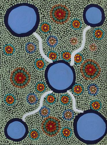
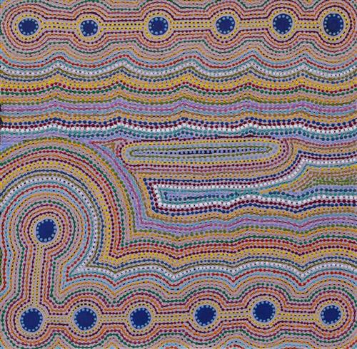
“When Martu paint, it’s like a map. Martu draw story on the ground and on the canvas, and all the circle and line there are the hunting areas and different waters and tracks where people used to walk, and [some you] can’t cross, like boundaries. So nowadays you see a colourful painting and wonder what it is, but that’s how Martu tell story long ago. It’s not just a lovely painting, it’s a story and a songline and a history and everything that goes with it.” 

– Ngalangka Nola Taylor and Joshua Booth

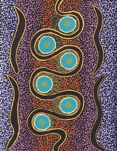
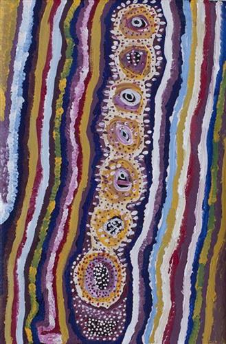
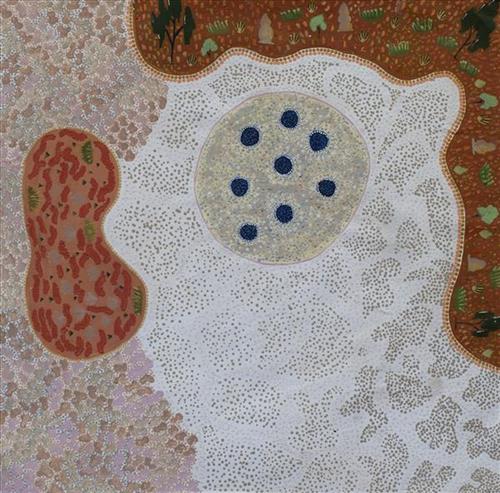
This work portrays an area of Country that can be interpreted in multiple ways. Firstly, the image may be read as an aerial representation of a particular location known to the artist- either land that they or their family travelled, from the pujiman (traditional, desert dwelling) era to now. During the pujiman period, Martu would traverse very large distances annually in small family groups, moving seasonally from water source to water source, and hunting and gathering bush tucker as they went. At this time, one’s survival depended on their intimate knowledge of the location of resources; thus physical elements of Country, such as sources of kapi (water), tali (sandhills), different varieties of warta (trees, vegetation), ngarrini (camps), and jina (tracks) are typically recorded with the use of a use of a system of iconographic forms universally shared across the desert. 

An additional layer of meaning in the work relates to more intangible concepts; life cycles based around kalyu (rain, water) and waru (fire) are also often evident. A thousands of year old practice, fire burning continues to be carried out as both an aid for hunting and a means of land management today. As the Martu travelled and hunted they would burn tracts of land, ensuring plant and animal biodiversity and reducing the risk of unmanageable, spontaneous bush fires. The patchwork nature of regrowth is evident in many landscape works, with each of the five distinctive phases of fire burning visually described with respect to the cycle of burning and regrowth.  

Finally, metaphysical information relating to a location may also be recorded; Jukurrpa (Dreaming) narratives chronicle the creation of physical landmarks, and can be referenced through depictions of ceremonial sites, songlines, and markers left in the land. Very often, however, information relating to Jukurrpa is censored by omission, or alternatively painted over with dotted patterns.

111581957655


Wildflowers on the Canning

“When they were laying out the Canning Stock Route, whitefellas used to get Martu people to show them where the permanent water was. The whitefellas was asking Martu people to show them permanent water, like soaks and rockholes, for a shortcut from Wiluna to Billiluna. When the whitefellas found out where the permanent water was, they made wells in every place and they called it the Canning Stock Route. That was how they went cut-across.”

– Yanjimi Peter Rowlands


Western Australia’s gold rush, beginning in 1885, created a huge demand for beef from mines located between Halls Creek and Wiluna. At that time, most of Western Australia’s cattle came from the Kimberley, though an infestation of tropical ticks among the East Kimberley herds gave the West Kimberley pastoralists a monopoly on the beef trade — causing prices to soar. A Royal Commission in 1904 proposed the construction of a stock route through Western Australia’s desert country to eliminate the ticks through exposure to its hot, dry conditions, resulting in the near 2000 kilometre Canning Stock Route. The proposal was successful insofar as the eradication of ticks was concerned; however, the establishment of the Canning Stock Route was to have far reaching repercussions for Western Australia’s Aboriginal population. 

The construction of the route by Alfred Canning and his team in 1910 resulted in first contact with Europeans for many Martu then living a pujiman (traditional, desert dwelling) life in the desert. This contact began with Canning’s use of Aboriginal guides to lead him to the sources of water that would be transformed into 48 stock route wells. Acts of cruelty toward these guides included, amongst other things, chaining them at night to prevent their escape and giving them salt water to drink, thereby ensuring their thirst and subsequent necessity to lead the party to water sources.

Following the construction of the Canning Stock Route, Martu encountered Europeans and other Martu working as cattle drovers as they would travel up and down the Stock Route from water source to water source. Increasingly, pujiman followed the route to newly established ration depots, mission and pastoral stations. They were drawn to the route in search of food, by a sense of curiosity, or by loneliness. By the late 1950s and early 1960s, most of the desert family groups had left the desert. Eventually, these factors combined with an extreme and prolonged drought in the 1960s to prompt the few remaining pujiman to move in from the desert. One of the last major migrations of Martu people occurred in 1963, when many of the pujiman born Martumili Artists moved to Jigalong.

Patterns of movement which had defined Aboriginal people’s relationships to Country were forever changed by the Canning Stock Route, but the Martu relationship with Country remains strong through the maintenance of physical and cultural ties to desert life and knowledge.

111581957653


Untitled

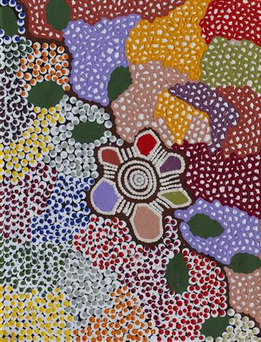
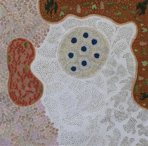
This work portrays an area known intimately to the artist, painted here in exquisite detail from memory. During the pujiman (traditional, desert dwelling) era one’s survival depended on their intimate knowledge of the location of resources; thus physical elements of Country, such as sources of kapi (water), tali (sandhills), and different varieties of warta (trees, vegetation) were carefully observed and remembered. Today, this relationship with Country remains equally strong, despite the movement of Martu out of the desert and into remote Aboriginal Communities, towns and cities.

Also visible may be traces of life cycles based around kalyu (rain, water) and waru (fire). A thousands of year old practice, fire burning continues to be carried out as both an aid for hunting and a means of land management today. As the Martu travelled and hunted they would burn tracts of land, ensuring plant and animal biodiversity and reducing the risk of unmanageable, spontaneous bush fires. The patchwork nature of regrowth is visible in many landscape works, with each of the five distinctive phases of fire burning visually described with respect to the cycle of burning and regrowth.  

Finally, metaphysical information relating to a location may also be recorded; Jukurrpa (Dreaming) narratives chronicle the creation of physical landmarks, and can be referenced through depictions of ceremonial sites, songlines, and markers left in the land. 

111581957646


Jila (snake, living water)

“Snake lives there in the salt and comes from Mandora – inside the salt, and travels underground. Hide him out and goes underneath in the direction of the spring country from Mandora and Bidgydanga, in the direction of the coast. He is underground, same like jila[snake]. You are not allowed to dig that place or come close to the clay pans cause it’s the snake, the snake will eat you. He will come up and you will have to run, he will send the wind to drag you back in his ngurra. You can make a waru[fire] and he will go back into his home. Creek going this side salt on the other. Old line, that rabbit proof fence. This country follows that line, we use to follow that line from Punmu.”  

– Biddy Bunnawarrie

The Western Desert term jila is used interchangeably to describe springs considered to be ‘living’ waters and snakes, both of which play a central role in Martu culture and Jukurrpa (Dreaming).

During the pujiman (traditional, desert dwelling) period, knowledge of water sources was critical for survival, and today Martu Country is still defined in terms of the location of water sources. Of the many permanent springs in Martu Country, very few are ‘living waters’; waters inhabited by jila (powerful ancestral beings). Before they became snakes, these beings were men who made rain, formed the land and introduced cultural practices like ceremonies and ritual songs. Some of the men travelled the desert together, visiting one another, but they all ended their journeys at their chosen spring alone, transformed into a snake. These important springs are named after their jila inhabitant, guarding their waters. 

Some of the jila snakes are known by Martu as quiet and benevolent, others as dangerous and ‘cheeky’. Regardless of the nature of the inhabitant snake, jila sites must be entered respectfully; particular rituals are practiced, such as lighting fires, sweeping the ground with branches, approaching in single file, and calling out to the site’s jila to announce one’s arrival and introduce people who are new to the jila. Those who do not follow these guidelines are in danger of becoming sick, or even being killed.

111581957644


Wantili (Warntili, Canning Stock Route Well 25)

“Bugai always tells about Wantili (Warntili, Canning Stock Route Well 25) because she grew up around Wantili. Her family would travel between Wantili, Kaalpa, Juntu-juntu, Raarki, and Wuranu Wells along the Canning Stock Route. She paints around Wantili. She saw whitefellas there for the first time, Canning mob when they were travelling up and down the stock route with the bullock. She was a young girl walking around at Wantili. Big mob of people they been walking around there. Canning and his drovers were travelling, making the road. They were running away from those whitefellas, watching them from a long distance. She was a teenager when she was travelling around there with her four mothers and one daddy. They used to travel around in family groups, Bugai and Jakayu [Biljabu], and Jakayu’s nyupa (partner) Phillip Biljabu.” 

– Bugai Whyoulter, as translated by her grandson, Cyril Whyoulter


“I was just becoming a teenager, still travelling around with my mother and father. We were at Juntu-juntu, Wuranu, Raarki, Tiwa and Wantili. At Wantili we killed a cow, they were bringing cattle through from Kunawarritji … Wantili was a good place to make yakapiri (woven bark sandals).”

– Bugai Whyoulter as translated by Ngalangka Nola Taylor


Wantili, which forms the focus of much of Bugai’s work, is a large round jurnu (soak) and linyji (claypan) near Well 25 on the Canning Stock Route. The Wantili region is dominated by claypans surrounded by tuwa (sandhills), and Nyilangkurr, a prominent yapu (hill) is located close to the eastern edge of the claypan. Following rain the typically dry claypans are filled with water, with the overflow from nearby waterholes flowing to Wantili. At that time, Wantili becomes an important place for obtaining fresh water for drinking and bathing. Wantili is significant for the fact that at this site Kartujarra, Manyjilyjarra, Putijarra and Warnman people would all come together for ceremonies during the pujiman (traditional, desert dwelling) era. Many jiwa (stones used by women for grinding seeds) from these times can still be found there today.

Wantili lies within Bugai’s ngurra (home Country, camp). As described in her account, Wantili was one of the sites she knew intimately and travelled extensively with her family and other family groups during the pujiman period. At this time, Martu would traverse very large distances annually, moving seasonally from water source to water source, and hunting and gathering bush tucker as they went. Knowledge of water sources was critical for survival, and today Martu Country is still defined in terms of the location and type of water. Each of the hundreds of claypans, rockholes, waterholes, soaks and springs found in the Martu desert homelands is known by name, location, quality and seasonal availability through real life experience and the recounting of Jukurrpa (Dreaming) narratives. 

Wantili is also especially significant to Bugai as it was here that she saw whitefellas for the first time; drovers with their cattle travelling along the Canning Stock Route. The establishment of the route by Alfred Canning and his team in 1910 resulted in first contact with Europeans for many Martu, including Bugai and her family, then living a pujiman life in the desert. Encounters occurred between Martu, Europeans, and other Martu working as cattle drovers as they travelled and down the Stock Route from water source to water source. Increasingly, Martu followed the route to newly established ration depots, mission and pastoral stations. They were drawn to the route in search of food, by a sense of curiosity, or by loneliness. By the late 1950s and early 1960s, most of the desert family groups had left the desert. Eventually, these factors combined with an extreme and prolonged drought in the 1960s to prompt the few remaining pujiman to move in from the desert. Bugai returned to the Wantili area as a young woman, when she herself drove cattle along the Stock Route.

Culturally, Wantili is an incredibly important site, ‘where the creation started.’ (Cyril Whyoulter). In this creation story, the world was initially dark, and people were like rocks, with no arms or legs. Following the sun’s first rising, life-forms become increasingly complex while particular features in the land are created. Beyond these details much of the Jukurrpa narrative relating to Wantili is ngurlu (sacred, taboo), and only for Martu, but the site is open, and anyone can go there. 

Wantili is also one of the many sites featured in the epic Minyipuru (Jakulyukulyu, Seven Sisters) Jukurrpa story. Minyipuru is a central Jukurrpa narrative for Martu, Ngaanyatjarra, Pitjantjatjara and Yankunytjatjara people that is associated with the seasonal Pleiades star constellation. Relayed in song, dance, stories and paintings, Minyipuru serves as a creation narrative, a source of information relating to the physical properties of the land, and an embodiment of Aboriginal cultural laws. The story follows the movement of a group of women travelling all the way across the desert, beginning at Roebourne on the coast of Western Australia, as they are pursued by Yurla, a lustful old man. As the women travelled, they stopped to rest at many sites to eat, dance, rest and sing, on the way leaving behind an assortment of articles that became formations in the land, such as groupings of rocks and trees, grinding stones and seeds. The sisters rested at Wantili before throwing seeds, then continued their journey far to the east and beyond Martu Country, stopping at various sites through central and South Australia.
111581957665


Kiriwirri

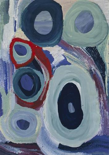
“We went to 3 places with KJ Parnngurr and Punmu ranger mob.  We had USB in the cars with stories on them talking about country, listening.  My Dad’s Uncle telling those stories when he was a little boy.  Telling Pujiman   (traditional, desert dwelling) stories.  Kiriwirri [points to centre of painting], it’s green out there, light green, very nice.  Like a jungle in the desert, trees, water.  Those red and yellow ones [points to red and yellow circles on painting] can’t go to those waterholes.”

  • Norelle Barndabba

Kiriwirri is a soak located in the Percival Lakes region of Western Australia’s Great Sandy Desert. The site was a popular camping area during the pujiman (traditional, desert dwelling) era due to its reliable water source and the abundance of minyarra (bush onion) found in the area. Kiriwirri is also a site visited by the Wati Kujarra (Two Goanna Men), ancestral beings responsible for the creation of many land features in Martu Country and beyond in a key Jukurrpa (Dreaming) narrative. The Wati Kujarra existed as half men, half goanna who travelled, hunted, and burned Country together.

During the pujiman period, Martu would traverse very large distances annually in small family groups, moving seasonally from water source to water source, and hunting and gathering bush tucker as they went. At this time, knowledge of water sources was critical for survival, and today Martu Country is still defined in terms of the location and type of water. Each of the hundreds of claypans, rockholes, waterholes, soaks and springs found in the Martu desert homelands is known by name, location, quality and seasonal availability through real life experience and the recounting of Jukurrpa narratives. 

Soaks, or soakwaters, derive their name from the manner in which their waters generally seep into the sand from below stores, sometimes as part of an ephemeral river or creek. Soaks were an especially important source of water during the pujiman era, being the most dependable water source in times of drought. Water was obtained from soaks by scooping away the sand with a piti (timber bowls used for carrying food and water) until clear water gathered at the base of the hole, sometimes at a depth of several metres. 

111581957652


Wilarra

“Two Rockholes other side Punmu- Kayili (North) all the way keep going Kakarra (East), long way. Dingomili ngurra (Dingo’s home). Big one is Willarra. Dingos all stay in that place together, wild one [dingo] became a quiet one. All the dingos come from that place. Make a kuna (faeces), go home. Kirl Kirl (Well 36), Pinlankujarra and Karrarrngarri claypan are here too”

Wilarra, the site depicted in this painting, lies on the edge of a large salt lake, Nyayartakujarra (Lake Dora), near Punmu community.  A distinctive group of small salt water pools are clustered together here. The water from these pools is known for its’ powerful healing properties, and the pools are still visited today by Martu to bathe cuts and sores. 

Wilarra is also a term for ‘moon’ in Manyjillyjarra, and through the site’s jukurrpa (Dreamtime story), the site is united with the moon in significance. It is said that at Wilarra, the moon called to a family of dingoes; a mother, father and their large litter of dingo pups. The dingoes gathered at Wilarra, where the moon cared for them and created a windbreak for the family to shelter. “They scratched there in the salt lake and made those pools. They lay down there and had a sleep.” After a time, the dingoes continued travelling eastward toward the rising moon until they reached Kinyu (Well 35 on the Canning Stock Route), where they remained until all of the dingo pups had grown up. The moon asked the sun where it was going, and the sun replied it was also travelling east. From Kinyu the family travelled further east with the moon.

111581957651


Wilarra

“Two Rockholes other side Punmu- Kayili (North) all the way keep going Kakarra (East), long way. Dingomili ngurra (Dingo’s home). Big one is Willarra. Dingos all stay in that place together, wild one [dingo] became a quiet one. All the dingos come from that place. Make a kuna (faeces), go home. Kirl Kirl (Well 36), Pinlankujarra and Karrarrngarri claypan are here too”

Wilarra, the site depicted in this painting, lies on the edge of a large salt lake, Nyayartakujarra (Lake Dora), near Punmu community.  A distinctive group of small salt water pools are clustered together here. The water from these pools is known for its’ powerful healing properties, and the pools are still visited today by Martu to bathe cuts and sores. 

Wilarra is also a term for ‘moon’ in Manyjillyjarra, and through the site’s jukurrpa (Dreamtime story), the site is united with the moon in significance. It is said that at Wilarra, the moon called to a family of dingoes; a mother, father and their large litter of dingo pups. The dingoes gathered at Wilarra, where the moon cared for them and created a windbreak for the family to shelter. “They scratched there in the salt lake and made those pools. They lay down there and had a sleep.” After a time, the dingoes continued travelling eastward toward the rising moon until they reached Kinyu (Well 35 on the Canning Stock Route), where they remained until all of the dingo pups had grown up. The moon asked the sun where it was going, and the sun replied it was also travelling east. From Kinyu the family travelled further east with the moon.

111581957649


Kunawarritji Rockholes

 “These are the rockholes around Kunawarritji. My mum (Dulcie Gibbs Jugarda) painted the same. It’s my father’s country, he was born at Well 33. I’m painting Well 35 – Kinyu, all the way to Well 38 Wajaparni. This is a big place for us. It’s important. I went on a trip with Kanyirninpa Jukurrpa last year (2018) to visit all these rockholes.”

Kunawarritji is an important site in the Great Sandy Desert where multiple stories and histories intersect. Originally a spring water, at the turn of the 20th century Kunawarritji was converted to a well (Well 33) along the Canning Stock Route. Each year throughout the 1930-50s, the well became a site of contact between the drovers, their cattle, and desert families. Long before colonial history entered this country, other stories dominated this site. In the jukurrpa (dreaming), the Minyipuru (Seven Sisters) stopped here, where they transformed themselves into a distinctive group of trees that remain in the area between Kunawarritji and Nyipil (Well 34).

Today, Kunawarritji is a site of return, a place where people came back to continue their life in the desert with the formation of Kunawarritji community in the early 1980s. The community’s cultural significance endures, with the population swelling up to 1000 during cultural business.