111581966639


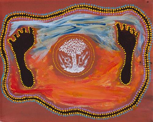
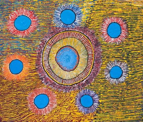
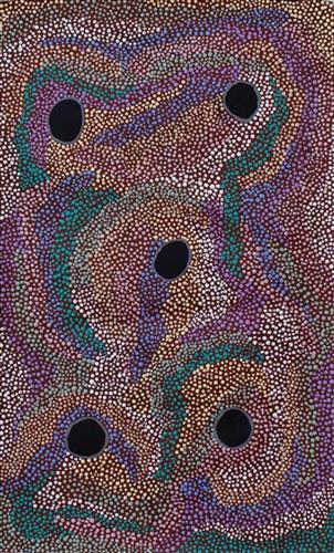
Punmu waterholes

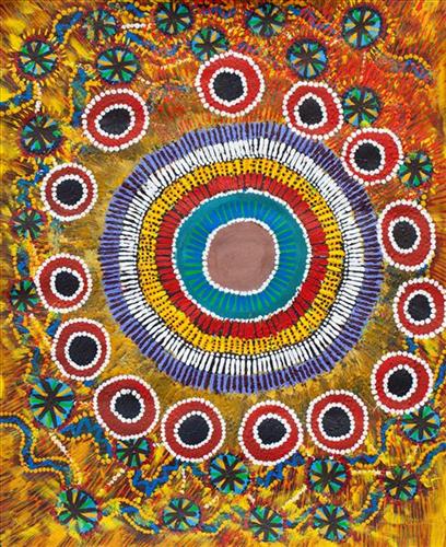
“Punmu, I went there when I was a young girl, a teenager with my mother and father before my mother passed. Big mob of people was there. No building, just little cubby houses [bough shelters]. Long time I been there. 

These here are the waterholes around Punmu; Rawa spring- Rawa means ‘long time’, Tuu-tuu, Jila-jila, Wirlarra and Yilyara. That is my ngurra (home Country, camp). We grew up in Punmu around all these water holes. I still live here with my grandkids, [we share the] same stories for all these places.” 

 – Marianne Burton


 Punmu refers to a region and an Aboriginal community within its vicinity, located 670km North-East of Newman. Created during the return to Country movement of the 1980s, with the recognition of Martu land rights and native title, the community was named after a nearby Jukurrpa (Dreaming) story. As described by Marianne, Punmu is her ngurra; she grew up in this region with her parents. 

Punmu community sits on the edge of a large salt lake known as Nyayartakujarra, or Lake Dora. The lake runs south into Karlamilyi River (Rudall River). Surrounding Punmu are numerous fresh water soaks and the red tali (sandhills) typical of the area. The most frequently visited yinta (permanent springs) around Punmu include Wirlarra, Rawa, Yilyara, Jila-jila and Tuu-tuu.

The Country around Punmu features in several Jukurrpa stories. Of particular importance is the story of the Jila Kujarra (Two Snakes), one of the key Jukurrpa narratives for the Martu. Though the story belongs to Warnman people, it is shared across the Western Desert with several other language groups. The narrative centres on the travels of two snakes as they are pursued by the Niminjarra, spiritual ancestors of the Warnman people. 

 Before transforming themselves into snakes, the Jila Kujarra were young brothers. As snakes, they began travelling home to their mother, but were intercepted by the Niminjarra, who tracked the Jila Kujarra to Paji, east of Nyayartakujarra (Lake Dora). Though the Jila Kujarra eluded their pursuers here by escaping under the lake at Paji, they were soon after speared and injured by two Pukurti (initiates with bundled hair) at Nyayartakujarra, who returned with the Niminjarra to cook the snakes at the site of Kumpupirntily (Kumpupintily, Lake Disappointment). As the Niminjarra cut down the length of the Jila Kujarra, the snake’s bladders were pierced, causing an explosion of scalding hot urine in which the Niminjarra all perished and became black rocks at the site. The spirits of the Jila Kujarra returned to their mother at Nyayartakujarra, where the mother and her sons entered the ground below Nyayartakujarra and remain to this day.
111581966635


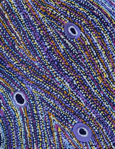
Kulyakartu

Kulyakartu; an area in the far north of the Martu homelands, near the Percival Lakes in the northern Great Sandy Desert. The artist’s elders have extensive knowledge of the Country in this region, where they grew up living traditionally during the pujiman (traditional, desert dwelling) days. Kulyakartu is mostly grass Country where there is very good hunting. There is no permanent water source in Kulyakartu,

111981966926


Warraburnburn

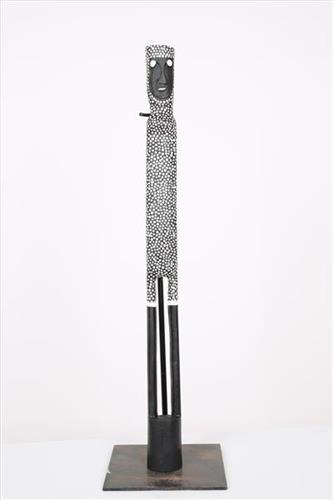
In Burarra and Gun-nartpa languages the figure represented in this artwork is generally known as a wangarra ‘ghost spirit’. For the Warrawarra clan ghost spirits have their own particular characteristics and their own name – Warraburnburn. The Warraburnburn and the closely related Galabarrbarr spirit (owned by the Balkarranga clan) are also manikay song topics.  The spirits are related to each other as maternal grandparent and grandchild, just as the people of Warrawarra and Balkarranga are. The dancing of the two ghost spirit figures forms the finale performance for funerals, and is the final goodbye to a deceased family member. In many ways the Warraburnburn and Galabarrbarr ghost spirits are like people. They emerge from the patches of jungle on Warrawarra and Balkarranga country in the late afternoon and go hunting in family groups of men, women and children. They stay in contact with each other by calling out as the men hunt for fish and the women walk with their dillybags looking for vegetable food.  The ghost spirits are associated closely with white ochre and artists commonly paint the bodies of carved figures in white. Different types of ghost spirit wear different patterns. Warraburnburn is decorated with uniform white dots while others are painted white all over. Some ghost spirits are shown with a design painted on their chest infilled with rarrk ‘cross-hatching’, the same designs that are painted onto japi an-guyinda ‘male initiations’.  They also have supernatural characteristics including superhuman size (jarra anbaykarda ‘super tall’). They know the country intimately – some are malevolent towards humans and will lead people astray, taking them to unfamiliar and dangerous places. These malevolent spirits are likened to an-muburda ‘sorcerers’ and can conduct dangerous rituals that cause harm to people. Others are benign and will lead humans back to familiar paths and their own camps.  

111581967084


Luka

“Luka is my home, my mummy and grandmother and fathers Country, all the families Country. This place is near the same place I was born, there’s pussy cat, dingo and fox all around. That jila (snake) there inside, always water there”

– Thelma Ngarga’s  Judson

Luka is a yinta (permanent waterhole) located kayili (north) of the Percival Lakes region in Western Australia’s Great Sandy Desert. Luka forms part of Ngarga’s ngurra (home Country, camp), and lies just west of the site where she was born.

Luka is home to an ancestral rainmaking jila (snake) of the same name. The Western Desert term jila is used interchangeably to describe springs considered to be ‘living’ waters and snakes, both of which play a central role in Martu culture and Jukurrpa (Dreaming). During the pujiman (traditional, desert dwelling) period, knowledge of water sources was critical for survival, and today Martu Country is still defined in terms of the location of water sources. Of the many permanent springs in Martu Country, very few are ‘living waters’; waters inhabited by jila. Before they became snakes, these beings were men who made rain, formed the land and introduced cultural practices like ceremonies and ritual songs. Some of the men travelled the desert together, visiting one another, but they all ended their journeys at their chosen spring alone, transformed into a snake. These important springs are named after their jila inhabitant, guarding their waters.

During the pujiman (traditional, desert dwelling) period, Martu would traverse very large distances annually in small family groups, moving seasonally from water source to water source, and hunting and gathering bush tucker as they went. At this time knowledge of water sources was critical for survival, and today Martu Country is still defined in terms of the location and type of water. Each of the hundreds of claypans, rockholes, waterholes, soaks and springs found in the Martu desert homelands is known by name, location, quality and seasonal availability through real life experience and the recounting of Jukurrpa (Dreaming) narratives.

111581967080


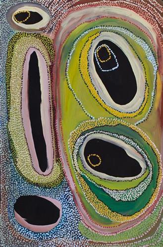
Untitled

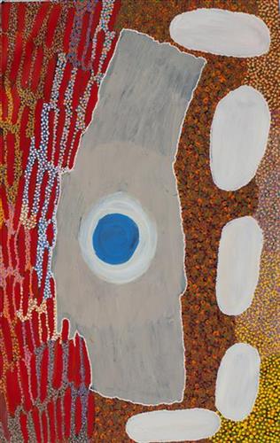
This work portrays an area known intimately to the artist, painted here in exquisite detail from memory. During the pujiman (traditional, desert dwelling) era one’s survival depended on their intimate knowledge of the location of resources; thus physical elements of Country, such as sources of kapi (water), tali (sandhills), and different varieties of warta (trees, vegetation) were carefully observed and remembered. Today, this relationship with Country remains equally strong, despite the movement of Martu out of the desert and into remote Aboriginal Communities, towns and cities.

Also visible may be traces of life cycles based around kalyu (rain, water) and waru (fire). A thousands of year old practice, fire burning continues to be carried out as both an aid for hunting and a means of land management today. As the Martu travelled and hunted they would burn tracts of land, ensuring plant and animal biodiversity and reducing the risk of unmanageable, spontaneous bush fires. The patchwork nature of regrowth is visible in many landscape works, with each of the five distinctive phases of fire burning visually described with respect to the cycle of burning and regrowth.  

Finally, metaphysical information relating to a location may also be recorded; Jukurrpa (Dreaming) narratives chronicle the creation of physical landmarks, and can be referenced through depictions of ceremonial sites, songlines, and markers left in the land. 

111581967075


Kaalpa (Kalypa, Canning Stock route 23)

“Kaalpa (Kalypa, Canning Stock Route Well 23) is my grandfather’s Country. There’s a waterhole there, Kaalpa waterhole. It’s my two pops’ Country. They been walking around, hunting around Kaalpa. You can see a yapu (rock), warla (lake), claypans, karru (creek) and tuwa (sandhills) there. It’s on the [Canning] Stock Route, it’s Well 23.  

In pujiman (traditional, desert dwelling) days, pujimanpa (desert born people) walking around all this Country. My pops told me about that place, a big flat area, parlkarra (flat country) good for hunting parnajarrpa (goanna), lunki (witchetty grub), lungkurta (blue tongue lizard), wamurla (bush tomato), jinyjiwirrilyi (wild gooseberry). Kaalpa is a busy place for emus getting a drink. 

I went [to Kaalpa] for the first time [in 2018] on a Martumili KJ (Kanyirninpa Jukurrpa) trip. I went hunting there, got a parnajarrpa. When I went there, I was pukurlpa (happy). It made you open up your spirit, it feels like home.”

 – Corban Clause Williams

Kaalpa is a permanent water source located northeast of Kumpupirntily (Kumpupintily, Lake Disappointment). This site is a place of great cultural significance, and is also known for good hunting. Adjacent to the waterhole is a hill of the same name. The landscape around Kaalpa is parlkarra, bordered by tali (sandhills) stretching as far as Windy Corner, northeast and towards the border of Western Australia and the Northern Territory. The large and dangerous Jukurrpa (Dreamtime) mosquito and fly beings partially created the landforms in this area and continue to live underground here.

Kaalpa also features in the Minyipuru (Jakulyukulyu, Seven Sisters) Jukurrpa, a central creation narrative for Martu, Ngaanyatjarra, Pitjantjatjara and Yankunytjatjara people that is associated with the seasonal Pleiades star constellation. At Kaalpa the Minyipuru met a group of men; it was the first time either group had seen members of the opposite sex. The men tried to grab the women, but the Minyipuru chased them, hitting them with their digging sticks leaving them lying there as they continued travelling east.

Minyipuru is Relayed in song, dance, stories and paintings, Minyipuru serves as a creation narrative, a source of information relating to the physical properties of the land, and an embodiment of Aboriginal cultural laws. Beginning in Roebourne on the west coast of Western Australia, the story morphs in its movement eastward across the land, following the women as they walk, dance, and even fly from waterhole to waterhole. As they travel the women camp, sing, wash, dance and gather food, leaving markers in the landscape and creating landforms that remain to this day, such as groupings of rocks and trees, grinding stones and seeds. During the entirety of their journey the women are pursued by a lustful old man, Yurla, although interactions with other animals, groups of men, and spirit beings are also chronicled in the narrative.

The intersection of the Canning Stock Route with Kaalpa also made this a site of early contact with Europeans for many Martu then living a pujiman life in the desert. Following the route’s construction, Martu encountered Europeans and other Martu working as cattle drovers as they would travel up and down the Stock Route from water source to water source. Increasingly, pujimanpa followed the route to newly established ration depots, mission and pastoral stations. They were drawn to the route in search of food, by a sense of curiosity, or by loneliness. By the late 1950s and early 1960s, most of the desert family groups had left the desert. Eventually, these factors combined with an extreme and prolonged drought in the 1960s to prompt the few remaining pujimanpa to move in from the desert.

111581967396


Wuu / Kurr Clans

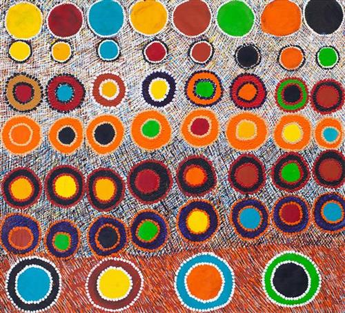
“When Martu paint, it’s like a map. Martu draw story on the ground and on the canvas, and all the circle and line there are the hunting areas and different waters and tracks where people used to walk, and [some you] can’t cross, like boundaries. So nowadays you see a colourful painting and wonder what it is, but that’s how Martu tell story long ago. It’s not just a lovely painting, it’s a story and a songline and a history and everything that goes with it.” 

– Ngalangka Nola Taylor and Joshua Booth

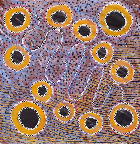
This work portrays an area of Country that can be interpreted in multiple ways. Firstly, the image may be read as an aerial representation of a particular location known to the artist- either land that they or their family travelled, from the pujiman (traditional, desert dwelling) era to now. During the pujiman period, Martu would traverse very large distances annually in small family groups, moving seasonally from water source to water source, and hunting and gathering bush tucker as they went. At this time, one’s survival depended on their intimate knowledge of the location of resources; thus physical elements of Country, such as sources of kapi (water), tali (sandhills), different varieties of warta (trees, vegetation), ngarrini (camps), and jina (tracks) are typically recorded with the use of a use of a system of iconographic forms universally shared across the desert. 

An additional layer of meaning in the work relates to more intangible concepts; life cycles based around kalyu (rain, water) and waru (fire) are also often evident. A thousands of year old practice, fire burning continues to be carried out as both an aid for hunting and a means of land management today. As the Martu travelled and hunted they would burn tracts of land, ensuring plant and animal biodiversity and reducing the risk of unmanageable, spontaneous bush fires. The patchwork nature of regrowth is evident in many landscape works, with each of the five distinctive phases of fire burning visually described with respect to the cycle of burning and regrowth.  

Finally, metaphysical information relating to a location may also be recorded; Jukurrpa (Dreaming) narratives chronicle the creation of physical landmarks, and can be referenced through depictions of ceremonial sites, songlines, and markers left in the land. Very often, however, information relating to Jukurrpa is censored by omission, or alternatively painted over with dotted patterns.

111581967393


Minyipuru (Jakulyukulyu, Seven Sisters)

The term Jukurrpa is often translated in English as the ‘dreaming’, or ‘dreamtime’. It refers generally to the period in which the world was created by ancestral beings, who assumed both human and nonhuman forms. These beings shaped what had been a formless landscape; creating waters, plants, animals, and people. At the same time they provided cultural protocols for the people they created, as well as rules for interacting with the natural environment. At their journey’s end, the ancestral beings transformed themselves into important waters, hills, rocks, and even constellations. 

Minyipuru, or Jakulyukulyu (Seven Sisters) is a central Jukurrpa narrative for Martu, Ngaanyatjarra, Pitjantjatjara and Yankunytjatjara people that is associated with the seasonal Pleiades star constellation. Relayed in song, dance, stories and paintings, Minyipuru serves as a creation narrative, a source of information relating to the physical properties of the land, and an embodiment of Aboriginal cultural laws. When Martumili Artists was established in 2005, this was the first Jukurrpa story the artists agreed to paint for a broader public. 

Beginning in Roebourne on the west coast of Western Australia, the story morphs in its movement eastward across the land, following a group of women as they walk, dance, and even fly from waterhole to waterhole. As they travel the women camp, sing, wash, dance and gather food, leaving markers in the landscape and creating landforms that remain to this day, such as groupings of rocks and trees, grinding stones and seeds. During the entirety of their journey the women are pursued by a lustful old man, Yurla, although interactions with other animals, groups of men, and spirit beings are also chronicled.

111581967391


Canning Stock Route

“When they were laying out the Canning Stock Route, whitefellas used to get Martu people to show them where the permanent water was. The whitefellas was asking Martu people to show them permanent water, like soaks and rockholes, for a shortcut from Wiluna to Billiluna. When the whitefellas found out where the permanent water was, they made wells in every place and they called it the Canning Stock Route. That was how they went cut-across.”

– Yanjimi Peter Rowlands


Western Australia’s gold rush, beginning in 1885, created a huge demand for beef from mines located between Halls Creek and Wiluna. At that time, most of Western Australia’s cattle came from the Kimberley, though an infestation of tropical ticks among the East Kimberley herds gave the West Kimberley pastoralists a monopoly on the beef trade — causing prices to soar. A Royal Commission in 1904 proposed the construction of a stock route through Western Australia’s desert country to eliminate the ticks through exposure to its hot, dry conditions, resulting in the near 2000 kilometre Canning Stock Route. The proposal was successful insofar as the eradication of ticks was concerned; however, the establishment of the Canning Stock Route was to have far reaching repercussions for Western Australia’s Aboriginal population. 

The construction of the route by Alfred Canning and his team in 1910 resulted in first contact with Europeans for many Martu then living a pujiman (traditional, desert dwelling) life in the desert. This contact began with Canning’s use of Aboriginal guides to lead him to the sources of water that would be transformed into 48 stock route wells. Acts of cruelty toward these guides included, amongst other things, chaining them at night to prevent their escape and giving them salt water to drink, thereby ensuring their thirst and subsequent necessity to lead the party to water sources.

Following the construction of the Canning Stock Route, Martu encountered Europeans and other Martu working as cattle drovers as they would travel up and down the Stock Route from water source to water source. Increasingly, pujiman followed the route to newly established ration depots, mission and pastoral stations. They were drawn to the route in search of food, by a sense of curiosity, or by loneliness. By the late 1950s and early 1960s, most of the desert family groups had left the desert. Eventually, these factors combined with an extreme and prolonged drought in the 1960s to prompt the few remaining pujiman to move in from the desert. One of the last major migrations of Martu people occurred in 1963, when many of the pujiman born Martumili Artists moved to Jigalong.

Patterns of movement which had defined Aboriginal people’s relationships to Country were forever changed by the Canning Stock Route, but the Martu relationship with Country remains strong through the maintenance of physical and cultural ties to desert life and knowledge.