

377814382075897
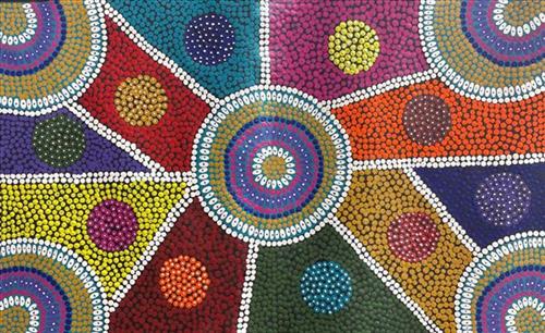
Desert Flowers
111582075957
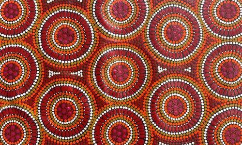
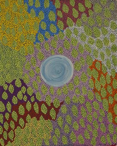
Punmu Kapi (Water)
Punmu is an Aboriginal community located 670km North-East of Newman, in the Pilbara region of Western Australia. Created during the return to Country movement of the 1980s, with the recognition of Martu land rights and native title, the community was named after a nearby jukurrpa (dreamtime) story.
Punmu community sits on the edge of a large salt lake known as Nyayartakujarra, or Lake Dora. The lake runs south into Karlamilyi River. There are many yinta (permanent water sources) in Punmu’s nearby vicinity including Wilarra, Rawa, Yilyara, Jilajila and Tuutuu.
Punmu features in several jukurrpa narratives. Of particular importance for the Warnman people is the story of the ‘Jila Kujarra’ (Two Snakes). These snakes travelled through Parnngurr, Punkulyi, Yulpu, and Winukurrujunu, forming lakes, claypans, rocks, rockholes, waterholes and soaks as they went. The powerful elder of the two snakes, Wirnpa, finally stopped at the site of Wirnpa, named for him. The young snake kept on travelling until coming to Punmu waterholes Rawa and Yilyarra, making that Country his ngurra (home camp). Another jukurrpa story describes the formation of Nyayartakujarra as occurring when two travelling snakes were first sung to sleep and then killed by magic men. The snakes’ fat was said to have burned away and melted into Nyayartakujarra.
111582075956
Punmu Kapi (Water)
Punmu is an Aboriginal community located 670km North-East of Newman, in the Pilbara region of Western Australia. Created during the return to Country movement of the 1980s, with the recognition of Martu land rights and native title, the community was named after a nearby jukurrpa (dreamtime) story.
Punmu community sits on the edge of a large salt lake known as Nyayartakujarra, or Lake Dora. The lake runs south into Karlamilyi River. There are many yinta (permanent water sources) in Punmu’s nearby vicinity including Wilarra, Rawa, Yilyara, Jilajila and Tuutuu.
Punmu features in several jukurrpa narratives. Of particular importance for the Warnman people is the story of the ‘Jila Kujarra’ (Two Snakes). These snakes travelled through Parnngurr, Punkulyi, Yulpu, and Winukurrujunu, forming lakes, claypans, rocks, rockholes, waterholes and soaks as they went. The powerful elder of the two snakes, Wirnpa, finally stopped at the site of Wirnpa, named for him. The young snake kept on travelling until coming to Punmu waterholes Rawa and Yilyarra, making that Country his ngurra (home camp). Another jukurrpa story describes the formation of Nyayartakujarra as occurring when two travelling snakes were first sung to sleep and then killed by magic men. The snakes’ fat was said to have burned away and melted into Nyayartakujarra.
111582075955
Untitled
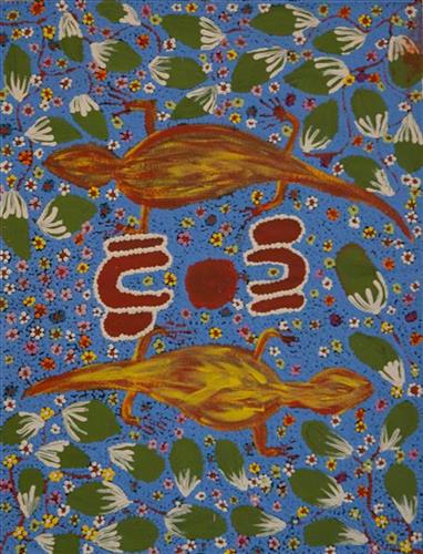
This work portrays an area known intimately to the artist, painted here in exquisite detail from memory. During the pujiman (traditional, desert dwelling) era one’s survival depended on their intimate knowledge of the location of resources; thus physical elements of Country, such as sources of kapi (water), tali (sandhills), and different varieties of warta (trees, vegetation) were carefully observed and remembered. Today, this relationship with Country remains equally strong, despite the movement of Martu out of the desert and into remote Aboriginal Communities, towns and cities.
Also visible may be traces of life cycles based around kalyu (rain, water) and waru (fire). A thousands of year old practice, fire burning continues to be carried out as both an aid for hunting and a means of land management today. As the Martu travelled and hunted they would burn tracts of land, ensuring plant and animal biodiversity and reducing the risk of unmanageable, spontaneous bush fires. The patchwork nature of regrowth is visible in many landscape works, with each of the five distinctive phases of fire burning visually described with respect to the cycle of burning and regrowth.
Finally, metaphysical information relating to a location may also be recorded; Jukurrpa (Dreaming) narratives chronicle the creation of physical landmarks, and can be referenced through depictions of ceremonial sites, songlines, and markers left in the land.
111582075953
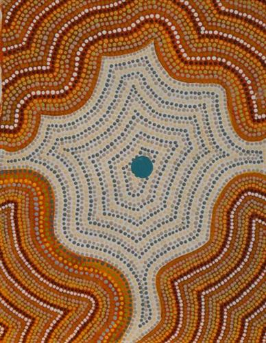
Yilyara
Yilyara is one of several frequently visited yinta (permanent springs) located in the Country immediately surrounding Punmu Aboriginal community. Yilyara is located immediately east of Nyayartakujarra (Lake Dora), a vast and culturally significant salt lake in the north east section of the Karlamilyi River (Rudall River) region. Surrounding the site are the permanent tali (sandhills) typical of the area.
Yilyara also features as a site in two important Jukurrpa narratives, Jila Kujarra (Two Snakes) and Wirnpa. Jila Kujarra is one of the key Jukurrpa narratives for the Martu. Though the story belongs to Warnman people, it is shared across the Western Desert with several other language groups. The narrative centres on the travels of two snakes as they are pursued by the Niminjarra, spiritual ancestors of the Warnman people. Wirnpa is one of the most powerful of the ancestral jila (snake) men and the last to travel the desert during the Jukurrpa. Wirnpa is a rainmaking jila whose travels are described in the songs and stories of many language groups across the Western Desert, even those far removed from his home site. In his epic travels, Wirnpa created a series of different laws and ceremonies.
111582075952
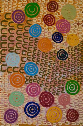
Untitled
“When Martu paint, it’s like a map. Martu draw story on the ground and on the canvas, and all the circle and line there are the hunting areas and different waters and tracks where people used to walk, and [some you] can’t cross, like boundaries. So nowadays you see a colourful painting and wonder what it is, but that’s how Martu tell story long ago. It’s not just a lovely painting, it’s a story and a songline and a history and everything that goes with it.”
– Ngalangka Nola Taylor and Joshua Booth
This work portrays an area of Country that can be interpreted in multiple ways. Firstly, the image may be read as an aerial representation of a particular location known to the artist- either land that they or their family travelled, from the pujiman (traditional, desert dwelling) era to now. During the pujiman period, Martu would traverse very large distances annually in small family groups, moving seasonally from water source to water source, and hunting and gathering bush tucker as they went. At this time, one’s survival depended on their intimate knowledge of the location of resources; thus physical elements of Country, such as sources of kapi (water), tali (sandhills), different varieties of warta (trees, vegetation), ngarrini (camps), and jina (tracks) are typically recorded with the use of a use of a system of iconographic forms universally shared across the desert.
An additional layer of meaning in the work relates to more intangible concepts; life cycles based around kalyu (rain, water) and waru (fire) are also often evident. A thousands of year old practice, fire burning continues to be carried out as both an aid for hunting and a means of land management today. As the Martu travelled and hunted they would burn tracts of land, ensuring plant and animal biodiversity and reducing the risk of unmanageable, spontaneous bush fires. The patchwork nature of regrowth is evident in many landscape works, with each of the five distinctive phases of fire burning visually described with respect to the cycle of burning and regrowth.
Finally, metaphysical information relating to a location may also be recorded; Jukurrpa (Dreaming) narratives chronicle the creation of physical landmarks, and can be referenced through depictions of ceremonial sites, songlines, and markers left in the land. Very often, however, information relating to Jukurrpa is censored by omission, or alternatively painted over with dotted patterns.
111582075951
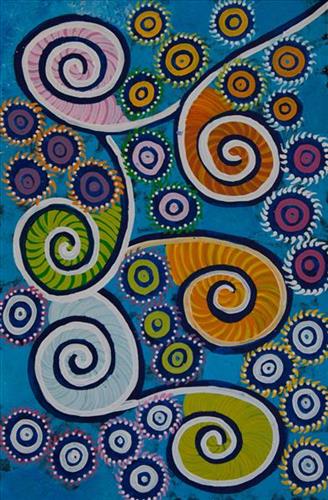
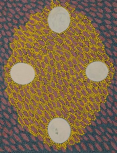
Jakapiri
“Jakapiri is a plant found in the sand dunes, they used to make sandals with it.”
– Morika Biljabu
This work portrays an area known intimately to the artist, painted here in exquisite detail from memory. During the pujiman (traditional, desert dwelling) era one’s survival depended on their intimate knowledge of the location of resources; thus physical elements of Country, such as sources of kapi (water), tali (sandhills), and different varieties of warta (trees, vegetation) were carefully observed and remembered. Today, this relationship with Country remains equally strong, despite the movement of Martu out of the desert and into remote Aboriginal Communities, towns and cities.
Also visible may be traces of life cycles based around kalyu (rain, water) and waru (fire). A thousands of year old practice, fire burning continues to be carried out as both an aid for hunting and a means of land management today. As the Martu travelled and hunted they would burn tracts of land, ensuring plant and animal biodiversity and reducing the risk of unmanageable, spontaneous bush fires. The patchwork nature of regrowth is visible in many landscape works, with each of the five distinctive phases of fire burning visually described with respect to the cycle of burning and regrowth.
Finally, metaphysical information relating to a location may also be recorded; Jukurrpa (Dreaming) narratives chronicle the creation of physical landmarks, and can be referenced through depictions of ceremonial sites, songlines, and markers left in the land.
111582075937
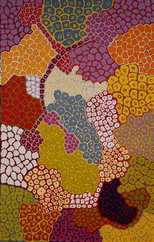
Yirriya
“I paint my dad’s country Yirriya. It’s got running water coming out of the ground into a big dam, surrounded by lots of trees. It’s really green. It’s on Rawlinson Ranges 50-60km from Warakurna. Nearby is Circus Waters where my dad was born we’d go swimming there, Lake Christopher is nearby too. All part of his country. We would go hunting, turkey, emu, kangaroo, look for bardi/lungi (witchetty grub), honey ants, yellow berries. It’s an outstation we call it home. We grew up in that place. Family from Warakurna, Docker River, Wingelina, Warnan would come and stay. Good memories of that place.”
– Roxanne Newberry
Warakurna is a large Aboriginal community, located in the Goldfields-Esperance region of Western Australia, within the Shire of Ngaanyatjarraku it lies near the foot of the spectacular Rawlinson Range, 300 kilometres west of Uluru (Ayers Rock) near the meeting of the borders of Western Australia, South Australia and the Northern Territory. Ngaanyatjarra people have strong ties with neighbouring Western Desert groups, including Martu.
This work portrays an area of Country that can be interpreted in multiple ways. Firstly, the image may be read as an aerial representation of a particular location known to the artist- either land that they or their family travelled, from the pujiman (traditional, desert dwelling) era to now. During the pujiman period, Martu would traverse very large distances annually in small family groups, moving seasonally from water source to water source, and hunting and gathering bush tucker as they went. At this time, one’s survival depended on their intimate knowledge of the location of resources; thus physical elements of Country, such as sources of kapi (water), tali (sandhills), different varieties of warta (trees, vegetation), ngarrini (camps), and jina (tracks) are typically recorded with the use of a system of iconographic forms universally shared across the desert.
An additional layer of meaning in the work relates to more intangible concepts; life cycles based around kalyu (rain, water) and waru (fire) are also often evident. A thousands of year old practice, fire burning continues to be carried out as both an aid for hunting and a means of land management today. As the Martu travelled and hunted they would burn tracts of land, ensuring plant and animal biodiversity and reducing the risk of unmanageable, spontaneous bush fires. The patchwork nature of regrowth is evident in many landscape works, with each of the five distinctive phases of fire burning visually described with respect to the cycle of burning and regrowth.
Finally, metaphysical information relating to a location may also be recorded; Jukurrpa (Dreaming) narratives chronicle the creation of physical landmarks, and can be referenced through depictions of ceremonial sites, songlines, and markers left in the land. Very often, however, information relating to Jukurrpa is censored by omission, or alternatively painted over with dotted patterns.
111582075936
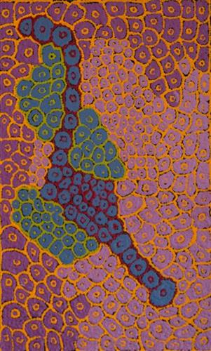
Yirriya
“I paint my dad’s country Yirriya. It’s got running water coming out of the ground into a big dam, surrounded by lots of trees. It’s really green. It’s on Rawlinson Ranges 50-60km from Warakurna. Nearby is Circus Waters where my dad was born we’d go swimming there, Lake Christopher is nearby too. All part of his country. We would go hunting, turkey, emu, kangaroo, look for bardi/lungi (witchetty grub), honey ants, yellow berries. It’s an outstation we call it home. We grew up in that place. Family from Warakurna, Docker River, Wingelina, Warnan would come and stay. Good memories of that place.”
– Roxanne Newberry
Warakurna is a large Aboriginal community, located in the Goldfields-Esperance region of Western Australia, within the Shire of Ngaanyatjarraku it lies near the foot of the spectacular Rawlinson Range, 300 kilometres west of Uluru (Ayers Rock) near the meeting of the borders of Western Australia, South Australia and the Northern Territory. Ngaanyatjarra people have strong ties with neighbouring Western Desert groups, including Martu.
This work portrays an area of Country that can be interpreted in multiple ways. Firstly, the image may be read as an aerial representation of a particular location known to the artist- either land that they or their family travelled, from the pujiman (traditional, desert dwelling) era to now. During the pujiman period, Martu would traverse very large distances annually in small family groups, moving seasonally from water source to water source, and hunting and gathering bush tucker as they went. At this time, one’s survival depended on their intimate knowledge of the location of resources; thus physical elements of Country, such as sources of kapi (water), tali (sandhills), different varieties of warta (trees, vegetation), ngarrini (camps), and jina (tracks) are typically recorded with the use of a system of iconographic forms universally shared across the desert.
An additional layer of meaning in the work relates to more intangible concepts; life cycles based around kalyu (rain, water) and waru (fire) are also often evident. A thousands of year old practice, fire burning continues to be carried out as both an aid for hunting and a means of land management today. As the Martu travelled and hunted they would burn tracts of land, ensuring plant and animal biodiversity and reducing the risk of unmanageable, spontaneous bush fires. The patchwork nature of regrowth is evident in many landscape works, with each of the five distinctive phases of fire burning visually described with respect to the cycle of burning and regrowth.
Finally, metaphysical information relating to a location may also be recorded; Jukurrpa (Dreaming) narratives chronicle the creation of physical landmarks, and can be referenced through depictions of ceremonial sites, songlines, and markers left in the land. Very often, however, information relating to Jukurrpa is censored by omission, or alternatively painted over with dotted patterns.