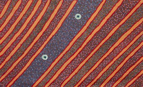
111582159486


Mungili Clay Pan

“When I was young – walk around, play around, slide around on the mud. Big one and little ones on the side. And the white gums, we would get witchetty grubs”

– Marlene Anderson

Mungilli is a small outstation community located just off the Eagle Highway in Western Australia, approximately 430 kilometres north east of Wiluna and 250 kilometres north of Warburton. Marlene grew up in Mungilli, and as such it forms a significant part of her ‘ngurra’ (home Country, camp).This work depicts a rock hole within Marlene’s’ ngurra (home Country, camp), typically Marlene depicts this site with a central large circular form, surrounded by satellite water bodies. During the pujiman (traditional, desert dwelling) period, knowledge of water sources was critical for survival, and today Martu Country is still defined in terms of the location and type of water. Each of the hundreds of claypans, rockholes, waterholes, soaks and springs found in the Martu desert homelands is known through real life experience and the recounting of Jukurrpa (Dreaming) narratives by name, location, quality and seasonal availability. This encyclopedic knowledge extends even to the nature and movement of arterial waterways, and sustained Martu as they travelled across their Country, hunting and gathering, visiting family, and fulfilling ceremonial obligations. They would traverse very large distances annually, visiting specific areas in the dry and wet season depending on the availability of water and the corresponding cycles of plant and animal life on which hunting and gathering bush tucker was reliant.

111582159482


Mungili Rock Hole

“Mungili rock hole, big rock hole, big country. I never see that place. My mother born, her and grandmother walk through there, they tell me story. Mother born there in the Country Mungili, walking through the bush. There is a camping spot, camping in bush – bush, bush, bush [points at painting] this is the lake Country and goes through there.”

– Matthew Mintern Smith

Mungilli is a small outstation community located just off the Eagle Highway in Western Australia, approximately 430 kilometres north east of Wiluna and 250 kilometres north of Warburton. Matthew grew up near Mungilli, and as such it forms a significant part of his ‘ngurra’ (home Country, camp).This work depicts a rock hole within Matthew’s ngurra (home Country, camp), typically Matthew depicts this site with a central large circular form, surrounded by satellite circles for water bodies. During the pujiman (traditional, desert dwelling) period, knowledge of water sources was critical for survival, and today Martu Country is still defined in terms of the location and type of water. Each of the hundreds of claypans, rockholes, waterholes, soaks and springs found in the Martu desert homelands is known through real life experience and the recounting of Jukurrpa (Dreaming) narratives by name, location, quality and seasonal availability. This encyclopedic knowledge extends even to the nature and movement of arterial waterways, and sustained Martu as they travelled across their Country, hunting and gathering, visiting family, and fulfilling ceremonial obligations. They would traverse very large distances annually, visiting specific areas in the dry and wet season depending on the availability of water and the corresponding cycles of plant and animal life on which hunting and gathering bush tucker was reliant.

111582159480


Ngurra Wild Flowers

This is Miriam’s Country- her ‘ngurra’ (home Country, camp). People identify with their ngurra in terms of specific rights and responsibilities, and the possession of intimate knowledge of the physical and cultural properties of one’s Country. Painting ngurra, and in so doing sharing the Jukurrpa (Dreaming) stories and physical characteristics of that place, has today become an important means of cultural maintenance. Miriam’s ngurra encompasses her birthplace on Bulloo Downs Station, south east of Newman, and the Country that her family walked in the pujiman (traditional, desert-dwelling) era, from the southern end of the Canning Stock Route through to Kumpupirntily (Kumpupintily, Lake Disappointment)

Portrayed in this work are features of Miriam’s family’s ngurra, such as the striking salt lakes, dominant permanent red tali (sandhills), warta (trees, vegetation), and the individually named water sources they camped at. Rock holes, waterholes, soaks and springs were all extremely important sites for Martu people during the pujiman period, and are generally depicted with circular forms. 

The encyclopaedic knowledge of the location, quality and seasonal availability of the hundreds of water bodies found in one’s Country sustained Martu as they travelled across their Country, hunting and gathering, visiting family, and fulfilling ceremonial obligations. They would traverse very large distances annually, visiting specific areas in the dry and wet season depending on the availability of water and the corresponding cycles of plant and animal life on which hunting and gathering bush tucker was reliant. As they travelled and hunted they would also burn areas of Country, generating a greater diversity of plant and animal life.

111582159441


Cuppa Tea

This is Jatarr’s Country- her ‘ngurra’ (home Country, camp). People identify with their ngurra in terms of specific rights and responsibilities, and the possession of intimate knowledge of the physical and cultural properties of one’s Country. Painting ngurra, and in so doing sharing the Jukurrpa (Dreaming) stories and physical characteristics of that place, has today become an important means of cultural maintenance. 

Jatarr’s ngurra encompasses the Country that she and her family walked in the pujiman (traditional, desert-dwelling) era. At this time Jatarr travelled nomadically with her own and other family groups. The Country they traversed encompassed an enormous tract of land, all around the Karlamily (Rudall River) region and through to Tiwa (Canning Stock Route Well 26) .

Jatarr was born at Jartarrangara. She grew up, walked and hunted primarily around Pangkartal, Yalpalpa, Walirrlirri, Yanytikuji, Wartararra, Tintinmarran, Pulikati, Pimurlu, Raarki (Canning Stock Route Well 27), and Tiwa. Her family continued to live nomadically before eventually deciding to move to Jigalong Mission along with many other relatives following an extreme and prolonged drought in the 1960s. 

Portrayed in this work are features of Jatarr’s ngurra, such as the hills, gorges and valleys, warta (trees, vegetation), and the individually named water sources she and her family camped at. Rock holes, waterholes, soaks and springs were all extremely important sites for Martu people during the pujiman period, and are generally depicted with circular forms. 

The encyclopaedic knowledge of the location, quality and seasonal availability of the hundreds of water bodies found in one’s Country sustained Martu as they travelled across their Country, hunting and gathering, visiting family, and fulfilling ceremonial obligations. They would traverse very large distances annually, visiting specific areas in the dry and wet season depending on the availability of water and the corresponding cycles of plant and animal life on which hunting and gathering bush tucker was reliant. As they travelled and hunted they would also burn areas of Country, generating a greater diversity of plant and animal life.

111582159440


Cuppa Tea

This is Dale’s Country- her ‘ngurra’ (home Country, camp). People identify with their ngurra in terms of specific rights and responsibilities, and the possession of intimate knowledge of the physical and cultural properties of one’s Country. Painting ngurra, and in so doing sharing the Jukurrpa (Dreaming) stories and physical characteristics of that place, has today become an important means of cultural maintenance. Dale’s ngurra encompasses her birthplace, Jigalong, and the Country that her family walked in the pujiman (traditional, desert-dwelling) era, including Puntawarri, Raarki (Canning Stock Route Well 27), Kularti, Kumpupirntily , Mirtikanya, (Kumpupintily, Lake Disappointment), and Mukurtu.

Portrayed in this work are features of Dale’s family’s ngurra, such as the striking salt lakes, dominant permanent red tali (sandhills), warta (trees, vegetation), and the individually named water sources they camped at. Rock holes, waterholes, soaks and springs were all extremely important sites for Martu people during the pujiman period, and are generally depicted with circular forms. 

The encyclopaedic knowledge of the location, quality and seasonal availability of the hundreds of water bodies found in one’s Country sustained Martu as they travelled across their Country, hunting and gathering, visiting family, and fulfilling ceremonial obligations. They would traverse very large distances annually, visiting specific areas in the dry and wet season depending on the availability of water and the corresponding cycles of plant and animal life on which hunting and gathering bush tucker was reliant. As they travelled and hunted they would also burn areas of Country, generating a greater diversity of plant and animal life.

111582159501


Untitled

This work portrays an area known intimately to the artist, painted here from memory. During the pujiman (traditional, desert dwelling) era one’s survival depended on their intimate knowledge of the location of resources; thus physical elements of Country, such as sources of kapi (water), tali (sandhills), and different varieties of warta (trees, vegetation) were carefully observed and remembered. Today, this relationship with Country remains equally strong, despite the movement of Martu out of the desert and into remote Aboriginal Communities, towns and cities.

Also visible may be traces of life cycles based around kalyu (rain, water) and waru (fire). A thousands of year old practice, fire burning continues to be carried out as both an aid for hunting and a means of land management today. As the Martu travelled and hunted they would burn tracts of land, ensuring plant and animal biodiversity and reducing the risk of unmanageable, spontaneous bush fires. The patchwork nature of regrowth is visible in many landscape works, with each of the five distinctive phases of fire burning visually described with respect to the cycle of burning and regrowth.  

Finally, metaphysical information relating to a location may also be recorded; Jukurrpa (Dreaming) narratives chronicle the creation of physical landmarks, and can be referenced through depictions of ceremonial sites, songlines, and markers left in the land. 

111582159498


Ngurra

This work represents Emily Bumba’s ngurra (home Country, camp) through her father- a Mangala man from the Ngurrara (Joanna Springs) area. Traditionally Mangala speakers lived in the north-western section of the Great Sandy Desert. To the west of this area and on the Western Australian coast lies Bidyadanga community, Emily’s own birth place. As Emily states, this work depicts four soaks within her father’s Country. During the pujiman (traditional, desert dwelling) period, Aboriginal people would traverse very large distances annually in small family groups, moving seasonally from water source to water source, and hunting and gathering bush tucker as they went. At this time knowledge of water sources was critical for survival, and each of the hundreds of claypans, rockholes, waterholes, soaks and springs were known by name, location, quality and seasonal availability through real life experience and the recounting of Jukurrpa (Dreaming) narratives.

111582159497


Two Countries – Ngangirri and Kun-Kun

“Grandfathers Country not far from Well 33 called ngangjirri. Not far, can go up by car. Go camping there. When it rains fills up, then is dry. Two Country’s Ngangirri and Kun-Kun (Kuny-Kuny), Marlene’s Country. Can just go out for the day lovely and quiet, go hunting and get some jinyjwirrily” – Kara Patch

111582159496


Kiriwirri

Kiriwirri is a soak located in the Percival Lakes region of Western Australia’s Great Sandy Desert. The site was a popular camping area during the pujiman (traditional, desert dwelling) era due to its reliable water source and the abundance of minyarra (bush onion) found in the area. Kiriwirri is also a site visited by the Wati Kujarra (Two Goanna Men), ancestral beings responsible for the creation of many land features in Martu Country and beyond in a key Jukurrpa (Dreaming) narrative. The Wati Kujarra existed as half men, half goanna who travelled, hunted, and burned Country together.

During the pujiman period, Martu would traverse very large distances annually in small family groups, moving seasonally from water source to water source, and hunting and gathering bush tucker as they went. At this time, knowledge of water sources was critical for survival, and today Martu Country is still defined in terms of the location and type of water. Each of the hundreds of claypans, rockholes, waterholes, soaks and springs found in the Martu desert homelands is known by name, location, quality and seasonal availability through real life experience and the recounting of Jukurrpa narratives. 

Soaks, or soakwaters, derive their name from the manner in which their waters generally seep into the sand from below stores, sometimes as part of an ephemeral river or creek. Soaks were an especially important source of water during the pujiman era, being the most dependable water source in times of drought. Water was obtained from soaks by scooping away the sand with a piti (timber bowls used for carrying food and water) until clear water gathered at the base of the hole, sometimes at a depth of several metres. 

111582159495


Yukuri near Kulyakartu

“Long time ago I been there. It is my grandmother’s, grandfather’s, father’s, [and] mother’s country, Kulyakartu.  I am painting this particular place. It keeps me connected, [gives me a] sense of belonging [to] tell my grandmother’s story through my art.  Where she was born, I’m a part of that. 

It makes me feel proud painting.  Most important is telling the story behind the painting so people can understand where I am coming from.  Kulyakartu is our ngurra (home Country, camp).  I will continue telling the story through my art.”

– Derrick Butt

This painting depicts Kulyakartu, Derrick’s ancestral ngurra (home Country, camp). Kulyakartu is a large area in the far north of the Martu homelands, near the Percival Lakes region of Western Australia’s Great Sandy Desert. Kulyakartu is mostly flat grass Country, and is known as a good hunting area. In particular, parnajarrpa (goanna), wild cats, and lunki (witchetty grub) are found in abundance here. In the wantajarra (wet season) the dry lakes in the region fill with water.