111582220394


Parnngurr Minyipuru

“The Seven Sisters came up to Parnngurr rockhole from the Canning Stock Route. They left behind marks in the hills near Parnngurr. They stopped at the rockhole a little while before moving on. That old man, Yurla, he met them at Parnngurr and kept going to the central desert, chasing the sisters.” 

 – Jatarr Lily Long

Parnngurr, now the locale of a remote Aboriginal community, has always been a significant site for the Martu. A permanent water source and a site within the epic Jukurrpa (Dreaming) story of the Minyipuru (Jakulyukulyu, Seven Sisters), historically many families would gather here to meet for important occasions. 

Parnngurr features in the Minyipuru journey at a point in which the sisters separated in several directions as they fled in panic from Yurla. Some of the sisters arrived at Parnngurr as they travelled south west, whilst the remainder of the sisters travelled east to Pangkapirni. At Parnngurr, the Minyipuru sit down to rest on top of a hill overlooking present day Parnngurr community following an important event in women’s law . From Parnngurr the songline extends south east to Kaalpa (Kalypa, Canning Stock Route Well 23) before leaving Martu Country. 

Minyipuru is a central Jukurrpa narrative for Martu, Ngaanyatjarra, Pitjantjatjara and Yankunytjatjara people that is associated with the seasonal Pleiades star constellation. Relayed in song, dance, stories and paintings, Minyipuru serves as a creation narrative, a source of information relating to the physical properties of the land, and an embodiment of Aboriginal cultural laws. Beginning in Roebourne on the west coast of Western Australia, the story morphs in its movement eastward across the land, following the women as they walk, dance, and even fly from waterhole to waterhole. As they travel the women camp, sing, wash, dance and gather food, leaving markers in the landscape and creating landforms that remain to this day, such as groupings of rocks and trees, grinding stones and seeds. During the entirety of their journey the women are pursued by a lustful old man, Yurla, although interactions with other animals, groups of men, and spirit beings are also chronicled in the narrative.

111582220393


Untitled

“When Martu paint, it’s like a map. Martu draw story on the ground and on the canvas, and all the circle and line there are the hunting areas and different waters and tracks where people used to walk, and [some you] can’t cross, like boundaries. So nowadays you see a colourful painting and wonder what it is, but that’s how Martu tell story long ago. It’s not just a lovely painting, it’s a story and a songline and a history and everything that goes with it.” 

– Ngalangka Nola Taylor and Joshua Booth

This work portrays an area of Country that can be interpreted in multiple ways. Firstly, the image may be read as an aerial representation of a particular location known to the artist- either land that they or their family travelled, from the pujiman (traditional, desert dwelling) era to now. During the pujiman period, Martu would traverse very large distances annually in small family groups, moving seasonally from water source to water source, and hunting and gathering bush tucker as they went. At this time, one’s survival depended on their intimate knowledge of the location of resources; thus physical elements of Country, such as sources of kapi (water), tali (sandhills), different varieties of warta (trees, vegetation), ngarrini (camps), and jina (tracks) are typically recorded with the use of a use of a system of iconographic forms universally shared across the desert. 

An additional layer of meaning in the work relates to more intangible concepts; life cycles based around kalyu (rain, water) and waru (fire) are also often evident. A thousands of year old practice, fire burning continues to be carried out as both an aid for hunting and a means of land management today. As the Martu travelled and hunted they would burn tracts of land, ensuring plant and animal biodiversity and reducing the risk of unmanageable, spontaneous bush fires. The patchwork nature of regrowth is evident in many landscape works, with each of the five distinctive phases of fire burning visually described with respect to the cycle of burning and regrowth.  

Finally, metaphysical information relating to a location may also be recorded; Jukurrpa (Dreaming) narratives chronicle the creation of physical landmarks, and can be referenced through depictions of ceremonial sites, songlines, and markers left in the land. Very often, however, information relating to Jukurrpa is censored by omission, or alternatively painted over with dotted patterns.

111582220390


Untitled

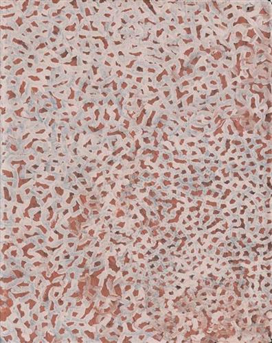
How did you get to this style of painting?

“Do you mean, what have I done with my life? (chuckles to herself) To me these paintings are a sense of energy. So if I see someone and they’re happy, I paint a happy vibe. Cos their spirit is happy. And sometimes it’s hard because on the outside they’re real happy but on the inside they’re real sad. Sometimes you do stuff (like a painting) and it adds up later on. But I still don’t know what it means and don’t know where my style comes from because it’s both the path I walk on and the cracks in the dirt. It’s like looking at a landscape but I haven’t been there yet. Maybe I’ll get there one day. I believe things happen for a reason.”

– Sylvia Wilson

111582220389


Untitled

This is Muuki’s Country- his ‘ngurra’ (home Country, camp). People identify with their ngurra in terms of specific rights and responsibilities, and the possession of intimate knowledge of the physical and cultural properties of one’s Country. Painting ngurra, and in so doing sharing the Jukurrpa (Dreaming) stories and physical characteristics of that place, has today become an important means of cultural maintenance. 

Muuki’s ngurra encompasses the Country that he and his family walked in the pujiman (traditional, desert-dwelling) era. Muuki was born at Wayinkurangu, a soak located within the Percival Lakes region of the Great Sandy Desert. In his youth Muuki’s family travelled hundreds of kilometres on foot, from the northern boundary of the Martu homelands through to Parrngurr, at the southern end of the Karlamily (Rudall River) region. They continued to live a pujiman lifestyle until being collected from Balfour Downs Station and taken to Jigalong Mission in the 1960s. They were one of the last Martu families to leave the desert. 

Portrayed in this work are features of Muuki’s ngurra, such as the dominant permanent red tali (sandhills), warta (trees, vegetation), and the individually named water sources he and his family camped at. These include Nyayartakujarra (Lake Dora), Nyukuwarta, Parnngurr, Paru, Matakurlu, Munkakulu, Wungungarlkulu, Jawalirli, Wirnpa, Yukuri, Matakurlu, and Ngaral. Rock holes, waterholes, soaks and springs were all extremely important sites for Martu people during the pujiman period, and are generally depicted with circular forms. 

The encyclopaedic knowledge of the location, quality and seasonal availability of the hundreds of water bodies found in one’s Country sustained Martu as they travelled across their Country, hunting and gathering, visiting family, and fulfilling ceremonial obligations. They would traverse very large distances annually, visiting specific areas in the dry and wet season depending on the availability of water and the corresponding cycles of plant and animal life on which hunting and gathering bush tucker was reliant. As they travelled and hunted they would also burn areas of Country, generating a greater diversity of plant and animal life.

111582220388


Pirrkili

Pirrkili is a rockhole surrounded in all directions by permanent tali (sandhills), located east of Nyayartakujarra (Lake Dora) and south of Punmu Aboriginal community. Linyji (claypans) such as Pirrkili were traditionally visited more often during the wantajarra (wet season) when they were filled with water. 

This site lies within Nyanjilpayi’s ngurra (home Country, camp) through her uncle and grandmother, and forms part of the area which she knew intimately and travelled extensively in her youth. The Western Desert term ‘ngurra’ is hugely versatile in application. Broadly denoting birthplace and belonging, ngurra can refer to a body of water, a camp site, a large area of Country, or even a modern house. People identify with their ngurra in terms of specific rights and responsibilities, and the possession of intimate knowledge of the physical and cultural properties of one’s Country. This knowledge is traditionally passed intergenerationally through family connections. Painting ngurra, and in so doing sharing the Jukurrpa (Dreaming) stories and physical characteristics of that place, has today become an important means of cultural maintenance. Physical maintenance of one’s ngurra, like cultural maintenance, ensures a site’s wellbeing, and is a responsibility of the people belonging to that area.

111582220387


Untitled

Most often explored in Doreen’s works are the motifs of her everyday modern Aboriginal community life; the animals hunted and plants gathered for bush tucker, the cars and aeroplanes used to travel to the cities and remote communities she regularly moves between, and depictions of the Country itself. 

Collectively this imagery, depicted with Doreen’s trademark wild palettes, painterly brushstrokes, and stark compositions, builds a layered representation of her Country. Doreen’s intimately known ngurra (home Country, camp) is viewed from multiple spatial perspectives, and in stylistic modes ranging from pure abstraction to images incorporating realist and traditional elements.

Doreen’s ngurra encompasses the Country between Western Desert communities and towns; Warralong, Strelley, Marble Bar, Port Hedland, and Jigalong, her birthplace. People identify with their ngurra in terms of specific rights and responsibilities, and the possession of intimate knowledge of the physical and cultural properties of one’s Country. Painting ngurra, and in so doing sharing the Jukurrpa (Dreaming) stories and physical characteristics of that place, has today become an important means of cultural maintenance.

111582220384


Tuwa (sandhills) in Puntawarri

“I do tuwa (sandhill) in my own style because that’s our Country. That’s a sandhill, that’s the Dreaming- the Jukurrpa. That’s our culture.

They stay there and we go through the sandhills at Puntawarri in the car. We go first tuwa, then the second tuwa, looking for the waterholes. Go up, up, up- ‘nother tuwa, ‘nother tuwa.

Long time [ago] in Puntawarri, when I was a little girl [with] my Nana and Pop [Dadda Samson and Yanjimi Peter Rowlands] we went climbing up the sandhill. And when I went up my Nana and Pop were at the bottom under a tree and I came down running then rolling, rolling right down to the ground! But I was ok- he right!”

– Judith Anya Samson

Puntawarri is an important cultural area located on the middle stretches of the Canning Stock Route and east of the Jigalong Mission (now Jigalong Aboriginal community), where Anya grew up with her grandmother and renowned Martumili Artist, Dadda Samson (dec.). Puntawarri is also the site of an abandoned community, a waterhole, creek and lake. Puntawarri’s close proximity to Jigalong Mission made it a popular site for Martu to visit during the ‘mission days’. While growing up at Jigalong Mission in the 1960’s, Dadda would return to Puntawarri every weekend to hunt and camp. 

For many Martu, like Anya’s family, Jigalong Mission was the site where their pujiman (traditional, desert dwelling) lifestyle came to an end from the late 1940s as they transitioned to a life as stockmen and women working in cattle stations in the Pilbara region and beyond. In the wake of the extreme and prolonged drought of the 1960s, the last of the remaining pujimanpa (desert dwellers) were forced to move to missions like Jigalong, where a supply of food and water was assured. There, many Martu were reunited with family members that had already moved in from the desert.

The traditional lands of the Martu people encompass the Great Sandy Desert and Rudall River regions of Western Australia, an enormous tract dominated by distinctive red tali, or tuwa (sandhills). These sandhills present an unforgiving landscape; sparse vegetation covers a seemingly never ending expanse of dunes, and yet these lands and the location of resources within them was known intimately by its pujiman inhabitants.


111582220382


Yarnkarl

Yarnkarl is a claypan, creek and soak at the southern end of Nyayartakujarra (Lake Dora). This site lies within Nyanjilpayi’s ngurra (home Country, camp), the area which she knew intimately and travelled extensively with her family in her youth. 

Yarnkarl, like many of the fresh water sources in the nearby vicinity, was created during the travels of the Wati Kujarra (Two Goanna Men). Wati Kujarra is a central Jukurrpa (Dreaming) narrative for Martu. The Wati Kujarra existed as half men, half goanna. They were responsible for the creation of many land features in Martu Country and beyond as they travelled, hunted and burned Country together. Wati Kujarra is a ngurlu (sacred, taboo) men’s story, and for this reason much of the content is only shared with initiated men. 

During the pujiman (traditional, desert dwelling) period, Martu would traverse very large distances annually in small family groups, moving seasonally from water source to water source, and hunting and gathering bush tucker as they went. At this time knowledge of water sources was critical for survival, and today Martu Country is still defined in terms of the location and type of water. Each of the hundreds of claypans, rockholes, waterholes, soaks and springs found in the Martu desert homelands is known by name, location, quality and seasonal availability through real life experience and the recounting of Jukurrpa narratives.

111582220381


Kunawarritji Rockholes

“These are the rockholes around Kunawarritji (Canning Stock Route Well 33). My mum [Jugarda Dulcie Gibbs] painted the same. It’s my father’s Country; he was born at Well 33. I’m painting Well 35, Kinyu, all the way to Well 38, Wajaparni. This is a big place for us. It’s important. I went on a trip with Kanyirninpa Jukurrpa [ranger group] last year [2018] to visit all these rockholes.”

– Pauline Williams 

Kunawarritji is an important site in the Great Sandy Desert where multiple stories and histories intersect. The area forms part of Pauline’s ngurra (home Country, camp) through her family. Originally a spring water and major Martu pujiman (traditional, desert dwelling) camping site, at the turn of the 20th century Kunawarritji was converted into a well along the Canning Stock Route. Each year throughout the 1930-50s, the well became a site of contact between the drovers, their cattle, and desert families.

Long before colonial history entered this Country, however, other stories dominated the site. Primarily, Kunawarritji features in the Minyipuru (Jakulyukulyu, Seven Sisters) Jukurrpa (Dreaming). Minyipuru is a central Jukurrpa narrative for Martu, Ngaanyatjarra, Pitjantjatjara and Yankunytjatjara people that is associated with the seasonal Pleiades star constellation. Today, Kunawarritji is a site of return, a place where people came back to continue their life in the desert with the formation of Kunawarritji Aboriginal community in the early 1980s. The community’s cultural significance endures, with the population swelling up to 1000 during cultural business. 

As Pauline states in her account, this work depicts the waterholes and tali (sandhills) in the area surrounding Kunawarritji, typically represented with circular forms. During the pujiman period, knowledge of water sources was critical for survival, and today Martu Country is still defined in terms of the location and type of water. Each of the hundreds of claypans, rockholes, waterholes, soaks and springs found in the Martu desert homelands is known through real life experience and the recounting of Jukurrpa narratives by name, location, quality and seasonal availability.

Transfer of cultural knowledge through visual arts is an important way for Martu artists to keep their culture strong. Younger Martu artists like Pauline typically begin painting with their parents, grandparents and extended family, thus fostering an organic process of learning, not only about painting techniques, but also specific locations, family histories, traditional ways of life, bush tucker and  Jukurrpa. 

111582220380


Pirrkili

Pirrkili is a rockhole surrounded in all directions by permanent tali (sandhills), located east of Nyayartakujarra (Lake Dora) and south of Punmu Aboriginal community. Linyji (claypans) such as Pirrkili were traditionally visited more often during the wantajarra (wet season) when they were filled with water. 

This site lies within Nyanjilpayi’s ngurra (home Country, camp) through her uncle and grandmother, and forms part of the area which she knew intimately and travelled extensively in her youth. The Western Desert term ‘ngurra’ is hugely versatile in application. Broadly denoting birthplace and belonging, ngurra can refer to a body of water, a camp site, a large area of Country, or even a modern house. People identify with their ngurra in terms of specific rights and responsibilities, and the possession of intimate knowledge of the physical and cultural properties of one’s Country. This knowledge is traditionally passed intergenerationally through family connections. Painting ngurra, and in so doing sharing the Jukurrpa (Dreaming) stories and physical characteristics of that place, has today become an important means of cultural maintenance. Physical maintenance of one’s ngurra, like cultural maintenance, ensures a site’s wellbeing, and is a responsibility of the people belonging to that area.