111582255297


Grandfather’s Country

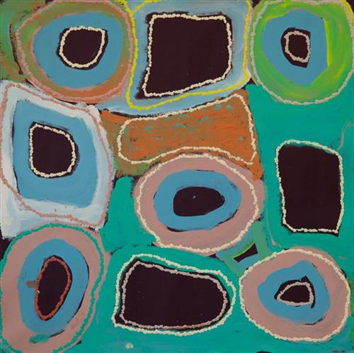
The traditional lands of the Martu people encompass the Great Sandy Desert and Rudall River regions of Western Australia, an enormous tract dominated by distinctive red tuwa (sandhills). These sandhills present an unforgiving landscape; sparse vegetation covers a seemingly never ending expanse of dunes, and yet these lands and the location of resources within them was known intimately by its pujiman (traditional, desert dwelling) inhabitants. At this time, Martu traversed very large distances annually in small family groups, moving from water source to water source through the harsh desert landscape with incredible stamina and resourcefulness. Travel was often undertaken at night, and when travelling during the day, Martu wore jakipiri (woven bark sandals) to protect their feet from the hot desert sand.

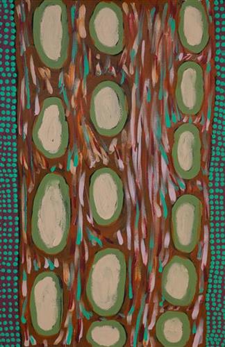
This work depicts a waterhole within the artists’ ngurra (home Country, camp), typically represented with circular forms. Waterholes are sites that require maintenance, including digging to increase flow, clearing out surrounding growth, and cleaning up after sullying by camels or cattle.

During the pujiman (traditional, desert dwelling) period, knowledge of water sources was critical for survival, and today Martu Country is still defined in terms of the location and type of water. Each of the hundreds of claypans, rockholes, waterholes, soaks and springs found in the Martu desert homelands is known through real life experience and the recounting of Jukurrpa (Dreaming) narratives by name, location, quality and seasonal availability. This encyclopedic knowledge extends even to the nature and movement of arterial waterways, and sustained Martu as they travelled across their Country, hunting and gathering, visiting family, and fulfilling ceremonial obligations. They would traverse very large distances annually, visiting specific areas in the dry and wet season depending on the availability of water and the corresponding cycles of plant and animal life on which hunting and gathering bush tucker was reliant.


111582255287


Marble Bar

Marble Bar is a town and a rock formation in the Pilbara region of Western Australia. The town’s name was derived from the jasper rock at the bed of the Coongan River, which run’s adjacent to the town. Jasper is similar to marble in its appearance. 

Marble Bar is the closest town to Warralong Aboriginal community, where Elizabeth lives with her family.

377810582255344


Djenj dja Komrdawh

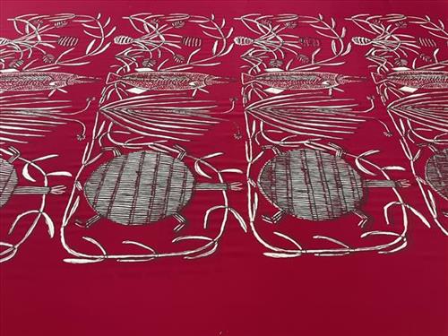
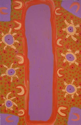
“My country is called Mankorlod. It is near the rock country. My dreaming is komrdawh (long neck turtle), the one I painted in my design. I like to eat komrdaw, it tastes really nice. We catch them in dry and wet season near Mankorlod. This is my first ever design, and I only have one design. I painted it with brush at Babbarra Women’s Centre and I feel proud when people print my design.” Margot Gurawiliwili

The vines depicted in this artwork are used by women to weave and create fibre sculpture. They grow naturally on the floodplains in Arnhem Land. The long-necked turtle and freshwater sword fish depicted are popular bush food.

116482255335


Spinifex Country

In September, when we are looking for gum from the Blue Gum Tree, we walk through the spinifex country. We pick the gum when it is crystal colour, and we eat it, or put it into hot water to make it like a toffee. We call it sugar lolly.

111582255309


Untitled

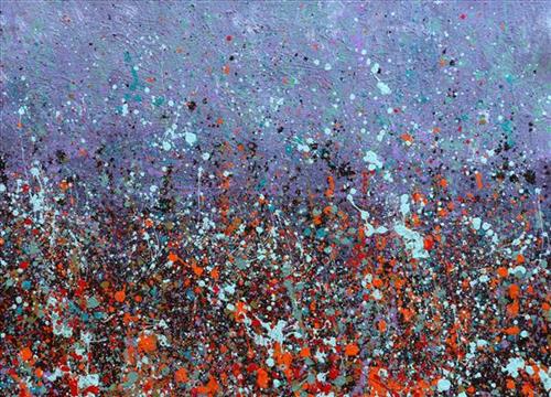
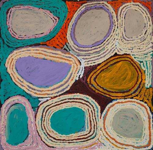
Most often explored in Doreen’s works are the motifs of her everyday modern Aboriginal community life; the animals hunted and plants gathered for bush tucker, the cars and aeroplanes used to travel to the cities and remote communities she regularly moves between, and depictions of the Country itself. 

Collectively this imagery, depicted with Doreen’s trademark wild palettes, painterly brushstrokes, and stark compositions, builds a layered representation of her Country. Doreen’s intimately known ngurra (home Country, camp) is viewed from multiple spatial perspectives, and in stylistic modes ranging from pure abstraction to images incorporating realist and traditional elements.

Doreen’s ngurra encompasses the Country between Western Desert communities and towns; Warralong, Strelley, Marble Bar, Port Hedland, and Jigalong, her birthplace. People identify with their ngurra in terms of specific rights and responsibilities, and the possession of intimate knowledge of the physical and cultural properties of one’s Country. Painting ngurra, and in so doing sharing the Jukurrpa (Dreaming) stories and physical characteristics of that place, has today become an important means of cultural maintenance.

111582255308


Untitled

This is Mayiwalku’s Country- her ‘ngurra’ (home Country, camp). People identify with their ngurra in terms of specific rights and responsibilities, and the possession of intimate knowledge of the physical and cultural properties of one’s Country. Painting ngurra, and in so doing sharing the Jukurrpa (Dreaming) stories and physical characteristics of that place, has today become an important means of cultural maintenance. 

Mayiwalku’s ngurra encompasses the Country that she and her family walked in the pujiman (traditional, desert-dwelling) era. Mayiwalku was born at Yirnangarri. She grew up, walked and hunted primarily around the Country extending across the Punmu, Kunawarritji (Canning Stock Route Well 33) and Karlamilyi (Rudall River) regions. Following the death of both their parents, Mayiwalku and her sisters travelled alone between Punmu and Kunawarritji, occasionally meeting with other family groups. They continued to live nomadically before eventually deciding to move to Jigalong Mission along with many other relatives following an extreme and prolonged drought in the 1960s. 

Portrayed in this work are features of Mayiwalku’s ngurra, such as the dominant permanent red tali (sandhills), warta (trees, vegetation), and the individually named water sources she and her family camped at. These include Januwa, Jilankujarra, Karlajarntu, Kartungu, Kularti, Kumpupajanu, Kunalimpi, Kunarra, Marnakarti, Pangkapirni, Wilunganinya, Wurur-wururna, Yilyara, and Yirrajarra Rock holes, waterholes, soaks and springs were all extremely important sites for Martu people during the pujiman period, and are generally depicted with circular forms. 

The encyclopaedic knowledge of the location, quality and seasonal availability of the hundreds of water bodies found in one’s Country sustained Martu as they travelled across their Country, hunting and gathering, visiting family, and fulfilling ceremonial obligations. They would traverse very large distances annually, visiting specific areas in the dry and wet season depending on the availability of water and the corresponding cycles of plant and animal life on which hunting and gathering bush tucker was reliant. As they travelled and hunted they would also burn areas of Country, generating a greater diversity of plant and animal life.

111582255307


Jarntinti

“This is a linyji (claypan). We find kalaru (seed used for making damper from samphire bush) there that we collect. Too much good tucker!”  

– Mayiwalku May Chapman

Jarntinti is a large claypan at the Southern end of Nyayartakujarra (Lake Dora), a large salt lake surrounded by tali (sand hills) within the Karlamilyi (Rudall River) region. This area forms part of Mayiwalku’s ngurra (home Country, camp), the region which she traversed extensively as a young girl. Mayiwalku’s sister Nyanjilpayi was born at Jarntinti. 

During the pujiman (traditional, desert dwelling) era, Jarntinti was primarily used as a camping site in the wantajarra (wet season), when the claypan filled with kapi (water). Other nearby water sources include Tarl, Kartuny, Wawul, Warnkarr, Jutupa, and Kunalimpi. 

Jarntinti is known as a site where kalaru grows in abundance. In the pujiman era, the black kalaru seeds were seasonally harvested from this area. Once collected a labour intensive process began to produce damper, a type of flat bread. The kalaru seeds were first washed several times before being ground with a jiwa (stones used by women for grinding seeds) to make a type of flour, which was then mixed with water to create a dough that was finally cooked in the ashes of a fire.

111582255306


Untitled

Most often explored in Doreen’s works are the motifs of her everyday modern Aboriginal community life; the animals hunted and plants gathered for bush tucker, the cars and aeroplanes used to travel to the cities and remote communities she regularly moves between, and depictions of the Country itself. 

Collectively this imagery, depicted with Doreen’s trademark wild palettes, painterly brushstrokes, and stark compositions, builds a layered representation of her Country. Doreen’s intimately known ngurra (home Country, camp) is viewed from multiple spatial perspectives, and in stylistic modes ranging from pure abstraction to images incorporating realist and traditional elements.

Doreen’s ngurra encompasses the Country between Western Desert communities and towns; Warralong, Strelley, Marble Bar, Port Hedland, and Jigalong, her birthplace. People identify with their ngurra in terms of specific rights and responsibilities, and the possession of intimate knowledge of the physical and cultural properties of one’s Country. Painting ngurra, and in so doing sharing the Jukurrpa (Dreaming) stories and physical characteristics of that place, has today become an important means of cultural maintenance.

111582255305


Kunawarritji creek

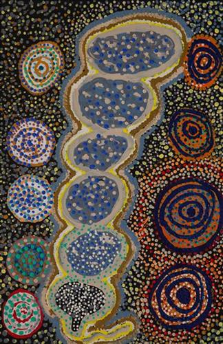
Kunawarritji is an important site in the Great Sandy Desert where multiple stories and histories intersect. Originally a spring water and major Martu pujiman (traditional, desert dwelling) camping site, at the turn of the 20th century Kunawarritji was converted into a well along the Canning Stock Route. Each year throughout the 1930-50s, the well became a site of contact between the drovers, their cattle, and desert families. 

Long before colonial history entered this Country, however, other stories dominated the site. Primarily, Kunawarritji features in the Minyipuru (Jakulyukulyu, Seven Sisters) Jukurrpa (Dreaming). Minyipuru is a central Jukurrpa narrative for Martu, Ngaanyatjarra, Pitjantjatjara and Yankunytjatjara people that is associated with the seasonal Pleiades star constellation. Beginning in Roebourne on the west coast of Western Australia, the story morphs in its movement eastward across the land, following a group of women as they walk, dance, and even fly from waterhole to waterhole. As they travelled the women left markers in the landscape and create landforms that remain to this day. During the entirety of their journey the women are pursued by a lustful old man, Yurla, although interactions with other animals, groups of men, and spirit beings are also chronicled in the narrative.

The Minyipuru travelled to Kunawarritji from Nyipily (Nyipil, Nibil, Canning Stock Route Well 34), and transformed themselves into a distinctive group of trees that remain in the area between these two sites. From Kunawarritji Yurla followed the sisters to Pangkapirni, where he finally caught one of the women. 

Today, Kunawarritji is a site of return, a place where people came back to continue their life in the desert with the formation of Kunawarritji Aboriginal community in the early 1980s. The community’s cultural significance endures, with the population swelling up to 1000 during cultural business.

111582255304


Kunawarritji lakes

Kunawarritji is an important site in the Great Sandy Desert where multiple stories and histories intersect. Originally a spring water and major Martu pujiman (traditional, desert dwelling) camping site, at the turn of the 20th century Kunawarritji was converted into a well along the Canning Stock Route. Each year throughout the 1930-50s, the well became a site of contact between the drovers, their cattle, and desert families. 

Long before colonial history entered this Country, however, other stories dominated the site. Primarily, Kunawarritji features in the Minyipuru (Jakulyukulyu, Seven Sisters) Jukurrpa (Dreaming). Minyipuru is a central Jukurrpa narrative for Martu, Ngaanyatjarra, Pitjantjatjara and Yankunytjatjara people that is associated with the seasonal Pleiades star constellation. Beginning in Roebourne on the west coast of Western Australia, the story morphs in its movement eastward across the land, following a group of women as they walk, dance, and even fly from waterhole to waterhole. As they travelled the women left markers in the landscape and create landforms that remain to this day. During the entirety of their journey the women are pursued by a lustful old man, Yurla, although interactions with other animals, groups of men, and spirit beings are also chronicled in the narrative.

The Minyipuru travelled to Kunawarritji from Nyipily (Nyipil, Nibil, Canning Stock Route Well 34), and transformed themselves into a distinctive group of trees that remain in the area between these two sites. From Kunawarritji Yurla followed the sisters to Pangkapirni, where he finally caught one of the women. 

Today, Kunawarritji is a site of return, a place where people came back to continue their life in the desert with the formation of Kunawarritji Aboriginal community in the early 1980s. The community’s cultural significance endures, with the population swelling up to 1000 during cultural business.