111582307007


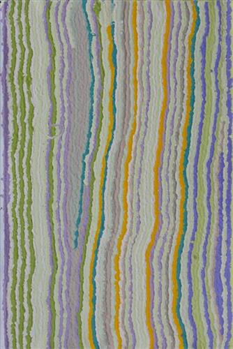
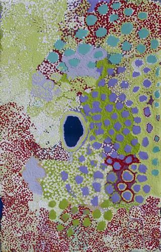
Taparl

“This is Taparl-taparl soak. The story is about an eagle who had two wives. He became jealous and he built the biggest fire. He put more and more wood on the fire until it was really enormous. The eagle turned into a rock, a black rock. One day I might show you this place, it’s really nice, you can clearly see the eagle in the rock, you can see the story.

Right next to the fire, the eagle’s two wives were fighting. The older wife was fighting the younger one and she fell into the fire and was burnt up. The eagle left with the younger wife. That was Taparl-taparl wanti (woman).”

 – Yikartu Bumba, as translated by Ngalangka Nola Taylor

Taparl-taparl lies within Yikartu’s ngurra (home Country, camp), the area which she knew intimately and travelled extensively with her family in her youth. Yikartu walked around this Country with her grandmother, mother, father and grandfather all together. In her account, Yikartu describes part of a Jukurrpa (Dreaming) narrative occurring at this site; here the Taparl-taparl wanti argued with her sister-wife and their mutual husband.

Taparl-taparl is a soak located northeast of the Percival Lakes area, and at the northernmost boundary of Martu Country. Soaks, or soakwaters, derive their name from the manner in which their waters generally seep into the sand from below stores, sometimes as part of an ephemeral river or creek. Soaks were an especially important source of water during the pujiman (traditional, desert dwelling) era, being the most dependable water source in times of drought. Water was obtained from soaks by scooping away the sand with a piti (timber bowls used for carrying food and water) until clear water gathered at the base of the hole, sometimes at a depth of several metres.

During the pujiman period, Martu would traverse very large distances annually in small family groups, moving seasonally from water source to water source, and hunting and gathering bush tucker as they went. At this time knowledge of water sources was critical for survival, and today Martu Country is still defined in terms of the location and type of water. Each of the hundreds of claypans, rockholes, waterholes, soaks and springs found in the Martu desert homelands is known by name, location, quality and seasonal availability through real life experience and the recounting of Jukurrpa narratives.
111582307003


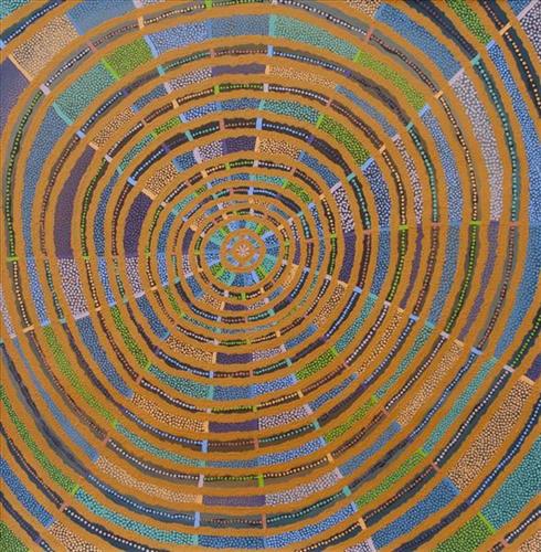
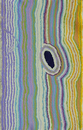
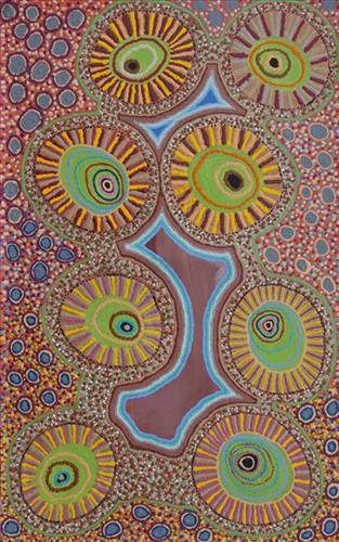
Mungili Waterhole and Claypan

“When I was young, [I would] walk around, play around, slide around on the mud. [At Mungili, there’s a] Big one [claypan] and little ones on the side. And the white gums, [where] we would get witchetty grubs”

– Marlene Anderson

In this work Marlene depicts a claypan located in Mungili, the small outstation community situated just off the Eagle Highway in Western Australia. Mungili lies approximately 430 kilometres northeast of Wiluna and 250 kilometres north of Warburton. Marlene grew up in Mungili, and as such it forms a significant part of her ‘ngurra’ (home Country, camp). Typically Marlene depicts this site with a central large circular form that represents the main claypan, surrounded by smaller circular forms symbolising satellite water bodies.

During the pujiman (traditional, desert dwelling) period, knowledge of water sources was critical for survival, and today Martu Country is still defined in terms of the location and type of water. Each of the hundreds of claypans, rockholes, waterholes, soaks and springs found in the Martu desert homelands is known through real life experience and the recounting of Jukurrpa (Dreaming) narratives by name, location, quality and seasonal availability. This encyclopedic knowledge extends even to the nature and movement of arterial waterways, and sustained Martu as they travelled across their Country, hunting and gathering, visiting family, and fulfilling ceremonial obligations. They would traverse very large distances annually, visiting specific areas in the dry and wet season depending on the availability of water and the corresponding cycles of plant and animal life on which hunting and gathering bush tucker was reliant.

111582307002


Gathering

“When Martu paint, it’s like a map. Martu draw story on the ground and on the canvas, and all the circle and line there are the hunting areas and different waters and tracks where people used to walk, and [some you] can’t cross, like boundaries. So nowadays you see a colourful painting and wonder what it is, but that’s how Martu tell story long ago. It’s not just a lovely painting, it’s a story and a songline and a history and everything that goes with it.” 

– Ngalangka Nola Taylor and Joshua Booth

This work portrays an area of Country that can be interpreted in multiple ways. Firstly, the image may be read as an aerial representation of a particular location known to the artist- either land that they or their family travelled, from the pujiman (traditional, desert dwelling) era to now. During the pujiman period, Martu would traverse very large distances annually in small family groups, moving seasonally from water source to water source, and hunting and gathering bush tucker as they went. At this time, one’s survival depended on their intimate knowledge of the location of resources; thus physical elements of Country, such as sources of kapi (water), tali (sandhills), different varieties of warta (trees, vegetation), ngarrini (camps), and jina (tracks) are typically recorded with the use of a use of a system of iconographic forms universally shared across the desert. 

An additional layer of meaning in the work relates to more intangible concepts; life cycles based around kalyu (rain, water) and waru (fire) are also often evident. A thousands of year old practice, fire burning continues to be carried out as both an aid for hunting and a means of land management today. As the Martu travelled and hunted they would burn tracts of land, ensuring plant and animal biodiversity and reducing the risk of unmanageable, spontaneous bush fires. The patchwork nature of regrowth is evident in many landscape works, with each of the five distinctive phases of fire burning visually described with respect to the cycle of burning and regrowth.  

Finally, metaphysical information relating to a location may also be recorded; Jukurrpa (Dreaming) narratives chronicle the creation of physical landmarks, and can be referenced through depictions of ceremonial sites, songlines, and markers left in the land. Very often, however, information relating to Jukurrpa is censored by omission, or alternatively painted over with dotted patterns.

111582307001


Spinifex

“When I went back to County, I thought how beautiful the spinifex was. How the sun glazed against the spinifex. The County that I speak of is Jilukurru, my grandfather’s country.”

– Kathleen Maree Sorenson

Martu Country is dominated by striking permanent tali (sandhills) covered with spinifex, gums, and other trees and shrubs. Spinifex is a pale green, spiky grass that grows in clumps throughout the Central and Western Deserts of Australia. Some varieties yield edible seeds and another contains a resin. 

111582307000


Untitled

This is Yikartu’s Country- her ‘ngurra’ (home Country, camp). People identify with their ngurra in terms of specific rights and responsibilities, and the possession of intimate knowledge of the physical and cultural properties of one’s Country. Painting ngurra, and in so doing sharing the Jukurrpa (Dreaming) stories and physical characteristics of that place, has today become an important means of cultural maintenance. 

Yikartu’s ngurra encompasses the Country that she and her family walked in the pujiman (traditional, desert-dwelling) era. Yikartu was born at Lalyipuka. She grew up, walked and hunted primarily within Yulparija Country, north of Manyjilyjarra Country, and through to the Percival Lakes area, at the northern boundary of the Martu homelands. She continued to live nomadically before eventually deciding to move to Jigalong Mission along with many other relatives following an extreme and prolonged drought in the 1960s. 

Portrayed in this work are features of Yikartu’s ngurra, such as the dominant permanent red tali (sandhills), warta (trees, vegetation), and the individually named water sources she and her family camped at. These include Yulpu, Yimiri, Kupankurlu, Kurturrara, Wirnpa, Jurnpanja, Rulu-rulu, Taparl-taparl, Wirrkujapayi, Tayiku and Puntita. Rock holes, waterholes, soaks and springs were all extremely important sites for Martu people during the pujiman period, and are generally depicted with circular forms. 

The encyclopaedic knowledge of the location, quality and seasonal availability of the hundreds of water bodies found in one’s Country sustained Martu as they travelled across their Country, hunting and gathering, visiting family, and fulfilling ceremonial obligations. They would traverse very large distances annually, visiting specific areas in the dry and wet season depending on the availability of water and the corresponding cycles of plant and animal life on which hunting and gathering bush tucker was reliant. As they travelled and hunted they would also burn areas of Country, generating a greater diversity of plant and animal life.

111582306999


Yirtal and Jupurrl

“Two yintas (permanent springs) in my ngurra (home Country, camp); the yintas are Yirtal and Jupurrl. They are kakarra (east) of Kulyakartu and kayili (north) side of Wirnpa. I was a married woman when I was walking around this place, pujiman (traditional, desert dwelling) time. I married a good man. There’s lots of kapi (water) there. Lots of yukari (green grass, vegetation). Plenty of bushtucker, pussycat and goanna. There’s no kapi when you first get there, but you dig him up and then there’s lots of kapi. We’ve got to take all the kids to that ngurra. Show them my daddy’s ngurra. There’s another waterhole, not far from there called Jakapinka. A jila (snake) made that kapi. It’s my brother’s Country. Not far from these yintas.”

– Yikartu Bumba

Yirtal is a soak located within the Percival Lakes region. The site is surrounded by a vegetation that needs to be cleared before accessing the water there. Yirtal is Yikartu’s ngurra through her father. As she recount, nearby water sources include Jupurl and Jakapinka.

During the pujiman (traditional, desert dwelling) days, Yikartu and her family travelled extensively through this Country. At this time Martu would traverse very large distances annually in small family groups, moving seasonally from water source to water source, and hunting and gathering bush tucker as they went. Knowledge of water sources was critical for survival, and today Martu Country is still defined in terms of the location and type of water. Each of the hundreds of claypans, rockholes, waterholes, soaks and springs found in the Martu desert homelands is known by name, location, quality and seasonal availability through real life experience and the recounting of Jukurrpa (Dreaming) narratives. 

The region surrounding Yurlpu was formed by Wirnpa, one of the most powerful of the ancestral jila (snake) men and the last to travel the desert during the Jukurrpa. Wirnpa is a rainmaking jila who lived and hunted in the Percival Lakes area. His travels are described in the songs and stories of many language groups across the Western Desert, even those far removed from his home site. In his epic travels, Wirnpa met and feasted with many other ancestral beings, exchanged ceremonial objects, and created a series of different laws and ceremonies. When he finally returned home, he searched for his many children only to discover that they had already died. They had laid down and become the salt springs of the Percival Lakes. Wirnpa wept for his children before himself transforming into a snake and entering the soak where he still resides.

111582306992


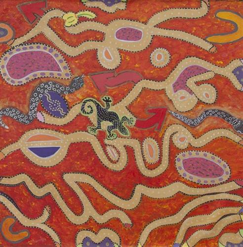
Finding your way home

“When Martu paint, it’s like a map. Martu draw story on the ground and on the canvas, and all the circle and line there are the hunting areas and different waters and tracks where people used to walk, and [some you] can’t cross, like boundaries. So nowadays you see a colourful painting and wonder what it is, but that’s how Martu tell story long ago. It’s not just a lovely painting, it’s a story and a songline and a history and everything that goes with it.” 

– Ngalangka Nola Taylor and Joshua Booth

This work portrays an area of Country that can be interpreted in multiple ways. Firstly, the image may be read as an aerial representation of a particular location known to the artist- either land that they or their family travelled, from the pujiman (traditional, desert dwelling) era to now. During the pujiman period, Martu would traverse very large distances annually in small family groups, moving seasonally from water source to water source, and hunting and gathering bush tucker as they went. At this time, one’s survival depended on their intimate knowledge of the location of resources; thus physical elements of Country, such as sources of kapi (water), tali (sandhills), different varieties of warta (trees, vegetation), ngarrini (camps), and jina (tracks) are typically recorded with the use of a use of a system of iconographic forms universally shared across the desert. 

An additional layer of meaning in the work relates to more intangible concepts; life cycles based around kalyu (rain, water) and waru (fire) are also often evident. A thousands of year old practice, fire burning continues to be carried out as both an aid for hunting and a means of land management today. As the Martu travelled and hunted they would burn tracts of land, ensuring plant and animal biodiversity and reducing the risk of unmanageable, spontaneous bush fires. The patchwork nature of regrowth is evident in many landscape works, with each of the five distinctive phases of fire burning visually described with respect to the cycle of burning and regrowth.  

Finally, metaphysical information relating to a location may also be recorded; Jukurrpa (Dreaming) narratives chronicle the creation of physical landmarks, and can be referenced through depictions of ceremonial sites, songlines, and markers left in the land. Very often, however, information relating to Jukurrpa is censored by omission, or alternatively painted over with dotted patterns.

111582306989


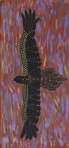
Bird finding the way home

“When Martu paint, it’s like a map. Martu draw story on the ground and on the canvas, and all the circle and line there are the hunting areas and different waters and tracks where people used to walk, and [some you] can’t cross, like boundaries. So nowadays you see a colourful painting and wonder what it is, but that’s how Martu tell story long ago. It’s not just a lovely painting, it’s a story and a songline and a history and everything that goes with it.” 

– Ngalangka Nola Taylor and Joshua Booth

This work portrays an area of Country that can be interpreted in multiple ways. Firstly, the image may be read as an aerial representation of a particular location known to the artist- either land that they or their family travelled, from the pujiman (traditional, desert dwelling) era to now. During the pujiman period, Martu would traverse very large distances annually in small family groups, moving seasonally from water source to water source, and hunting and gathering bush tucker as they went. At this time, one’s survival depended on their intimate knowledge of the location of resources; thus physical elements of Country, such as sources of kapi (water), tali (sandhills), different varieties of warta (trees, vegetation), ngarrini (camps), and jina (tracks) are typically recorded with the use of a use of a system of iconographic forms universally shared across the desert. 

An additional layer of meaning in the work relates to more intangible concepts; life cycles based around kalyu (rain, water) and waru (fire) are also often evident. A thousands of year old practice, fire burning continues to be carried out as both an aid for hunting and a means of land management today. As the Martu travelled and hunted they would burn tracts of land, ensuring plant and animal biodiversity and reducing the risk of unmanageable, spontaneous bush fires. The patchwork nature of regrowth is evident in many landscape works, with each of the five distinctive phases of fire burning visually described with respect to the cycle of burning and regrowth.  

Finally, metaphysical information relating to a location may also be recorded; Jukurrpa (Dreaming) narratives chronicle the creation of physical landmarks, and can be referenced through depictions of ceremonial sites, songlines, and markers left in the land. Very often, however, information relating to Jukurrpa is censored by omission, or alternatively painted over with dotted patterns.

222082307305


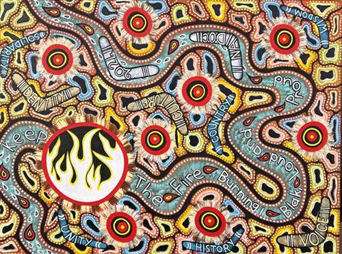
DUNGALA (Murray River / home country)

In this artwork I’ve painted the (DUNGALA) Murray River of my home country Echuca, Yorta Yorta. Tribes along the river coming to gather to pass down knowledge and talk and have discussions keeping the Fire Burning! Blak, Loud & Proud. I’ve put words to express what ‘Keep the Fire Burning! Blak, Loud & Proud’ means to me. The (DUNGALA) Murray River running through the art piece. Boomerangs representing us as Aboriginal people.

Colours: Black, Red, Yellow and white Colours represent the following:

Black represents the Aboriginal people of Australia. It symbolizes their identity, resilience, and connection to the land.

Red represents the earth, fire, and blood. It signifies the life force and energy that binds Indigenous Australians to their ancestral lands.

Yellow symbolizes the sun—the giver of life and protector. It represents warmth, light, and vitality.

White is associated with purity and spirituality. The main white circle representing flames and spirits of strength. Also being the main gathering spot.

222082307304


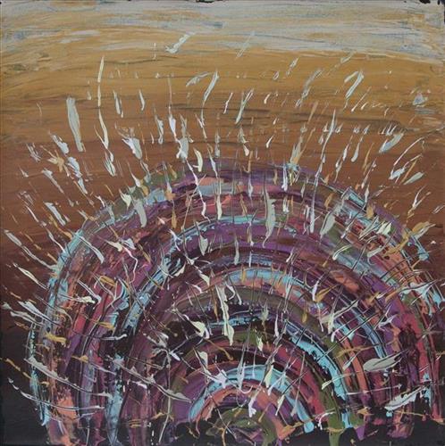
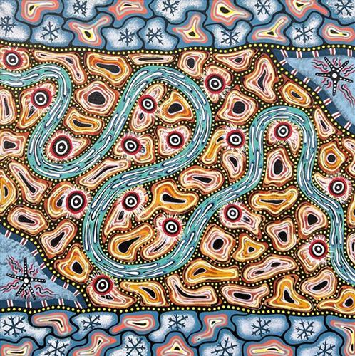
Winter days

Winter days for me in this art piece means a time when Aboriginal people would move from the outlands to inland to avoid the cold ocean breezes. Winter days also means to me a time on my home country that the river would burst its banks and flood the countryside, nourishing the land.