115982324841


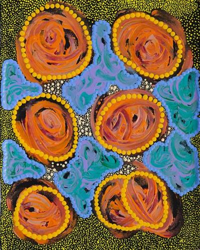
Langkwa (Bush Banana)

Langkwa (bush bananas) are a popular bush tucker in Central Australia. The banana vine grows by winding up other trees or along the ground. The leaves and flowers are edible and the white fibre of the fruit has a mild flavour, described by some as tasting like a snowpea.

111582324815


Nyilangkurr

Nyilangkurr is a group of three large tali (sandhills) located between Kartarru (Canning Stock Route Well 24) and Tiwa (Canning Stock Route 26), and just east of Wantili, an important creation site.

The traditional lands of the Martu people encompass the Great Sandy Desert and Rudall River regions of Western Australia, an enormous tract dominated by distinctive red tali, or tuwa (sandhills). These sandhills present an unforgiving landscape; sparse vegetation covers a seemingly never ending expanse of dunes, and yet these lands and the location of resources within them was known intimately by its pujiman (traditional, desert dwelling) inhabitants. At this time, Martu traversed very large distances annually in small family groups, moving from water source to water source through the harsh desert landscape with incredible stamina and resourcefulness. Travel was often undertaken at night, and when travelling during the day, Martu wore yakipiri (woven bark sandals) to protect their feet from the hot desert sand.

111582324809


Nyilangkurr

Nyilangkurr is a group of three large tali (sandhills) located between Kartarru (Canning Stock Route Well 24) and Tiwa (Canning Stock Route 26), and just east of Wantili, an important creation site.

The traditional lands of the Martu people encompass the Great Sandy Desert and Rudall River regions of Western Australia, an enormous tract dominated by distinctive red tali, or tuwa (sandhills). These sandhills present an unforgiving landscape; sparse vegetation covers a seemingly never ending expanse of dunes, and yet these lands and the location of resources within them was known intimately by its pujiman (traditional, desert dwelling) inhabitants. At this time, Martu traversed very large distances annually in small family groups, moving from water source to water source through the harsh desert landscape with incredible stamina and resourcefulness. Travel was often undertaken at night, and when travelling during the day, Martu wore yakipiri (woven bark sandals) to protect their feet from the hot desert sand.

111582324798


Nyilangkurr

Nyilangkurr is a group of three large tali (sandhills) located between Kartarru (Canning Stock Route Well 24) and Tiwa (Canning Stock Route 26), and just east of Wantili, an important creation site.

The traditional lands of the Martu people encompass the Great Sandy Desert and Rudall River regions of Western Australia, an enormous tract dominated by distinctive red tali, or tuwa (sandhills). These sandhills present an unforgiving landscape; sparse vegetation covers a seemingly never ending expanse of dunes, and yet these lands and the location of resources within them was known intimately by its pujiman (traditional, desert dwelling) inhabitants. At this time, Martu traversed very large distances annually in small family groups, moving from water source to water source through the harsh desert landscape with incredible stamina and resourcefulness. Travel was often undertaken at night, and when travelling during the day, Martu wore yakipiri (woven bark sandals) to protect their feet from the hot desert sand.

111582324797


Pitu (Separation Well)

“Pitu (Separation Well) is my grandfather’s Country, Wikiri is my nanna’s country, GJ (Georgia) Bore is my mama’s country and in the middle is Wantili.

I’m painting the Country. My grandmother and grandfather was from this Country. They walked around eating, hunting, making fire from the spinifex on this Country.

You can see all the way through; GJ Bore to Pitu, with Wantili in the middle. Ngayuku ngurra (my home Country, camp). That’s my home.”

– Brett Bidu

In this work Brett depicts his ngurra. The Western Desert term ‘ngurra’ is hugely versatile in application. Broadly denoting birthplace and belonging, ngurra can refer to a body of water, a camp site, a large area of Country, or even a modern house. People identify with their ngurra in terms of specific rights and responsibilities, and the possession of intimate knowledge of the physical and cultural properties of one’s Country. This knowledge is traditionally passed intergenerationally through family connections. Country for Martu is full of memory; not just the memory of their own movement through it, but also of their family. 

Painting ngurra, and in so doing sharing the Jukurrpa (Dreaming) stories and physical characteristics of that place, has today become an important means of cultural maintenance. Physical maintenance of one’s ngurra, like cultural maintenance, ensures a site’s wellbeing, and is a responsibility of the people belonging to that area.  

Pitu is an important cultural site and large soak located yulparirra (south) of Wuranu (Canning Stock Route Well 29) and Kulilu rockhole and soak. As a site where fresh water was available all year, Pitu was an important camp and a meeting place for Kartujarra and Manyjilyjarra people during the pujiman (traditional, desert dwelling) era.

Wikiri (Midway Well) is a large soak and claypan located southeast of Parnngurr Aboriginal community. A windmill has been built at the site to access the permanent underground water available there. The many foods and seeds found at Wikiri were left by ancestors in the Jukurrpa (Dreaming), Wirnpa and Jaramarra, rainmaking snakes that now reside around the Great Sandy Desert’s Percival Lakes region, and at the northernmost boundary of Martu Country.

Wantili (Warntili, Canning Stock Route Well 25) is a large round jurnu (soak) and linyji (claypan) near Well 25 on the Canning Stock Route. It is also an incredibly important cultural site, ‘where the creation started.’ (Cyril Whyoulter). The area is dominated by claypans surrounded by tuwa (sandhills), and Nyilangkurr, a prominent yapu (hill) is located on the edge of the claypan. Following rain the typically dry claypans are filled with water, with the overflow from nearby waterholes flowing to Wantili. At that time, Wantili becomes an important place for obtaining fresh water for drinking and bathing. Wantili is significant for the fact that at this site Kartujarra, Manyjilyjarra, Putijarra and Warnman people would all come together for ceremonies during the pujiman era. Many jiwa (stones used by women for grinding seeds) from these times can still be found there today. 

111582324796


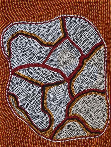
Untitled

“When Martu paint, it’s like a map. Martu draw story on the ground and on the canvas, and all the circle and line there are the hunting areas and different waters and tracks where people used to walk, and [some you] can’t cross, like boundaries. So nowadays you see a colourful painting and wonder what it is, but that’s how Martu tell story long ago. It’s not just a lovely painting, it’s a story and a songline and a history and everything that goes with it.” 

– Ngalangka Nola Taylor and Joshua Booth

This work portrays an area of Country that can be interpreted in multiple ways. Firstly, the image may be read as an aerial representation of a particular location known to the artist- either land that they or their family travelled, from the pujiman (traditional, desert dwelling) era to now. During the pujiman period, Martu would traverse very large distances annually in small family groups, moving seasonally from water source to water source, and hunting and gathering bush tucker as they went. At this time, one’s survival depended on their intimate knowledge of the location of resources; thus physical elements of Country, such as sources of kapi (water), tali (sandhills), different varieties of warta (trees, vegetation), ngarrini (camps), and jina (tracks) are typically recorded with the use of a use of a system of iconographic forms universally shared across the desert. 

An additional layer of meaning in the work relates to more intangible concepts; life cycles based around kalyu (rain, water) and waru (fire) are also often evident. A thousands of year old practice, fire burning continues to be carried out as both an aid for hunting and a means of land management today. As the Martu travelled and hunted they would burn tracts of land, ensuring plant and animal biodiversity and reducing the risk of unmanageable, spontaneous bush fires. The patchwork nature of regrowth is evident in many landscape works, with each of the five distinctive phases of fire burning visually described with respect to the cycle of burning and regrowth.  

Finally, metaphysical information relating to a location may also be recorded; Jukurrpa (Dreaming) narratives chronicle the creation of physical landmarks, and can be referenced through depictions of ceremonial sites, songlines, and markers left in the land. Very often, however, information relating to Jukurrpa is censored by omission, or alternatively painted over with dotted patterns.

111582324794


Rockholes

Depicted in this work are sources of kapi (water) within the artists’ ngurra (home Country, camp). Today Martu Country is still defined in terms of the location and type of water. Each of the hundreds of claypans, rockholes, waterholes, soaks and springs found in the Martu desert homelands is known through real life experience and the recounting of Jukurrpa (Dreaming) narratives by name, location, quality and seasonal availability. For thousands of years, Aboriginal people have typically represented water with circular forms, and tali with linear groupings in rock art, sand drawings, and now contemporary paintings. Parnngurr rockhole is located just south of Parnngurr Aboriginal community. At the junction of three linguistic groups; Manyjilyjarra, Kartujarra, and Warnman, it was a critical and permanent source of water during the pujiman (traditional, desert born) era that supported many ritual large gatherings. During this nomadic period families stopped and camped here depending on the seasonal availability of water and the corresponding cycles of plant and animal life on which hunting and gathering bush tucker was reliant. At Parnngurr and other similarly important camp sites families would meet for a time before moving to their next destination. Parnngurr and its surrounds are physically dominated by distinctively red tali (sandhills), covered sparingly with spinifex and low lying shrub.

115982314964


Lyarra-lyarra (wren)

Lyarra-lyarra (blue bird) Lyarra-lyarra always comes to my house and they come and look for water. They always comes to my fence and they look for water, they make me happy when I see the birds.

115982314886


Tjaapa (Witchetty Grub)

Witchery grub (Tjaapa) All the family’s went to bush somewhere near ntaria, we went hunting for Tjaapa tnyamaatja means whitchery grub. We sit by the trees to dig for whitchery grubs.