220282379354


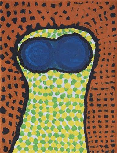
Ininti at Muruntji

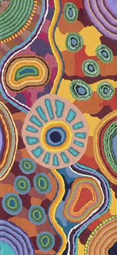
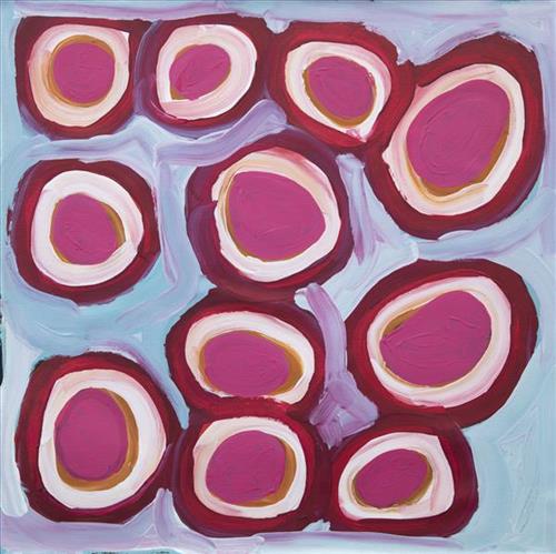
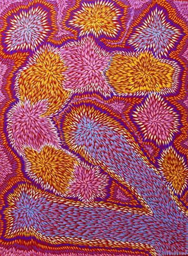
This painting depicts the bush seeds that come from the ininti tree (batwinged coral tree).  The tree is native to the Western Desert of Central Australia, growing in sand around creek beds. The ininti grow abundantly in Muruntji country where the artist has spent much time collecting the seeds. Muruntji is west of Kungkayunti (Browns Bore), the outstation where the artist’s family is from. Both Patricia Multa, and her daughter Virgillia Multa paint the ininti at Muruntji, expressing the colours and movement of the ininti tree and its seeds and flowers throughout the seasons. Patricia remembers collecting the seeds when she was a child and making them into necklaces. The seeds can be found in the sand, or inside the pods still on the trees. The seeds naturally grow in varying colours from dark reds to light yellows. The flowers are equally vibrant, ranging from rich oranges into reds. Ininti are still collected today and made into jewellery at Ikuntji Artists. 

115682379638


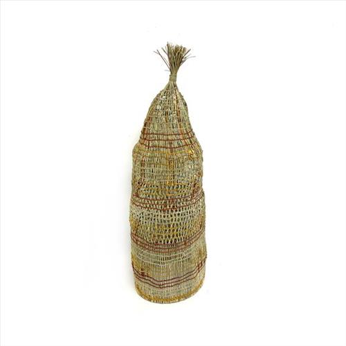
Dhawurr or Batjbarra (Fish Trap)

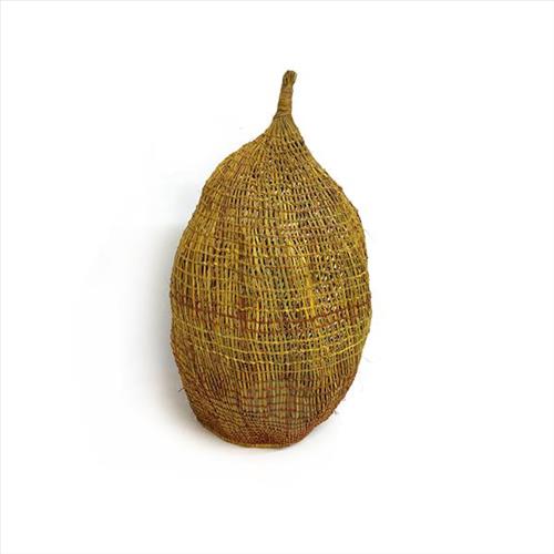
Dhawurr, or Batjbarra, is a traditional fishing method used by Indigenous people in the Arafura Swamp and surrounding wetlands of Arnhem Land. Yolŋu now prefer the modern fishing methods of reels and bait, however, weavers continue to make Batjbarra for cultural conservation and to be sold as decorative pieces.

When used for practical purposes, the Batjbarra was placed into the river with the opening facing oncoming fish. The woven tunnel trapped the fish with the weave tight enough to prevent escape but loose enough to allow water to freely flow through. The traps tapered so that when they were submerged, the water pressure wedged them into place.

The primary material used in this piece is the young, green leaves of the Pandanus spiralis tree, that were harvested using a long wooden hook. The leaves are stripped of their prickles, with the smaller fibres being dried to produce a strong, resilient material. These fibres are then twisted, coiled, or combined using various techniques to create the fish trap.

Bula’bula weavers exclusively use natural dyes, derived from locally sourced roots, leaves and grasses. These pigments are extracted and infused into pandanus fibres by boiling over an open fire, producing the rich, vibrant colours characteristic of contemporary Yolŋu weavings.

220982379633


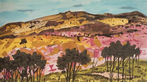
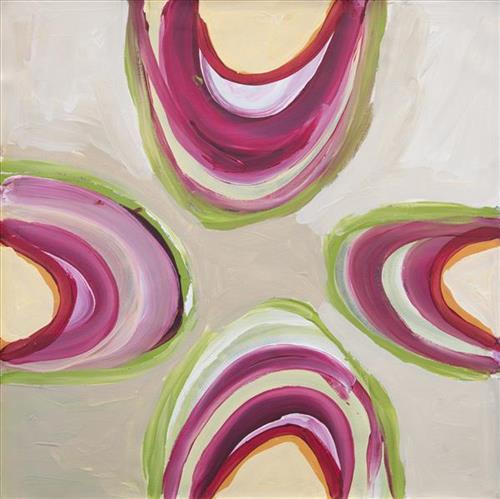
Elizabeth Ngwarraye Bonney – My Grandmothers Country

I still hunt my Grand Mothers country for goanna, bush medicine and yams.

I hunt all year round, hunting and walking through the country makes me happy.  When I look at the distant hills I can feel my grandmother.  Bush flowers are everywhere.

Painting and printing my grandmother’s country reminds about those times.

115682379454


Dhawurr or Batjbarra (Fish Trap)

Dhawurr, or Batjbarra, is a traditional fishing method used by Indigenous people in the Arafura Swamp and surrounding wetlands of Arnhem Land. Yolŋu now prefer the modern fishing methods of reels and bait, however, weavers continue to make Batjbarra for cultural conservation and to be sold as decorative pieces.

When used for practical purposes, the Batjbarra was placed into the river with the opening facing oncoming fish. The woven tunnel trapped the fish with the weave tight enough to prevent escape but loose enough to allow water to freely flow through. The traps tapered so that when they were submerged, the water pressure wedged them into place.

The primary material used in this piece is the young, green leaves of the Pandanus spiralis tree, that were harvested using a long wooden hook. The leaves are stripped of their prickles, with the smaller fibres being dried to produce a strong, resilient material. These fibres are then twisted, coiled, or combined using various techniques to create the fish trap.

Bula’bula weavers exclusively use natural dyes, derived from locally sourced roots, leaves and grasses. These pigments are extracted and infused into pandanus fibres by boiling over an open fire, producing the rich, vibrant colours characteristic of contemporary Yolŋu weavings.

111582379759


Mungili Waterholes and Rockholes

“No one goes there and sees that landscape. Only two, Mr and Mrs [refers to footsteps in painting]. They was walking to see if the water was in there. Walking on the creek sand, they see the colours and walk down to the water hole and dig where the waters been left. Dig the creek sand where there is still water. Little huts where they sit; move when it dries out. Leave remembrance behind. When the water fills up again; come back.

When the creek sand is still moist you can see the colours. You can see many colours – lovely colours come out. I do that in my mind [when painting], go and think about the rock colours there.

Different plants, water runs, and different plants are growing, different seeds. When it rains, all year round, when its overflowing. It’s all connected. The orange sand connects to one waterhole full of water, then flowing through the creek sand. This side down [pointing to one rock hole]; and it’s a bit up [pointing to another rock hole].

I was swimming there. Yeah, we go visit them a long time [ago]. We drink it, rainwater from the rain. Big waterhole. It’s a fresh water, when the rain comes, fills it up. One for swimming and another rock hole for drinking. 3 rock holes; another is special.”

– Marlene Anderson

In this work Marlene depicts a waterhole and rock hole located in Mungili, the small outstation community located just off the Eagle Highway in Western Australia, approximately 430 kilometres northeast of Wiluna and 250 kilometres north of Warburton. Marlene grew up in Mungili, and as such it forms a significant part of her ‘ngurra’ (home Country, camp). Typically Marlene depicts this site with a central large circular form that represents the main waterhole, surrounded by smaller circular forms representing satellite water bodies.

During the pujiman (traditional, desert dwelling) period, knowledge of water sources was critical for survival, and today Martu Country is still defined in terms of the location and type of water. Each of the hundreds of claypans, rockholes, waterholes, soaks and springs found in the Martu desert homelands is known through real life experience and the recounting of Jukurrpa (Dreaming) narratives by name, location, quality and seasonal availability. This encyclopedic knowledge extends even to the nature and movement of arterial waterways, and sustained Martu as they travelled across their Country, hunting and gathering, visiting family, and fulfilling ceremonial obligations. They would traverse very large distances annually, visiting specific areas in the dry and wet season depending on the availability of water and the corresponding cycles of plant and animal life on which hunting and gathering bush tucker was reliant.
111582379628


Untitled

“When Martu paint, it’s like a map. Martu draw story on the ground and on the canvas, and all the circle and line there are the hunting areas and different waters and tracks where people used to walk, and [some you] can’t cross, like boundaries. So nowadays you see a colourful painting and wonder what it is, but that’s how Martu tell story long ago. It’s not just a lovely painting, it’s a story and a songline and a history and everything that goes with it.” 

– Ngalangka Nola Taylor and Joshua Booth

This work portrays an area of Country that can be interpreted in multiple ways. Firstly, the image may be read as an aerial representation of a particular location known to the artist- either land that they or their family travelled, from the pujiman (traditional, desert dwelling) era to now. During the pujiman period, Martu would traverse very large distances annually in small family groups, moving seasonally from water source to water source, and hunting and gathering bush tucker as they went. At this time, one’s survival depended on their intimate knowledge of the location of resources; thus physical elements of Country, such as sources of kapi (water), tali (sandhills), different varieties of warta (trees, vegetation), ngarrini (camps), and jina (tracks) are typically recorded with the use of a use of a system of iconographic forms universally shared across the desert. 

An additional layer of meaning in the work relates to more intangible concepts; life cycles based around kalyu (rain, water) and waru (fire) are also often evident. A thousands of year old practice, fire burning continues to be carried out as both an aid for hunting and a means of land management today. As the Martu travelled and hunted they would burn tracts of land, ensuring plant and animal biodiversity and reducing the risk of unmanageable, spontaneous bush fires. The patchwork nature of regrowth is evident in many landscape works, with each of the five distinctive phases of fire burning visually described with respect to the cycle of burning and regrowth.  

Finally, metaphysical information relating to a location may also be recorded; Jukurrpa (Dreaming) narratives chronicle the creation of physical landmarks, and can be referenced through depictions of ceremonial sites, songlines, and markers left in the land. Very often, however, information relating to Jukurrpa is censored by omission, or alternatively painted over with dotted patterns.

111582379626


Jartuti

Jartuti is a water source located close to Parnngurr Aboriginal Community (otherwise known as Cotton Creek). The site is near to the home of the jangara (cannibal devil), spiritual beings from the Jukurrpa (Dreaming) era.

111582379774


Tuwa (sandhills) in Puntawarri

“I do tuwa (sandhill) in my own style because that’s our Country. That’s a sandhill, that’s the Dreaming- the Jukurrpa. That’s our culture.

They stay there and we go through the sandhills at Puntawarri in the car. We go first tuwa, then the second tuwa, looking for the waterholes. Go up, up, up- ‘nother tuwa, ‘nother tuwa.

Long time [ago] in Puntawarri, when I was a little girl [with] my Nana and Pop [Dadda Samson (dec.) and Yanjimi Peter Rowlands (dec.)] we went climbing up the sandhill. And when I went up my Nana and Pop were at the bottom under a tree and I came down running then rolling, rolling right down to the ground! But I was ok- he right!”

– Judith Anya Samson

Puntawarri is an important cultural area located on the middle stretches of the Canning Stock Route and east of the Jigalong Mission (now Jigalong Aboriginal community), where Anya grew up with her grandmother and renowned Martumili Artist, Dadda Samson (dec.). Puntawarri is also the site of an abandoned community, a waterhole, creek and lake. Puntawarri’s close proximity to Jigalong Mission made it a popular site for Martu to visit during the ‘mission days’. While growing up at Jigalong Mission in the 1960’s, Dadda would return to Puntawarri every weekend to hunt and camp. 

For many Martu, like Anya’s family, Jigalong Mission was the site where their pujiman (traditional, desert dwelling) lifestyle came to an end from the late 1940s as they transitioned to a life as stockmen and women working in cattle stations in the Pilbara region and beyond. In the wake of the extreme and prolonged drought of the 1960s, the last of the remaining pujimanpa (desert dwellers) were forced to move to missions like Jigalong, where a supply of food and water was assured. There, many Martu were reunited with family members that had already moved in from the desert.

The traditional lands of the Martu people encompass the Great Sandy Desert and Rudall River regions of Western Australia, an enormous tract dominated by distinctive red tali, or tuwa (sandhills). These sandhills present an unforgiving landscape; sparse vegetation covers a seemingly never ending expanse of dunes, and yet these lands and the location of resources within them was known intimately by its pujiman inhabitants.


111582379771


Puntawarri

“We drink water at Puntawarri. We clean and dig that waterhole. This Country is Puntawarri. My nanna, Dadda, taught me to paint this Country. Puntawarri is important because it is my pop’s, my nannas’ husband’s, place. They camped there and went hunting for goanna or anything, kangaroo or turkey. At Puntawarri there are all the waterholes. Good hunting this Country. There is still some Rabbit Proof Fence there.”

 – Judith Anya Samson

Puntawarri is an important cultural area located on the middle stretches of the Canning Stock Route and east of the Jigalong Mission (now Jigalong Aboriginal community), where Judith grew up with her grandmother and renowned Martumili Artist, Dadda Samson (dec.). Puntawarri is also the site of an abandoned community, a waterhole, creek and lake. Puntawarri’s close proximity to Jigalong Mission made it a popular site for Martu to visit during the ‘mission days’.

While growing up at Jigalong Mission in the 1960’s, Dadda would return to Puntawarri every weekend to hunt and camp. Dadda has been teaching Judith to paint for a number of years, sharing the knowledge and Jukurrpa (Dreaming) stories associated with her ngurra (home Country, camp). 

For many Martu, like Dadda and her family, Jigalong Mission was the site where their pujiman (traditional, desert dwelling) lifestyle came to an end from the late 1940s as they transitioned to a life as stockmen and women working in cattle stations in the Pilbara region and beyond. In the wake of the extreme and prolonged drought of the 1960s, the last of the remaining pujimanpa (desert dwellers) were forced to move to missions like Jigalong, where a supply of food and water was assured. There, many Martu were reunited with family members that had already moved in from the desert.

The waterhole at Puntawarri is said to be populated by several kinds of ancestral jila (snake), however the site is best known for its association with the Ngayurnangalku, fearsome ancestral cannibal beings. During the Jukurrpa the Ngayurnangalku came together from all over the desert, first stopping near Puntawarri on their travels to Kumpupirntily (Kumpupintily, Lake Disappointment). At Kumpupirntily, they had a big meeting to debate whether or not they would continue to live as cannibals, and eventually came to the decision to stop eating people. That night, a female baby cannibal was born to the eastern Ngayurnangalku on the red sandhills at Puntawarri, where she continues to live today as the ‘big mummy’ Ngayurnangalku. Following protocol, the baby also had to be consulted by the group. She determined that the Ngayurnangalku should continue to eat people. Her decision divided the group, and from this point the group from the east continued to live as ‘bad’ cannibals at Kumpupirntily, while the group from the west became ‘good’, thereafter consuming only animals.