111582379672


Kangaroos

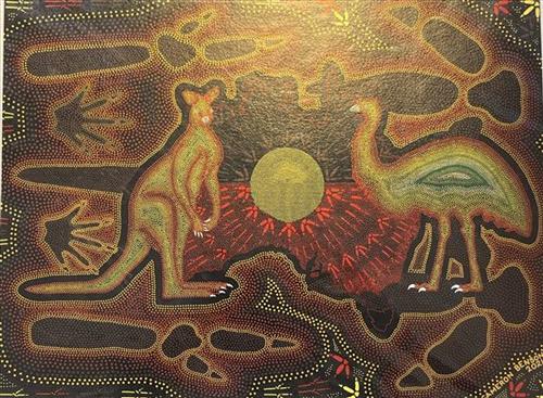
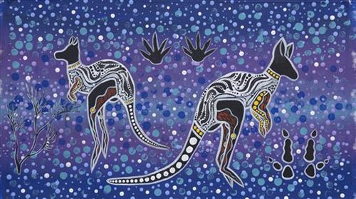
Marlu (kangaroo) are one of the largest species that form part of the Martu diet, and are typically hunted by men on specific trips targeting major game. Marlu are prized not only for the high yield of meat which they represent, but also for the level of skill and stamina required to hunt them. When hunted, marlu are typically directed via fire and then tracked for a lengthy period of up to several hours. Effective hunting also relies on one’s knowledge of seasonal conditions and preferred foods and habitats. Traditionally, marlu were stalked and then speared. Today, marlu are generally hunted with rifles at the beginning of yalijarra (hot season), before the rains. 

During the pujiman (traditional, desert dwelling) period, Martu would traverse very large distances annually in small family groups, moving seasonally from water source to water source, and hunting and gathering bush tucker as they went. Whilst desert life has moved away from mobile hunter-gatherer subsistence throughout the course of the twentieth century, bush tucker continues to be a significant component of the modern Martu diet. Hunting and gathering bush tucker remains equally valuable as an important cultural practice that is passed on intergenerationally. Though hunting and gathering implements have been modernised, methods of harvesting, tracking and the use of fire burning to drive animals from their retreats are still commonly practiced today. 

111582379670


Untitled

“When Martu paint, it’s like a map. Martu draw story on the ground and on the canvas, and all the circle and line there are the hunting areas and different waters and tracks where people used to walk, and [some you] can’t cross, like boundaries. So nowadays you see a colourful painting and wonder what it is, but that’s how Martu tell story long ago. It’s not just a lovely painting, it’s a story and a songline and a history and everything that goes with it.” 

– Ngalangka Nola Taylor and Joshua Booth

This work portrays an area of Country that can be interpreted in multiple ways. Firstly, the image may be read as an aerial representation of a particular location known to the artist- either land that they or their family travelled, from the pujiman (traditional, desert dwelling) era to now. During the pujiman period, Martu would traverse very large distances annually in small family groups, moving seasonally from water source to water source, and hunting and gathering bush tucker as they went. At this time, one’s survival depended on their intimate knowledge of the location of resources; thus physical elements of Country, such as sources of kapi (water), tali (sandhills), different varieties of warta (trees, vegetation), ngarrini (camps), and jina (tracks) are typically recorded with the use of a use of a system of iconographic forms universally shared across the desert. 

An additional layer of meaning in the work relates to more intangible concepts; life cycles based around kalyu (rain, water) and waru (fire) are also often evident. A thousands of year old practice, fire burning continues to be carried out as both an aid for hunting and a means of land management today. As the Martu travelled and hunted they would burn tracts of land, ensuring plant and animal biodiversity and reducing the risk of unmanageable, spontaneous bush fires. The patchwork nature of regrowth is evident in many landscape works, with each of the five distinctive phases of fire burning visually described with respect to the cycle of burning and regrowth.  

Finally, metaphysical information relating to a location may also be recorded; Jukurrpa (Dreaming) narratives chronicle the creation of physical landmarks, and can be referenced through depictions of ceremonial sites, songlines, and markers left in the land. Very often, however, information relating to Jukurrpa is censored by omission, or alternatively painted over with dotted patterns.

111582379669


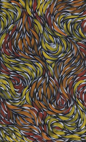
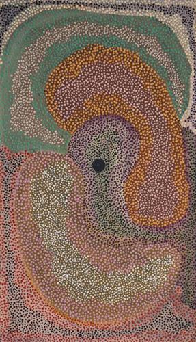
Untitled

This work portrays an area known to the artist, painted here from memory. During the pujiman (traditional, desert dwelling) era one’s survival depended on their intimate knowledge of the location of resources; thus physical elements of Country, such as sources of kapi (water), tali (sandhills), and different varieties of warta (trees, vegetation) were carefully observed and remembered. Today, this relationship with Country remains equally strong, despite the movement of Martu out of the desert and into remote Aboriginal communities, towns and cities.

Also visible may be traces of life cycles based around kalyu (rain, water) and waru (fire). A thousands of year old practice, fire burning continues to be carried out as both an aid for hunting and a means of land management today. As the Martu travelled and hunted they would burn tracts of land, ensuring plant and animal biodiversity and reducing the risk of unmanageable, spontaneous bush fires. The patchwork nature of regrowth is visible in many landscape works, with each of the five distinctive phases of fire burning visually described with respect to the cycle of burning and regrowth.  

Finally, metaphysical information relating to a location may also be recorded; Jukurrpa (Dreaming) narratives chronicle the creation of physical landmarks, and can be referenced through depictions of ceremonial sites, songlines, and markers left in the land. 

111582379667


Punmu waterholes

“Punmu, I went there when I was a young girl, a teenager with my mother and father before my mother passed. Big mob of people was there. No building, just little cubby houses [bough shelters]. Long time I been there. 

These here are the waterholes around Punmu; Rawa spring- Rawa means ‘long time’, Tuu-tuu, Jila-jila, Wirlarra and Yilyara. That is my ngurra (home Country, camp). We grew up in Punmu around all these water holes. I still live here with my grandkids, [we share the] same stories for all these places.” 

 – Marianne Burton


Punmu refers to a region and an Aboriginal community within its vicinity, located 670km North-East of Newman. Created during the return to Country movement of the 1980s, with the recognition of Martu land rights and native title, the community was named after a nearby Jukurrpa (Dreaming) story. As described by Marianne, Punmu is her ngurra; she grew up in this region with her parents. 

Punmu community sits on the edge of a large salt lake known as Nyayartakujarra, or Lake Dora. The lake runs south into Karlamilyi River (Rudall River). Surrounding Punmu are numerous fresh water soaks and the red tali (sandhills) typical of the area. The most frequently visited yinta (permanent springs) around Punmu include Wirlarra, Rawa, Yilyara, Jila-jila and Tuu-tuu.

The Country around Punmu features in several Jukurrpa stories. Of particular importance is the story of the Jila Kujarra (Two Snakes), one of the key Jukurrpa narratives for the Martu. Though the story belongs to Warnman people, it is shared across the Western Desert with several other language groups. The narrative centres on the travels of two snakes as they are pursued by the Niminjarra, spiritual ancestors of the Warnman people. 

Before transforming themselves into snakes, the Jila Kujarra were young brothers. As snakes, they began travelling home to their mother, but were intercepted by the Niminjarra, who tracked the Jila Kujarra to Paji, east of Nyayartakujarra (Lake Dora). Though the Jila Kujarra eluded their pursuers here by escaping under the lake at Paji, they were soon after speared and injured by two Pukurti (initiates with bundled hair) at Nyayartakujarra, who returned with the Niminjarra to cook the snakes at the site of Kumpupirntily (Kumpupintily, Lake Disappointment). As the Niminjarra cut down the length of the Jila Kujarra, the snake’s bladders were pierced, causing an explosion of scalding hot urine in which the Niminjarra all perished and became black rocks at the site. The spirits of the Jila Kujarra returned to their mother at Nyayartakujarra, where the mother and her sons entered the ground below Nyayartakujarra and remain to this day.

111582379665


Untitled

“When Martu paint, it’s like a map. Martu draw story on the ground and on the canvas, and all the circle and line there are the hunting areas and different waters and tracks where people used to walk, and [some you] can’t cross, like boundaries. So nowadays you see a colourful painting and wonder what it is, but that’s how Martu tell story long ago. It’s not just a lovely painting, it’s a story and a songline and a history and everything that goes with it.” 

– Ngalangka Nola Taylor and Joshua Booth

This work portrays an area of Country that can be interpreted in multiple ways. Firstly, the image may be read as an aerial representation of a particular location known to the artist- either land that they or their family travelled, from the pujiman (traditional, desert dwelling) era to now. During the pujiman period, Martu would traverse very large distances annually in small family groups, moving seasonally from water source to water source, and hunting and gathering bush tucker as they went. At this time, one’s survival depended on their intimate knowledge of the location of resources; thus physical elements of Country, such as sources of kapi (water), tali (sandhills), different varieties of warta (trees, vegetation), ngarrini (camps), and jina (tracks) are typically recorded with the use of a use of a system of iconographic forms universally shared across the desert. 

An additional layer of meaning in the work relates to more intangible concepts; life cycles based around kalyu (rain, water) and waru (fire) are also often evident. A thousands of year old practice, fire burning continues to be carried out as both an aid for hunting and a means of land management today. As the Martu travelled and hunted they would burn tracts of land, ensuring plant and animal biodiversity and reducing the risk of unmanageable, spontaneous bush fires. The patchwork nature of regrowth is evident in many landscape works, with each of the five distinctive phases of fire burning visually described with respect to the cycle of burning and regrowth.  

Finally, metaphysical information relating to a location may also be recorded; Jukurrpa (Dreaming) narratives chronicle the creation of physical landmarks, and can be referenced through depictions of ceremonial sites, songlines, and markers left in the land. Very often, however, information relating to Jukurrpa is censored by omission, or alternatively painted over with dotted patterns.

111582379663


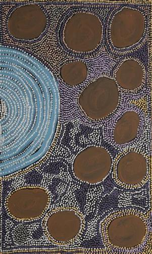
Mungili Waterholes and Rockholes

“No one goes there and sees that landscape. Only two, Mr and Mrs [refers to footsteps in painting]. They was walking to see if the water was in there. Walking on the creek sand, they see the colours and walk down to the water hole and dig where the waters been left. Dig the creek sand where there is still water. Little huts where they sit; move when it dries out. Leave remembrance behind. When the water fills up again; come back.

When the creek sand is still moist you can see the colours. You can see many colours – lovely colours come out. I do that in my mind [when painting], go and think about the rock colours there.

Different plants, water runs, and different plants are growing, different seeds. When it rains, all year round, when its overflowing. It’s all connected. The orange sand connects to one waterhole full of water, then flowing through the creek sand. This side down [pointing to one rock hole]; and it’s a bit up [pointing to another rock hole].

I was swimming there. Yeah, we go visit them a long time [ago]. We drink it, rainwater from the rain. Big waterhole. It’s a fresh water, when the rain comes, fills it up. One for swimming and another rock hole for drinking. 3 rock holes; another is special.”

– Marlene Anderson

In this work Marlene depicts a waterhole and rock hole located in Mungili, the small outstation community located just off the Eagle Highway in Western Australia, approximately 430 kilometres northeast of Wiluna and 250 kilometres north of Warburton. Marlene grew up in Mungili, and as such it forms a significant part of her ‘ngurra’ (home Country, camp). Typically Marlene depicts this site with a central large circular form that represents the main waterhole, surrounded by smaller circular forms representing satellite water bodies.

During the pujiman (traditional, desert dwelling) period, knowledge of water sources was critical for survival, and today Martu Country is still defined in terms of the location and type of water. Each of the hundreds of claypans, rockholes, waterholes, soaks and springs found in the Martu desert homelands is known through real life experience and the recounting of Jukurrpa (Dreaming) narratives by name, location, quality and seasonal availability. This encyclopedic knowledge extends even to the nature and movement of arterial waterways, and sustained Martu as they travelled across their Country, hunting and gathering, visiting family, and fulfilling ceremonial obligations. They would traverse very large distances annually, visiting specific areas in the dry and wet season depending on the availability of water and the corresponding cycles of plant and animal life on which hunting and gathering bush tucker was reliant.