114182397417


Women collecting bush foods

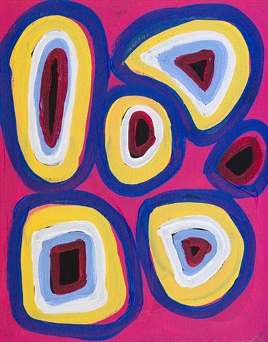
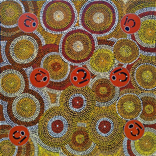
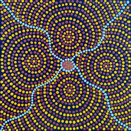
The Anangu people travelled vast desert landscapes, following the seasons for food and shelter, deeply attuned to the rhythms of the land. This resilience and wisdom embedded in traditional bush foods that sustained them across generations.

Maku (Witchety Grubs), with their creamy, nutty flavour, represent survival and the resourcefulness to draw nourishment from deep within tree roots. Kampurarrpa (Desert Raisins), small and tangy, add brightness and essential nutrients to desert diets, thriving under intense sun.

Ipalu (Bush Banana), a climbing vine with crisp, slender fruits, offers fibre and hydration—a refreshing staple in arid climates. Ili (Bush Figs), with their mild sweetness, grow from rugged trees, offering a delicate treat in the harsh terrain.

Through vibrant colours and intricate designs, these bush foods embody the spirit of Ngaanyatjarra culture, each a testament to the land’s gifts and the knowledge passed through generations.

111582397415


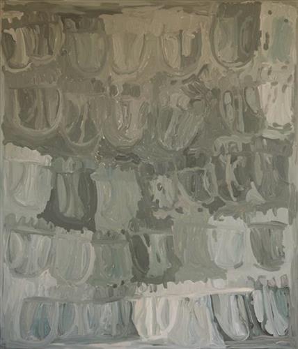
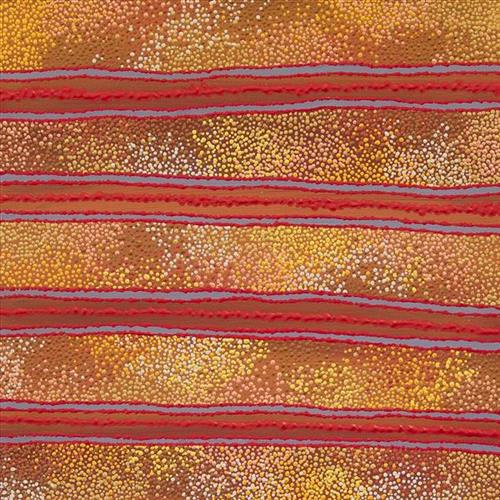
Pitu

“I paint Pitu because my father come[s] from Pitu and all the rest of the family, they belong to there. Family hear the stories all the time from Jakayu [Biljabu]. It’s their connection to that place. All the old people were walking through that area, aunty Jakayu was born there. It’s a sad story, hers. We [went] there… to see it again. It’s a long, long way from Punmu. All the other family [saw] where their family is from and where they belong to.”


–       Kuru Gladys Bidu


Pitu (Separation Well) forms part of Kuru’s ngurra (home Country, camp) through her father. It is a significant cultural site and large soak located yulparirra (south) of Wuranu (Canning Stock Route Well 29) and Kulilu rockhole and soak. As a site where fresh water was available all year, Pitu was an important camp and a meeting place for Kartujarra and Manyjilyjarra people during the pujiman (traditional, desert dwelling) era. At this time, knowledge of water sources was critical for survival, and today Martu Country is still defined in terms of the location and type of water. Each of the hundreds of claypans, rockholes, waterholes, soaks and springs found in the Martu desert homelands is known by name, location, quality and seasonal availability through real life experience and the recounting of Jukurrpa (Dreaming) narratives. 


Soaks, or soakwaters, derive their name from the manner in which their waters generally seep into the sand from below stores, sometimes as part of an ephemeral river or creek. Soaks were an especially important source of water during the pujiman era, being the most dependable water source in times of drought. Water was obtained from soaks by scooping away the sand with a piti (timber bowls used for carrying food and water) until clear water gathered at the base of the hole, sometimes at a depth of several metres. Pitu is also surrounded by shrubs that need to be cleared to access its waters.

111582397412


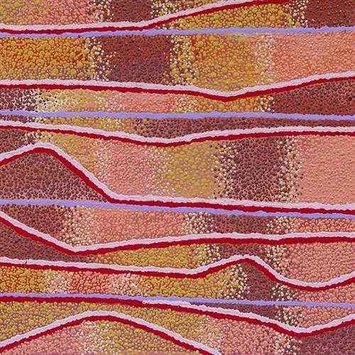
Wirnpa

Wirnpa is an extremely significant cultural site and a soak surrounded by a cluster of salt springs and located within a salt lake at the northern end of the Percival Lakes region. Wirnpa lies in Yulparija Country, in a region dominated by dramatic salt lakes and corrugations of permanent red tali (sandhills).

The soak at Wirnpa is named after one of the most powerful of the ancestral jila (snake) men and the last to travel the desert during the Jukurrpa (Dreaming). The Western Desert term jila is used interchangeably to describe springs considered to be ‘living’ waters and snakes, both of which play a central role in Martu culture and Jukurrpa. Wirnpa is a rainmaking jila who lived and hunted in the Percival Lakes area. His travels are described in the songs and stories of many language groups across the Western Desert, even those far removed from his home site. In his epic travels, Wirnpa met and feasted with many other ancestral beings, exchanged ceremonial objects, and created a series of different laws and ceremonies. When he finally returned home, he searched for his many children only to discover that they had already died. They had laid down and become the salt springs of the Percival Lakes. Wirnpa wept for his children before himself transforming into a snake and entering the soak where he still resides.  

Jila sites like Wirnpa must be entered respectfully; particular rituals are practiced, such as lighting fires, sweeping the ground with branches, approaching in single file, and calling out to the site’s jila to announce one’s arrival and introduce people who are new to the jila. Those who do not follow these guidelines are in danger of becoming sick, or even being killed.

377810582397397


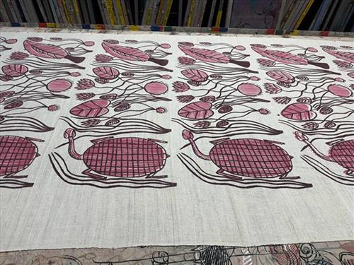
Djenj dja Komrdawh (Swordfish and Turtle)

“My country is called Mankorlod. It is near the rock country. My dreaming is komrdawh (long neck turtle), the one I painted in my design. I like to eat komrdaw, it tastes really nice. We catch them in dry and wet season near Mankorlod. This is my first ever design, and I only have one design. I painted it with brush at Babbarra Women’s Centre and I feel proud when people print my design.” Margot Gurawiliwili

The vines depicted in this artwork are used by women to weave and create fibre sculpture. They grow naturally on the floodplains in Arnhem Land. The long-necked turtle and freshwater sword fish depicted are popular bush food.

111582397189


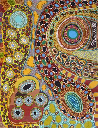
Mungili Waterholes and Rockholes

“No one goes there and sees that landscape. Only two, Mr and Mrs [refers to footsteps in painting]. They was walking to see if the water was in there. Walking on the creek sand, they see the colours and walk down to the water hole and dig where the waters been left. Dig the creek sand where there is still water. Little huts where they sit; move when it dries out. Leave remembrance behind. When the water fills up again; come back.

When the creek sand is still moist you can see the colours. You can see many colours – lovely colours come out. I do that in my mind [when painting], go and think about the rock colours there.

Different plants, water runs, and different plants are growing, different seeds. When it rains, all year round, when its overflowing. It’s all connected. The orange sand connects to one waterhole full of water, then flowing through the creek sand. This side down [pointing to one rock hole]; and it’s a bit up [pointing to another rock hole].

I was swimming there. Yeah, we go visit them a long time [ago]. We drink it, rainwater from the rain. Big waterhole. It’s a fresh water, when the rain comes, fills it up. One for swimming and another rock hole for drinking. 3 rock holes; another is special.”

– Marlene Anderson

In this work Marlene depicts a waterhole and rock hole located in Mungili, the small outstation community located just off the Eagle Highway in Western Australia, approximately 430 kilometres northeast of Wiluna and 250 kilometres north of Warburton. Marlene grew up in Mungili, and as such it forms a significant part of her ‘ngurra’ (home Country, camp). Typically Marlene depicts this site with a central large circular form that represents the main waterhole, surrounded by smaller circular forms representing satellite water bodies.

During the pujiman (traditional, desert dwelling) period, knowledge of water sources was critical for survival, and today Martu Country is still defined in terms of the location and type of water. Each of the hundreds of claypans, rockholes, waterholes, soaks and springs found in the Martu desert homelands is known through real life experience and the recounting of Jukurrpa (Dreaming) narratives by name, location, quality and seasonal availability. This encyclopedic knowledge extends even to the nature and movement of arterial waterways, and sustained Martu as they travelled across their Country, hunting and gathering, visiting family, and fulfilling ceremonial obligations. They would traverse very large distances annually, visiting specific areas in the dry and wet season depending on the availability of water and the corresponding cycles of plant and animal life on which hunting and gathering bush tucker was reliant.

114182397595


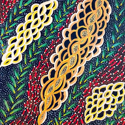
Kungkarrangkalpa (Seven Sisters)

‘Kungkarrangkalpa’ (The Seven Sisters or Pleaides) is significant Tjukurrpa (dreamtime). Its origins you may be familiar with in astronomy and its connection to ‘Wati Nyiru’ (Magic Man or Orion).  The roots of this dreaming stems across indigenous groups around the world. The Australian Aboriginal songline is one part to the whole dreaming which can be traced all around the world. The ladies of the Ngaanyatjarra Lands depict their significant chapter and understanding of the journey of the sisters. The different versions of this story depend on where you live and the significance’s of local Tjukurrpa places.

Nyiru fell in love with the sisters but he was of the wrong skin group to marry, but he still pursued them on their journey. The sisters travel across the land to escape Nyiru’s unwanted attentions, but he is persistent and always finds them. There are significant land forms which can be sited today that evidence this dreaming. As Nyiru is chasing the sisters he tries to catch them by using magic to turn into the most tempting kampurarrpa (bush tomato) and the most beautiful Yirli (wild fig tree), for them to eat and camp under. However, the sisters are knowledgeable of his magic and too clever for Nyiru who they outwit again and again. They go hungry and run through the night rather than be caught by him. As the journey continues, Nyiru gets so frustrated at the wit of the sisters that he uses his magic to make the oldest sister sick to try and get closer to her. The other sisters rescue the big sister and nurse her back to health. It is said he also captures the youngest sister, but with the help of the oldest sister, she escapes back to her sisters who are waiting for her. Eventually, the sisters fly into the sky to escape Nyiru, forming the constellation. Nyiru felt lonely, longing for the sisters who were so far away. Nyiru used his magic to go to the sky, forever in pursuit.

220982397564


Maisie Petyarre Bundey – Anhelengkw (Emu) Dreaming

Anhelengkw (emu) dreaming is the breast body painting depicting the story of the mother emu who runs away and leaves the father emu to look after the eggs until they hatch, he then raises the chicks.

This story is passed down through Maisie’s family and celebrated in dance.

111582397518


Kulyakartu

“Kulyakartu is where my Taylor family come from. My grandmother Nyunkunyal (Angelina) Taylor was born there. My Nana grew up there up until she was about 8 or 10 years old. My Nana and her sister Managabayi got mixed up with another tribe then ended up living with the Mangala and Juwaliny people, they are neighbours of the Yulparrija (Ngangatjarra) people painting Kulyakartu brings back memories of my grandmother and her sisters, Managabayi, Mida and Tuulul.”

– Nuriah Jadai

The Martu term for family, walytja, encapsulates a broader idea of relatedness that permeates every aspect of life. The Martu four-section kinship system determines a person as belonging to either the Purungu, Milangka, Panaka or Karrimarra skin group, and was created by the Jukurrpa (Dreaming) ancestors.

Walytja groups had rights to their ngurra (home Country, camp) as inherited over generations. Also passed down over generations was the intimate knowledge of the physical and cultural properties of one’s Country, and the responsibility to care for and nurture one’s ngurra. The passing of rights and responsibilities through walytja in relation to specific lands continues today.

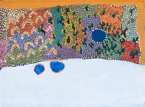
This painting depicts Kulyakartu, part of Nuriah’s ngurra (home Country, camp). Kulyakartu is located in the far north of the Martu homelands, near the Percival Lakes region of Western Australia’s Great Sandy Desert. Kulyakartu is mostly grass Country where there is very good hunting. In particular parnajarrpa (goanna), wild cats, and lunki (witchetty grub) are found in abundance here. There is no permanent water source in Kulyakartu, so Nuriah’s family would walk here annually following the wantajarra (wet season). During the yalijarra (hot, dry season) they would head south again to more permanent water.

111582397517


Kulyakartu

“My great grandmothers Tjarli-Tjarli and Nganyaltunta (Tunta) are from this country, Kulyakartu. As I learnt through going out with KJ Rangers that this area is fertile country. Many wild flowers and bush tucker back in the day. Fewer wildflowers than before my grandmother Nola told me, because the land is getting more warmer. Kulyakartu is my mother’s maternal side, my mother’s mother country. It is important to paint country to tell our children where we come from and our obligation to look after it.”

– Nuriah Jadai


The Martu term for family, walytja, encapsulates a broader idea of relatedness that permeates every aspect of life. The Martu four-section kinship system determines a person as belonging to either the Purungu, Milangka, Panaka or Karrimarra skin group, and was created by the Jukurrpa (Dreaming) ancestors.

Walytja groups had rights to their ngurra (home Country, camp) as inherited over generations. Also passed down over generations was the intimate knowledge of the physical and cultural properties of one’s Country, and the responsibility to care for and nurture one’s ngurra. The passing of rights and responsibilities through walytja in relation to specific lands continues today.

This painting depicts Kulyakartu, part of Nuriah’s ngurra (home Country, camp). Kulyakartu is located in the far north of the Martu homelands, near the Percival Lakes region of Western Australia’s Great Sandy Desert. Kulyakartu is mostly grass Country where there is very good hunting. In particular parnajarrpa (goanna), wild cats, and lunki (witchetty grub) are found in abundance here. There is no permanent water source in Kulyakartu, so Nuriah’s family would walk here annually following the wantajarra (wet season). During the yalijarra (hot, dry season) they would head south again to more permanent water.