111582399256


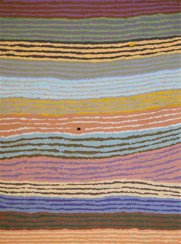
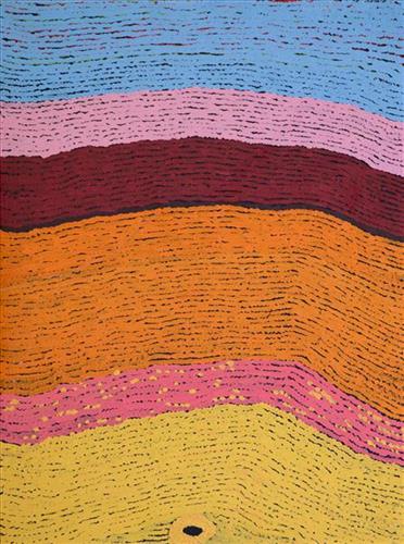
Jarntinti

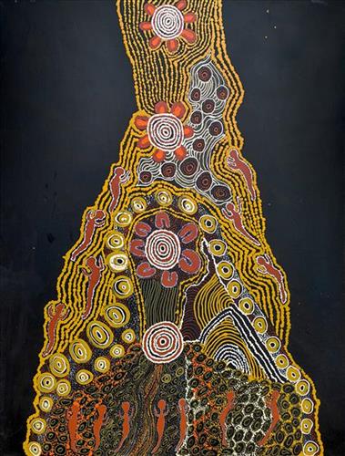
“This is a linyji (claypan). We find kalaru (seed used for making damper from samphire bush) there that we collect. Too much good tucker!”  

– Mayiwalku May Chapman

Jarntinti is a large claypan at the Southern end of Nyayartakujarra (Lake Dora), a large salt lake surrounded by tali (sand hills) within the Karlamilyi (Rudall River) region. This area forms part of Mayiwalku’s ngurra (home Country, camp), the region which she traversed extensively as a young girl. Mayiwalku’s sister Nyanjilpayi was born at Jarntinti. 

During the pujiman (traditional, desert dwelling) era, Jarntinti was primarily used as a camping site in the wantajarra (wet season), when the claypan filled with kapi (water). Other nearby water sources include Tarl, Kartuny, Wawul, Warnkarr, Jutupa, and Kunalimpi. 

Jarntinti is known as a site where kalaru grows in abundance. In the pujiman era, the black kalaru seeds were seasonally harvested from this area. Once collected a labour intensive process began to produce damper, a type of flat bread. The kalaru seeds were first washed several times before being ground with a jiwa (stones used by women for grinding seeds) to make a type of flour, which was then mixed with water to create a dough that was finally cooked in the ashes of a fire.

111582399255


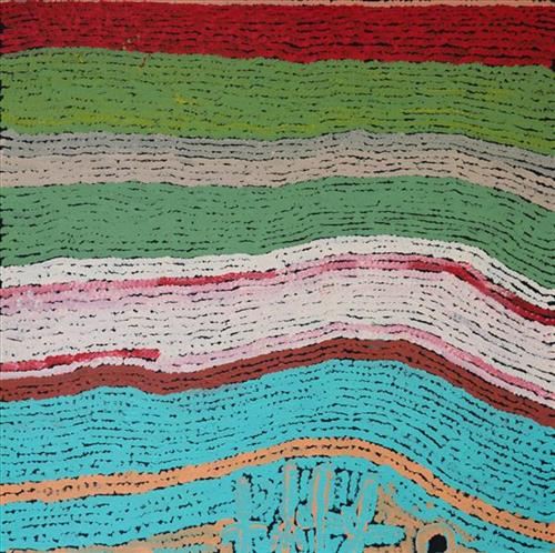
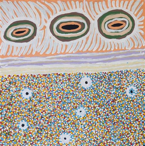
Moolyella Rockhole

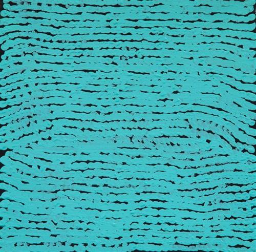
“This is a rockhole- people coming this side and people coming round this [other] side, coming to that waterhole.

This painting is about every rockhole in Moolyella, where I used to work… We would walk and get some water from the rockholes and go away back home-  get that water from these rockholes when we were working. My father and mother’s surname was Mulialla, they were named after that place.”

– Lorna Linmurra

This work depicts a waterhole in the area around Moolyella, an area close to Marble Bar that was mined for tin from 1898. Industrial production ceased by 1921, and from the late 1920’s several Aboriginals families, including Lorna’s, began working the mine. Tin and other minerals were retrieved from claypans and dry river beds using a yandy (dish used for winnowing seed).  

Moolyella forms part of Lorna’s ngurra (home Country, camp), and as she describes in her account, each of the many water sources around the area were well known to herself and her family.

During the pujiman (traditional, desert dwelling) period, knowledge of water sources was critical for survival, and today Martu Country is still defined in terms of the location and type of water. Each of the hundreds of claypans, rockholes, waterholes, soaks and springs found in the Martu desert homelands is known through real life experience and the recounting of Jukurrpa (Dreaming) narratives by name, location, quality and seasonal availability. This encyclopedic knowledge extends even to the nature and movement of arterial waterways, and sustained Martu as they travelled across their Country, hunting and gathering, visiting family, and fulfilling ceremonial obligations. They would traverse very large distances annually, visiting specific areas in the dry and wet season depending on the availability of water and the corresponding cycles of plant and animal life on which hunting and gathering bush tucker was reliant.

111582399253


Moolyella Rockhole

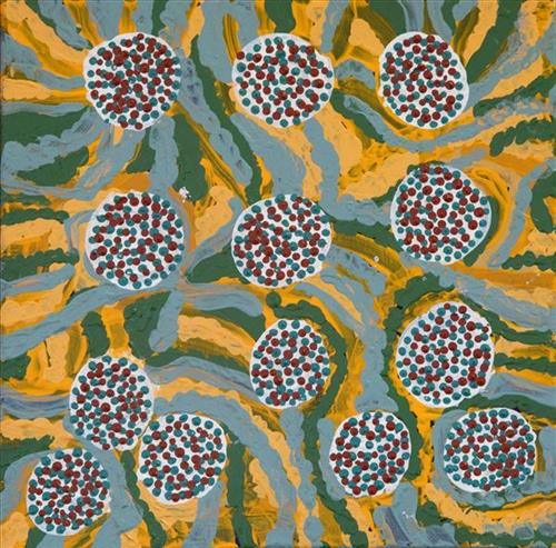
“This is a rockhole- people coming this side and people coming round this [other] side, coming to that waterhole.

This painting is about every rockhole in Moolyella, where I used to work… We would walk and get some water from the rockholes and go away back home-  get that water from these rockholes when we were working. My father and mother’s surname was Mulialla, they were named after that place.”

– Lorna Linmurra

This work depicts a waterhole in the area around Moolyella, an area close to Marble Bar that was mined for tin from 1898. Industrial production ceased by 1921, and from the late 1920’s several Aboriginals families, including Lorna’s, began working the mine. Tin and other minerals were retrieved from claypans and dry river beds using a yandy (dish used for winnowing seed).  

Moolyella forms part of Lorna’s ngurra (home Country, camp), and as she describes in her account, each of the many water sources around the area were well known to herself and her family.

During the pujiman (traditional, desert dwelling) period, knowledge of water sources was critical for survival, and today Martu Country is still defined in terms of the location and type of water. Each of the hundreds of claypans, rockholes, waterholes, soaks and springs found in the Martu desert homelands is known through real life experience and the recounting of Jukurrpa (Dreaming) narratives by name, location, quality and seasonal availability. This encyclopedic knowledge extends even to the nature and movement of arterial waterways, and sustained Martu as they travelled across their Country, hunting and gathering, visiting family, and fulfilling ceremonial obligations. They would traverse very large distances annually, visiting specific areas in the dry and wet season depending on the availability of water and the corresponding cycles of plant and animal life on which hunting and gathering bush tucker was reliant.

111582399252


Moolyella Rockhole

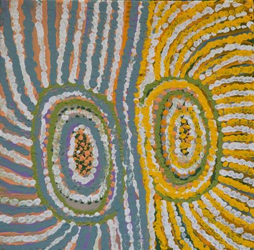
“This is a rockhole- people coming this side and people coming round this [other] side, coming to that waterhole.

This painting is about every rockhole in Moolyella, where I used to work… We would walk and get some water from the rockholes and go away back home-  get that water from these rockholes when we were working. My father and mother’s surname was Mulialla, they were named after that place.”

– Lorna Linmurra

This work depicts a waterhole in the area around Moolyella, an area close to Marble Bar that was mined for tin from 1898. Industrial production ceased by 1921, and from the late 1920’s several Aboriginals families, including Lorna’s, began working the mine. Tin and other minerals were retrieved from claypans and dry river beds using a yandy (dish used for winnowing seed).  

Moolyella forms part of Lorna’s ngurra (home Country, camp), and as she describes in her account, each of the many water sources around the area were well known to herself and her family.

During the pujiman (traditional, desert dwelling) period, knowledge of water sources was critical for survival, and today Martu Country is still defined in terms of the location and type of water. Each of the hundreds of claypans, rockholes, waterholes, soaks and springs found in the Martu desert homelands is known through real life experience and the recounting of Jukurrpa (Dreaming) narratives by name, location, quality and seasonal availability. This encyclopedic knowledge extends even to the nature and movement of arterial waterways, and sustained Martu as they travelled across their Country, hunting and gathering, visiting family, and fulfilling ceremonial obligations. They would traverse very large distances annually, visiting specific areas in the dry and wet season depending on the availability of water and the corresponding cycles of plant and animal life on which hunting and gathering bush tucker was reliant.

111582399251


Jarntinti

“This is a linyji (claypan). We find kalaru (seed used for making damper from samphire bush) there that we collect. Too much good tucker!”  

– Mayiwalku May Chapman

Jarntinti is a large claypan at the Southern end of Nyayartakujarra (Lake Dora), a large salt lake surrounded by tali (sand hills) within the Karlamilyi (Rudall River) region. This area forms part of Mayiwalku’s ngurra (home Country, camp), the region which she traversed extensively as a young girl. Mayiwalku’s sister Nyanjilpayi was born at Jarntinti. 

During the pujiman (traditional, desert dwelling) era, Jarntinti was primarily used as a camping site in the wantajarra (wet season), when the claypan filled with kapi (water). Other nearby water sources include Tarl, Kartuny, Wawul, Warnkarr, Jutupa, and Kunalimpi. 

Jarntinti is known as a site where kalaru grows in abundance. In the pujiman era, the black kalaru seeds were seasonally harvested from this area. Once collected a labour intensive process began to produce damper, a type of flat bread. The kalaru seeds were first washed several times before being ground with a jiwa (stones used by women for grinding seeds) to make a type of flour, which was then mixed with water to create a dough that was finally cooked in the ashes of a fire.

116482399152


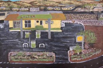
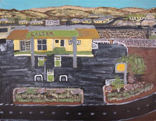
Childhoof Memories of Caltex

This is a memory of my childhood growing up this place called Caltex in Roebourne. This is one of the locations that I spent time growing up with a mate. A very popular place for the locals and now today it still it exists as BP. Little bit of changes in the landscape, not the building. The building is still the same. I used to go there after school and chill out there with my mate Paul, son of the owner. Their family tried to steal me and take me to New Zealand which is where they went back home to! In those days, the 50cent hall was getting built which is in the background. Lots of memories here of Roebourne. After cyclone Tracey where everything was underwater, even under the BP. That highway was rebuilt, stacked up. That’s how far the damage come up. As kids we used to jump off the Caltex sign. Today its known as the BP and its famous chips. it’s always been our only shop in town back in the day and still today.

114182399382


Kungkarrangkalpa (Seven Sisters)

‘Kungkarrangkalpa’ (The Seven Sisters or Pleaides) is significant Tjukurrpa (dreamtime). Its origins you may be familiar with in astronomy and its connection to ‘Wati Nyiru’ (Magic Man or Orion).  The roots of this dreaming stems across indigenous groups around the world. The Australian Aboriginal songline is one part to the whole dreaming which can be traced all around the world. The ladies of the Ngaanyatjarra Lands depict their significant chapter and understanding of the journey of the sisters. The different versions of this story depend on where you live and the significance’s of local Tjukurrpa places.

Nyiru fell in love with the sisters but he was of the wrong skin group to marry, but he still pursued them on their journey. The sisters travel across the land to escape Nyiru’s unwanted attentions, but he is persistent and always finds them. There are significant land forms which can be sited today that evidence this dreaming. As Nyiru is chasing the sisters he tries to catch them by using magic to turn into the most tempting kampurarrpa (bush tomato) and the most beautiful Yirli (wild fig tree), for them to eat and camp under. However, the sisters are knowledgeable of his magic and too clever for Nyiru who they outwit again and again. They go hungry and run through the night rather than be caught by him. As the journey continues, Nyiru gets so frustrated at the wit of the sisters that he uses his magic to make the oldest sister sick to try and get closer to her. The other sisters rescue the big sister and nurse her back to health. It is said he also captures the youngest sister, but with the help of the oldest sister, she escapes back to her sisters who are waiting for her. Eventually, the sisters fly into the sky to escape Nyiru, forming the constellation. Nyiru felt lonely, longing for the sisters who were so far away. Nyiru used his magic to go to the sky, forever in pursuit.

111582399380


Jarntinti

“This is a linyji (claypan). We find kalaru (seed used for making damper from samphire bush) there that we collect. Too much good tucker!”  

– Mayiwalku May Chapman

Jarntinti is a large claypan at the Southern end of Nyayartakujarra (Lake Dora), a large salt lake surrounded by tali (sand hills) within the Karlamilyi (Rudall River) region. This area forms part of Mayiwalku’s ngurra (home Country, camp), the region which she traversed extensively as a young girl. Mayiwalku’s sister Nyanjilpayi was born at Jarntinti. 

During the pujiman (traditional, desert dwelling) era, Jarntinti was primarily used as a camping site in the wantajarra (wet season), when the claypan filled with kapi (water). Other nearby water sources include Tarl, Kartuny, Wawul, Warnkarr, Jutupa, and Kunalimpi. 

Jarntinti is known as a site where kalaru grows in abundance. In the pujiman era, the black kalaru seeds were seasonally harvested from this area. Once collected a labour intensive process began to produce damper, a type of flat bread. The kalaru seeds were first washed several times before being ground with a jiwa (stones used by women for grinding seeds) to make a type of flour, which was then mixed with water to create a dough that was finally cooked in the ashes of a fire.
111582399379


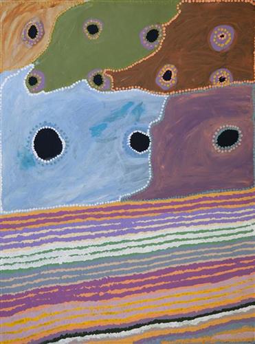
Moolyella Rockhole

“This is a rockhole- people coming this side and people coming round this [other] side, coming to that waterhole.

This painting is about every rockhole in Moolyella, where I used to work… We would walk and get some water from the rockholes and go away back home-  get that water from these rockholes when we were working. My father and mother’s surname was Mulialla, they were named after that place.”

– Lorna Linmurra

This work depicts a waterhole in the area around Moolyella, an area close to Marble Bar that was mined for tin from 1898. Industrial production ceased by 1921, and from the late 1920’s several Aboriginals families, including Lorna’s, began working the mine. Tin and other minerals were retrieved from claypans and dry river beds using a yandy (dish used for winnowing seed).  

Moolyella forms part of Lorna’s ngurra (home Country, camp), and as she describes in her account, each of the many water sources around the area were well known to herself and her family.

During the pujiman (traditional, desert dwelling) period, knowledge of water sources was critical for survival, and today Martu Country is still defined in terms of the location and type of water. Each of the hundreds of claypans, rockholes, waterholes, soaks and springs found in the Martu desert homelands is known through real life experience and the recounting of Jukurrpa (Dreaming) narratives by name, location, quality and seasonal availability. This encyclopedic knowledge extends even to the nature and movement of arterial waterways, and sustained Martu as they travelled across their Country, hunting and gathering, visiting family, and fulfilling ceremonial obligations. They would traverse very large distances annually, visiting specific areas in the dry and wet season depending on the availability of water and the corresponding cycles of plant and animal life on which hunting and gathering bush tucker was reliant.

111582399378


Wilapa (spring), Nyapa (water) at wungu (rock) hill

This is Lorna’s Country- her ‘ngurra’ (home Country, camp). People identify with their ngurra in terms of specific rights and responsibilities, and the possession of intimate knowledge of the physical and cultural properties of one’s Country. Painting ngurra, and in so doing sharing the Jukurrpa (Dreaming) stories and physical characteristics of that place, has today become an important means of cultural maintenance. 

Though Lorna was born in the Port Hedland hospital and she attended school from a young age, she still lived a somewhat traditional pujiman (traditional, desert dwelling) lifestyle, travelling in the Country between Marble Bar and Roebourne with ‘nomad people’. Today Lorna lives in Warralong Aboriginal community, 50km north of Marble Bar.

Portrayed in this work are features of Lorna’s ngurra, such as the dominant permanent red tali (sandhills), warta (trees, vegetation), and the individually named water sources she and her family camped at.