111582399360


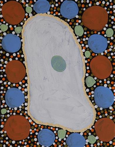
Moolyella Rockhole

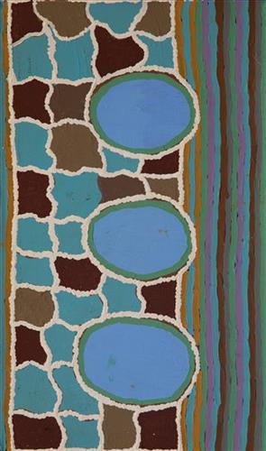
“This is a rockhole- people coming this side and people coming round this [other] side, coming to that waterhole.

This painting is about every rockhole in Moolyella, where I used to work… We would walk and get some water from the rockholes and go away back home-  get that water from these rockholes when we were working. My father and mother’s surname was Mulialla, they were named after that place.”

– Lorna Linmurra

This work depicts a waterhole in the area around Moolyella, an area close to Marble Bar that was mined for tin from 1898. Industrial production ceased by 1921, and from the late 1920’s several Aboriginals families, including Lorna’s, began working the mine. Tin and other minerals were retrieved from claypans and dry river beds using a yandy (dish used for winnowing seed).  

Moolyella forms part of Lorna’s ngurra (home Country, camp), and as she describes in her account, each of the many water sources around the area were well known to herself and her family.

During the pujiman (traditional, desert dwelling) period, knowledge of water sources was critical for survival, and today Martu Country is still defined in terms of the location and type of water. Each of the hundreds of claypans, rockholes, waterholes, soaks and springs found in the Martu desert homelands is known through real life experience and the recounting of Jukurrpa (Dreaming) narratives by name, location, quality and seasonal availability. This encyclopedic knowledge extends even to the nature and movement of arterial waterways, and sustained Martu as they travelled across their Country, hunting and gathering, visiting family, and fulfilling ceremonial obligations. They would traverse very large distances annually, visiting specific areas in the dry and wet season depending on the availability of water and the corresponding cycles of plant and animal life on which hunting and gathering bush tucker was reliant.

111582399359


Moolyella Rockhole

“This is a rockhole- people coming this side and people coming round this [other] side, coming to that waterhole.

This painting is about every rockhole in Moolyella, where I used to work… We would walk and get some water from the rockholes and go away back home-  get that water from these rockholes when we were working. My father and mother’s surname was Mulialla, they were named after that place.”

– Lorna Linmurra

This work depicts a waterhole in the area around Moolyella, an area close to Marble Bar that was mined for tin from 1898. Industrial production ceased by 1921, and from the late 1920’s several Aboriginals families, including Lorna’s, began working the mine. Tin and other minerals were retrieved from claypans and dry river beds using a yandy (dish used for winnowing seed).  

Moolyella forms part of Lorna’s ngurra (home Country, camp), and as she describes in her account, each of the many water sources around the area were well known to herself and her family.

During the pujiman (traditional, desert dwelling) period, knowledge of water sources was critical for survival, and today Martu Country is still defined in terms of the location and type of water. Each of the hundreds of claypans, rockholes, waterholes, soaks and springs found in the Martu desert homelands is known through real life experience and the recounting of Jukurrpa (Dreaming) narratives by name, location, quality and seasonal availability. This encyclopedic knowledge extends even to the nature and movement of arterial waterways, and sustained Martu as they travelled across their Country, hunting and gathering, visiting family, and fulfilling ceremonial obligations. They would traverse very large distances annually, visiting specific areas in the dry and wet season depending on the availability of water and the corresponding cycles of plant and animal life on which hunting and gathering bush tucker was reliant.

111582399358


Moolyella Rockhole

“This is a rockhole- people coming this side and people coming round this [other] side, coming to that waterhole.

This painting is about every rockhole in Moolyella, where I used to work… We would walk and get some water from the rockholes and go away back home-  get that water from these rockholes when we were working. My father and mother’s surname was Mulialla, they were named after that place.”

– Lorna Linmurra

This work depicts a waterhole in the area around Moolyella, an area close to Marble Bar that was mined for tin from 1898. Industrial production ceased by 1921, and from the late 1920’s several Aboriginals families, including Lorna’s, began working the mine. Tin and other minerals were retrieved from claypans and dry river beds using a yandy (dish used for winnowing seed).  

Moolyella forms part of Lorna’s ngurra (home Country, camp), and as she describes in her account, each of the many water sources around the area were well known to herself and her family.

During the pujiman (traditional, desert dwelling) period, knowledge of water sources was critical for survival, and today Martu Country is still defined in terms of the location and type of water. Each of the hundreds of claypans, rockholes, waterholes, soaks and springs found in the Martu desert homelands is known through real life experience and the recounting of Jukurrpa (Dreaming) narratives by name, location, quality and seasonal availability. This encyclopedic knowledge extends even to the nature and movement of arterial waterways, and sustained Martu as they travelled across their Country, hunting and gathering, visiting family, and fulfilling ceremonial obligations. They would traverse very large distances annually, visiting specific areas in the dry and wet season depending on the availability of water and the corresponding cycles of plant and animal life on which hunting and gathering bush tucker was reliant.
111582399357


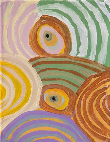
Moolyella Rockhole

“This is a rockhole- people coming this side and people coming round this [other] side, coming to that waterhole.

This painting is about every rockhole in Moolyella, where I used to work… We would walk and get some water from the rockholes and go away back home-  get that water from these rockholes when we were working. My father and mother’s surname was Mulialla, they were named after that place.”

– Lorna Linmurra

This work depicts a waterhole in the area around Moolyella, an area close to Marble Bar that was mined for tin from 1898. Industrial production ceased by 1921, and from the late 1920’s several Aboriginals families, including Lorna’s, began working the mine. Tin and other minerals were retrieved from claypans and dry river beds using a yandy (dish used for winnowing seed).  

Moolyella forms part of Lorna’s ngurra (home Country, camp), and as she describes in her account, each of the many water sources around the area were well known to herself and her family.

During the pujiman (traditional, desert dwelling) period, knowledge of water sources was critical for survival, and today Martu Country is still defined in terms of the location and type of water. Each of the hundreds of claypans, rockholes, waterholes, soaks and springs found in the Martu desert homelands is known through real life experience and the recounting of Jukurrpa (Dreaming) narratives by name, location, quality and seasonal availability. This encyclopedic knowledge extends even to the nature and movement of arterial waterways, and sustained Martu as they travelled across their Country, hunting and gathering, visiting family, and fulfilling ceremonial obligations. They would traverse very large distances annually, visiting specific areas in the dry and wet season depending on the availability of water and the corresponding cycles of plant and animal life on which hunting and gathering bush tucker was reliant.

111582399356


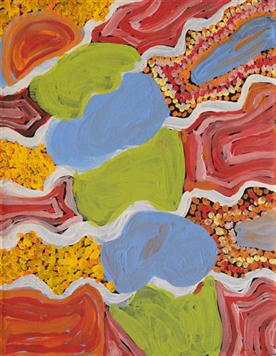
Untitled

“When Martu paint, it’s like a map. Martu draw story on the ground and on the canvas, and all the circle and line there are the hunting areas and different waters and tracks where people used to walk, and [some you] can’t cross, like boundaries. So nowadays you see a colourful painting and wonder what it is, but that’s how Martu tell story long ago. It’s not just a lovely painting, it’s a story and a songline and a history and everything that goes with it.” 

– Ngalangka Nola Taylor and Joshua Booth

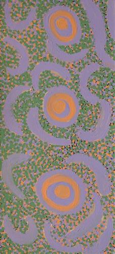
This work portrays an area of Country that can be interpreted in multiple ways. Firstly, the image may be read as an aerial representation of a particular location known to the artist- either land that they or their family travelled, from the pujiman (traditional, desert dwelling) era to now. During the pujiman period, Martu would traverse very large distances annually in small family groups, moving seasonally from water source to water source, and hunting and gathering bush tucker as they went. At this time, one’s survival depended on their intimate knowledge of the location of resources; thus physical elements of Country, such as sources of kapi (water), tali (sandhills), different varieties of warta (trees, vegetation), ngarrini (camps), and jina (tracks) are typically recorded with the use of a use of a system of iconographic forms universally shared across the desert. 

An additional layer of meaning in the work relates to more intangible concepts; life cycles based around kalyu (rain, water) and waru (fire) are also often evident. A thousands of year old practice, fire burning continues to be carried out as both an aid for hunting and a means of land management today. As the Martu travelled and hunted they would burn tracts of land, ensuring plant and animal biodiversity and reducing the risk of unmanageable, spontaneous bush fires. The patchwork nature of regrowth is evident in many landscape works, with each of the five distinctive phases of fire burning visually described with respect to the cycle of burning and regrowth.  

Finally, metaphysical information relating to a location may also be recorded; Jukurrpa (Dreaming) narratives chronicle the creation of physical landmarks, and can be referenced through depictions of ceremonial sites, songlines, and markers left in the land. Very often, however, information relating to Jukurrpa is censored by omission, or alternatively painted over with dotted patterns.

111582399354


Lake

“When Martu paint, it’s like a map. Martu draw story on the ground and on the canvas, and all the circle and line there are the hunting areas and different waters and tracks where people used to walk, and [some you] can’t cross, like boundaries. So nowadays you see a colourful painting and wonder what it is, but that’s how Martu tell story long ago. It’s not just a lovely painting, it’s a story and a songline and a history and everything that goes with it.” 

– Ngalangka Nola Taylor and Joshua Booth

This work portrays an area of Country that can be interpreted in multiple ways. Firstly, the image may be read as an aerial representation of a particular location known to the artist- either land that they or their family travelled, from the pujiman (traditional, desert dwelling) era to now. During the pujiman period, Martu would traverse very large distances annually in small family groups, moving seasonally from water source to water source, and hunting and gathering bush tucker as they went. At this time, one’s survival depended on their intimate knowledge of the location of resources; thus physical elements of Country, such as sources of kapi (water), tali (sandhills), different varieties of warta (trees, vegetation), ngarrini (camps), and jina (tracks) are typically recorded with the use of a use of a system of iconographic forms universally shared across the desert. 

An additional layer of meaning in the work relates to more intangible concepts; life cycles based around kalyu (rain, water) and waru (fire) are also often evident. A thousands of year old practice, fire burning continues to be carried out as both an aid for hunting and a means of land management today. As the Martu travelled and hunted they would burn tracts of land, ensuring plant and animal biodiversity and reducing the risk of unmanageable, spontaneous bush fires. The patchwork nature of regrowth is evident in many landscape works, with each of the five distinctive phases of fire burning visually described with respect to the cycle of burning and regrowth.  

Finally, metaphysical information relating to a location may also be recorded; Jukurrpa (Dreaming) narratives chronicle the creation of physical landmarks, and can be referenced through depictions of ceremonial sites, songlines, and markers left in the land. Very often, however, information relating to Jukurrpa is censored by omission, or alternatively painted over with dotted patterns.

111582399353


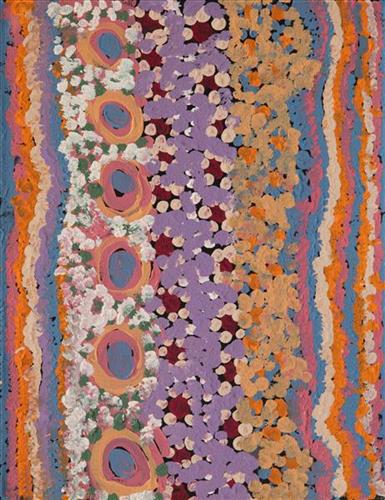
Bush Tucker

“I like to paint bush foods and flowers.”

– Mary Rowlands


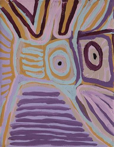
Depicted in this work are a combination of desert flowers and traditional types of mayi (plant food).

During the pujiman (traditional, desert dwelling) period, Martu would traverse very large distances annually in small family groups, moving seasonally from water source to water source, and hunting and gathering bush tucker as they went. Whilst desert life has moved away from mobile hunter-gatherer subsistence throughout the course of the twentieth century, bush tucker continues to be a significant component of the modern Martu diet, and hunting and gathering bush tucker remains equally valuable as an important cultural practice that is passed on intergenerationally.

Popular mayi includes minyarra (bush onion), collected from small, grass like plants; root vegetables dug from underground such as kulyu and mata (types of bush potato); and seeds such as kalaru (samphire, salt bush), yuwinyji, and marnkalpa (spinifex species). Jawirli (quondong), wamurla (bush tomatoes), jinyjiwirrily (wild gooseberry), ngaputa (melon), and karlkula (bush banana) are some of the most popular bush fruits. These are often collected in the wantajarra (cool season) and tuulpara (spring) months, along with juri (sweet) botanical gums and wama (nectar), obtained from various plant species.

Mary, through her work, acknowledges the intrinsic value of the remarkably diverse flora found through Martu Country. These plants are not only vital as significant food sources, but also celebrated for their aesthetic splendour. In the context of the often harsh and arid environments in which desert flowers bloom, their vibrancy, delicacy, and variation become even more spectacular. 

111582399352


Moolyella Rockhole

“This is a rockhole- people coming this side and people coming round this [other] side, coming to that waterhole.

This painting is about every rockhole in Moolyella, where I used to work… We would walk and get some water from the rockholes and go away back home-  get that water from these rockholes when we were working. My father and mother’s surname was Mulialla, they were named after that place.”

– Lorna Linmurra

This work depicts a waterhole in the area around Moolyella, an area close to Marble Bar that was mined for tin from 1898. Industrial production ceased by 1921, and from the late 1920’s several Aboriginals families, including Lorna’s, began working the mine. Tin and other minerals were retrieved from claypans and dry river beds using a yandy (dish used for winnowing seed).  

Moolyella forms part of Lorna’s ngurra (home Country, camp), and as she describes in her account, each of the many water sources around the area were well known to herself and her family.

During the pujiman (traditional, desert dwelling) period, knowledge of water sources was critical for survival, and today Martu Country is still defined in terms of the location and type of water. Each of the hundreds of claypans, rockholes, waterholes, soaks and springs found in the Martu desert homelands is known through real life experience and the recounting of Jukurrpa (Dreaming) narratives by name, location, quality and seasonal availability. This encyclopedic knowledge extends even to the nature and movement of arterial waterways, and sustained Martu as they travelled across their Country, hunting and gathering, visiting family, and fulfilling ceremonial obligations. They would traverse very large distances annually, visiting specific areas in the dry and wet season depending on the availability of water and the corresponding cycles of plant and animal life on which hunting and gathering bush tucker was reliant.
111582399344


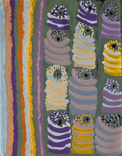
Rock pools at Cape Keraudren

“When Martu paint, it’s like a map. Martu draw story on the ground and on the canvas, and all the circle and line there are the hunting areas and different waters and tracks where people used to walk, and [some you] can’t cross, like boundaries. So nowadays you see a colourful painting and wonder what it is, but that’s how Martu tell story long ago. It’s not just a lovely painting, it’s a story and a songline and a history and everything that goes with it.” 

– Ngalangka Nola Taylor and Joshua Booth

This work portrays an area of Country that can be interpreted in multiple ways. Firstly, the image may be read as an aerial representation of a particular location known to the artist- either land that they or their family travelled, from the pujiman (traditional, desert dwelling) era to now. During the pujiman period, Martu would traverse very large distances annually in small family groups, moving seasonally from water source to water source, and hunting and gathering bush tucker as they went. At this time, one’s survival depended on their intimate knowledge of the location of resources; thus physical elements of Country, such as sources of kapi (water), tali (sandhills), different varieties of warta (trees, vegetation), ngarrini (camps), and jina (tracks) are typically recorded with the use of a use of a system of iconographic forms universally shared across the desert. 

An additional layer of meaning in the work relates to more intangible concepts; life cycles based around kalyu (rain, water) and waru (fire) are also often evident. A thousands of year old practice, fire burning continues to be carried out as both an aid for hunting and a means of land management today. As the Martu travelled and hunted they would burn tracts of land, ensuring plant and animal biodiversity and reducing the risk of unmanageable, spontaneous bush fires. The patchwork nature of regrowth is evident in many landscape works, with each of the five distinctive phases of fire burning visually described with respect to the cycle of burning and regrowth.  

Finally, metaphysical information relating to a location may also be recorded; Jukurrpa (Dreaming) narratives chronicle the creation of physical landmarks, and can be referenced through depictions of ceremonial sites, songlines, and markers left in the land. Very often, however, information relating to Jukurrpa is censored by omission, or alternatively painted over with dotted patterns.

111582399343


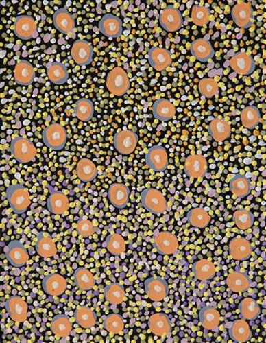
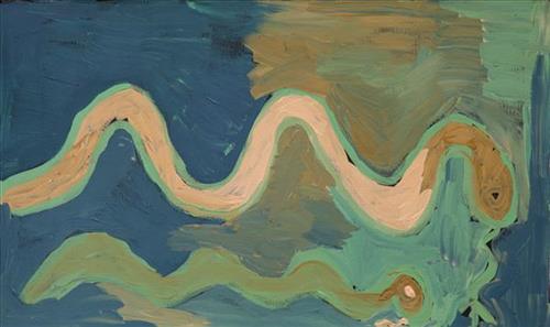
Untitled (jila-jila, two snakes)

Most often explored in Doreen’s works are the motifs of her everyday modern Aboriginal community life; the animals hunted and plants gathered for bush tucker, the cars and aeroplanes used to travel to the cities and remote communities she regularly moves between, and depictions of the Country itself. 

Collectively this imagery, depicted with Doreen’s trademark wild palettes, painterly brushstrokes, and stark compositions, builds a layered representation of her Country. Doreen’s intimately known ngurra (home Country, camp) is viewed from multiple spatial perspectives, and in stylistic modes ranging from pure abstraction to images incorporating realist and traditional elements.

Doreen’s ngurra encompasses the Country between Western Desert communities and towns; Warralong, Strelley, Marble Bar, Port Hedland, and Jigalong, her birthplace. People identify with their ngurra in terms of specific rights and responsibilities, and the possession of intimate knowledge of the physical and cultural properties of one’s Country. Painting ngurra, and in so doing sharing the Jukurrpa (Dreaming) stories and physical characteristics of that place, has today become an important means of cultural maintenance.