377810582295676


Djabayéna (Ancestral sawfish spirit)


Djabayéna is a highly significant saw fish creation spirit that is part of the symbolic identity of the Ndjébbana speaking Kunibidji people of West Arnhem Land. 

When seen from the sky, the formation of a large Djabayéna can be seen at the opening of the Liverpool River on the Western Point.

‘When tide in and then tide out we can see it’s up there round the corner on the point. There is one Djabayéna, really big. He sleep all the time here. Our dreaming, Djabayéna. We make t-shirt and they play football – home ground with Djabayéna.’ Verity Bangarra 2023

222082295674


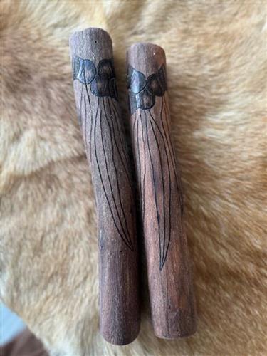
Clapsticks

Redgum is native to Australia and the gum nuts need to be burnt well to generate.

377810582295668


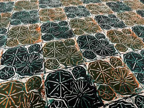
Water Lily

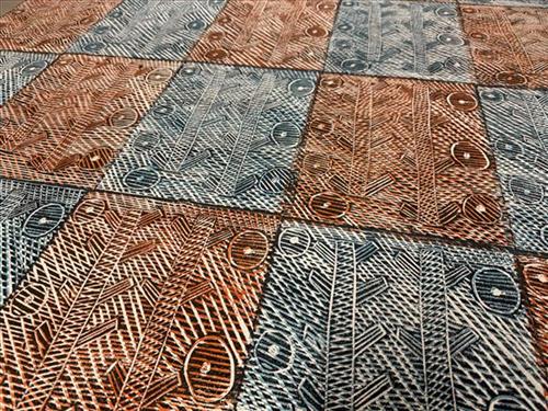
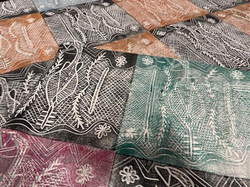
This fabric was created using the linocut printing technique. The lino tile has been carved by the artist in Maningrida, and has been printed by hand using a variety of colours and layers. The linocut technique ensures each textile piece is a one-off, limited edition piece. Bábbarra Women’s Centre supports the economic independence of Indigenous women in the Arnhem Land community of Maningrida, Northern Territory, Australia. Designs created by the women at Bábbarra reflect strong cultural knowledge, which is passed down to younger generations through their textile design practice.

377810582295667


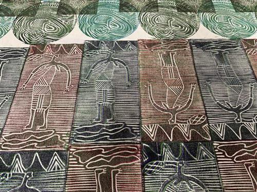
Babbarra story

This fabric was created using the linocut printing technique. The lino tile has been carved by the artist in Maningrida, and has been printed by hand using a variety of colours and layers. The linocut technique ensures each textile piece is a one-off, limited edition piece. Bábbarra Women’s Centre supports the economic independence of Indigenous women in the Arnhem Land community of Maningrida, Northern Territory, Australia. Designs created by the women at Bábbarra reflect strong cultural knowledge, which is passed down to younger generations through their textile design practice.

377810582295665


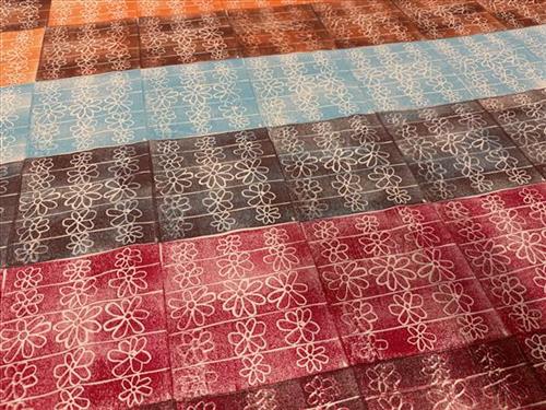
Kakárra (bush flowers)


This design features lost of flowers and bush food from around the coastal areas of Entrance Island and Maningrida.

‘There are the leaves of the black plum – we call that karranganjónganja vita glabrata. There are also jungle flowers that we find when we are looking for yam, I don’t know what they call them but that’s the curly one. The small one in the middle is the flowers of the warakkála (flowers of the long yam). These flowers grow all over this region, you can find them when you walk around the bush. Marilyn James

377810582295664


Kunkurra (Spiral Wind)

‘My designs, they are all alive living up in my head’- Janet Marawarr

Janet Marawarr has depicted kunkurra, the spiralling wind associated with several sites in the Kardbam clan. On one level, this design can be interpreted as a depiction of the kinds of mini-cyclones common during the wet season in Arnhem Land, where the artist lives. Kunkurra also relates specifically to a site called Bilwoyinj, near Mankorlod, on the artist’s clan estate.

At this site, two of the most important Kuninjku creation beings, a father and son known as na-korrkko, are believed to have hunted and eaten a goanna. They left some of the goanna fat behind at the site, which turned into the rock that still stands there today.

Bilwoyinj site is also a ceremonial ground for a ceremony called Yabbaduruwa, a major ceremony owned by the Yirridja patrimoiety. The Yabbaduruwa ceremony is primarily concerned with initiation, land ownership and promoting the cyclical regeneration of the human and natural worlds.

37781614004513


Status: Stock


Banana leaf print green – Mary

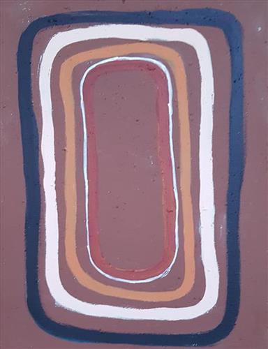
“I, me, Nyanjilpayi paint this one, Jarntinti Lake. I been born there, mine. I been little girl born there, Jarntinti area.

Jarntinti big claypan near Punmu. Tarlpa, Jutupa, Wawulpa, all waterhole and yinta (permanent spring) in Jarntinti area. Long time [ago] plenty bush tucker there, yukuri (green grass, vegetation) everywhere, plenty kalaru (Samphire, salt bush). You can find him biggest mob there. You got to get that kalaru, grind it and make a damper. Get him up and wash him, wash him, wash him then grind him into flour for a damper.

No kalaru today, no bush tucker, nothing. I don’t know [why]. Bush tucker nothing now, he never grow there anymore. Jarntinti everywhere clean water today, big rain there. I don’t know why no bush tucker now. I don’t know what’s wrong”.
– Nyanjilpayi (Ngarnjapayi) Nancy Chapman

“When I was born, my spirit appeared at Jarntinti. I was born at the waterhole called Jarntinti. That’s my Country, Jarntinti. I know all about it, about that water over there, about my home, our grandparent’s Country. We travelled all around as pujiman (traditional, desert dwelling), camping and then setting off again by foot. My family’s water, my grandmother’s, my grandfathers and my ancestors. I was taught from them. Our knowledge is ancient and has been passed on by our grandparents.”
– Nyanjilpayi Nancy Chapman, as translated by Kanyirninpa Jukurrpa

Jarntinti is a large claypan at the Southern end of Nyayartakujarra (Lake Dora), a large salt lake surrounded by tali (sand hills) within the Karlamilyi (Rudall River) region. This area is Nyanjilpayi’s birthplace; her ngurra (home Country, camp). Jarntinti formed part of the region which Nyanjilpayi traversed extensively as a young girl. During the pujiman era, Jarntinti was primarily used as a camping site in the wantajarra (wet season), when the claypan filled with kapi (water).

As related by Nyanjilpayi, an abundance of bush tucker could be found at Jarntinti. During the pujiman period, Martu would traverse very large distances annually in small family groups, moving seasonally from water source to water source, and hunting and gathering bush tucker as they went. Whilst desert life has moved away from mobile hunter-gatherer subsistence throughout the course of the twentieth century, bush tucker continues to be a significant component of the modern Martu diet. Hunting and gathering bush tucker remains equally valuable as an important cultural practice that is passed on intergenerationally.

111582295457


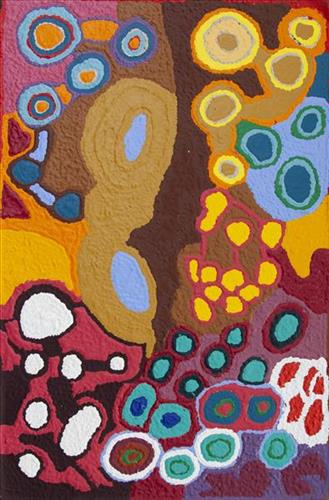
Kun Kun (Kuny-Kuny) Kumpaya Girgirba

“My ngurra (home Country, camp) long, long time ago, Kun Kun! This is a big waterhole. In Kun Kun, my Country, all the animals are coming to drink here. Big and small kangaroos, snakes, goannas, emus, skinks – they all drinking here. Big tali (sandhills). Big ones, four of them near the waterhole.”

– Kumpaya Girgirba (Girgaba)

Kun Kun (Kuny-kuny) is a soak accessing a large body of underground water, located south east of Kunawarritji (Canning Stock Route Well 33). The site is sacred for its association with the marlu (kangaroo) Jukurrpa (Dreaming), and was an important ceremonial site during the pujiman (traditional, desert dwelling) period.

Kun Kun lies within Kumpaya’s ngurra (home Country, camp), the area which she knew intimately and travelled extensively with her family in her youth. The Western Desert term ‘ngurra’ is hugely versatile in application. Broadly denoting birthplace and belonging, ngurra can refer to a body of water, a camp site, a large area of Country, or even a modern house. People identify with their ngurra in terms of specific rights and responsibilities, and the possession of intimate knowledge of the physical and cultural properties of one’s Country. This knowledge is traditionally passed intergenerationally through family connections. Painting ngurra, and in so doing sharing the Jukurrpa stories and physical characteristics of that place, has today become an important means of cultural maintenance. Physical maintenance of one’s ngurra, like cultural maintenance, ensures a site’s wellbeing, and is a responsibility of the people belonging to that area. 

During the pujiman period, knowledge of water sources was critical for survival, and today Martu Country is still defined in terms of the location and type of water. Each of the hundreds of claypans, rockholes, waterholes, soaks and springs found in the Martu desert homelands is known by name, location, quality and seasonal availability through real life experience and the recounting of Jukurrpa narratives. 

111582295456


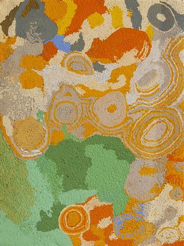
Wantili (Warntili, Canning Stock Route Well 25) – Ngamaru Bidu

“Wantili (Warntili, Canning Stock Route Well 25) area, close to Parnngurr. My ngurra (home Country, camp), my jamu’s (grandfather’s) Country, my father’s daddy, Jakayu [Biljabu’s] daddy and my daddy’s Country. Jakayu been bury her father there. In pujiman (traditional, desert dwelling) days, my family and Jakayu’s family been walking round there together. Big sandhills here. Sandhill, sandhill, sandhill everywhere. Claypan there, in the middle. Good place for swimming and drinking, for hunting little kangaroo. When no water [we would] go to [the adjacent Canning Stock Route] well. When there [was] rain we stay there at Wantili. Everywhere, we been walking everywhere.       

Near to Wantili, road [Canning Stock Route] going kayili (north). Long time [ago] only horses and cattle [travelled along that road], going Meekatharra and back in the cold time, gone right up to GJ (Georgia) Bore. Half way, when he see water at Wantili, that mob would camp one night, bullock eating all the grass and men’s drinking water. One Martu been working with that mob, droving bullock. Every time he been give us meat, all the pujimanpa (desert dwellers).”

– Ngamaru Bidu


Wantili is a large round jurnu (soak) and linyji (claypan) near Well 25 on the Canning Stock Route. The Wantili region is dominated by claypans surrounded by tuwa (sandhills), and Nyilangkurr, a prominent yapu (hill) is located close to the eastern edge of the claypan. Following rain the typically dry claypans are filled with water, with the overflow from nearby waterholes flowing to Wantili. At that time, Wantili becomes an important place for obtaining fresh water for drinking and bathing. Wantili is significant for the fact that at this site Kartujarra, Manyjilyjarra, Putijarra and Warnman people would all come together for ceremonies during the pujiman era. Many jiwa (stones used by women for grinding seeds) from these times, including those used by Ngamaru’s family, can still be found there today.

Wantili lies within Ngamaru’s ngurra (home Country, camp) through her grandfather and father. As described in her account, Wantili was one of the sites Ngamaru knew intimately and travelled extensively with her family and other family groups, such as the Biljabu family. During the pujiman period Martu would traverse very large distances annually, moving seasonally from water source to water source, and hunting and gathering bush tucker as they went. Knowledge of water sources was critical for survival, and today Martu Country is still defined in terms of the location and type of water. 

As Ngamaru recounts, Wantili also held significance for her as a site of contact between her family and kartiya (white people); drovers with their cattle travelling along the Canning Stock Route. The establishment of the route by Alfred Canning and his team in 1910 resulted in first contact with Europeans for many Martu, including Ngamaru and her family. Increasingly, Martu followed the route to newly established ration depots, mission and pastoral stations. They were drawn to the route in search of food, by a sense of curiosity, or by loneliness. By the late 1950s and early 1960s, most of the desert family groups had left the desert. Eventually, these factors combined with an extreme and prolonged drought in the 1960s to prompt the few remaining pujimanpa to move in from the desert. 

Culturally, Wantili is an incredibly important site in two central Jukurrpa (Dreaming) stories. The first relates to the world’s creation. In this narrative, the world was initially dark, and people were like rocks, with no arms or legs. Following the sun’s first rising, life-forms become increasingly complex while particular features in the land are created. Beyond these details much of the narrative is ngurlu (sacred, taboo), and only for Martu, but the site is open, and anyone can go there. 

Wantili is also one of the many sites featured in the epic Minyipuru (Jakulyukulyu, Seven Sisters) Jukurrpa story. Minyipuru is a central Jukurrpa narrative for Martu, Ngaanyatjarra, Pitjantjatjara and Yankunytjatjara people that is associated with the seasonal Pleiades star constellation. Relayed in song, dance, stories and paintings, Minyipuru serves as a creation narrative, a source of information relating to the physical properties of the land, and an embodiment of Aboriginal cultural laws. The story follows the movement of a group of women travelling all the way across the desert, beginning at Roebourne on the coast of Western Australia, as they are pursued by Yurla, a lustful old man. As the women travelled, they stopped to rest at many sites to eat, dance, rest and sing, on the way leaving behind an assortment of articles that became formations in the land, such as groupings of rocks and trees, grinding stones and seeds. The sisters rested at Wantili before throwing seeds, then continued their journey far to the east and beyond Martu Country, stopping at various sites through central and South Australia.

111582295455


Kun Kun (Kuny-Kuny) Kumpaya Girgirba

“My ngurra (home Country, camp) long, long time ago, Kun Kun! This is a big waterhole. In Kun Kun, my Country, all the animals are coming to drink here. Big and small kangaroos, snakes, goannas, emus, skinks – they all drinking here. Big tali (sandhills). Big ones, four of them near the waterhole.”

– Kumpaya Girgirba (Girgaba)

Kun Kun (Kuny-kuny) is a soak accessing a large body of underground water, located south east of Kunawarritji (Canning Stock Route Well 33). The site is sacred for its association with the marlu (kangaroo) Jukurrpa (Dreaming), and was an important ceremonial site during the pujiman (traditional, desert dwelling) period.

Kun Kun lies within Kumpaya’s ngurra (home Country, camp), the area which she knew intimately and travelled extensively with her family in her youth. The Western Desert term ‘ngurra’ is hugely versatile in application. Broadly denoting birthplace and belonging, ngurra can refer to a body of water, a camp site, a large area of Country, or even a modern house. People identify with their ngurra in terms of specific rights and responsibilities, and the possession of intimate knowledge of the physical and cultural properties of one’s Country. This knowledge is traditionally passed intergenerationally through family connections. Painting ngurra, and in so doing sharing the Jukurrpa stories and physical characteristics of that place, has today become an important means of cultural maintenance. Physical maintenance of one’s ngurra, like cultural maintenance, ensures a site’s wellbeing, and is a responsibility of the people belonging to that area. 

During the pujiman period, knowledge of water sources was critical for survival, and today Martu Country is still defined in terms of the location and type of water. Each of the hundreds of claypans, rockholes, waterholes, soaks and springs found in the Martu desert homelands is known by name, location, quality and seasonal availability through real life experience and the recounting of Jukurrpa narratives.