111582446513


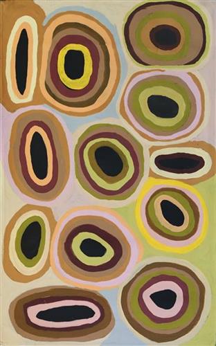
Kaalpa (Kalypa, Canning Stock Route Well 23)

“Kaalpa (Kalypa, Canning Stock Route Well 23) is my grandfather’s Country. There’s a waterhole there, Kaalpa waterhole. It’s my two pops’ Country. They been walking around, hunting around Kaalpa. You can see a yapu (rock), warla (lake), claypans, karru (creek) and tuwa (sandhills) there. It’s on the [Canning] Stock Route, it’s Well 23. One walypala One walypala (whitefella) well, and a real kalyu (water) there, jurnu. The Seven Sisters landed there, Jukurrpa (Dreaming). That man Yurla yapu (hill, stone, rock) there.” [Yurla, who chased the Seven Sisters during the Jukurrpa remains at Kaalpa in the form of a rock]) 

In pujiman (traditional, desert dwelling) days, pujimanpa (desert born people) walking around all this Country. My pops told me about that place, a big flat area, parlkarra (flat country) good for hunting parnajarrpa (goanna), lunki (witchetty grub), lungkurta (blue tongue lizard), wamurla (bush tomato), jinyjiwirrilyi (wild gooseberry). Kaalpa is a busy place for emus getting a drink. 

The old people were telling me “Kaalpa’s your grandfather’s Country, you gotta paint it.” I went [to Kaalpa] for the first time [in 2018] on a Martumili KJ [Kanyirninpa Jukurrpa] trip. We went out there when we were looking for the [Greater] Bilby. They took me and [my sister] Tamisha, they showed us our grandfather’s Country, Well 23. I went out there, had a good look, walked around, and went back to Wantili (Warntili, Canning Stock Route Well 25), Parnngurr, and I started painting it. Now it’s my mind, now I know what Kaalpa looks like. When I went there, I was pukurlpa (happy). It made you open up your spirit, it feels like home.”

 – Corban Clause Williams

Kaalpa is a permanent water source located northeast of Kumpupirntily (Kumpupintily, Lake Disappointment). This site is a place of great cultural significance, and is also known for good hunting. Adjacent to the waterhole is a hill of the same name. The landscape around Kaalpa is parlkarra (flat country), bordered by tali (sandhills) stretching as far as Windy Corner, northeast and towards the border of Western Australia and the Northern Territory. The large and dangerous Jukurrpa (Dreamtime) mosquito and fly beings partially created the landforms in this area and continue to live underground here.

Kaalpa also features in the Minyipuru (Jakulyukulyu, Seven Sisters) Jukurrpa, a central creation narrative for Martu, Ngaanyatjarra, Pitjantjatjara and Yankunytjatjara people that is associated with the seasonal Pleiades star constellation. At Kaalpa the Minyipuru met a group of men; it was the first time either group had seen members of the opposite sex. The men tried to grab the women, but the Minyipuru chased them, hitting them with their digging sticks and leaving them lying there as they continued travelling east.

Relayed in song, dance, stories and paintings, Minyipuru serves as a creation narrative, a source of information relating to the physical properties of the land, and an embodiment of Aboriginal cultural laws. Beginning in Roebourne on the west coast of Western Australia, the story morphs in its movement eastward across the land, following the women as they walk, dance, and even fly from waterhole to waterhole. As they travel the women camp, sing, wash, dance and gather food, leaving markers in the landscape and creating landforms that remain to this day, such as groupings of rocks and trees, grinding stones and seeds. During the entirety of their journey the women are pursued by a lustful old man, Yurla, although interactions with other animals, groups of men, and spirit beings are also chronicled in the narrative.

The intersection of the Canning Stock Route with Kaalpa also made this a site of early contact with Europeans for many Martu then living a pujiman life in the desert. Following the route’s construction, Martu encountered Europeans and other Martu working as cattle drovers as they would travel up and down the Stock Route from water source to water source. Increasingly, pujimanpa followed the route to newly established ration depots, mission and pastoral stations. They were drawn to the route in search of food, by a sense of curiosity, or by loneliness. By the late 1950s and early 1960s, most of the desert family groups had left the desert. Eventually, these factors combined with an extreme and prolonged drought in the 1960s to prompt the few remaining pujimanpa to move in from the desert.
111582446512


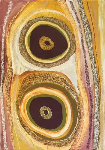
Kaalpa (Kalypa, Canning Stock Route Well 23)

“Kaalpa (Kalypa, Canning Stock Route Well 23) is my grandfather’s Country. There’s a waterhole there, Kaalpa waterhole. It’s my two pops’ Country. They been walking around, hunting around Kaalpa. You can see a yapu (rock), warla (lake), claypans, karru (creek) and tuwa (sandhills) there. It’s on the [Canning] Stock Route, it’s Well 23. One walypala One walypala (whitefella) well, and a real kalyu (water) there, jurnu. The Seven Sisters landed there, Jukurrpa (Dreaming). That man Yurla yapu (hill, stone, rock) there.” [Yurla, who chased the Seven Sisters during the Jukurrpa remains at Kaalpa in the form of a rock]) 

In pujiman (traditional, desert dwelling) days, pujimanpa (desert born people) walking around all this Country. My pops told me about that place, a big flat area, parlkarra (flat country) good for hunting parnajarrpa (goanna), lunki (witchetty grub), lungkurta (blue tongue lizard), wamurla (bush tomato), jinyjiwirrilyi (wild gooseberry). Kaalpa is a busy place for emus getting a drink. 

The old people were telling me “Kaalpa’s your grandfather’s Country, you gotta paint it.” I went [to Kaalpa] for the first time [in 2018] on a Martumili KJ [Kanyirninpa Jukurrpa] trip. We went out there when we were looking for the [Greater] Bilby. They took me and [my sister] Tamisha, they showed us our grandfather’s Country, Well 23. I went out there, had a good look, walked around, and went back to Wantili (Warntili, Canning Stock Route Well 25), Parnngurr, and I started painting it. Now it’s my mind, now I know what Kaalpa looks like. When I went there, I was pukurlpa (happy). It made you open up your spirit, it feels like home.”

 – Corban Clause Williams

Kaalpa is a permanent water source located northeast of Kumpupirntily (Kumpupintily, Lake Disappointment). This site is a place of great cultural significance, and is also known for good hunting. Adjacent to the waterhole is a hill of the same name. The landscape around Kaalpa is parlkarra (flat country), bordered by tali (sandhills) stretching as far as Windy Corner, northeast and towards the border of Western Australia and the Northern Territory. The large and dangerous Jukurrpa (Dreamtime) mosquito and fly beings partially created the landforms in this area and continue to live underground here.

Kaalpa also features in the Minyipuru (Jakulyukulyu, Seven Sisters) Jukurrpa, a central creation narrative for Martu, Ngaanyatjarra, Pitjantjatjara and Yankunytjatjara people that is associated with the seasonal Pleiades star constellation. At Kaalpa the Minyipuru met a group of men; it was the first time either group had seen members of the opposite sex. The men tried to grab the women, but the Minyipuru chased them, hitting them with their digging sticks and leaving them lying there as they continued travelling east.

Relayed in song, dance, stories and paintings, Minyipuru serves as a creation narrative, a source of information relating to the physical properties of the land, and an embodiment of Aboriginal cultural laws. Beginning in Roebourne on the west coast of Western Australia, the story morphs in its movement eastward across the land, following the women as they walk, dance, and even fly from waterhole to waterhole. As they travel the women camp, sing, wash, dance and gather food, leaving markers in the landscape and creating landforms that remain to this day, such as groupings of rocks and trees, grinding stones and seeds. During the entirety of their journey the women are pursued by a lustful old man, Yurla, although interactions with other animals, groups of men, and spirit beings are also chronicled in the narrative.

The intersection of the Canning Stock Route with Kaalpa also made this a site of early contact with Europeans for many Martu then living a pujiman life in the desert. Following the route’s construction, Martu encountered Europeans and other Martu working as cattle drovers as they would travel up and down the Stock Route from water source to water source. Increasingly, pujimanpa followed the route to newly established ration depots, mission and pastoral stations. They were drawn to the route in search of food, by a sense of curiosity, or by loneliness. By the late 1950s and early 1960s, most of the desert family groups had left the desert. Eventually, these factors combined with an extreme and prolonged drought in the 1960s to prompt the few remaining pujimanpa to move in from the desert.
111582446511


Kaalpa (Kalypa, Canning Stock Route Well 23)

“Kaalpa (Kalypa, Canning Stock Route Well 23) is my grandfather’s Country. There’s a waterhole there, Kaalpa waterhole. It’s my two pops’ Country. They been walking around, hunting around Kaalpa. You can see a yapu (rock), warla (lake), claypans, karru (creek) and tuwa (sandhills) there. It’s on the [Canning] Stock Route, it’s Well 23. One walypala One walypala (whitefella) well, and a real kalyu (water) there, jurnu. The Seven Sisters landed there, Jukurrpa (Dreaming). That man Yurla yapu (hill, stone, rock) there.” [Yurla, who chased the Seven Sisters during the Jukurrpa remains at Kaalpa in the form of a rock]) 

In pujiman (traditional, desert dwelling) days, pujimanpa (desert born people) walking around all this Country. My pops told me about that place, a big flat area, parlkarra (flat country) good for hunting parnajarrpa (goanna), lunki (witchetty grub), lungkurta (blue tongue lizard), wamurla (bush tomato), jinyjiwirrilyi (wild gooseberry). Kaalpa is a busy place for emus getting a drink. 

The old people were telling me “Kaalpa’s your grandfather’s Country, you gotta paint it.” I went [to Kaalpa] for the first time [in 2018] on a Martumili KJ [Kanyirninpa Jukurrpa] trip. We went out there when we were looking for the [Greater] Bilby. They took me and [my sister] Tamisha, they showed us our grandfather’s Country, Well 23. I went out there, had a good look, walked around, and went back to Wantili (Warntili, Canning Stock Route Well 25), Parnngurr, and I started painting it. Now it’s my mind, now I know what Kaalpa looks like. When I went there, I was pukurlpa (happy). It made you open up your spirit, it feels like home.”

 – Corban Clause Williams

Kaalpa is a permanent water source located northeast of Kumpupirntily (Kumpupintily, Lake Disappointment). This site is a place of great cultural significance, and is also known for good hunting. Adjacent to the waterhole is a hill of the same name. The landscape around Kaalpa is parlkarra (flat country), bordered by tali (sandhills) stretching as far as Windy Corner, northeast and towards the border of Western Australia and the Northern Territory. The large and dangerous Jukurrpa (Dreamtime) mosquito and fly beings partially created the landforms in this area and continue to live underground here.

Kaalpa also features in the Minyipuru (Jakulyukulyu, Seven Sisters) Jukurrpa, a central creation narrative for Martu, Ngaanyatjarra, Pitjantjatjara and Yankunytjatjara people that is associated with the seasonal Pleiades star constellation. At Kaalpa the Minyipuru met a group of men; it was the first time either group had seen members of the opposite sex. The men tried to grab the women, but the Minyipuru chased them, hitting them with their digging sticks and leaving them lying there as they continued travelling east.

Relayed in song, dance, stories and paintings, Minyipuru serves as a creation narrative, a source of information relating to the physical properties of the land, and an embodiment of Aboriginal cultural laws. Beginning in Roebourne on the west coast of Western Australia, the story morphs in its movement eastward across the land, following the women as they walk, dance, and even fly from waterhole to waterhole. As they travel the women camp, sing, wash, dance and gather food, leaving markers in the landscape and creating landforms that remain to this day, such as groupings of rocks and trees, grinding stones and seeds. During the entirety of their journey the women are pursued by a lustful old man, Yurla, although interactions with other animals, groups of men, and spirit beings are also chronicled in the narrative.

The intersection of the Canning Stock Route with Kaalpa also made this a site of early contact with Europeans for many Martu then living a pujiman life in the desert. Following the route’s construction, Martu encountered Europeans and other Martu working as cattle drovers as they would travel up and down the Stock Route from water source to water source. Increasingly, pujimanpa followed the route to newly established ration depots, mission and pastoral stations. They were drawn to the route in search of food, by a sense of curiosity, or by loneliness. By the late 1950s and early 1960s, most of the desert family groups had left the desert. Eventually, these factors combined with an extreme and prolonged drought in the 1960s to prompt the few remaining pujimanpa to move in from the desert.
111582446510


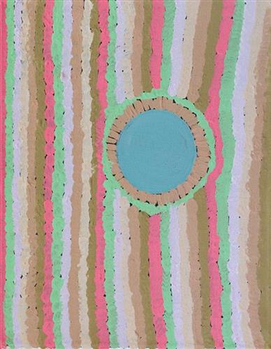
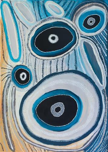
Wantili (Warntili, Canning Stock Route Well 25)

“Wantili is my place, where I was born. It’s a place where everyone was living- it’s all of their ngurra (home Country, camp). It’s the Jukurrpa (Dreaming) of that place. All those claypans, a place where everyone comes together for ceremony and gatherings, all meeting with different families. I went there with my aunt [Jakayu Biljabu]  and my sister [Kumpaya Girgirba]- they told me the story of where I was born, in pujiman (traditional, desert dwelling) times. We walked all over the place. I was just a little one.”

– Kuru Glady Bidu

Wantili (Warntili, Canning Stock Route Well 25) is a large round jurnu (soak) and linyji (claypan) near Well 25 on the Canning Stock Route. This site is Kuru’s birthplace, and as such forms an integral part of her ngurra. The area is dominated by claypans surrounded by tuwa (sandhills), and Nyilangkurr, a prominent yapu (hill) is located on the edge of the claypan. Following rain the typically dry claypans are filled with water, with the overflow from nearby waterholes flowing to Wantili. At that time, Wantili becomes an important place for obtaining fresh water for drinking and bathing. Wantili is significant for the fact that at this site Kartujarra, Manyjilyjarra, Putijarra and Warnman people would all come together for ceremonies during the pujiman era. Many jiwa (stones used by women for grinding seeds) from these times can still be found there today. 

Wantili is an incredibly important cultural site, ‘where the creation started.’  (Cyril Whyoulter). In this creation story, the world was initially dark, and people were like rocks, with no arms or legs. Following the sun’s first rising, life-forms become increasingly complex while particular features in the land were created. Beyond these details much of the Jukurrpa (Dreaming) narrative relating to Wantili is ngurlu (sacred, taboo), and only for Martu, but the site is open, and anyone can go there. 

Wantili is also one of the many sites featured in the epic Minyipuru (Jakulyukulyu, Seven Sisters) Jukurrpa story. Minyipuru is a central Jukurrpa narrative for Martu, Ngaanyatjarra, Pitjantjatjara and Yankunytjatjara people that is associated with the seasonal Pleiades star constellation. Relayed in song, dance, stories and paintings, Minyipuru serves as a creation narrative, a source of information relating to the physical properties of the land, and an embodiment of Aboriginal cultural laws. The story follows the movement of a group of women travelling all the way across the desert, beginning at Roebourne on the coast of Western Australia, as they are pursued by Yurla, a lustful old man. As the women travelled, they stopped to rest at many sites to eat, dance, rest and sing, on the way leaving behind an assortment of articles that became formations in the land, such as groupings of rocks and trees, grinding stones and seeds. The sisters rested at Wantili before throwing seeds, then continued their journey far to the east and beyond Martu Country, stopping at various sites through central and South Australia.

The intersection of the Canning Stock Route with Wantili also made this a site of early contact with Europeans for many Martu then living a pujiman life in the desert. Following the route’s construction, Martu encountered Europeans and other Martu working as cattle drovers as they would travel up and down the Stock Route from water source to water source. Increasingly, pujimanpa  (desert dwellers) followed the route to newly established ration depots, mission and pastoral stations. They were drawn to the route in search of food, by a sense of curiosity, or by loneliness. By the late 1950s and early 1960s, most of the desert family groups had left the desert. Eventually, these factors combined with an extreme and prolonged drought in the 1960s to prompt the few remaining pujimanpa to move in from the desert.
111582446507


Untitled

Martumili Artists work with over three hundred artists from remote Martu Aboriginal communities, including Punmu, Parnngurr, Kunawarritji, Jigalong, Irrungadji (Nullagine), and Warralong, as well as from the Parnpajinya (Newman) gallery and studio spaces. Known for their diverse, energetic, and unmediated painting styles, their works reflect the dramatic geography and scale of their homelands. Each artist, however, brings a unique approach to their craft.

Younger Martu artists often start painting alongside their parents, grandparents, and extended family, which fosters an organic learning process. This not only involves mastering painting techniques but also understanding specific locations, family histories, traditional ways of life, bush tucker, and Jukurrpa (Dreaming). Over time, with encouragement from their peers, they develop their own distinct styles and explore unique painting techniques and subject matter. In this work the artist brings a contemporary, evolving perspective to their work.

111582446504


Untitled

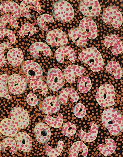
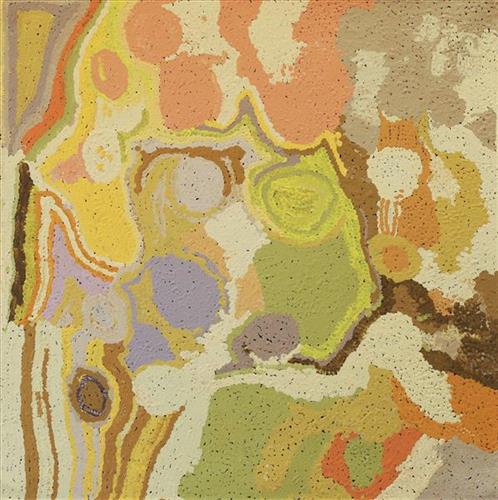
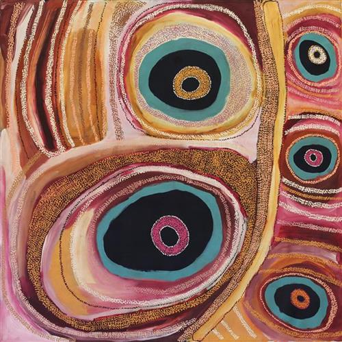
This is Lorna’s Country- her ‘ngurra’ (home Country, camp). People identify with their ngurra in terms of specific rights and responsibilities, and the possession of intimate knowledge of the physical and cultural properties of one’s Country. Painting ngurra, and in so doing sharing the Jukurrpa (Dreaming) stories and physical characteristics of that place, has today become an important means of cultural maintenance. 

Though Lorna was born in the Port Hedland hospital and she attended school from a young age, she still lived a somewhat traditional pujiman (traditional, desert dwelling) lifestyle, travelling in the Country between Marble Bar and Roebourne with ‘nomad people’. Today Lorna lives in Warralong Aboriginal community, 50km north of Marble Bar.

Portrayed in this work are features of Lorna’s ngurra, such as the dominant permanent red tali (sandhills), warta (trees, vegetation), and the individually named water sources she and her family camped at.

111582446501


Punmu Jurnukaja

Punmu is an Aboriginal community located 670km North-East of Newman, in the Pilbara region of Western Australia. Created during the return to Country movement of the 1980s, with the recognition of Martu land rights and native title, the community was named after a nearby jukurrpa (dreamtime) story.

Punmu community sits on the edge of a large salt lake known as Nyayartakujarra, or Lake Dora. The lake runs south into Karlamilyi River. There are many yinta (permanent water sources) in Punmu’s nearby vicinity including Wilarra, Rawa, Yilyara, Jilajila and Tuutuu.

Punmu features in several jukurrpa narratives. Of particular importance for the Warnman people is the story of the ‘Jila Kujarra’ (Two Snakes). These snakes travelled through Parnngurr, Punkulyi, Yulpu, and Winukurrujunu, forming lakes, claypans, rocks, rockholes, waterholes and soaks as they went. The powerful elder of the two snakes, Wirnpa, finally stopped at the site of Wirnpa, named for him. The young snake kept on travelling until coming to Punmu waterholes Rawa and Yilyarra, making that Country his ngurra (home camp). Another jukurrpa story describes the formation of Nyayartakujarra as occurring when two travelling snakes were first sung to sleep and then killed by magic men. The snakes’ fat was said to have burned away and melted into Nyayartakujarra.

111582446498


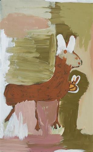
Untitled [Kangaroo]

“Jigalong, Doreen, [s]he been born there, [s]he been go Nullagine, as a little little one. [S]He gone Marble Bar staying there and Strelley. I been marry her father.

Every painting Jigalong, Punmu, Parnngurr, go back town. Make em painting big one town. Get em, you gotta get em maybe big one.”

 – May Chapman Mayiwalku (May Wokka)


Most often explored in Doreen’s works are the motifs of her everyday modern Aboriginal community life; the animals hunted and plants gathered for bush tucker, the cars and aeroplanes used to travel to the cities and remote communities she regularly moves between, and depictions of the Country itself. 

Collectively this imagery, depicted with Doreen’s trademark wild palettes, painterly brushstrokes, and stark compositions, builds a layered representation of her Country. Doreen’s intimately known ngurra (home Country, camp) is viewed from multiple spatial perspectives, and in stylistic modes ranging from pure abstraction to images incorporating realist and traditional elements.

Doreen’s ngurra encompasses the Country between Western Desert communities and towns; Warralong, Strelley, Marble Bar, Port Hedland, and Jigalong, her birthplace. People identify with their ngurra in terms of specific rights and responsibilities, and the possession of intimate knowledge of the physical and cultural properties of one’s Country. Painting ngurra, and in so doing sharing the Jukurrpa (Dreaming) stories and physical characteristics of that place, has today become an important means of cultural maintenance.

111582446495


Yiranang

“Yiranang claypan, near [Canning Stock Route] Well 24. It’s a [seed] grinding place. You know that kalaru (samphire, salt bush)? Green one, it grows in the Kaalpa (Kalypa, Canning Stock Route Well 23) area. He grows there, I’ll show you. You make a damper from him. But no kalaru there in Yiranang.

All the bushes there, wintamarra (mulga tree), and tuwa (sandhills). I was walking there as a young girl. No man, single woman. All the women were there; me, Kumpaya [Girgirba], Jakayu [Biljabu], Bugai [Whyoulter], my mother. We would walk there.”

– Ngamaru Bidu


Yiranang is a large claypan located just north of Kartarru (Canning Stock Route Well 24). Forming part of Ngamaru’s ngurra (home Country, camp), Yiranang was one of the sites Ngamaru knew intimately and travelled extensively with her family and other family groups, such as the Girgirba, Biljabu and Whyoulter families. Linyji (claypans) like Yiranang were typically visited more often during the wantajarra (wet season) as they filled with water. 

Ngamaru also recalls Yiranang as a ‘grinding place’; here the black kalaru seeds collected from nearby Kaalpa were first washed several times before being ground with jiwa (stones used by women for grinding seeds) to make a type of flour, which was then mixed with water to create a dough that was finally cooked in the ashes of a fire. Kalaru seeds were seasonally harvested in the yalijarra (hot dry months).

During the pujiman (traditional, desert dwelling) period Martu would traverse very large distances annually, moving seasonally from water source to water source, and hunting and gathering bush tucker as they went. Knowledge of water sources was critical for survival, and today Martu Country is still defined in terms of the location and type of water. Each of the hundreds of claypans, rockholes, waterholes, soaks and springs found in the Martu desert homelands is known by name, location, quality and seasonal availability through real life experience and the recounting of Jukurrpa (Dreaming) narratives.

111582446493


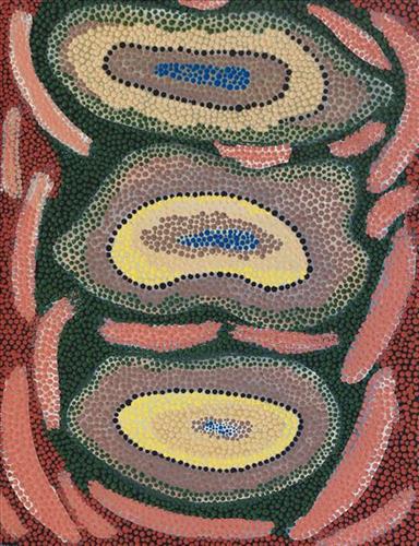
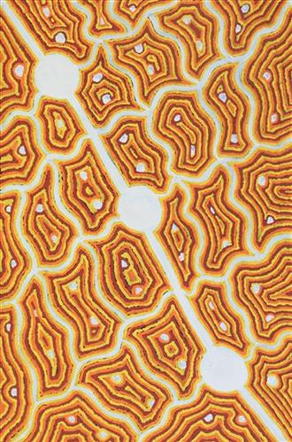
Nyilangkurr

Nyilangkurr is a group of three large tali (sandhills) located between Kartarru (Canning Stock Route Well 24) and Tiwa (Canning Stock Route 26), and just east of Wantili, an important creation site.

The traditional lands of the Martu people encompass the Great Sandy Desert and Rudall River regions of Western Australia, an enormous tract dominated by distinctive red tali, or tuwa (sandhills). These sandhills present an unforgiving landscape; sparse vegetation covers a seemingly never ending expanse of dunes, and yet these lands and the location of resources within them was known intimately by its pujiman (traditional, desert dwelling) inhabitants. At this time, Martu traversed very large distances annually in small family groups, moving from water source to water source through the harsh desert landscape with incredible stamina and resourcefulness. Travel was often undertaken at night, and when travelling during the day, Martu wore yakipiri (woven bark sandals) to protect their feet from the hot desert sand.