111582399255


Moolyella Rockhole

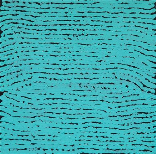
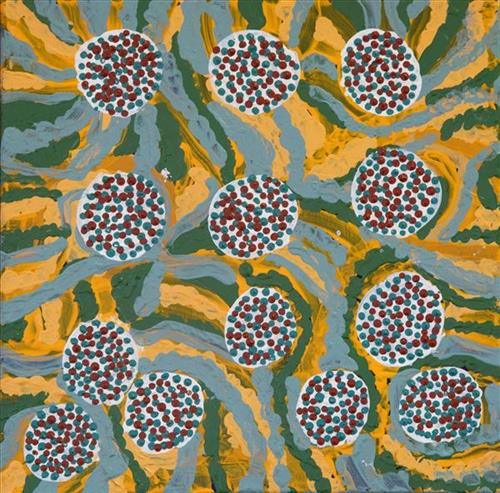
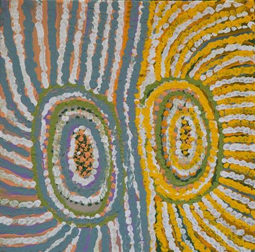
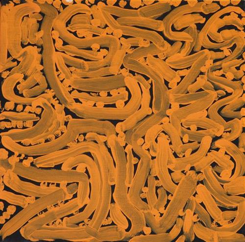
“This is a rockhole- people coming this side and people coming round this [other] side, coming to that waterhole.

This painting is about every rockhole in Moolyella, where I used to work… We would walk and get some water from the rockholes and go away back home-  get that water from these rockholes when we were working. My father and mother’s surname was Mulialla, they were named after that place.”

– Lorna Linmurra

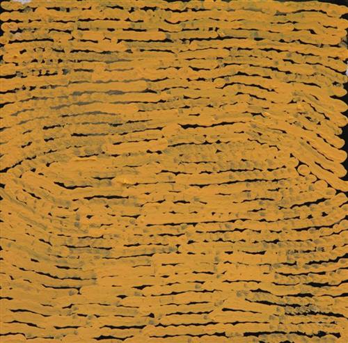
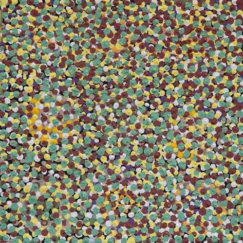
This work depicts a waterhole in the area around Moolyella, an area close to Marble Bar that was mined for tin from 1898. Industrial production ceased by 1921, and from the late 1920’s several Aboriginals families, including Lorna’s, began working the mine. Tin and other minerals were retrieved from claypans and dry river beds using a yandy (dish used for winnowing seed).  

Moolyella forms part of Lorna’s ngurra (home Country, camp), and as she describes in her account, each of the many water sources around the area were well known to herself and her family.

During the pujiman (traditional, desert dwelling) period, knowledge of water sources was critical for survival, and today Martu Country is still defined in terms of the location and type of water. Each of the hundreds of claypans, rockholes, waterholes, soaks and springs found in the Martu desert homelands is known through real life experience and the recounting of Jukurrpa (Dreaming) narratives by name, location, quality and seasonal availability. This encyclopedic knowledge extends even to the nature and movement of arterial waterways, and sustained Martu as they travelled across their Country, hunting and gathering, visiting family, and fulfilling ceremonial obligations. They would traverse very large distances annually, visiting specific areas in the dry and wet season depending on the availability of water and the corresponding cycles of plant and animal life on which hunting and gathering bush tucker was reliant.

111582399253


Moolyella Rockhole

“This is a rockhole- people coming this side and people coming round this [other] side, coming to that waterhole.

This painting is about every rockhole in Moolyella, where I used to work… We would walk and get some water from the rockholes and go away back home-  get that water from these rockholes when we were working. My father and mother’s surname was Mulialla, they were named after that place.”

– Lorna Linmurra

This work depicts a waterhole in the area around Moolyella, an area close to Marble Bar that was mined for tin from 1898. Industrial production ceased by 1921, and from the late 1920’s several Aboriginals families, including Lorna’s, began working the mine. Tin and other minerals were retrieved from claypans and dry river beds using a yandy (dish used for winnowing seed).  

Moolyella forms part of Lorna’s ngurra (home Country, camp), and as she describes in her account, each of the many water sources around the area were well known to herself and her family.

During the pujiman (traditional, desert dwelling) period, knowledge of water sources was critical for survival, and today Martu Country is still defined in terms of the location and type of water. Each of the hundreds of claypans, rockholes, waterholes, soaks and springs found in the Martu desert homelands is known through real life experience and the recounting of Jukurrpa (Dreaming) narratives by name, location, quality and seasonal availability. This encyclopedic knowledge extends even to the nature and movement of arterial waterways, and sustained Martu as they travelled across their Country, hunting and gathering, visiting family, and fulfilling ceremonial obligations. They would traverse very large distances annually, visiting specific areas in the dry and wet season depending on the availability of water and the corresponding cycles of plant and animal life on which hunting and gathering bush tucker was reliant.

111582399252


Moolyella Rockhole

“This is a rockhole- people coming this side and people coming round this [other] side, coming to that waterhole.

This painting is about every rockhole in Moolyella, where I used to work… We would walk and get some water from the rockholes and go away back home-  get that water from these rockholes when we were working. My father and mother’s surname was Mulialla, they were named after that place.”

– Lorna Linmurra

This work depicts a waterhole in the area around Moolyella, an area close to Marble Bar that was mined for tin from 1898. Industrial production ceased by 1921, and from the late 1920’s several Aboriginals families, including Lorna’s, began working the mine. Tin and other minerals were retrieved from claypans and dry river beds using a yandy (dish used for winnowing seed).  

Moolyella forms part of Lorna’s ngurra (home Country, camp), and as she describes in her account, each of the many water sources around the area were well known to herself and her family.

During the pujiman (traditional, desert dwelling) period, knowledge of water sources was critical for survival, and today Martu Country is still defined in terms of the location and type of water. Each of the hundreds of claypans, rockholes, waterholes, soaks and springs found in the Martu desert homelands is known through real life experience and the recounting of Jukurrpa (Dreaming) narratives by name, location, quality and seasonal availability. This encyclopedic knowledge extends even to the nature and movement of arterial waterways, and sustained Martu as they travelled across their Country, hunting and gathering, visiting family, and fulfilling ceremonial obligations. They would traverse very large distances annually, visiting specific areas in the dry and wet season depending on the availability of water and the corresponding cycles of plant and animal life on which hunting and gathering bush tucker was reliant.
111582399251


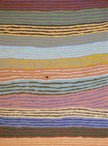
Jarntinti

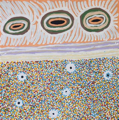
“This is a linyji (claypan). We find kalaru (seed used for making damper from samphire bush) there that we collect. Too much good tucker!”  

– Mayiwalku May Chapman

Jarntinti is a large claypan at the Southern end of Nyayartakujarra (Lake Dora), a large salt lake surrounded by tali (sand hills) within the Karlamilyi (Rudall River) region. This area forms part of Mayiwalku’s ngurra (home Country, camp), the region which she traversed extensively as a young girl. Mayiwalku’s sister Nyanjilpayi was born at Jarntinti. 

During the pujiman (traditional, desert dwelling) era, Jarntinti was primarily used as a camping site in the wantajarra (wet season), when the claypan filled with kapi (water). Other nearby water sources include Tarl, Kartuny, Wawul, Warnkarr, Jutupa, and Kunalimpi. 

Jarntinti is known as a site where kalaru grows in abundance. In the pujiman era, the black kalaru seeds were seasonally harvested from this area. Once collected a labour intensive process began to produce damper, a type of flat bread. The kalaru seeds were first washed several times before being ground with a jiwa (stones used by women for grinding seeds) to make a type of flour, which was then mixed with water to create a dough that was finally cooked in the ashes of a fire.

111582399380


Jarntinti

“This is a linyji (claypan). We find kalaru (seed used for making damper from samphire bush) there that we collect. Too much good tucker!”  

– Mayiwalku May Chapman

Jarntinti is a large claypan at the Southern end of Nyayartakujarra (Lake Dora), a large salt lake surrounded by tali (sand hills) within the Karlamilyi (Rudall River) region. This area forms part of Mayiwalku’s ngurra (home Country, camp), the region which she traversed extensively as a young girl. Mayiwalku’s sister Nyanjilpayi was born at Jarntinti. 

During the pujiman (traditional, desert dwelling) era, Jarntinti was primarily used as a camping site in the wantajarra (wet season), when the claypan filled with kapi (water). Other nearby water sources include Tarl, Kartuny, Wawul, Warnkarr, Jutupa, and Kunalimpi. 

Jarntinti is known as a site where kalaru grows in abundance. In the pujiman era, the black kalaru seeds were seasonally harvested from this area. Once collected a labour intensive process began to produce damper, a type of flat bread. The kalaru seeds were first washed several times before being ground with a jiwa (stones used by women for grinding seeds) to make a type of flour, which was then mixed with water to create a dough that was finally cooked in the ashes of a fire.

111582399379


Moolyella Rockhole

“This is a rockhole- people coming this side and people coming round this [other] side, coming to that waterhole.

This painting is about every rockhole in Moolyella, where I used to work… We would walk and get some water from the rockholes and go away back home-  get that water from these rockholes when we were working. My father and mother’s surname was Mulialla, they were named after that place.”

– Lorna Linmurra

This work depicts a waterhole in the area around Moolyella, an area close to Marble Bar that was mined for tin from 1898. Industrial production ceased by 1921, and from the late 1920’s several Aboriginals families, including Lorna’s, began working the mine. Tin and other minerals were retrieved from claypans and dry river beds using a yandy (dish used for winnowing seed).  

Moolyella forms part of Lorna’s ngurra (home Country, camp), and as she describes in her account, each of the many water sources around the area were well known to herself and her family.

During the pujiman (traditional, desert dwelling) period, knowledge of water sources was critical for survival, and today Martu Country is still defined in terms of the location and type of water. Each of the hundreds of claypans, rockholes, waterholes, soaks and springs found in the Martu desert homelands is known through real life experience and the recounting of Jukurrpa (Dreaming) narratives by name, location, quality and seasonal availability. This encyclopedic knowledge extends even to the nature and movement of arterial waterways, and sustained Martu as they travelled across their Country, hunting and gathering, visiting family, and fulfilling ceremonial obligations. They would traverse very large distances annually, visiting specific areas in the dry and wet season depending on the availability of water and the corresponding cycles of plant and animal life on which hunting and gathering bush tucker was reliant.

111582399378


Wilapa (spring), Nyapa (water) at wungu (rock) hill

This is Lorna’s Country- her ‘ngurra’ (home Country, camp). People identify with their ngurra in terms of specific rights and responsibilities, and the possession of intimate knowledge of the physical and cultural properties of one’s Country. Painting ngurra, and in so doing sharing the Jukurrpa (Dreaming) stories and physical characteristics of that place, has today become an important means of cultural maintenance. 

Though Lorna was born in the Port Hedland hospital and she attended school from a young age, she still lived a somewhat traditional pujiman (traditional, desert dwelling) lifestyle, travelling in the Country between Marble Bar and Roebourne with ‘nomad people’. Today Lorna lives in Warralong Aboriginal community, 50km north of Marble Bar.

Portrayed in this work are features of Lorna’s ngurra, such as the dominant permanent red tali (sandhills), warta (trees, vegetation), and the individually named water sources she and her family camped at.

111582399377


Untitled

This is Mayiwalku’s Country- her ‘ngurra’ (home Country, camp). People identify with their ngurra in terms of specific rights and responsibilities, and the possession of intimate knowledge of the physical and cultural properties of one’s Country. Painting ngurra, and in so doing sharing the Jukurrpa (Dreaming) stories and physical characteristics of that place, has today become an important means of cultural maintenance. 

Mayiwalku’s ngurra encompasses the Country that she and her family walked in the pujiman (traditional, desert-dwelling) era. Mayiwalku was born at Yirnangarri. She grew up, walked and hunted primarily around the Country extending across the Punmu, Kunawarritji (Canning Stock Route Well 33) and Karlamilyi (Rudall River) regions. Following the death of both their parents, Mayiwalku and her sisters travelled alone between Punmu and Kunawarritji, occasionally meeting with other family groups. They continued to live nomadically before eventually deciding to move to Jigalong Mission along with many other relatives following an extreme and prolonged drought in the 1960s. 

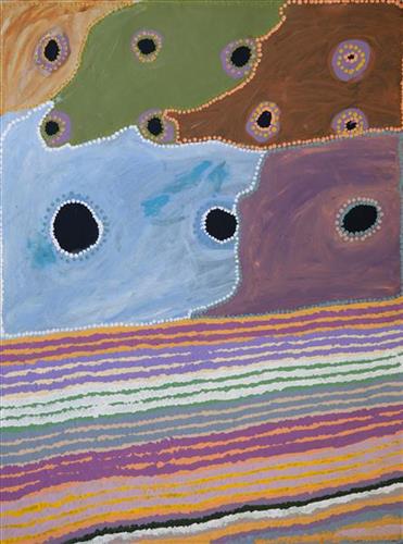
Portrayed in this work are features of Mayiwalku’s ngurra, such as the dominant permanent red tali (sandhills), warta (trees, vegetation), and the individually named water sources she and her family camped at. These include Januwa, Jilankujarra, Karlajarntu, Kartungu, Kularti, Kumpupajanu, Kunalimpi, Kunarra, Marnakarti, Pangkapirni, Wilunganinya, Wurur-wururna, Yilyara, and Yirrajarra Rock holes, waterholes, soaks and springs were all extremely important sites for Martu people during the pujiman period, and are generally depicted with circular forms. 

The encyclopaedic knowledge of the location, quality and seasonal availability of the hundreds of water bodies found in one’s Country sustained Martu as they travelled across their Country, hunting and gathering, visiting family, and fulfilling ceremonial obligations. They would traverse very large distances annually, visiting specific areas in the dry and wet season depending on the availability of water and the corresponding cycles of plant and animal life on which hunting and gathering bush tucker was reliant. As they travelled and hunted they would also burn areas of Country, generating a greater diversity of plant and animal life.
111582399375


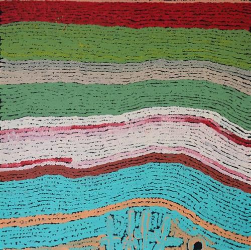
Moolyella Rockhole

“This is a rockhole- people coming this side and people coming round this [other] side, coming to that waterhole.

This painting is about every rockhole in Moolyella, where I used to work… We would walk and get some water from the rockholes and go away back home-  get that water from these rockholes when we were working. My father and mother’s surname was Mulialla, they were named after that place.”

– Lorna Linmurra

This work depicts a waterhole in the area around Moolyella, an area close to Marble Bar that was mined for tin from 1898. Industrial production ceased by 1921, and from the late 1920’s several Aboriginals families, including Lorna’s, began working the mine. Tin and other minerals were retrieved from claypans and dry river beds using a yandy (dish used for winnowing seed).  

Moolyella forms part of Lorna’s ngurra (home Country, camp), and as she describes in her account, each of the many water sources around the area were well known to herself and her family.

During the pujiman (traditional, desert dwelling) period, knowledge of water sources was critical for survival, and today Martu Country is still defined in terms of the location and type of water. Each of the hundreds of claypans, rockholes, waterholes, soaks and springs found in the Martu desert homelands is known through real life experience and the recounting of Jukurrpa (Dreaming) narratives by name, location, quality and seasonal availability. This encyclopedic knowledge extends even to the nature and movement of arterial waterways, and sustained Martu as they travelled across their Country, hunting and gathering, visiting family, and fulfilling ceremonial obligations. They would traverse very large distances annually, visiting specific areas in the dry and wet season depending on the availability of water and the corresponding cycles of plant and animal life on which hunting and gathering bush tucker was reliant.

111582399374


Moolyella Rockhole

“This is a rockhole- people coming this side and people coming round this [other] side, coming to that waterhole.

This painting is about every rockhole in Moolyella, where I used to work… We would walk and get some water from the rockholes and go away back home-  get that water from these rockholes when we were working. My father and mother’s surname was Mulialla, they were named after that place.”

– Lorna Linmurra

This work depicts a waterhole in the area around Moolyella, an area close to Marble Bar that was mined for tin from 1898. Industrial production ceased by 1921, and from the late 1920’s several Aboriginals families, including Lorna’s, began working the mine. Tin and other minerals were retrieved from claypans and dry river beds using a yandy (dish used for winnowing seed).  

Moolyella forms part of Lorna’s ngurra (home Country, camp), and as she describes in her account, each of the many water sources around the area were well known to herself and her family.

During the pujiman (traditional, desert dwelling) period, knowledge of water sources was critical for survival, and today Martu Country is still defined in terms of the location and type of water. Each of the hundreds of claypans, rockholes, waterholes, soaks and springs found in the Martu desert homelands is known through real life experience and the recounting of Jukurrpa (Dreaming) narratives by name, location, quality and seasonal availability. This encyclopedic knowledge extends even to the nature and movement of arterial waterways, and sustained Martu as they travelled across their Country, hunting and gathering, visiting family, and fulfilling ceremonial obligations. They would traverse very large distances annually, visiting specific areas in the dry and wet season depending on the availability of water and the corresponding cycles of plant and animal life on which hunting and gathering bush tucker was reliant.