111582367431


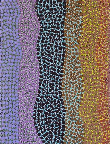
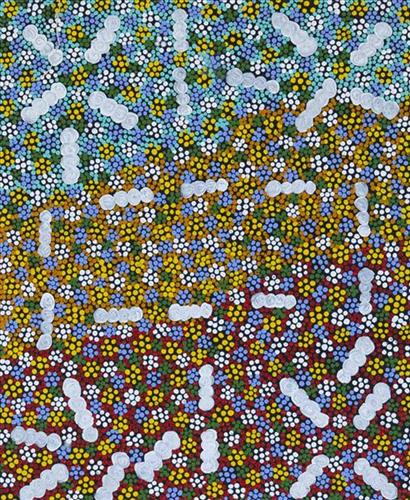
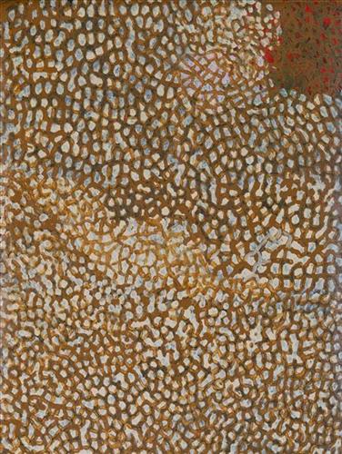
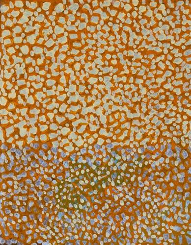
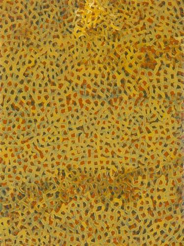
Parnngurr

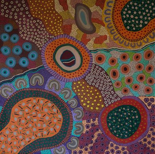
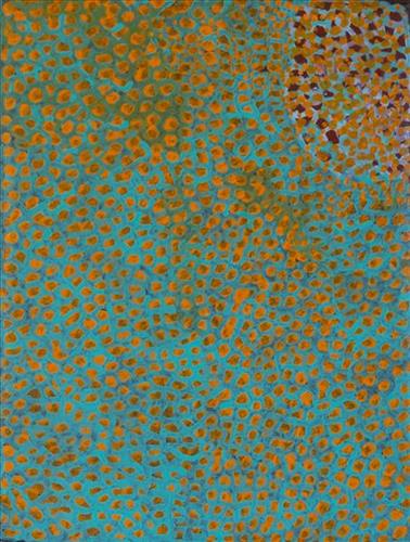
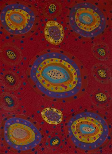
Parnngurr rockhole is located just south of Parnngurr Aboriginal community. At the junction of three linguistic groups; Manyjilyjarra, Kartujarra, and Warnman, it was a critical and permanent source of water during the pujiman (traditional, desert born) era that supported many ritual large gatherings. During this nomadic period families stopped and camped here depending on the seasonal availability of water and the corresponding cycles of plant and animal life on which hunting and gathering bush tucker was reliant. At Parnngurr and other similarly important camp sites families would meet for a time before moving to their next destination. Parnngurr and its surrounds are physically dominated by distinctively red tali (sandhills), covered sparingly with spinifex and low lying shrub. Parnngurr forms part of Betty’s ngurra (home Country, camp) through her parents and through renowned fellow Martumili Artist and aunt Bugai Whyoulter. 

Parnngurr Aboriginal community was created during the return to Country movement of the 1980s, and named after Parnngurr rockhole, its original primary water source. However, until recently the community was widely known as Cotton Creek, after the European name for the ephemeral creek running alongside the community. 

Parnngurr is an important site chronicled in the epic Jukurrpa (Dreaming) story of the Minyipuru (Jakulyukulyu, Seven Sisters). The sisters stopped to rest on Parnngurr Hill before continuing on their long journey east. Minyipuru is a central Jukurrpa narrative for Martu, Ngaanyatjarra, Pitjantjatjara and Yankunytjatjara people that is associated with the seasonal Pleiades star constellation. Relayed in song, dance, stories and paintings, Minyipuru serves as a creation narrative, a source of information relating to the physical properties of the land, and an embodiment of Aboriginal cultural laws. Beginning in Roebourne on the west coast of Western Australia, the story morphs in its movement eastward across the land, following the women as they walk, dance, and even fly from waterhole to waterhole. As they travel the women camp, sing, wash, dance and gather food, leaving markers in the landscape and creating landforms that remain to this day, such as groupings of rocks and trees, grinding stones and seeds. During the entirety of their journey the women are pursued by a lustful old man, Yurla, although interactions with other animals, groups of men, and spirit beings are also chronicled in the narrative. 

For many Martu, Parnngurr also signifies the location at which their nomadic bush life came to an end. It was here that a group of 29 Martu were picked up by the Native Welfare Department to be taken to Jigalong Mission in 1963. Collectively the group had come to the decision to move to the mission as a result of an extended drought, which had caused a scarcity in food and water resources. The group also wanted to join their families, who had already moved to Jigalong. Among them were Martumili artists Jakayu Biljabu, Kumpaya Girgirba, Bugai Whyoulter and Ngamaru Bidu.
111582367430


Parnngurr

Parnngurr rockhole is located just south of Parnngurr Aboriginal community. At the junction of three linguistic groups; Manyjilyjarra, Kartujarra, and Warnman, it was a critical and permanent source of water during the pujiman (traditional, desert born) era that supported many ritual large gatherings. During this nomadic period families stopped and camped here depending on the seasonal availability of water and the corresponding cycles of plant and animal life on which hunting and gathering bush tucker was reliant. At Parnngurr and other similarly important camp sites families would meet for a time before moving to their next destination. Parnngurr and its surrounds are physically dominated by distinctively red tali (sandhills), covered sparingly with spinifex and low lying shrub. Parnngurr forms part of Betty’s ngurra (home Country, camp) through her parents and through renowned fellow Martumili Artist and aunt Bugai Whyoulter. 

Parnngurr Aboriginal community was created during the return to Country movement of the 1980s, and named after Parnngurr rockhole, its original primary water source. However, until recently the community was widely known as Cotton Creek, after the European name for the ephemeral creek running alongside the community. 

Parnngurr is an important site chronicled in the epic Jukurrpa (Dreaming) story of the Minyipuru (Jakulyukulyu, Seven Sisters). The sisters stopped to rest on Parnngurr Hill before continuing on their long journey east. Minyipuru is a central Jukurrpa narrative for Martu, Ngaanyatjarra, Pitjantjatjara and Yankunytjatjara people that is associated with the seasonal Pleiades star constellation. Relayed in song, dance, stories and paintings, Minyipuru serves as a creation narrative, a source of information relating to the physical properties of the land, and an embodiment of Aboriginal cultural laws. Beginning in Roebourne on the west coast of Western Australia, the story morphs in its movement eastward across the land, following the women as they walk, dance, and even fly from waterhole to waterhole. As they travel the women camp, sing, wash, dance and gather food, leaving markers in the landscape and creating landforms that remain to this day, such as groupings of rocks and trees, grinding stones and seeds. During the entirety of their journey the women are pursued by a lustful old man, Yurla, although interactions with other animals, groups of men, and spirit beings are also chronicled in the narrative. 

For many Martu, Parnngurr also signifies the location at which their nomadic bush life came to an end. It was here that a group of 29 Martu were picked up by the Native Welfare Department to be taken to Jigalong Mission in 1963. Collectively the group had come to the decision to move to the mission as a result of an extended drought, which had caused a scarcity in food and water resources. The group also wanted to join their families, who had already moved to Jigalong. Among them were Martumili artists Jakayu Biljabu, Kumpaya Girgirba, Bugai Whyoulter and Ngamaru Bidu.
111582366572


Mungili Waterhole

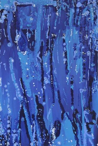
“No one goes there and sees that landscape. Only two, Mr and Mrs [refers to footsteps in painting]. They was walking to see if the water was in there. Walking on the creek sand, they see the colours and walk down to the water hole and dig where the waters been left. Dig the creek sand where there is still water. Little huts where they sit; move when it dries out. Leave remembrance behind. When the water fills up again; come back.

When the creek sand is still moist you can see the colours. You can see many colours – lovely colours come out. I do that in my mind [when painting], go and think about the rock colours there.

Different plants, water runs, and different plants are growing, different seeds. When it rains, all year round, when its overflowing. It’s all connected. The orange sand connects to one waterhole full of water, then flowing through the creek sand. This side down [pointing to one rock hole]; and it’s a bit up [pointing to another rock hole].

I was swimming there. Yeah, we go visit them a long time [ago]. We drink it, rainwater from the rain. Big waterhole. It’s a fresh water, when the rain comes, fills it up. One for swimming and another rock hole for drinking. 3 rock holes; another is special.”

– Marlene Anderson

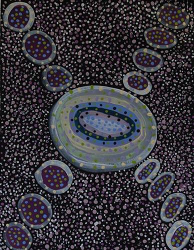
In this work Marlene depicts a waterhole and rock hole located in Mungili, the small outstation community located just off the Eagle Highway in Western Australia, approximately 430 kilometres northeast of Wiluna and 250 kilometres north of Warburton. Marlene grew up in Mungili, and as such it forms a significant part of her ‘ngurra’ (home Country, camp). Typically Marlene depicts this site with a central large circular form that represents the main waterhole, surrounded by smaller circular forms representing satellite water bodies.

During the pujiman (traditional, desert dwelling) period, knowledge of water sources was critical for survival, and today Martu Country is still defined in terms of the location and type of water. Each of the hundreds of claypans, rockholes, waterholes, soaks and springs found in the Martu desert homelands is known through real life experience and the recounting of Jukurrpa (Dreaming) narratives by name, location, quality and seasonal availability. This encyclopedic knowledge extends even to the nature and movement of arterial waterways, and sustained Martu as they travelled across their Country, hunting and gathering, visiting family, and fulfilling ceremonial obligations. They would traverse very large distances annually, visiting specific areas in the dry and wet season depending on the availability of water and the corresponding cycles of plant and animal life on which hunting and gathering bush tucker was reliant.

111582364420


Karlamilyi

Karlamilyi (Rudall River region) and its surrounds are Warnman Country, located in the very heart of the Martu homelands. The region is situated southwest of the Great Sandy Desert and northeast of the Little Sandy Desert. Spanning through the region is the epic Karlamilyi River, which runs north into Nyayartakujarra (Ngayarta Kujarra, Lake Dora), a large salt lake. The Broadhurst and Fingoon Ranges extend diagonally across the river’s path. The landscape is striking for its abundance of gorges and valleys carved by ice age glaciers, rugged cliffs, red tali (sand dunes), grasslands, sandstone and quartz rocky outcrops, and salt lakes. 

Across the whole region are hundreds of water sources; including waterholes, creeks, soaks, lakes, pools and rockholes. Lining the rivers are coolabah, walyji (river gum), yulbah (bats wing coral tree), and several species of acacia and hakea. Jalkuran (paperbark), kurrulyu/ mijarrpa (bloodwood) and jawirli (quandong) are found in the region’s valleys, and wikirrpa (desert oaks) and grasses in the sandplains. The area is abundant with bird species, jila (snakes), maruntu (goannas), red kangaroos and warlpaju (rock wallabies). The region is also home to remote aboriginal communities Punmu and Parnngurr.

According to two of the central Martu Jukurrpa (Dreaming) narratives, the Karlamilyi River and its surrounds were created by the ancestral beings Jila Kujarra (Two Snakes) and the Wati Kujarra (Two Goanna Men) as they travelled across the lands.

111582364419


Bush seeds after rain

“When Martu paint, it’s like a map. Martu draw story on the ground and on the canvas, and all the circle and line there are the hunting areas and different waters and tracks where people used to walk, and [some you] can’t cross, like boundaries. So nowadays you see a colourful painting and wonder what it is, but that’s how Martu tell story long ago. It’s not just a lovely painting, it’s a story and a songline and a history and everything that goes with it.” 

– Ngalangka Nola Taylor and Joshua Booth

This work portrays an area of Country that can be interpreted in multiple ways. Firstly, the image may be read as an aerial representation of a particular location known to the artist- either land that they or their family travelled, from the pujiman (traditional, desert dwelling) era to now. During the pujiman period, Martu would traverse very large distances annually in small family groups, moving seasonally from water source to water source, and hunting and gathering bush tucker as they went. At this time, one’s survival depended on their intimate knowledge of the location of resources; thus physical elements of Country, such as sources of kapi (water), tali (sandhills), different varieties of warta (trees, vegetation), ngarrini (camps), and jina (tracks) are typically recorded with the use of a use of a system of iconographic forms universally shared across the desert. 

An additional layer of meaning in the work relates to more intangible concepts; life cycles based around kalyu (rain, water) and waru (fire) are also often evident. A thousands of year old practice, fire burning continues to be carried out as both an aid for hunting and a means of land management today. As the Martu travelled and hunted they would burn tracts of land, ensuring plant and animal biodiversity and reducing the risk of unmanageable, spontaneous bush fires. The patchwork nature of regrowth is evident in many landscape works, with each of the five distinctive phases of fire burning visually described with respect to the cycle of burning and regrowth.  

Finally, metaphysical information relating to a location may also be recorded; Jukurrpa (Dreaming) narratives chronicle the creation of physical landmarks, and can be referenced through depictions of ceremonial sites, songlines, and markers left in the land. Very often, however, information relating to Jukurrpa is censored by omission, or alternatively painted over with dotted patterns.

111582364418


Lunki (witchetty grub)

Lunki (witchetty grubs) are the large, pinkish white, wood eating larvae of several moth species. During the pujiman (traditional, desert dwelling) era, lunki were a reliable food source, forming a staple of the Martu diet, and today they remain equally popular. Lunki are eaten either raw or cooked in hot ashes, with a raw nutty taste that becomes creamy when cooked. Though they are available through the year, lunki are particularly prevalent in late wantajarra (cool season). They are found in the trunks and roots of several tree species including acacia, tinjirla (coolabah), and yurungkura (red river gum). 

Martu forage for lunki by creating a small incision in the bark of a tree where the lunki is located, which is then used as the entry point for the insertion of a small hook, typically fashioned from a stick but sometimes using wire. Typically, lunki is collected incidentally during hunting trips or resting stops, and is a relatively relaxing, sociable activity. 

During the pujiman period, Martu would traverse very large distances annually in small family groups, moving seasonally from water source to water source, and hunting and gathering bush tucker as they went. Whilst desert life has moved away from mobile hunter-gatherer subsistence throughout the course of the twentieth century, bush tucker continues to be a significant component of the modern Martu diet. Hunting and gathering bush tucker remains equally valuable as an important cultural practice that is passed on intergenerationally. Though hunting and gathering implements have been modernised, methods of harvesting, tracking and the use of fire burning to drive animals from their retreats are still commonly practiced today.

111582364417


Kulyakartu

“My Country, Kulyakartu. I grew up there, from little boy to big boy grew up there.”

 – Muuki Taylor

This painting depicts Kulyakartu, Muuki’s ngurra (home Country, camp). Kulyakartu is located in the far north of the Martu homelands, near the Percival Lakes region of Western Australia’s Great Sandy Desert. Muuki has extensive knowledge of the Country in this region, where he grew up living traditionally during the pujiman (traditional, desert dwelling) days with his family. Kulyakartu is mostly grass Country where there is very good hunting. In particular parnajarrpa (goanna), wild cats, and lunki (witchetty grub) are found in abundance here. There is no permanent water source in Kulyakartu, so Muuki’s family would walk here annually following the wantajarra (wet season). During the yalijarra (hot, dry season) they would head south again to more permanent water.

Muuki paints Kulyakartu in all its different seasonal stages. Often visible in his work is the patchwork nature of regrowth subsequent to the practice of waru (fire) burning that assists with hunting, regenerates growth, and encourages greater diversity in plant and animal life. This mosaic patterning is aligned with the five distinct Martu cyclical phases of burning and regrowth. First is nyurnma (freshly burnt Country) when Muuki is “making waru”. Following nyurnma are the rains and subsequent waru-waru, when young, bright green plants start to grow. Nyukura occurs between one and three years after burning, when plants have matured and are fruiting and seeding. Manguu is “when him finished”, four to six years post burning, and when spinifex has matured to the point that it can be burned once again. Finally, kunarka signifies the time when spinifex and other plant species have become old growth, and pose a risk of destructive bushfires.

111582364416


Kulyakartu

“My Country, Kulyakartu. I grew up there, from little boy to big boy grew up there.”

 – Muuki Taylor

This painting depicts Kulyakartu, Muuki’s ngurra (home Country, camp). Kulyakartu is located in the far north of the Martu homelands, near the Percival Lakes region of Western Australia’s Great Sandy Desert. Muuki has extensive knowledge of the Country in this region, where he grew up living traditionally during the pujiman (traditional, desert dwelling) days with his family. Kulyakartu is mostly grass Country where there is very good hunting. In particular parnajarrpa (goanna), wild cats, and lunki (witchetty grub) are found in abundance here. There is no permanent water source in Kulyakartu, so Muuki’s family would walk here annually following the wantajarra (wet season). During the yalijarra (hot, dry season) they would head south again to more permanent water.

Muuki paints Kulyakartu in all its different seasonal stages. Often visible in his work is the patchwork nature of regrowth subsequent to the practice of waru (fire) burning that assists with hunting, regenerates growth, and encourages greater diversity in plant and animal life. This mosaic patterning is aligned with the five distinct Martu cyclical phases of burning and regrowth. First is nyurnma (freshly burnt Country) when Muuki is “making waru”. Following nyurnma are the rains and subsequent waru-waru, when young, bright green plants start to grow. Nyukura occurs between one and three years after burning, when plants have matured and are fruiting and seeding. Manguu is “when him finished”, four to six years post burning, and when spinifex has matured to the point that it can be burned once again. Finally, kunarka signifies the time when spinifex and other plant species have become old growth, and pose a risk of destructive bushfires.

111582364415


Kulyakartu

“My Country, Kulyakartu. I grew up there, from little boy to big boy grew up there.”

 – Muuki Taylor

This painting depicts Kulyakartu, Muuki’s ngurra (home Country, camp). Kulyakartu is located in the far north of the Martu homelands, near the Percival Lakes region of Western Australia’s Great Sandy Desert. Muuki has extensive knowledge of the Country in this region, where he grew up living traditionally during the pujiman (traditional, desert dwelling) days with his family. Kulyakartu is mostly grass Country where there is very good hunting. In particular parnajarrpa (goanna), wild cats, and lunki (witchetty grub) are found in abundance here. There is no permanent water source in Kulyakartu, so Muuki’s family would walk here annually following the wantajarra (wet season). During the yalijarra (hot, dry season) they would head south again to more permanent water.

Muuki paints Kulyakartu in all its different seasonal stages. Often visible in his work is the patchwork nature of regrowth subsequent to the practice of waru (fire) burning that assists with hunting, regenerates growth, and encourages greater diversity in plant and animal life. This mosaic patterning is aligned with the five distinct Martu cyclical phases of burning and regrowth. First is nyurnma (freshly burnt Country) when Muuki is “making waru”. Following nyurnma are the rains and subsequent waru-waru, when young, bright green plants start to grow. Nyukura occurs between one and three years after burning, when plants have matured and are fruiting and seeding. Manguu is “when him finished”, four to six years post burning, and when spinifex has matured to the point that it can be burned once again. Finally, kunarka signifies the time when spinifex and other plant species have become old growth, and pose a risk of destructive bushfires.

111582364414


Kulyakartu

“My Country, Kulyakartu. I grew up there, from little boy to big boy grew up there.”

 – Muuki Taylor

This painting depicts Kulyakartu, Muuki’s ngurra (home Country, camp). Kulyakartu is located in the far north of the Martu homelands, near the Percival Lakes region of Western Australia’s Great Sandy Desert. Muuki has extensive knowledge of the Country in this region, where he grew up living traditionally during the pujiman (traditional, desert dwelling) days with his family. Kulyakartu is mostly grass Country where there is very good hunting. In particular parnajarrpa (goanna), wild cats, and lunki (witchetty grub) are found in abundance here. There is no permanent water source in Kulyakartu, so Muuki’s family would walk here annually following the wantajarra (wet season). During the yalijarra (hot, dry season) they would head south again to more permanent water.

Muuki paints Kulyakartu in all its different seasonal stages. Often visible in his work is the patchwork nature of regrowth subsequent to the practice of waru (fire) burning that assists with hunting, regenerates growth, and encourages greater diversity in plant and animal life. This mosaic patterning is aligned with the five distinct Martu cyclical phases of burning and regrowth. First is nyurnma (freshly burnt Country) when Muuki is “making waru”. Following nyurnma are the rains and subsequent waru-waru, when young, bright green plants start to grow. Nyukura occurs between one and three years after burning, when plants have matured and are fruiting and seeding. Manguu is “when him finished”, four to six years post burning, and when spinifex has matured to the point that it can be burned once again. Finally, kunarka signifies the time when spinifex and other plant species have become old growth, and pose a risk of destructive bushfires.