111582363532


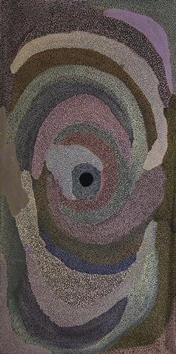
Yalta

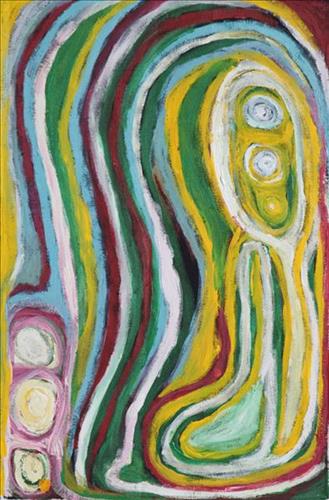
“This is my grandmother’s and mother’s Country, Yalta. It’s very close to Kunawarritji side. I’ve never been there. That was where my mother was born during the pujiman (traditional, desert dwelling) times. All the tali (sandhills) around. I want to go there one day, to see that Country, I might go there one day” 

 – Marianne Burton

Yalta is a waterhole located between the Great Sandy Desert’s Percival Lakes region and Kunawarritji Aboriginal community. This site was visited by the Ngayurnangalku (cannibals) during the Jukurrpa (Dreaming). These fearsome ancestral cannibal beings are said to resemble people in their appearance, except for their fangs and long curved knife like fingernails they use to catch and hold their human victims. The Ngayurnangalku continue to live beneath the crust of Kumpupirntily (Kumpupintily, Lake Disappointment), south east of Yalta.  

Yalta lies within Marianne’s ngurra (home Country, camp) through her grandmother and mother. As stated by Marianne here, the site is especially significant to her as it was here that her mother was born. The Western Desert term ‘ngurra’ is hugely versatile in application. Broadly denoting birthplace and belonging, ngurra can refer to a body of water, a camp site, a large area of Country, or even a modern house. People identify with their ngurra in terms of specific rights and responsibilities, and the possession of intimate knowledge of the physical and cultural properties of one’s Country. This knowledge is traditionally passed intergenerationally through family connections. Painting ngurra, and in so doing sharing the Jukurrpa stories and physical characteristics of that place, has today become an important means of cultural maintenance. Physical maintenance of one’s ngurra, like cultural maintenance, ensures a site’s wellbeing, and is a responsibility of the people belonging to that area.
11151033100


Untitled

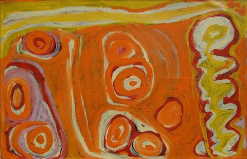
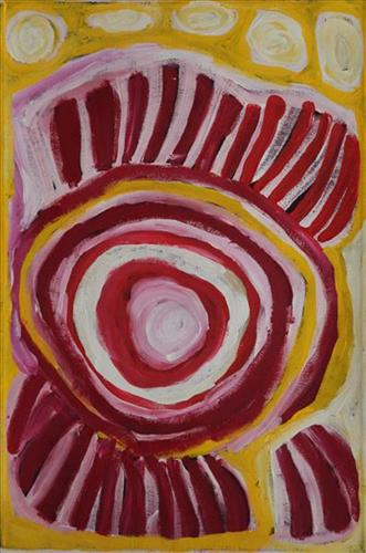
This is Bugai’s Country- her ‘ngurra’ (home Country, camp). People identify with their ngurra in terms of specific rights and responsibilities, and the possession of intimate knowledge of the physical and cultural properties of one’s Country. Painting ngurra, and in so doing sharing the Jukurrpa (Dreaming) stories and physical characteristics of that place, has today become an important means of cultural maintenance. 

Bugai’s ngurra encompasses the Country that she and her family walked in the pujiman (traditional, desert-dwelling) era. At this time Bugai travelled nomadically with her own and other family groups, most notably the Bidu family. The Country they traversed encompassed an enormous tract of land, with an aerial distance of more than 600 kilometres, from present day Balfour Downs Station to Kunawarritji (Canning Stock Route Well 33). Bugai was born at Pulkinya. She grew up, walked and hunted primarily around Parnngurr, Punmu, Kun Kun (Kuny-kuny) and Kunawarritji. As a young woman Bugai travelled with her husband through the Karlamily (Rudall River) region and up and down the Canning Stock Route, where she first met cattle drovers. She continued to live nomadically before eventually deciding to move to Jigalong Mission along with many other relatives following an extreme and prolonged drought in the 1960s. 

Portrayed in this work are features of Bugai’s ngurra, such as the striking salt lakes, dominant permanent red tali (sandhills), warta (trees, vegetation), and the individually named water sources Bugai and her family camped at. These include Parnngurr, Martilirri, Wangkakalu, Kurta-kurta (Camel Rock), Pimurlu, Jilkupuka (Canning Stock Route Well 21), Kaalpa (Canning Stock Route Well 23), Kartarru (Canning Stock Route Well 24), Wantili (Warntili, Canning Stock Route Well 25), Tiwa (Canning Stock Route Well 26), Partujarrapirri, Raarki (Canning Stock Route Well 27), Wuranu (Canning Stock Route Well 29), Juntu- juntu (Canning Stock Route Well 30), and Kunawarritji. Rock holes, waterholes, soaks and springs were all extremely important sites for Martu people during the pujiman period, and are generally depicted with circular forms. 

The encyclopaedic knowledge of the location, quality and seasonal availability of the hundreds of water bodies found in one’s Country sustained Martu as they travelled across their Country, hunting and gathering, visiting family, and fulfilling ceremonial obligations. They would traverse very large distances annually, visiting specific areas in the dry and wet season depending on the availability of water and the corresponding cycles of plant and animal life on which hunting and gathering bush tucker was reliant. As they travelled and hunted they would also burn areas of Country, generating a greater diversity of plant and animal life.

11152117673


Untitled

This is Bugai’s Country- her ‘ngurra’ (home Country, camp). People identify with their ngurra in terms of specific rights and responsibilities, and the possession of intimate knowledge of the physical and cultural properties of one’s Country. Painting ngurra, and in so doing sharing the Jukurrpa (Dreaming) stories and physical characteristics of that place, has today become an important means of cultural maintenance. 

Bugai’s ngurra encompasses the Country that she and her family walked in the pujiman (traditional, desert-dwelling) era. At this time Bugai travelled nomadically with her own and other family groups, most notably the Bidu family. The Country they traversed encompassed an enormous tract of land, with an aerial distance of more than 600 kilometres, from present day Balfour Downs Station to Kunawarritji (Canning Stock Route Well 33). Bugai was born at Pulkinya. She grew up, walked and hunted primarily around Parnngurr, Punmu, Kun Kun (Kuny-kuny) and Kunawarritji. As a young woman Bugai travelled with her husband through the Karlamily (Rudall River) region and up and down the Canning Stock Route, where she first met cattle drovers. She continued to live nomadically before eventually deciding to move to Jigalong Mission along with many other relatives following an extreme and prolonged drought in the 1960s. 

Portrayed in this work are features of Bugai’s ngurra, such as the striking salt lakes, dominant permanent red tali (sandhills), warta (trees, vegetation), and the individually named water sources Bugai and her family camped at. These include Parnngurr, Martilirri, Wangkakalu, Kurta-kurta (Camel Rock), Pimurlu, Jilkupuka (Canning Stock Route Well 21), Kaalpa (Canning Stock Route Well 23), Kartarru (Canning Stock Route Well 24), Wantili (Warntili, Canning Stock Route Well 25), Tiwa (Canning Stock Route Well 26), Partujarrapirri, Raarki (Canning Stock Route Well 27), Wuranu (Canning Stock Route Well 29), Juntu- juntu (Canning Stock Route Well 30), and Kunawarritji. Rock holes, waterholes, soaks and springs were all extremely important sites for Martu people during the pujiman period, and are generally depicted with circular forms. 

The encyclopaedic knowledge of the location, quality and seasonal availability of the hundreds of water bodies found in one’s Country sustained Martu as they travelled across their Country, hunting and gathering, visiting family, and fulfilling ceremonial obligations. They would traverse very large distances annually, visiting specific areas in the dry and wet season depending on the availability of water and the corresponding cycles of plant and animal life on which hunting and gathering bush tucker was reliant. As they travelled and hunted they would also burn areas of Country, generating a greater diversity of plant and animal life.

11153038090


Jartijiti Kapi

‘Jartijiti’ is how Martu people pronounce ‘33’, the colloquial name for the Kunawarritji community where Bugai lives and paints. Kunawarritji is an important site in the Great Sandy Desert where multiple stories and histories intersect. Originally an important spring kapi (water), at the turn of the 20th century Kunawarritji became a well (Well 33) along the Canning Stock Route. Each year throughout the 1930-50s, the well became a site of contact between the drovers, their cattle, and desert families such as Bugai’s. Long before colonial history entered this country, other stories dominated this site. In the Jukurrpa (Dreaming), the Minyi Puru (Seven Sisters) stopped here and shaped a number of landforms before continuing on their epic journey east across the desert. Today, Kunawarritji is a site of return, a place where people have come back to continue making their life in the desert. Bugai continues to live at and look after ‘Jartijiti’ today, painting it and the many other life-giving waterholes of her country further south along the Stock Route.

11151030307


Two snakes travelling

This painting depicts 2 snakes travelling across Yiritijanu and Punmu Hill in the artists country.

This is Nungabar’s Country- her ‘ngurra’ (home Country, camp). People identify with their ngurra in terms of specific rights and responsibilities, and the possession of intimate knowledge of the physical and cultural properties of one’s Country. Painting ngurra, and in so doing sharing the Jukurrpa (Dreaming) stories and physical characteristics of that place, has today become an important means of cultural maintenance. Nungabar’s ngurra encompasses her birthplace, near Lipuru well (Libral Well, Canning Stock Route Well 37) and the Country that became Wells 33 through to 38 along the Canning Stock Route, where her family walked in the pujiman (traditional, desert-dwelling) era. From an early age Nungabar and her family had encounters with the white men who drove cattle along the route. As a young woman, together with her close friend Nora Wompi, Nungabar followed the drovers north to Balgo Mission, where she settled and raised a family.

Portrayed in this work are features of Nungabar’s family’s ngurra, such as the striking salt lakes, permanent red tali (sandhills), warta (trees, vegetation), and the individually named water sources they camped at. Rock holes, waterholes, soaks and springs were all extremely important sites for Martu people during the pujiman period, and are generally depicted with circular forms. 

The encyclopaedic knowledge of the location, quality and seasonal availability of the hundreds of water bodies found in one’s Country sustained Martu as they travelled across their Country, hunting and gathering, visiting family, and fulfilling ceremonial obligations. They would traverse very large distances annually, visiting specific areas in the dry and wet season depending on the availability of water and the corresponding cycles of plant and animal life on which hunting and gathering bush tucker was reliant. As they travelled and hunted they would also burn areas of Country, generating a greater diversity of plant and animal life.

11151032882


Nattery

This artist primarily paints her country in the Canning Stock Route area. As a younger woman the artist lived and travelled traditionally with her family during the pujiman (bush) days. They travelled up and down the Stock Route from well 33 to well 38 and as far as Balgo. Well 33 is now known as Kunawarritji Community and is the artist’s ngurra (home).

11152117953


Untitled

This is Nungabar’s Country- her ‘ngurra’ (home Country, camp). People identify with their ngurra in terms of specific rights and responsibilities, and the possession of intimate knowledge of the physical and cultural properties of one’s Country. Painting ngurra, and in so doing sharing the Jukurrpa (Dreaming) stories and physical characteristics of that place, has today become an important means of cultural maintenance. Nungabar’s ngurra encompasses her birthplace, near Lipuru well (Libral Well, Canning Stock Route Well 37) and the Country that became Wells 33 through to 38 along the Canning Stock Route, where her family walked in the pujiman (traditional, desert-dwelling) era. From an early age Nungabar and her family had encounters with the white men who drove cattle along the route. As a young woman, together with her close friend Nora Wompi, Nungabar followed the drovers north to Balgo Mission, where she settled and raised a family.

Portrayed in this work are features of Nungabar’s family’s ngurra, such as the striking salt lakes, permanent red tali (sandhills), warta (trees, vegetation), and the individually named water sources they camped at. Rock holes, waterholes, soaks and springs were all extremely important sites for Martu people during the pujiman period, and are generally depicted with circular forms. 

The encyclopaedic knowledge of the location, quality and seasonal availability of the hundreds of water bodies found in one’s Country sustained Martu as they travelled across their Country, hunting and gathering, visiting family, and fulfilling ceremonial obligations. They would traverse very large distances annually, visiting specific areas in the dry and wet season depending on the availability of water and the corresponding cycles of plant and animal life on which hunting and gathering bush tucker was reliant. As they travelled and hunted they would also burn areas of Country, generating a greater diversity of plant and animal life.

111576333942


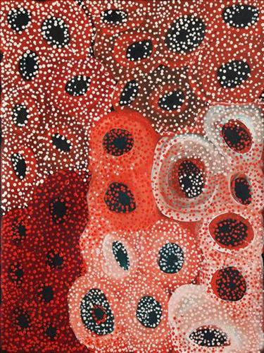
Rockholes

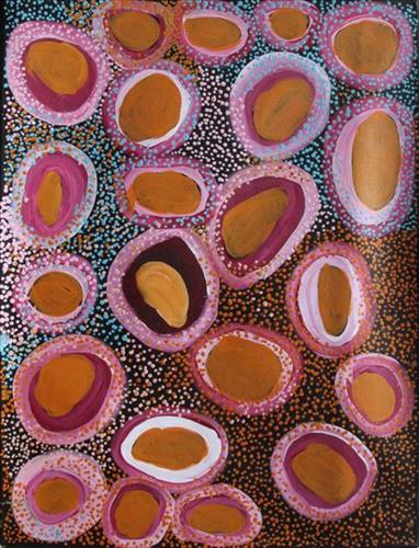
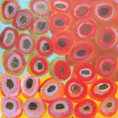
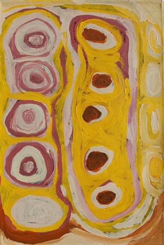
This work depicts a waterhole within the artists’ ngurra (home Country, camp), typically represented with circular forms. Waterholes are sites that require maintenance, including digging to increase flow, clearing out surrounding growth, and cleaning up after sullying by camels or cattle.

During the pujiman (traditional, desert dwelling) period, knowledge of water sources was critical for survival, and today Martu Country is still defined in terms of the location and type of water. Each of the hundreds of claypans, rockholes, waterholes, soaks and springs found in the Martu desert homelands is known through real life experience and the recounting of Jukurrpa (Dreaming) narratives by name, location, quality and seasonal availability. This encyclopedic knowledge extends even to the nature and movement of arterial waterways, and sustained Martu as they travelled across their Country, hunting and gathering, visiting family, and fulfilling ceremonial obligations. They would traverse very large distances annually, visiting specific areas in the dry and wet season depending on the availability of water and the corresponding cycles of plant and animal life on which hunting and gathering bush tucker was reliant.

111582362489


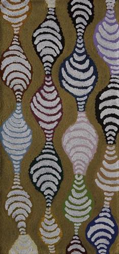
Tuwa (Sandhills)

‘’Went with Martumili. Old Jigalong. Judith’s nanna Country, where Judith nanna was born. Went from old Jigalong to Jigalong to right through Parnngurr, Camped the night and then Judith’s pop went to pick him up. His name is Mr Rowlands and I call him brother. He showing me where my nanna’s Country started from Parnngurr towards Lake Disappointment. We camped the night. Judith’s nanna was getting cheeky bossing him (Mr Rowland) around; “we not married anymore that’s why I left him.” Between Lake Disappointment and Durba Springs (Pinpi) there were these beautiful rolling sand hills, we winding through them over top, we stopped half way and I looked out to the sunset saw all the glistening spinifex. The orange from the sunset lit the sand dunes up. When I do the Tuwa paintings I think of that day.’’

– Kathleen Sorensen

The traditional lands of the Martu people encompass the Great Sandy Desert and Rudall River regions of Western Australia, an enormous tract dominated by distinctive red tali, or tuwa (sandhills). These sandhills present an unforgiving landscape; sparse vegetation covers a seemingly never ending expanse of dunes, and yet these lands and the location of resources within them was known intimately by its pujiman (traditional, desert dwelling) inhabitants. At this time, Martu traversed very large distances annually in small family groups, moving from water source to water source through the harsh desert landscape with incredible stamina and resourcefulness. Travel was often undertaken at night, and when travelling during the day, Martu wore yakipiri (woven bark sandals) to protect their feet from the hot desert sand.

111582362533


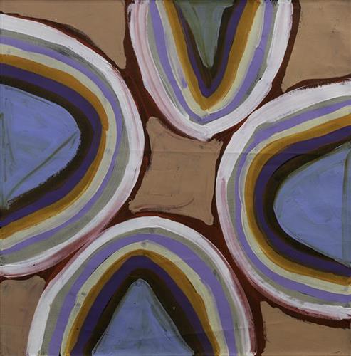
Tuwa (sandhills)

“I do tuwa (sandhill) in my own style because that’s our Country. That’s a sandhill, that’s the Dreaming- the Jukurrpa. That’s our culture.

They stay there and we go through the sandhills at Puntawarri in the car. We go first tuwa, then the second tuwa, looking for the waterholes. Go up, up, up- ‘nother tuwa, ‘nother tuwa.

Long time [ago] in Puntawarri, when I was a little girl [with] my Nana and Pop [Dadda Samson (dec.) and Yanjimi Peter Rowlands (dec.)] we went climbing up the sandhill. And when I went up my Nana and Pop were at the bottom under a tree and I came down running then rolling, rolling right down to the ground! But I was ok- he right!”

– Judith Anya Samson

Puntawarri is an important cultural area located on the middle stretches of the Canning Stock Route and east of the Jigalong Mission (now Jigalong Aboriginal community), where Anya grew up with her grandmother and renowned Martumili Artist, Dadda Samson (dec.). Puntawarri is also the site of an abandoned community, a waterhole, creek and lake. Puntawarri’s close proximity to Jigalong Mission made it a popular site for Martu to visit during the ‘mission days’. While growing up at Jigalong Mission in the 1960’s, Dadda would return to Puntawarri every weekend to hunt and camp. 

For many Martu, like Anya’s family, Jigalong Mission was the site where their pujiman (traditional, desert dwelling) lifestyle came to an end from the late 1940s as they transitioned to a life as stockmen and women working in cattle stations in the Pilbara region and beyond. In the wake of the extreme and prolonged drought of the 1960s, the last of the remaining pujimanpa (desert dwellers) were forced to move to missions like Jigalong, where a supply of food and water was assured. There, many Martu were reunited with family members that had already moved in from the desert.

The traditional lands of the Martu people encompass the Great Sandy Desert and Rudall River regions of Western Australia, an enormous tract dominated by distinctive red tali, or tuwa (sandhills). These sandhills present an unforgiving landscape; sparse vegetation covers a seemingly never ending expanse of dunes, and yet these lands and the location of resources within them was known intimately by its pujiman inhabitants.