111582448440


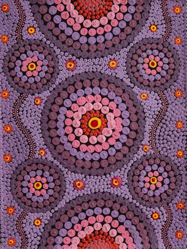
Mungili Rock Holes

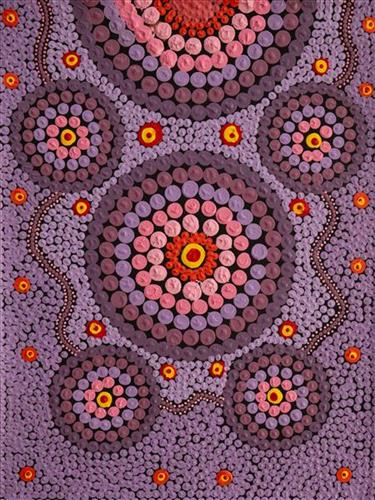
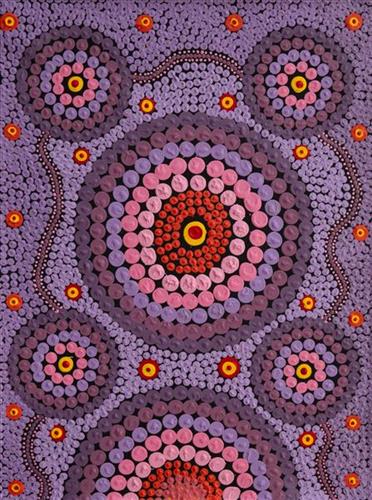
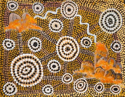
“Mungili rock hole. Big rock hole, big Country. I never see that place. My mother born [there], her and her grandmother walk through there, they tell me story [for that place]. Mother born there in the Country Mungili, walking through the bush. There is a camping spot, camping in bush – bush, bush, bush. [Points at painting] This is the lake Country and goes through there.”

– Matthew Mintern Smith

In this work Matthew depicts a claypan located in Mungili, the small outstation community situated just off the Eagle Highway in Western Australia. Mungili lies approximately 430 kilometres northeast of Wiluna and 250 kilometres north of Warburton. Mungili is ngurra (home (home Country, camp) for Matthew through his mother and grandmother. He typically depicts the site with a central large circular form that represents the main claypan, surrounded by smaller circular forms symbolising satellite water bodies.

The Western Desert term ‘ngurra’ is hugely versatile in application. Broadly denoting birthplace and belonging, ngurra can refer to a body of water, a camp site, a large area of Country, or even a modern house. People identify with their ngurra in terms of specific rights and responsibilities, and the possession of intimate knowledge of the physical and cultural properties of one’s Country. This knowledge is traditionally passed intergenerationally through family connections. Country for Martu is full of memory; not just the memory of their own movement through it, but also of their family. As summarised by Ngalangka Nola Taylor, “painting the ngurra, they do it to remember their connections.” 

Painting ngurra, and in so doing sharing the Jukurrpa (Dreaming) stories and physical characteristics of that place, has today become an important means of cultural maintenance. Physical maintenance of one’s ngurra, like cultural maintenance, ensures a site’s wellbeing, and is a responsibility of the people belonging to that area.  
111582448436


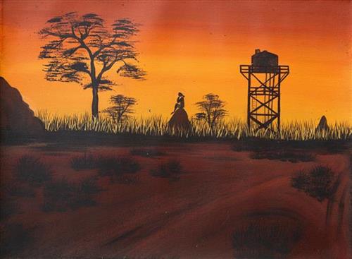
Rollah Tank, Missing Home

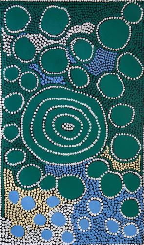
“This one’s a little block where I grew up, near Bidyadanga. It reminds me of when I was little, we used to play in the old chicken house. Reminds me of home. That tank I always paint, that’s the water tank. The water we get from the tank, it’s all underground.

My grandmother stays out there, in that big house. My mother built that other house; we’d stay there. I still go out there now and then.

It’s like a 20-minute drive out of Bidyadanga. Sometimes when you stand on the water tank you can see the beach. There’s lots of fish, crabs, sharks. There’s a croc there now. Some people pass through to get water and keep going, but just my family stay there.”

– Ciarn Dean-Bullen

Bidyadanga is a community located on the Kimberley coast in Western Australia, where the Great Sandy Desert meets the sea. The word Bidyadanga is derived from pijarta/ bidyada (emu watering hole).

Bidyadanga is Ciarn’s Country – her ‘ngurra’ (home Country, camp). People identify with their ngurra in terms of specific rights and responsibilities, and the possession of intimate knowledge of the physical and cultural properties of one’s Country. Painting ngurra, and in so doing sharing the Jukurrpa (Dreaming) stories and physical characteristics of that place, has today become an important means of cultural maintenance. Common motifs depicted in her work relate specifically to her heritage of both saltwater country and desert, including marine animals, depictions of water, as well as desert landscapes.

Ciarn is family to fellow Martumili Artists Muuki Taylor OAM and Zia Dean-Bullen. Younger Martu artists often start painting alongside their parents, grandparents, and extended family, which fosters an organic learning process. This not only involves mastering painting techniques but also understanding specific locations, family histories, traditional ways of life, bush tucker, and Jukurrpa (Dreaming). Over time, with encouragement from their peers, they develop their own distinct styles and explore unique painting techniques and subject matter. In this work the artist brings a contemporary, evolving perspective to their work.

111582448432


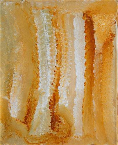
Untitled

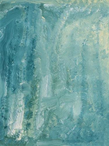
This is Bugai’s Country- her ‘ngurra’ (home Country, camp). People identify with their ngurra in terms of specific rights and responsibilities, and the possession of intimate knowledge of the physical and cultural properties of one’s Country. Painting ngurra, and in so doing sharing the Jukurrpa (Dreaming) stories and physical characteristics of that place, has today become an important means of cultural maintenance. 

Bugai’s ngurra encompasses the Country that she and her family walked in the pujiman (traditional, desert-dwelling) era. At this time Bugai travelled nomadically with her own and other family groups, most notably the Bidu family. The Country they traversed encompassed an enormous tract of land, with an aerial distance of more than 600 kilometres, from present day Balfour Downs Station to Kunawarritji (Canning Stock Route Well 33). Bugai was born at Pulkinya. She grew up, walked and hunted primarily around Parnngurr, Punmu, Kun Kun (Kuny-kuny) and Kunawarritji. As a young woman Bugai travelled with her husband through the Karlamilyi (Rudall River) region and up and down the Canning Stock Route, where she first met cattle drovers. She continued to live nomadically before eventually deciding to move to Jigalong Mission along with many other relatives following an extreme and prolonged drought in the 1960s. 

Portrayed in this work are features of Bugai’s ngurra, such as the striking salt lakes, dominant permanent red tali (sandhills), warta (trees, vegetation), and the individually named water sources Bugai and her family camped at. These include Parnngurr, Martilirri, Wangkakalu, Kurta-kurta (Camel Rock), Pimurlu, Jilkupuka (Canning Stock Route Well 21), Kaalpa (Canning Stock Route Well 23), Kartarru (Canning Stock Route Well 24), Wantili (Warntili, Canning Stock Route Well 25), Tiwa (Canning Stock Route Well 26), Partujarrapirri, Raarki (Canning Stock Route Well 27), Wuranu (Canning Stock Route Well 29), Juntu- juntu (Canning Stock Route Well 30), and Kunawarritji. Rock holes, waterholes, soaks and springs were all extremely important sites for Martu people during the pujiman period, and are generally depicted with circular forms. 

The encyclopaedic knowledge of the location, quality and seasonal availability of the hundreds of water bodies found in one’s Country sustained Martu as they travelled across their Country, hunting and gathering, visiting family, and fulfilling ceremonial obligations. They would traverse very large distances annually, visiting specific areas in the dry and wet season depending on the availability of water and the corresponding cycles of plant and animal life on which hunting and gathering bush tucker was reliant. As they travelled and hunted they would also burn areas of Country, generating a greater diversity of plant and animal life.

111582448430


Dreamtime

The term Jukurrpa is often translated in English as the ‘dreaming’, or ‘dreamtime’. It refers generally to the period in which the world was created by ancestral beings, who assumed both human and nonhuman forms. These beings shaped what had been a formless landscape; creating waters, plants, animals, and people. At the same time they provided cultural protocols for the people they created, as well as rules for interacting with the natural environment. At their journey’s end, the ancestral beings transformed themselves into important waters, hills, rocks, and even constellations.

111582448429


Karlamilyi

Karlamilyi (Rudall River region) and its surrounds are Warnman Country, located in the very heart of the Martu homelands. The region is situated southwest of the Great Sandy Desert and northeast of the Little Sandy Desert. Spanning through the region is the epic Karlamilyi River, which runs north into Nyayartakujarra (Ngayarta Kujarra, Lake Dora), a large salt lake. The Broadhurst and Fingoon Ranges extend diagonally across the river’s path. The landscape is striking for its abundance of gorges and valleys carved by ice age glaciers, rugged cliffs, red tali (sand dunes), grasslands, sandstone and quartz rocky outcrops, and salt lakes. 

Across the whole region are hundreds of water sources; including waterholes, creeks, soaks, lakes, pools and rockholes. Lining the rivers are coolabah, walyji (river gum), yulbah (bats wing coral tree), and several species of acacia and hakea. Jalkuran (paperbark), kurrulyu/ mijarrpa (bloodwood) and jawirli (quandong) are found in the region’s valleys, and wikirrpa (desert oaks) and grasses in the sandplains. The area is abundant with bird species, jila (snakes), maruntu (goannas), red kangaroos and warlpaju (rock wallabies). The region is also home to remote aboriginal communities Punmu and Parnngurr.

According to two of the central Martu Jukurrpa (Dreaming) narratives, the Karlamilyi River and its surrounds were created by the ancestral beings Jila Kujarra (Two Snakes) and the Wati Kujarra (Two Goanna Men) as they travelled across the lands.

111582448428


Mulla-Mulla

This work depicts the remarkably diverse flora found through Martu Country. These plants are not only vital as significant food sources, but also celebrated for their aesthetic splendour. In the context of the often harsh and arid environments in which desert flowers bloom, their vibrancy, delicacy, and variation become even more spectacular. 

111582448427


Mulla-Mulla

This work depicts the remarkably diverse flora found through Martu Country. These plants are not only vital as significant food sources, but also celebrated for their aesthetic splendour. In the context of the often harsh and arid environments in which desert flowers bloom, their vibrancy, delicacy, and variation become even more spectacular. 

111582448426


Mulla-Mulla

This work depicts the remarkably diverse flora found through Martu Country. These plants are not only vital as significant food sources, but also celebrated for their aesthetic splendour. In the context of the often harsh and arid environments in which desert flowers bloom, their vibrancy, delicacy, and variation become even more spectacular. 

111582448419


Untitled

This is Bugai’s Country- her ‘ngurra’ (home Country, camp). People identify with their ngurra in terms of specific rights and responsibilities, and the possession of intimate knowledge of the physical and cultural properties of one’s Country. Painting ngurra, and in so doing sharing the Jukurrpa (Dreaming) stories and physical characteristics of that place, has today become an important means of cultural maintenance. 

Bugai’s ngurra encompasses the Country that she and her family walked in the pujiman (traditional, desert-dwelling) era. At this time Bugai travelled nomadically with her own and other family groups, most notably the Bidu family. The Country they traversed encompassed an enormous tract of land, with an aerial distance of more than 600 kilometres, from present day Balfour Downs Station to Kunawarritji (Canning Stock Route Well 33). Bugai was born at Pulkinya. She grew up, walked and hunted primarily around Parnngurr, Punmu, Kun Kun (Kuny-kuny) and Kunawarritji. As a young woman Bugai travelled with her husband through the Karlamilyi (Rudall River) region and up and down the Canning Stock Route, where she first met cattle drovers. She continued to live nomadically before eventually deciding to move to Jigalong Mission along with many other relatives following an extreme and prolonged drought in the 1960s. 

Portrayed in this work are features of Bugai’s ngurra, such as the striking salt lakes, dominant permanent red tali (sandhills), warta (trees, vegetation), and the individually named water sources Bugai and her family camped at. These include Parnngurr, Martilirri, Wangkakalu, Kurta-kurta (Camel Rock), Pimurlu, Jilkupuka (Canning Stock Route Well 21), Kaalpa (Canning Stock Route Well 23), Kartarru (Canning Stock Route Well 24), Wantili (Warntili, Canning Stock Route Well 25), Tiwa (Canning Stock Route Well 26), Partujarrapirri, Raarki (Canning Stock Route Well 27), Wuranu (Canning Stock Route Well 29), Juntu- juntu (Canning Stock Route Well 30), and Kunawarritji. Rock holes, waterholes, soaks and springs were all extremely important sites for Martu people during the pujiman period, and are generally depicted with circular forms. 

The encyclopaedic knowledge of the location, quality and seasonal availability of the hundreds of water bodies found in one’s Country sustained Martu as they travelled across their Country, hunting and gathering, visiting family, and fulfilling ceremonial obligations. They would traverse very large distances annually, visiting specific areas in the dry and wet season depending on the availability of water and the corresponding cycles of plant and animal life on which hunting and gathering bush tucker was reliant. As they travelled and hunted they would also burn areas of Country, generating a greater diversity of plant and animal life.

111582448407


Lighting and Rock

“Kiwirrkurra road. That’s where the Kataputa (thorny devil) is. Two Wati (men) Kujarra there. They were fighting and they striked each other. That’s why they turned into rock. Kumpaya told me this story.


Tingarri [is a] man who hold the lore and the land. Man who holds knowledge. Tingarri look after the land. I was showing young man how to carve the boomerang and the shield. Tingarri is the name of the man who controls the lore, looks after the people, and the country, the waterholes. It’s a person, and three rockholes. Not far from 33 [Kunawarritji], just further East. Tingarri is more of a story – man who holds knowledge and holds law. Lighting strikes turned the human into rocks. On Manyjilyjarra land. Right up to east of Wiluna. That old fella, he was the last one holding the Tingarri but know he’s finished, in 33”
–           Kennedy Finlay


The term Jukurrpa is often translated in English as the ‘dreaming’, or ‘dreamtime’. It refers generally to the period in which the world was created by ancestral beings, who assumed both human and nonhuman forms. These beings shaped what had been a formless landscape; creating waters, plants, animals, and people. At the same time they provided cultural protocols for the people they created, as well as rules for interacting with the natural environment. At their journey’s end, the ancestral beings transformed themselves into important waters, hills, rocks, and even constellations.


Kunawarritji (33) is an important site in the Great Sandy Desert where multiple stories and histories intersect. Originally a spring water and major Martu pujiman (traditional, desert dwelling) camping site, at the turn of the 20th century Kunawarritji was converted into a well along the Canning Stock Route. Each year throughout the 1930-50s, the well became a site of contact between the drovers, their cattle, and desert families.