111582303329


Camp at Claypan

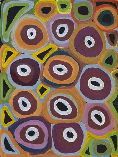
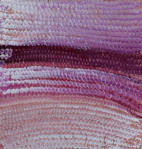
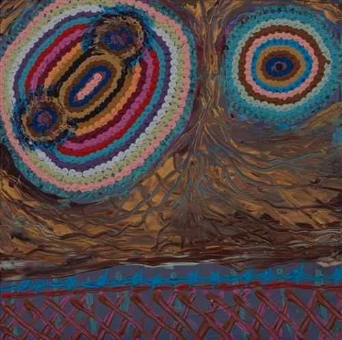
This work depicts a linyji (claypan) within the artists’ ngurra (home Country, camp), typically represented with circular forms. Claypans were visited more often during the wet seasons as they filled with water. 

During the pujiman (traditional, desert dwelling) period, knowledge of water sources was critical for survival, and today Martu Country is still defined in terms of the location and type of water. Each of the hundreds of claypans, rockholes, waterholes, soaks and springs found in the Martu desert homelands is known through real life experience and the recounting of Jukurrpa (Dreaming) narratives by name, location, quality and seasonal availability. This encyclopedic knowledge extends even to the nature and movement of arterial waterways, and sustained Martu as they travelled across their Country, hunting and gathering, visiting family, and fulfilling ceremonial obligations. They would traverse very large distances annually, visiting specific areas in the dry and wet season depending on the availability of water and the corresponding cycles of plant and animal life on which hunting and gathering bush tucker was reliant.

111582303327


Jila-Jila

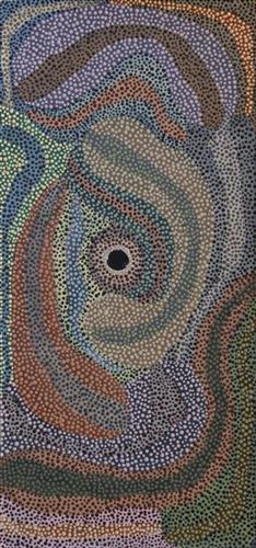
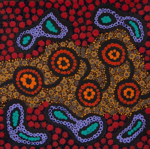
Jila-jila is one of several soaks located close to Punmu Aboriginal Community, and on the eastern edge of Kumpupirntily (Kumpupintily, Lake Disappointment). Extensive permanent tali (sandhills) surround this soak. Jila-jila is also a popular area for collecting minyarra (bush onion). Minyarra (bush onion) are a favoured bush tucker amongst the Martu, popular for their sweet, nutty taste and for the relative ease with which they are foraged. Typically, minyarra is collected in large quantities close to springs, and then shared and eaten over the following days. The minyarra plant is small and grass like, with edible tubers at the root. They can be eaten raw or cooked, and are harvested by first loosening the soil at their base with a pounding stone, and then pulling out the plant. 

During the pujiman (traditional, desert dwelling) period, Martu would traverse very large distances annually in small family groups, moving seasonally from water source to water source, and hunting and gathering bush tucker as they went. Whilst desert life has moved away from mobile hunter-gatherer subsistence throughout the course of the twentieth century, bush tucker continues to be a significant component of the modern Martu diet. Hunting and gathering bush tucker remains equally valuable as an important cultural practice that is passed on intergenerationally.

111582303322


Yilyara

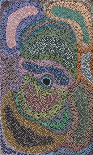
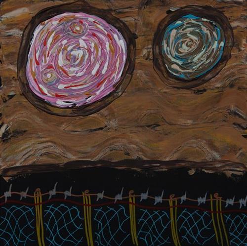
Yilyara is one of several frequently visited yinta (permanent springs) located in the Country immediately surrounding Punmu Aboriginal community. Yilyara is located immediately east of Nyayartakujarra (Lake Dora), a vast and culturally significant salt lake in the north east section of the Karlamilyi River (Rudall River) region. Surrounding the site are the permanent tali (sandhills) typical of the area. 


Yilyara also features as a site in two important Jukurrpa narratives, Jila Kujarra (Two Snakes) and Wirnpa. Jila Kujarra is one of the key Jukurrpa narratives for the Martu. Though the story belongs to Warnman people, it is shared across the Western Desert with several other language groups. The narrative centres on the travels of two snakes as they are pursued by the Niminjarra, spiritual ancestors of the Warnman people. Wirnpa is one of the most powerful of the ancestral jila (snake) men and the last to travel the desert during the Jukurrpa. Wirnpa is a rainmaking jila whose travels are described in the songs and stories of many language groups across the Western Desert, even those far removed from his home site. In his epic travels, Wirnpa created a series of different laws and ceremonies.

111582303319


Pitu (Separation Well)

Pitu (Separation Well) is an important cultural site and large soak located yulparirra (south) of Wuranu (Canning Stock Route Well 29) and Kulilu rockhole and soak. As a site where fresh water was available all year, Pitu was an important camp and a meeting place for Kartujarra and Manyjilyjarra people during the pujiman (traditional, desert dwelling) era. At this time, knowledge of water sources was critical for survival, and today Martu Country is still defined in terms of the location and type of water. Each of the hundreds of claypans, rockholes, waterholes, soaks and springs found in the Martu desert homelands is known by name, location, quality and seasonal availability through real life experience and the recounting of Jukurrpa (Dreaming) narratives. 

Soaks, or soakwaters, derive their name from the manner in which their waters generally seep into the sand from below stores, sometimes as part of an ephemeral river or creek. Soaks were an especially important source of water during the pujiman era, being the most dependable water source in times of drought. Water was obtained from soaks by scooping away the sand with a piti (timber bowls used for carrying food and water) until clear water gathered at the base of the hole, sometimes at a depth of several metres. Pitu is also surrounded by shrubs that need to be cleared to access its waters.

111581888901


Parnngurr

Parnngurr is an Aboriginal community located 370km east of Newman, at the Southern end of the Karlimilyi area in the Pilbara region of Western Australia. Created during the Return to Country movement of the 1980s, with the recognition of Aboriginal land rights and native title, the community was named after its original primary water source, a nearby rockhole and yinta (permanent water source). Until recently the community was widely known as Cotton Creek, after the European name for the ephemeral creek running alongside the community. Parngurr and its surrounds are physically dominated by distinctively red tali (sandhills), sparsely covered with spinifex and low lying shrub.

Historically and culturally Parnngurr was an important site for Aboriginal people during the pujiman (traditional, desert-dwelling) era. In the epic jukurrpa (dreamtime) story of the Jakulyukulyu, or Minyipuru (Seven Sisters), the sisters stop to rest on the adjacent Parnngurr hill before continuing on their long journey east. Throughout the pujiman period families stopped and camped here depending on the seasonal availability of water, and the corresponding cycles of plant and animal life on which hunting and gathering bush tucker was reliant. At Parnngurr and other similarly significant camp sites families would meet for a time before moving to their next destination.

Parnngurr is Bugai’s father’s Country, as well as her own ngurra (home country). She was born nearby, close to what is now Balfour Downs Station, and travelled extensively through the Parnngurr area and up and down the Canning Stock Route as far as Kunawarritji in her youth. For Bugai, Parnngurr also signifies the location at which her nomadic bush life came to an end; it was here that she and her group were picked up by whitefellas to be taken to Jigalong Mission in 1963. Collectively the group had come to the decision to move to the mission as a result of an extended drought, which had caused a scarcity in food and water resources.

111582302910


Family Protection

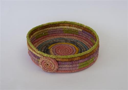
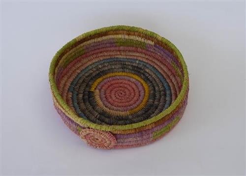
This basket is created from hand dyed raffia veggie dyes, which depict the “colours of the country we live in.” [The] “spirit wheel represents all the Aunty’s and Nanna’s that watch over us from the Dream Time.”

111582301812


Two Countries: Kun Kun (Kuny-Kuny) and Nganjirr

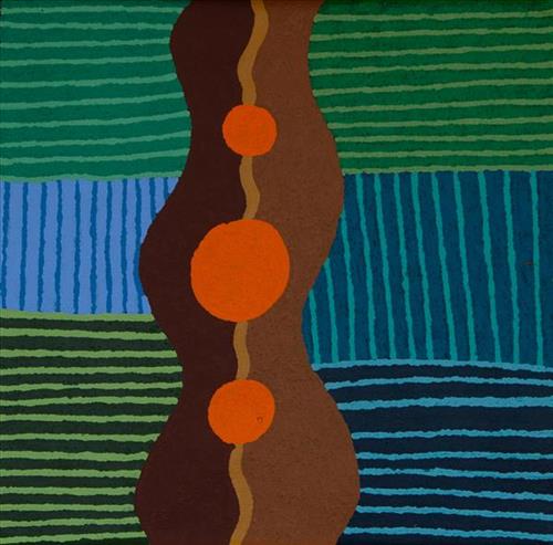
“Grandfather’s Country, not far from Well 33, called Nganjirr. Not far, [you] can go up by car. Go camping there. When it rains, fills up, then is dry.

Two Countries – Nganjirr and Kun Kun (Kuny-Kuny), Marlene’s Country. [You] can just go out for the day- lovely and quiet. Go hunting and get some jinyjwirrily (wild gooseberry, or desert raisins)”

– Kara Patch

Nganjirr and Kun Kun are both significant parts of Kara’s ‘ngurra’ (home Country, camp). Nganjirr, a grouping of three rockholes just south of Kil-kil (Canning Stock Route Well 36), is an importaint place for the Patch family through two brothers, Nganjirrmarta and Wirrulypa. A large marntila/tarntulu (Acacia pruinocarpa) sitting on rocky outcrop close to Nganjirr is used to locate the rockholes.

Kun Kun (Kuny-kuny) is a soak accessing a large body of underground water, located southeast of Kunawarritji (Canning Stock Route Well 33). The site is sacred for its association with the marlu (kangaroo) Jukurrpa (Dreaming), and was an important ceremonial site during the pujiman (traditional, desert dwelling) period. Soaks, or soakwaters, derive their name from the manner in which their waters generally seep into the sand from below stores, sometimes as part of an ephemeral river or creek. Soaks were an especially important source of water during the pujiman era, being the most dependable water source in times of drought. Water was obtained from soaks by scooping away the sand with a piti (timber bowls used for carrying food and water) until clear water gathered at the base of the hole, sometimes at a depth of several metres.

In the Pujiman time, Martu would traverse very large distances annually in small family groups, moving seasonally from water source to water source, and hunting and gathering bush tucker as they went. Knowledge of water sources was critical for survival, and today Martu Country is still defined in terms of the location and type of water. Each of the hundreds of claypans, rockholes, waterholes, soaks and springs found in the Martu desert homelands is known by name, location, quality and seasonal availability through real life experience and the recounting of Jukurrpa narratives.

111582301820


Country

In 1931 sisters Molly Craig, Daisy Kadibil and Gracie Fields were taken from their families, like many other Aboriginal children at that time, and transported to Moore River Native Settlement, north of Perth. They were taken away in the belief that part-Aboriginal children should be trained as domestic servants. 

The three girls escaped the next day and, incredibly, walked 1600 kilometres home to Jigalong using the Rabbit-Proof Fence to navigate. The Rabbit Proof Fence remains the world’s longest fence, and was built in the early 1900s to separate rabbits from pasture. For nine weeks, the girls followed its length in order to be reunited with their family. They crossed a flooded river, sand dunes, heathlands, wheatbelts and plains, claypans and salt lakes. They slept in dug-out rabbit burrows, and caught and cooked rabbits, along with other plant based bush tucker. For the duration of their journey they were pursued by policeman and an Aboriginal police tracker.

The girls’ story has been immortalised in the novel “Follow the Rabbit-Proof Fence” by Doris Pilkington (Nugi Garimara, 1996), and was adapted into the film “Rabbit Proof Fence” (2002). This story retains special significance for the Martu, and in particular those inhabitants of Jigalong Aboriginal community. The three girls were Martu, and their children and grandchildren continue to live in the Martu homelands today.

111582301819


Country

“When I was a little girl, my sister and I would visit our nanna [Molly Craig]. We really looked after her and checked if she had any food and sometimes she would say ” I’m hungry one.” We would race home to make damper and cook some meat and take it back to her before it got dark. She was a caring and beautiful lady but she never told her story about what happened when she was young because my sister and I were part of welfare. That’s why my sister and I had a great connection with our nanna, an unspoken connection.”

– Kathleen Sorenson

In 1931 sisters Molly Craig, Daisy Kadibil and Gracie Fields were taken from their families, like many other Aboriginal children at that time, and transported to Moore River Native Settlement, north of Perth. They were taken away in the belief that part-Aboriginal children should be trained as domestic servants. 

The three girls escaped the next day and, incredibly, walked 1600 kilometres home to Jigalong using the Rabbit-Proof Fence to navigate. The Rabbit Proof Fence remains the world’s longest fence, and was built in the early 1900s to separate rabbits from pasture. For nine weeks, the girls followed its length in order to be reunited with their family. They crossed a flooded river, sand dunes, heathlands, wheatbelts and plains, claypans and salt lakes. They slept in dug-out rabbit burrows, and caught and cooked rabbits, along with other plant based bush tucker. For the duration of their journey they were pursued by policeman and an Aboriginal police tracker.

The girls’ story has been immortalised in the novel “Follow the Rabbit-Proof Fence” by Doris Pilkington (Nugi Garimara, 1996), and was adapted into the film “Rabbit Proof Fence” (2002). This story retains special significance for the Martu, and in particular those inhabitants of Jigalong Aboriginal community. The three girls were Martu, and their children and grandchildren continue to live in the Martu homelands today.

111582301818


Canning Stock Route (Wells 1 to 5)

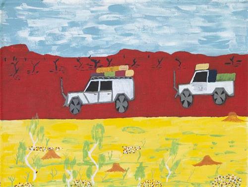
“When they were laying out the Canning Stock Route, whitefellas used to get Martu people to show them where the permanent water was. The whitefellas was asking Martu people to show them permanent water, like soaks and rockholes, for a shortcut from Wiluna to Billiluna. When the whitefellas found out where the permanent water was, they made wells in every place and they called it the Canning Stock Route. That was how they went cut-across.”

– Yanjimi Peter Rowlands (dec.)


Western Australia’s gold rush, beginning in 1885, created a huge demand for beef from mines located between Halls Creek and Wiluna. At that time, most of Western Australia’s cattle came from the Kimberley, though an infestation of tropical ticks among the East Kimberley herds gave the West Kimberley pastoralists a monopoly on the beef trade — causing prices to soar. A Royal Commission in 1904 proposed the construction of a stock route through Western Australia’s desert country to eliminate the ticks through exposure to its hot, dry conditions, resulting in the near 2000 kilometre Canning Stock Route. The proposal was successful insofar as the eradication of ticks was concerned; however, the establishment of the Canning Stock Route was to have far reaching repercussions for Western Australia’s Aboriginal population. 

The construction of the route by Alfred Canning and his team in 1910 resulted in first contact with Europeans for many Martu then living a pujiman (traditional, desert dwelling) life in the desert. This contact began with Canning’s use of Aboriginal guides to lead him to the sources of water that would be transformed into 48 stock route wells. Acts of cruelty toward these guides included, amongst other things, chaining them at night to prevent their escape and giving them salt water to drink, thereby ensuring their thirst and subsequent necessity to lead the party to water sources.

Following the construction of the Canning Stock Route, Martu encountered Europeans and other Martu working as cattle drovers as they would travel up and down the Stock Route from water source to water source. Increasingly, pujiman followed the route to newly established ration depots, mission and pastoral stations. They were drawn to the route in search of food, by a sense of curiosity, or by loneliness. By the late 1950s and early 1960s, most of the desert family groups had left the desert. Eventually, these factors combined with an extreme and prolonged drought in the 1960s to prompt the few remaining pujiman to move in from the desert. One of the last major migrations of Martu people occurred in 1963, when many of the pujiman born Martumili Artists moved to Jigalong.

Patterns of movement which had defined Aboriginal people’s relationships to Country were forever changed by the Canning Stock Route, but the Martu relationship with Country remains strong through the maintenance of physical and cultural ties to desert life and knowledge.