111582260683


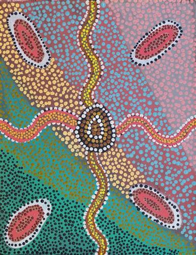
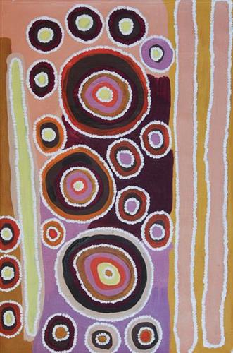
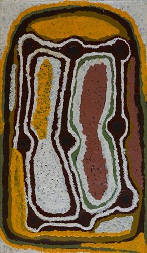
Yilyara, Jila-Jila, Rawa

Punmu refers to a region and an Aboriginal community within its vicinity, located 670km North-East of Newman. Created during the return to Country movement of the 1980s, with the recognition of Martu land rights and native title, the community was named after a nearby Jukurrpa (Dreaming) story.

Punmu community sits on the edge of a large salt lake known as Nyayartakujarra, or Lake Dora. The lake runs south into Karlamilyi River (Rudall River). Surrounding Punmu are numerous fresh water soaks and the red tali (sandhills) typical of the area. The most frequently visited water sources around Punmu include Wirlarra, Rawa, Yilyara, Jila-jila, Tuu-tuu, Pirrkili, Jurnu, Wilurr, and Wala- Wala. Further south are Juturrpa, Wawul, and Tarl. 

During the pujiman (traditional, desert dwelling) period, Martu would traverse very large distances annually in small family groups, moving seasonally from water source to water source, and hunting and gathering bush tucker as they went. At this time knowledge of water sources was critical for survival, and today Martu Country is still defined in terms of the location and type of water. Each of the hundreds of claypans, rockholes, waterholes, soaks and springs found in the Martu desert homelands is known by name, location, quality and seasonal availability through real life experience and the recounting of Jukurrpa narratives.

111582260681


Jila-Jila

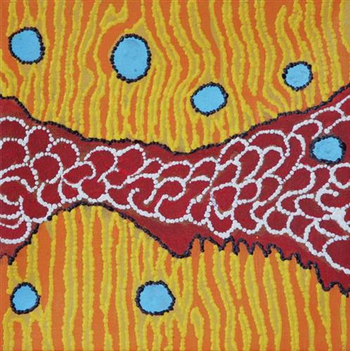
Jila-jila is one of several soaks located close to Punmu Aboriginal Community, and on the eastern edge of Kumpupirntily (Kumpupintily, Lake Disappointment). Extensive permanent tali (sandhills) surround this soak. Jila-jila is also a popular area for collecting minyarra (bush onion). Minyarra (bush onion) are a favoured bush tucker amongst the Martu, popular for their sweet, nutty taste and for the relative ease with which they are foraged. Typically, minyarra is collected in large quantities close to springs, and then shared and eaten over the following days. The minyarra plant is small and grass like, with edible tubers at the root. They can be eaten raw or cooked, and are harvested by first loosening the soil at their base with a pounding stone, and then pulling out the plant. 

During the pujiman (traditional, desert dwelling) period, Martu would traverse very large distances annually in small family groups, moving seasonally from water source to water source, and hunting and gathering bush tucker as they went. Whilst desert life has moved away from mobile hunter-gatherer subsistence throughout the course of the twentieth century, bush tucker continues to be a significant component of the modern Martu diet. Hunting and gathering bush tucker remains equally valuable as an important cultural practice that is passed on intergenerationally.

111582260679


Rawa

Rawa is a soak and spring located along the eastern edge of the large salt lake, Nyayartakujarra (Lake Dora), and at the western edge of Punmu Aboriginal community, 670km northeast of Newman. Surrounding Rawa are numerous fresh water soaks and the permanent red tali (sandhills) typical of the area. 

During the pujiman (traditional, desert dwelling) period, Martu would traverse very large distances annually in small family groups, moving seasonally from water source to water source, and hunting and gathering bush tucker as they went. At this time knowledge of water sources was critical for survival, and today Martu Country is still defined in terms of the location and type of water. Each of the hundreds of claypans, rockholes, waterholes, soaks and springs found in the Martu desert homelands is known by name, location, quality and seasonal availability through real life experience and the recounting of Jukurrpa (Dreaming) narratives.

Rawa features as a resting place for the Minyipuru (Jakulyukulyu, Seven Sisters) during the Jukurrpa period. Minyipuru is a central Jukurrpa narrative for Martu, Ngaanyatjarra, Pitjantjatjara and Yankunytjatjara people that is associated with the seasonal Pleiades star constellation. Relayed in song, dance, stories and paintings, Minyipuru serves as a creation narrative, a source of information relating to the physical properties of the land, and an embodiment of Aboriginal cultural laws. Beginning in Roebourne on the west coast of Western Australia, the story morphs in its movement eastward across the land, following the women as they walk, dance, and even fly from waterhole to waterhole. As they travel the women camp, sing, wash, dance and gather food, leaving markers in the landscape and creating landforms that remain to this day, such as groupings of rocks and trees, grinding stones and seeds. During the entirety of their journey the women are pursued by a lustful old man, Yurla, although interactions with other animals, groups of men, and spirit beings are also chronicled in the narrative.

111582260957


Kaalpa (Kalypa, Canning Stock Route Well 23)- Corban Clause Williams

“Kaalpa (Kalypa, Canning Stock Route Well 23) is my grandfather’s Country. There’s a waterhole there, Kaalpa waterhole. It’s my two pops’ Country. They been walking around, hunting around Kaalpa. You can see a yapu (rock), warla (lake), claypans, karru (creek) and tuwa (sandhills) there. It’s on the [Canning] Stock Route, it’s Well 23.  

In pujiman (traditional, desert dwelling) days, pujimanpa (desert born people) walking around all this Country. My pops told me about that place, a big flat area, parlkarra (flat country) good for hunting parnajarrpa (goanna), lunki (witchetty grub), lungkurta (blue tongue lizard), wamurla (bush tomato), jinyjiwirrilyi (wild gooseberry). Kaalpa is a busy place for emus getting a drink. 

I went [to Kaalpa] for the first time [in 2018] on a Martumili KJ [Kanyirninpa Jukurrpa] trip. I went hunting there, got a parnajarrpa. When I went there, I was pukurlpa (happy). It made you open up your spirit, it feels like home.”

 – Corban Clause Williams

Kaalpa is a permanent water source located northeast of Kumpupirntily (Kumpupintily, Lake Disappointment). This site is a place of great cultural significance, and is also known for good hunting. Adjacent to the waterhole is a hill of the same name. The landscape around Kaalpa is parlkarra (flat country), bordered by tali (sandhills) stretching as far as Windy Corner, northeast and towards the border of Western Australia and the Northern Territory. The large and dangerous Jukurrpa (Dreamtime) mosquito and fly beings partially created the landforms in this area and continue to live underground here.

Kaalpa also features in the Minyipuru (Jakulyukulyu, Seven Sisters) Jukurrpa, a central creation narrative for Martu, Ngaanyatjarra, Pitjantjatjara and Yankunytjatjara people that is associated with the seasonal Pleiades star constellation. At Kaalpa the Minyipuru met a group of men; it was the first time either group had seen members of the opposite sex. The men tried to grab the women, but the Minyipuru chased them, hitting them with their digging sticks and leaving them lying there as they continued travelling east.

Relayed in song, dance, stories and paintings, Minyipuru serves as a creation narrative, a source of information relating to the physical properties of the land, and an embodiment of Aboriginal cultural laws. Beginning in Roebourne on the west coast of Western Australia, the story morphs in its movement eastward across the land, following the women as they walk, dance, and even fly from waterhole to waterhole. As they travel the women camp, sing, wash, dance and gather food, leaving markers in the landscape and creating landforms that remain to this day, such as groupings of rocks and trees, grinding stones and seeds. During the entirety of their journey the women are pursued by a lustful old man, Yurla, although interactions with other animals, groups of men, and spirit beings are also chronicled in the narrative.

The intersection of the Canning Stock Route with Kaalpa also made this a site of early contact with Europeans for many Martu then living a pujiman life in the desert. Following the route’s construction, Martu encountered Europeans and other Martu working as cattle drovers as they would travel up and down the Stock Route from water source to water source. Increasingly, pujimanpa followed the route to newly established ration depots, mission and pastoral stations. They were drawn to the route in search of food, by a sense of curiosity, or by loneliness. By the late 1950s and early 1960s, most of the desert family groups had left the desert. Eventually, these factors combined with an extreme and prolonged drought in the 1960s to prompt the few remaining pujimanpa to move in from the desert.
111582260956


Kaalpa (Kalypa, Canning Stock Route Well 23)- Corban Clause Williams

“Kaalpa (Kalypa, Canning Stock Route Well 23) is my grandfather’s Country. There’s a waterhole there, Kaalpa waterhole. It’s my two pops’ Country. They been walking around, hunting around Kaalpa. You can see a yapu (rock), warla (lake), claypans, karru (creek) and tuwa (sandhills) there. It’s on the [Canning] Stock Route, it’s Well 23.  

In pujiman (traditional, desert dwelling) days, pujimanpa (desert born people) walking around all this Country. My pops told me about that place, a big flat area, parlkarra (flat country) good for hunting parnajarrpa (goanna), lunki (witchetty grub), lungkurta (blue tongue lizard), wamurla (bush tomato), jinyjiwirrilyi (wild gooseberry). Kaalpa is a busy place for emus getting a drink. 

I went [to Kaalpa] for the first time [in 2018] on a Martumili KJ [Kanyirninpa Jukurrpa] trip. I went hunting there, got a parnajarrpa. When I went there, I was pukurlpa (happy). It made you open up your spirit, it feels like home.”

 – Corban Clause Williams

Kaalpa is a permanent water source located northeast of Kumpupirntily (Kumpupintily, Lake Disappointment). This site is a place of great cultural significance, and is also known for good hunting. Adjacent to the waterhole is a hill of the same name. The landscape around Kaalpa is parlkarra (flat country), bordered by tali (sandhills) stretching as far as Windy Corner, northeast and towards the border of Western Australia and the Northern Territory. The large and dangerous Jukurrpa (Dreamtime) mosquito and fly beings partially created the landforms in this area and continue to live underground here.

Kaalpa also features in the Minyipuru (Jakulyukulyu, Seven Sisters) Jukurrpa, a central creation narrative for Martu, Ngaanyatjarra, Pitjantjatjara and Yankunytjatjara people that is associated with the seasonal Pleiades star constellation. At Kaalpa the Minyipuru met a group of men; it was the first time either group had seen members of the opposite sex. The men tried to grab the women, but the Minyipuru chased them, hitting them with their digging sticks and leaving them lying there as they continued travelling east.

Relayed in song, dance, stories and paintings, Minyipuru serves as a creation narrative, a source of information relating to the physical properties of the land, and an embodiment of Aboriginal cultural laws. Beginning in Roebourne on the west coast of Western Australia, the story morphs in its movement eastward across the land, following the women as they walk, dance, and even fly from waterhole to waterhole. As they travel the women camp, sing, wash, dance and gather food, leaving markers in the landscape and creating landforms that remain to this day, such as groupings of rocks and trees, grinding stones and seeds. During the entirety of their journey the women are pursued by a lustful old man, Yurla, although interactions with other animals, groups of men, and spirit beings are also chronicled in the narrative.

The intersection of the Canning Stock Route with Kaalpa also made this a site of early contact with Europeans for many Martu then living a pujiman life in the desert. Following the route’s construction, Martu encountered Europeans and other Martu working as cattle drovers as they would travel up and down the Stock Route from water source to water source. Increasingly, pujimanpa followed the route to newly established ration depots, mission and pastoral stations. They were drawn to the route in search of food, by a sense of curiosity, or by loneliness. By the late 1950s and early 1960s, most of the desert family groups had left the desert. Eventually, these factors combined with an extreme and prolonged drought in the 1960s to prompt the few remaining pujimanpa to move in from the desert.
111582260379


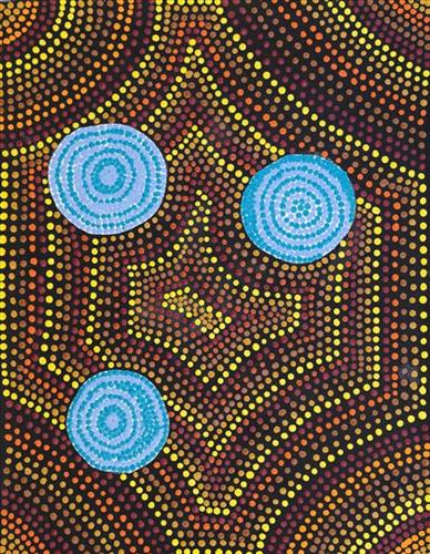
Partjanta

“Katjarra’s  [Katjarra Butler] ngurra (home Country, camp). Birthplace. [It is] sandhill country. Rockhole, little bit of rocks. And in the sandhill, there is a jurnu (soakwater). They take that water, come out [of the soakwater]. Partjanta the name of that jurnu. Main one. She [Katjarra Butler] been go jina [foot, walking]. Early days. Walking [to] Kintore, Papunya.”

“I’m painting my grandmother’s country, her way. Katjarra style.”

-Sharon Porter

This site forms part of Sharon’s ngurra (home Country, camp) through her grandmother, Katjarra Butler. Located east of Kiwirrkurra and on Pintupi country.

The Western Desert term ‘ngurra’ is hugely versatile in application. Broadly denoting birthplace and belonging, ngurra can refer to a body of water, a camp site, a large area of Country, or even a modern house. People identify with their ngurra in terms of specific rights and responsibilities, and the possession of intimate knowledge of the physical and cultural properties of one’s Country. This knowledge is traditionally passed intergenerationally through family connections. Country for Martu is full of memory; not just the memory of their own movement through it, but also of their family. As summarised by Ngalangka Nola Taylor, “painting the ngurra, they do it to remember their connections.”

Painting ngurra, and in so doing sharing the Jukurrpa (Dreaming) stories and physical characteristics of that place, has today become an important means of cultural maintenance. Physical maintenance of one’s ngurra, like cultural maintenance, ensures a site’s wellbeing, and is a responsibility of the people belonging to that area. 

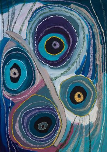
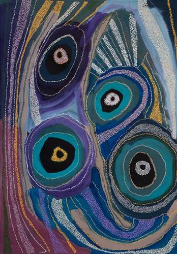
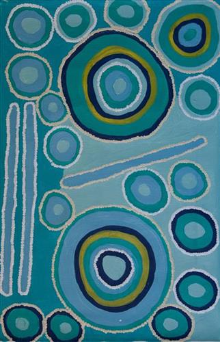
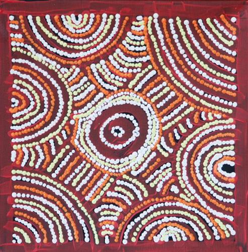
This work depicts a yinta (permanent spring) within the artists’ ngurra (home Country, camp), typically depicted with circular forms. Yinta provided a reliable source of water and were traditionally used as camping sites throughout the year.

During the pujiman (traditional, desert dwelling) period, knowledge of water sources was critical for survival, and today Martu Country is still defined in terms of the location and type of water. Each of the hundreds of claypans, rockholes, waterholes, soaks and springs found in the Martu desert homelands is known through real life experience and the recounting of Jukurrpa (Dreaming) narratives by name, location, quality and seasonal availability. This encyclopedic knowledge extends even to the nature and movement of arterial waterways, and sustained Martu as they travelled across their Country, hunting and gathering, visiting family, and fulfilling ceremonial obligations. They would traverse very large distances annually, visiting specific areas in the dry and wet season depending on the availability of water and the corresponding cycles of plant and animal life on which hunting and gathering bush tucker was reliant.

111582260377


Partjanta

“Katjarra’s  [Katjarra Butler] ngurra (home Country, camp). Birthplace. [It is] sandhill country. Rockhole, little bit of rocks. And in the sandhill, there is a jurnu (soakwater). They take that water, come out [of the soakwater]. Partjanta the name of that jurnu. Main one. She [Katjarra Butler] been go jina [foot, walking]. Early days. Walking [to] Kintore, Papunya.”

“I’m painting my grandmother’s country, her way. Katjarra style.”

-Sharon Porter

This site forms part of Sharon’s ngurra (home Country, camp) through her grandmother, Katjarra Butler. Located east of Kiwirrkurra and on Pintupi country.

The Western Desert term ‘ngurra’ is hugely versatile in application. Broadly denoting birthplace and belonging, ngurra can refer to a body of water, a camp site, a large area of Country, or even a modern house. People identify with their ngurra in terms of specific rights and responsibilities, and the possession of intimate knowledge of the physical and cultural properties of one’s Country. This knowledge is traditionally passed intergenerationally through family connections. Country for Martu is full of memory; not just the memory of their own movement through it, but also of their family. As summarised by Ngalangka Nola Taylor, “painting the ngurra, they do it to remember their connections.”

Painting ngurra, and in so doing sharing the Jukurrpa (Dreaming) stories and physical characteristics of that place, has today become an important means of cultural maintenance. Physical maintenance of one’s ngurra, like cultural maintenance, ensures a site’s wellbeing, and is a responsibility of the people belonging to that area. 

This work depicts a yinta (permanent spring) within the artists’ ngurra (home Country, camp), typically depicted with circular forms. Yinta provided a reliable source of water and were traditionally used as camping sites throughout the year.

During the pujiman (traditional, desert dwelling) period, knowledge of water sources was critical for survival, and today Martu Country is still defined in terms of the location and type of water. Each of the hundreds of claypans, rockholes, waterholes, soaks and springs found in the Martu desert homelands is known through real life experience and the recounting of Jukurrpa (Dreaming) narratives by name, location, quality and seasonal availability. This encyclopedic knowledge extends even to the nature and movement of arterial waterways, and sustained Martu as they travelled across their Country, hunting and gathering, visiting family, and fulfilling ceremonial obligations. They would traverse very large distances annually, visiting specific areas in the dry and wet season depending on the availability of water and the corresponding cycles of plant and animal life on which hunting and gathering bush tucker was reliant.

111582260367


Around Kinyu (Canning Stock Route Well 35)

“That flat hill. You can see it when you climb up to [the Kunawarritji] airport. This one here, this the main place. This is where Manyjilyjarra people start. The dreaming is right here. Kinyu (Well 34, Canning Stock Route). When people are sick they just go here [to Kinyu). Sleep, they get better. They don’t go right in, they just go there and sleep, healing.”

-Nigel Neech

Kinyu (Canning Stock Route Well 35) is a small yinta (permanent spring) that was a popular camping ground during the pujiman (traditional, desert dwelling) era. The site is home to the ancestral mother dingo, who is both a generous provider and fierce protector of her Martu countrymen. Kinyu is so revered that the site and its associated ancestral being are often deferentially referred to as jarntu (dog) in place of uttering the actual name. The site is believed to possess healing and magical powers, and children born here are said to inherit these same powers.

During the Jukurrpa (Dreaming), Kinyu was the home for a family of dingoes; a mother, father, and their litter of pups. Originally the family had travelled to Wirlarra, following the call of the moon. At Wirlarra the moon cared for them and created a windbreak for the family to shelter. The dingoes stayed for a time at Wirlarra, scratching into the earth to create several distinctive small salt water pools which are still visited by the Martu for their healing properties. After a time, the dingoes continued travelling eastward toward the rising moon until they reached Kinyu, where they remained until all of the dingo pups had grown up. From Kinyu the family travelled further east. 

The intersection of the Canning Stock Route with Kinyu also made this a site of early contact with Europeans for many Martu then living a pujiman life in the desert. Following the route’s construction, Martu encountered Europeans and other Martu working as cattle drovers as they would travel up and down the Stock Route from water source to water source. Increasingly, pujimanpa (desert dwellers) followed the route to newly established ration depots, mission and pastoral stations. They were drawn to the route in search of food, by a sense of curiosity, or by loneliness. By the late 1950s and early 1960s, most of the desert family groups had left the desert. Eventually, these factors combined with an extreme and prolonged drought in the 1960s to prompt the few remaining pujimanpa to move in from the desert.
 

111582260369


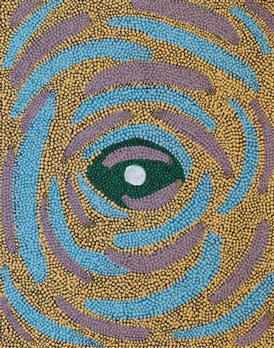
All the mima (women) -Sharon Porter

The site depicted in this work, situated to the east of Kiwirrkurra and on Pintupi Country, forms part of Sharon’s ngurra (home Country, camp) through her grandmother, Katjarra Butler. Katjarra shared with Sharon the jukurrpa (dreaming) story for this area. This narrative describes how a distinctive group of rocks located here came to be formed by “all the mima (women) sitting down next to two rocks and one rockhole. They was eating bush tucker, yellow berries, and they was drinking water from one rockhole. They was in one place, and they was eating a big round one, that yellow berry. They was looking round and round for more. They never went, they stayed sitting in one place. They still there, they turned into rocks there.” (Sharon Porter)

The term Jukurrpa is often translated in English as the ‘dreaming’, or ‘dreamtime’. It refers generally to the period in which the world was created by ancestral beings, who assumed both human and nonhuman forms. These beings shaped what had been a formless landscape; creating waters, plants, animals, and people. At the same time they provided cultural protocols for the people they created, as well as rules for interacting with the natural environment. At their journey’s end, the ancestral beings transformed themselves into important waters, hills, rocks, and even constellations.

111582258930


Kinyu (Canning Stock Route Well 35), Kunawarritji Jarntu (Dog)

“In pujiman (traditional, desert dwelling) time there were giant jarntu (dogs) walking around Kunawarritji (Canning Stock Route Well 33). Like I can see you, you can see me, real life those jarntu showed themselves. Those jarntu would go under ground. Under the parna (ground, earth). There was a male and female dog. The wanti (woman, girl) jarntu was juri (beautiful, good) one. The male jarntu wanted to be nyupa- nyupa (partners). The wanti jarntu say, no, paki (nothing). The male jarntu was young and claimed that female jarntu.”

– Kumpaya Girgirba as translated by Ignatius Taylor

Kinyu (Canning Stock Route Well 35) is a small yinta (permanent spring) that was a popular camping site during the pujiman (traditional, desert dwelling) era. Kinyu forms part of Kumpaya’s ngurra (home Country, camp), the area which she knew intimately and travelled extensively with her family in her youth.

As alluded to in Kumpaya’s account, the site is home to the ancestral mother dingo, a generous provider and fierce protector of her Martu countrymen. Kinyu is so revered that the site and its associated ancestral being are often deferentially called jarntu (dog) in place of uttering the actual name. The site is believed to possess healing and magical powers, and children born here are said to inherit these same powers. 

During the Jukurrpa (Dreaming), Kinyu was the home for a family of dingoes; a mother, father, and their litter of pups. Originally the family had travelled to Wirlarra, following the call of the moon. At Wirlarra the moon cared for them and created a windbreak for the family to shelter. The dingoes stayed for a time at Wirlarra, scratching into the earth to create several distinctive small salt water pools which are still visited by the Martu for their healing properties. After a time, the dingoes continued travelling eastward toward the rising moon until they reached Kinyu, where they remained until all of the dingo pups had grown up. From Kinyu the family travelled further east. 

The intersection of the Canning Stock Route with Kinyu also made this a site of early contact with Europeans for many Martu then living a pujiman life in the desert. Following the route’s construction, Martu encountered Europeans and other Martu working as cattle drovers as they would travel up and down the Stock Route from water source to water source. Increasingly, pujimanpa (desert dwellers) followed the route to newly established ration depots, mission and pastoral stations. They were drawn to the route in search of food, by a sense of curiosity, or by loneliness. By the late 1950s and early 1960s, most of the desert family groups had left the desert. Eventually, these factors combined with an extreme and prolonged drought in the 1960s to prompt the few remaining pujimanpa to move in from the desert.