111582154577


Untitled

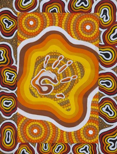
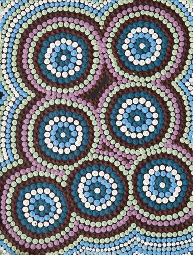
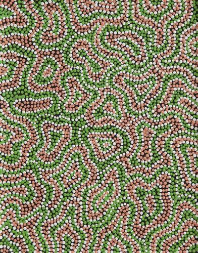
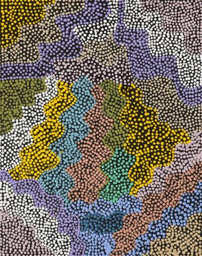
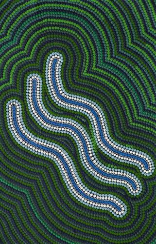
“When Martu paint, it’s like a map. Martu draw story on the ground and on the canvas, and all the circle and line there are the hunting areas and different waters and tracks where people used to walk, and [some you] can’t cross, like boundaries. So nowadays you see a colourful painting and wonder what it is, but that’s how Martu tell story long ago. It’s not just a lovely painting, it’s a story and a songline and a history and everything that goes with it.” 

– Ngalangka Nola Taylor and Joshua Booth

This work portrays an area of Country that can be interpreted in multiple ways. Firstly, the image may be read as an aerial representation of a particular location known to the artist- either land that they or their family travelled, from the pujiman (traditional, desert dwelling) era to now. During the pujiman period, Martu would traverse very large distances annually in small family groups, moving seasonally from water source to water source, and hunting and gathering bush tucker as they went. At this time, one’s survival depended on their intimate knowledge of the location of resources; thus physical elements of Country, such as sources of kapi (water), tali (sandhills), different varieties of warta (trees, vegetation), ngarrini (camps), and jina (tracks) are typically recorded with the use of a use of a system of iconographic forms universally shared across the desert. 

An additional layer of meaning in the work relates to more intangible concepts; life cycles based around kalyu (rain, water) and waru (fire) are also often evident. A thousands of year old practice, fire burning continues to be carried out as both an aid for hunting and a means of land management today. As the Martu travelled and hunted they would burn tracts of land, ensuring plant and animal biodiversity and reducing the risk of unmanageable, spontaneous bush fires. The patchwork nature of regrowth is evident in many landscape works, with each of the five distinctive phases of fire burning visually described with respect to the cycle of burning and regrowth.  

Finally, metaphysical information relating to a location may also be recorded; Jukurrpa (Dreaming) narratives chronicle the creation of physical landmarks, and can be referenced through depictions of ceremonial sites, songlines, and markers left in the land. Very often, however, information relating to Jukurrpa is censored by omission, or alternatively painted over with dotted patterns.
111582154575


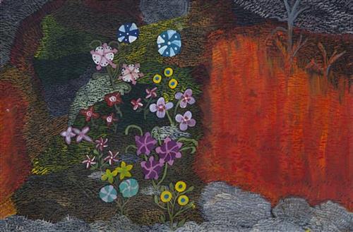
Waru (fire)

This work depicts the practice of fire burning as it continues to be used today through the Martu homelands. Over thousands of years, as Martu travelled and hunted on foot they would burn tracts of land, using waru (fire) as a means to assist with hunting and to encourage regenerative growth. Whilst fire burning practices have modernised in recent times, with Martu burning areas close to Aboriginal communities and along roads, or else further afield using helicopters and 4WDs with Indigenous ranger group Karnyirninpa Jukurrpa (KJ), the same objectives are met as those during pujiman (traditional, desert dwelling) times.

Targeted waru is an important tool in animal tracking. Small burns are lit to clear vegetation, expose burrows, and to allow for access to walk and track readily in exposed sands. Fires are typically burnt during cooler weather in small, controlled areas, reducing the risk of unmanageable, spontaneous bush fires whilst simultaneously providing diverse regenerating habitats. Remaining is a defined mosaic fire scar pattern in the land, across tali (sand dunes), linyji (clay pans), parulyukurru (spinifex country) and pila (sandy plains). This patterning is clearly visible from an aerial perspective, and becomes even more defined as new growth emerges. 

The patchwork nature of regrowth is aligned with the Martu cycle of burning and regrowth and its five distinct phases. First is nyurnma (freshly burnt Country), followed after the rains by waru-waru, when young, bright green plants start to grow. Nyukura occurs between one and three years after burning, when plants have matured and are fruiting and seeding. Manguu is four to six years post burning, when spinifex has matured to the point that it can be burned once again. Finally, kunarka signifies the time when spinifex and other plant species have become old growth, and pose a risk of destructive bushfires.

111582154574


Birriliburu (Pirrilipuru)

Birriliburu is Miriam’s family’s ngurra (home Country, camp), at the southern end of Martu Country and incorporating Wells 1 to 9 of the Canning Stock Route. Birriliburu lies at the intersection of the Little Sandy and Gibson Deserts of Western Australia, and is characterised largely by the red sand dunes and rocky outcrops typical of the Gibson Desert region. In the south-western corner of Birriliburu Indigenous Protected Area are the Blue Hills and Katjarra (Carnarvon Range) mountain ranges, distinctive from a distance for their blue hue. Other areas of cultural significance in the area are Milyinirri (Pierre Springs, Canning Stock Route Well 6) and Palatji (Palarji, Weld Springs, Canning Stock Route Well 9).

Spinifex, desert oak and acacia species are found in this region, along with edible plant species including yuwinyji (woolly-butt grass), karlkula (bush banana), jawirli (quandong), kulyu (bush potato), wamurla (bush tomato), and pipijarli (pencil shaped potato). 

The Western Desert term ‘ngurra’ is hugely versatile in application. Broadly denoting birthplace and belonging, ngurra can refer to a body of water, a camp site, a large area of Country, or even a modern house. People identify with their ngurra in terms of specific rights and responsibilities, and the possession of intimate knowledge of the physical and cultural properties of one’s Country. This knowledge is traditionally passed intergenerationally through family connections. Painting ngurra, and in so doing sharing the Jukurrpa (Dreaming) stories and physical characteristics of that place, has today become an important means of cultural maintenance. Physical maintenance of one’s ngurra, like cultural maintenance, ensures a site’s wellbeing, and is a responsibility of the people belonging to that area.

111582154559


Untitled

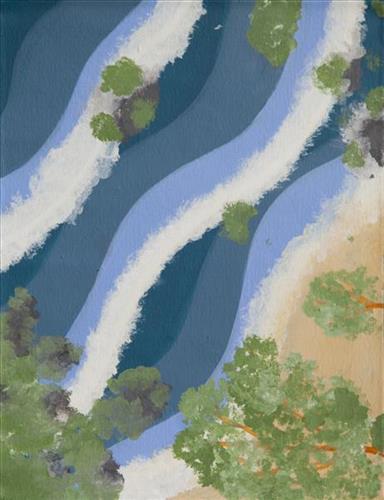
This work portrays an area known intimately to the artist, painted here from memory. During the pujiman (traditional, desert dwelling) era one’s survival depended on their intimate knowledge of the location of resources; thus physical elements of Country, such as sources of kapi (water), tali (sandhills), and different varieties of warta (trees, vegetation) were carefully observed and remembered. Today, this relationship with Country remains equally strong, despite the movement of Martu out of the desert and into remote Aboriginal Communities, towns and cities.

Also visible may be traces of life cycles based around kalyu (rain, water) and waru (fire). A thousands of year old practice, fire burning continues to be carried out as both an aid for hunting and a means of land management today. As the Martu travelled and hunted they would burn tracts of land, ensuring plant and animal biodiversity and reducing the risk of unmanageable, spontaneous bush fires. The patchwork nature of regrowth is visible in many landscape works, with each of the five distinctive phases of fire burning visually described with respect to the cycle of burning and regrowth.  

Finally, metaphysical information relating to a location may also be recorded; Jukurrpa (Dreaming) narratives chronicle the creation of physical landmarks, and can be referenced through depictions of ceremonial sites, songlines, and markers left in the land. 

111582154546


Untitled

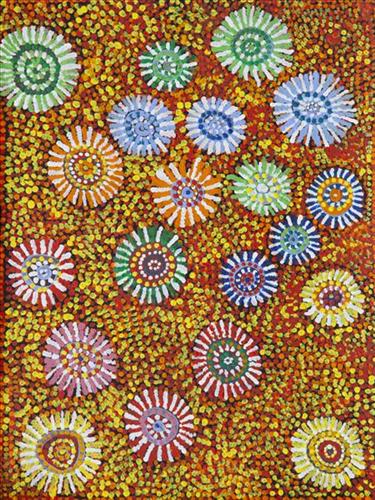
“When Martu paint, it’s like a map. Martu draw story on the ground and on the canvas, and all the circle and line there are the hunting areas and different waters and tracks where people used to walk, and [some you] can’t cross, like boundaries. So nowadays you see a colourful painting and wonder what it is, but that’s how Martu tell story long ago. It’s not just a lovely painting, it’s a story and a songline and a history and everything that goes with it.” 

– Ngalangka Nola Taylor and Joshua Booth

This work portrays an area of Country that can be interpreted in multiple ways. Firstly, the image may be read as an aerial representation of a particular location known to the artist- either land that they or their family travelled, from the pujiman (traditional, desert dwelling) era to now. During the pujiman period, Martu would traverse very large distances annually in small family groups, moving seasonally from water source to water source, and hunting and gathering bush tucker as they went. At this time, one’s survival depended on their intimate knowledge of the location of resources; thus physical elements of Country, such as sources of kapi (water), tali (sandhills), different varieties of warta (trees, vegetation), ngarrini (camps), and jina (tracks) are typically recorded with the use of a use of a system of iconographic forms universally shared across the desert. 

An additional layer of meaning in the work relates to more intangible concepts; life cycles based around kalyu (rain, water) and waru (fire) are also often evident. A thousands of year old practice, fire burning continues to be carried out as both an aid for hunting and a means of land management today. As the Martu travelled and hunted they would burn tracts of land, ensuring plant and animal biodiversity and reducing the risk of unmanageable, spontaneous bush fires. The patchwork nature of regrowth is evident in many landscape works, with each of the five distinctive phases of fire burning visually described with respect to the cycle of burning and regrowth.  

Finally, metaphysical information relating to a location may also be recorded; Jukurrpa (Dreaming) narratives chronicle the creation of physical landmarks, and can be referenced through depictions of ceremonial sites, songlines, and markers left in the land. Very often, however, information relating to Jukurrpa is censored by omission, or alternatively painted over with dotted patterns.
111582154541


Punmu Waterholes

Punmu refers to a region and an Aboriginal community within its vicinity, located 670km North-East of Newman. Created during the return to Country movement of the 1980s, with the recognition of Martu land rights and native title, the community was named after a nearby Jukurrpa (Dreaming) story.

Punmu community sits on the edge of a large salt lake known as Nyayartakujarra, or Lake Dora. The lake runs south into Karlamilyi River (Rudall River). Surrounding Punmu are numerous fresh water soaks and the red tali (sandhills) typical of the area. The most frequently visited water sources around Punmu include Wirlarra, Rawa, Yilyara, Jila-jila, Tuu-tuu, Pirrkili, Jurnu, Wilurr, and Wala- Wala. Further south are Juturrpa, Wawul, and Tarl. 

During the pujiman (traditional, desert dwelling) period, Martu would traverse very large distances annually in small family groups, moving seasonally from water source to water source, and hunting and gathering bush tucker as they went. At this time knowledge of water sources was critical for survival, and today Martu Country is still defined in terms of the location and type of water. Each of the hundreds of claypans, rockholes, waterholes, soaks and springs found in the Martu desert homelands is known by name, location, quality and seasonal availability through real life experience and the recounting of Jukurrpa narratives.

111582154540


Untitled

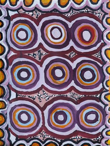
“When Martu paint, it’s like a map. Martu draw story on the ground and on the canvas, and all the circle and line there are the hunting areas and different waters and tracks where people used to walk, and [some you] can’t cross, like boundaries. So nowadays you see a colourful painting and wonder what it is, but that’s how Martu tell story long ago. It’s not just a lovely painting, it’s a story and a songline and a history and everything that goes with it.” 

– Ngalangka Nola Taylor and Joshua Booth

This work portrays an area of Country that can be interpreted in multiple ways. Firstly, the image may be read as an aerial representation of a particular location known to the artist- either land that they or their family travelled, from the pujiman (traditional, desert dwelling) era to now. During the pujiman period, Martu would traverse very large distances annually in small family groups, moving seasonally from water source to water source, and hunting and gathering bush tucker as they went. At this time, one’s survival depended on their intimate knowledge of the location of resources; thus physical elements of Country, such as sources of kapi (water), tali (sandhills), different varieties of warta (trees, vegetation), ngarrini (camps), and jina (tracks) are typically recorded with the use of a use of a system of iconographic forms universally shared across the desert. 

An additional layer of meaning in the work relates to more intangible concepts; life cycles based around kalyu (rain, water) and waru (fire) are also often evident. A thousands of year old practice, fire burning continues to be carried out as both an aid for hunting and a means of land management today. As the Martu travelled and hunted they would burn tracts of land, ensuring plant and animal biodiversity and reducing the risk of unmanageable, spontaneous bush fires. The patchwork nature of regrowth is evident in many landscape works, with each of the five distinctive phases of fire burning visually described with respect to the cycle of burning and regrowth.  

Finally, metaphysical information relating to a location may also be recorded; Jukurrpa (Dreaming) narratives chronicle the creation of physical landmarks, and can be referenced through depictions of ceremonial sites, songlines, and markers left in the land. Very often, however, information relating to Jukurrpa is censored by omission, or alternatively painted over with dotted patterns.
111582154535


Untitled

“When Martu paint, it’s like a map. Martu draw story on the ground and on the canvas, and all the circle and line there are the hunting areas and different waters and tracks where people used to walk, and [some you] can’t cross, like boundaries. So nowadays you see a colourful painting and wonder what it is, but that’s how Martu tell story long ago. It’s not just a lovely painting, it’s a story and a songline and a history and everything that goes with it.” 

– Ngalangka Nola Taylor and Joshua Booth

This work portrays an area of Country that can be interpreted in multiple ways. Firstly, the image may be read as an aerial representation of a particular location known to the artist- either land that they or their family travelled, from the pujiman (traditional, desert dwelling) era to now. During the pujiman period, Martu would traverse very large distances annually in small family groups, moving seasonally from water source to water source, and hunting and gathering bush tucker as they went. At this time, one’s survival depended on their intimate knowledge of the location of resources; thus physical elements of Country, such as sources of kapi (water), tali (sandhills), different varieties of warta (trees, vegetation), ngarrini (camps), and jina (tracks) are typically recorded with the use of a use of a system of iconographic forms universally shared across the desert. 

An additional layer of meaning in the work relates to more intangible concepts; life cycles based around kalyu (rain, water) and waru (fire) are also often evident. A thousands of year old practice, fire burning continues to be carried out as both an aid for hunting and a means of land management today. As the Martu travelled and hunted they would burn tracts of land, ensuring plant and animal biodiversity and reducing the risk of unmanageable, spontaneous bush fires. The patchwork nature of regrowth is evident in many landscape works, with each of the five distinctive phases of fire burning visually described with respect to the cycle of burning and regrowth.  

Finally, metaphysical information relating to a location may also be recorded; Jukurrpa (Dreaming) narratives chronicle the creation of physical landmarks, and can be referenced through depictions of ceremonial sites, songlines, and markers left in the land. Very often, however, information relating to Jukurrpa is censored by omission, or alternatively painted over with dotted patterns.
111582154531


Untitled

“When Martu paint, it’s like a map. Martu draw story on the ground and on the canvas, and all the circle and line there are the hunting areas and different waters and tracks where people used to walk, and [some you] can’t cross, like boundaries. So nowadays you see a colourful painting and wonder what it is, but that’s how Martu tell story long ago. It’s not just a lovely painting, it’s a story and a songline and a history and everything that goes with it.” 

– Ngalangka Nola Taylor and Joshua Booth

This work portrays an area of Country that can be interpreted in multiple ways. Firstly, the image may be read as an aerial representation of a particular location known to the artist- either land that they or their family travelled, from the pujiman (traditional, desert dwelling) era to now. During the pujiman period, Martu would traverse very large distances annually in small family groups, moving seasonally from water source to water source, and hunting and gathering bush tucker as they went. At this time, one’s survival depended on their intimate knowledge of the location of resources; thus physical elements of Country, such as sources of kapi (water), tali (sandhills), different varieties of warta (trees, vegetation), ngarrini (camps), and jina (tracks) are typically recorded with the use of a use of a system of iconographic forms universally shared across the desert. 

An additional layer of meaning in the work relates to more intangible concepts; life cycles based around kalyu (rain, water) and waru (fire) are also often evident. A thousands of year old practice, fire burning continues to be carried out as both an aid for hunting and a means of land management today. As the Martu travelled and hunted they would burn tracts of land, ensuring plant and animal biodiversity and reducing the risk of unmanageable, spontaneous bush fires. The patchwork nature of regrowth is evident in many landscape works, with each of the five distinctive phases of fire burning visually described with respect to the cycle of burning and regrowth.  

Finally, metaphysical information relating to a location may also be recorded; Jukurrpa (Dreaming) narratives chronicle the creation of physical landmarks, and can be referenced through depictions of ceremonial sites, songlines, and markers left in the land. Very often, however, information relating to Jukurrpa is censored by omission, or alternatively painted over with dotted patterns.
111582154530


Punmu

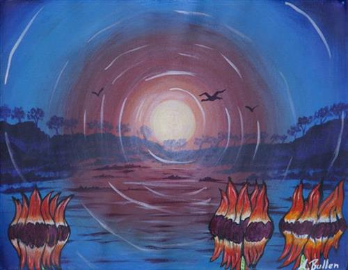
“This area here is our Country. It’s our Country right here. We returned to our Country with a Toyota and a grader that made the road. A grader right up to here. Punmu is a good place. It’s a happy place to live. My spirit feels good living here. In pujiman (traditional, desert dwelling) time we lived in this area now. I’m happy with this life now, happy because I feel grounded by my Country. It’s important to hold onto the legacy of the ancestors. It’s up to the young people to carry it on now. For the ancestors past and present.”

– Minyawe Miller as translated by Kanyirninpa Jukurrpa


Punmu refers to a region and an Aboriginal community within its vicinity, located 670km North-East of Newman. Created during the return to Country movement of the 1980s, with the recognition of Martu land rights and native title, the community was named after a nearby Jukurrpa (Dreaming) story.

Punmu Aboriginal community sits on the edge of a large salt lake known as Nyayartakujarra, or Lake Dora. The lake runs south into Karlamilyi River (Rudall River). Surrounding Punmu are numerous fresh water soaks and the red tali (sandhills) typical of the area. The most frequently visited yinta (permanent springs) around Punmu include Wirlarra, Rawa, Yilyara, Jila-jila and Tuu-tuu.

The Country around Punmu features in several Jukurrpa stories. Of particular importance is the story of the Jila Kujarra (Two Snakes), one of the key Jukurrpa narratives for the Martu. Though the story belongs to Warnman people, it is shared across the Western Desert with several other language groups. The narrative centres on the travels of two snakes as they are pursued by the Niminjarra, spiritual ancestors of the Warnman people. 

Before transforming themselves into snakes, the Jila Kujarra were young brothers. As snakes, they began travelling home to their mother, but were intercepted by the Niminjarra, who tracked the Jila Kujarra to Paji, east of Nyayartakujarra (Lake Dora). Though the Jila Kujarra eluded their pursuers here by escaping under the lake at Paji, they were soon after speared and injured by two Pukurti (initiates with bundled hair) at Nyayartakujarra, who returned with the Niminjarra to cook the snakes at the site of Kumpupirntily (Kumpupintily, Lake Disappointment). As the Niminjarra cut down the length of the Jila Kujarra, the snake’s bladders were pierced, causing an explosion of scalding hot urine in which the Niminjarra all perished and became black rocks at the site. The spirits of the Jila Kujarra returned to their mother at Nyayartakujarra, where the mother and her sons entered the ground below Nyayartakujarra and remain to this day.