11151031522


Luurnkurangu

Luurnkurangu is a soak located between Nyarruri (Canning Stock Route Well 32) and Warla-warla (Canning Stock Route Well 31), and south west of Kunawarritji Aboriginal community. This site is ngurra (home Country, camp) for Nungabar (Nyangapa) (dec.), and forms part of the area which she knew intimately and travelled extensively with her family in her youth. 

During the pujiman (traditional, desert dwelling) period, Martu would traverse very large distances annually in small family groups, moving seasonally from water source to water source, and hunting and gathering bush tucker as they went. At this time knowledge of water sources was critical for survival, and today Martu Country is still defined in terms of the location and type of water. Each of the hundreds of claypans, rockholes, waterholes, soaks and springs found in the Martu desert homelands is known by name, location, quality and seasonal availability through real life experience and the recounting of Jukurrpa (Dreaming) narratives. 

Soaks, or soakwaters, derive their name from the manner in which their waters generally seep into the sand from below stores, sometimes as part of an ephemeral river or creek. Soaks were an especially important source of water during the pujiman era, being the most dependable water source in times of drought. Water was obtained from soaks by scooping away the sand with a piti (timber bowls used for carrying food and water) until clear water gathered at the base of the hole, sometimes at a depth of several metres.

11152117948


Untitled

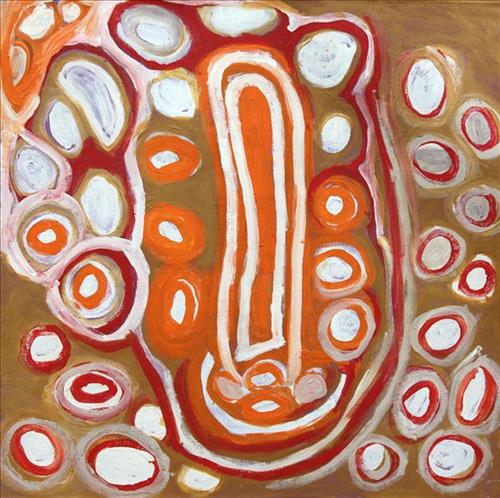
This is Nungabar’s Country- her ‘ngurra’ (home Country, camp). People identify with their ngurra in terms of specific rights and responsibilities, and the possession of intimate knowledge of the physical and cultural properties of one’s Country. Painting ngurra, and in so doing sharing the Jukurrpa (Dreaming) stories and physical characteristics of that place, has today become an important means of cultural maintenance. Nungabar’s ngurra encompasses her birthplace, near Lipuru well (Libral Well, Canning Stock Route Well 37) and the Country that became Wells 33 through to 38 along the Canning Stock Route, where her family walked in the pujiman (traditional, desert-dwelling) era. From an early age Nungabar and her family had encounters with the white men who drove cattle along the route. As a young woman, together with her close friend Nora Wompi, Nungabar followed the drovers north to Balgo Mission, where she settled and raised a family.

Portrayed in this work are features of Nungabar’s family’s ngurra, such as the striking salt lakes, permanent red tali (sandhills), warta (trees, vegetation), and the individually named water sources they camped at. Rock holes, waterholes, soaks and springs were all extremely important sites for Martu people during the pujiman period, and are generally depicted with circular forms. 

The encyclopaedic knowledge of the location, quality and seasonal availability of the hundreds of water bodies found in one’s Country sustained Martu as they travelled across their Country, hunting and gathering, visiting family, and fulfilling ceremonial obligations. They would traverse very large distances annually, visiting specific areas in the dry and wet season depending on the availability of water and the corresponding cycles of plant and animal life on which hunting and gathering bush tucker was reliant. As they travelled and hunted they would also burn areas of Country, generating a greater diversity of plant and animal life.

111576341538


Kunawarritji (Canning Stock Route Well 33)

Kunawarritji is an important site in the Great Sandy Desert where multiple stories and histories intersect. Originally a spring water and major Martu pujiman (traditional, desert dwelling) camping site, at the turn of the 20th century Kunawarritji was converted into a well along the Canning Stock Route. Each year throughout the 1930-50s, the well became a site of contact between the drovers, their cattle, and desert families like Nungabar’s (dec.). Nungabar was born near Lipuru (Libral Well, Canning Stock Route Well 37), north east of Kunawarritji. She grew up in the Country between these sites, and from an early age she and her family had encounters with drovers along the Canning Stock Route.

Long before colonial history entered this Country, however, other stories dominated this site. Primarily, Kunawarritji features in the Minyipuru (Jakulyukulyu, Seven Sisters) Jukurrpa (Dreaming). Minyipuru is a central Jukurrpa narrative for Martu, Ngaanyatjarra, Pitjantjatjara and Yankunytjatjara people that is associated with the seasonal Pleiades star constellation. Beginning in Roebourne on the west coast of Western Australia, the story morphs in its movement eastward across the land, following a group of women as they walk, dance, and even fly from waterhole to waterhole. As they travelled the women left markers in the landscape and create landforms that remain to this day. During the entirety of their journey the women are pursued by a lustful old man, Yurla, although interactions with other animals, groups of men, and spirit beings are also chronicled in the narrative.

The Minyipuru travelled to Kunawarritji from Nyipily (Nyipil, Nibil, Canning Stock Route Well 34), and transformed themselves into a distinctive group of trees that remain in the area between these two sites. From Kunawarritji Yurla followed the sisters to Pangkapirni, where he finally caught one of the women. 

Today, Kunawarritji is a site of return, a place where people came back to continue their life in the desert with the formation of Kunawarritji Aboriginal community in the early 1980s. The community’s cultural significance endures, with the population swelling up to 1000 during cultural business. In her late years Nungabar relocated to her homelands at Kunawarritji, though she continued to travel regularly between Kunawarritji, Balgo and Mulan. Nungabar was a custodian of a great deal of cultural knowledge about the Kunawarritji area, much of which is referred to in her extensive body of work.

111582419427


Punmu

“Punmu, I went there when I was a young girl, a teenager with my mother and father before my mother passed. Big mob of people was there. No building, just little cubby houses [bough shelters]. Long time I been there. 

These here are the waterholes around Punmu; Rawa spring- Rawa means ‘long time’, Tuu-tuu, Jila-jila, Wirlarra and Yilyara. That is my ngurra (home Country, camp). We grew up in Punmu around all these water holes. I still live here with my grandkids, [we share the] same stories for all these places.” 

 – Marianne Burton


Punmu refers to a region and an Aboriginal community within its vicinity, located 670km North-East of Newman. Created during the return to Country movement of the 1980s, with the recognition of Martu land rights and native title, the community was named after a nearby Jukurrpa (Dreaming) story. As described by Marianne, Punmu is her ngurra; she grew up in this region with her parents. 

Punmu community sits on the edge of a large salt lake known as Nyayartakujarra, or Lake Dora. The lake runs south into Karlamilyi River (Rudall River). Surrounding Punmu are numerous fresh water soaks and the red tali (sandhills) typical of the area. The most frequently visited yinta (permanent springs) around Punmu include Wirlarra, Rawa, Yilyara, Jila-jila and Tuu-tuu.

The Country around Punmu features in several Jukurrpa stories. Of particular importance is the story of the Jila Kujarra (Two Snakes), one of the key Jukurrpa narratives for the Martu. Though the story belongs to Warnman people, it is shared across the Western Desert with several other language groups. The narrative centres on the travels of two snakes as they are pursued by the Niminjarra, spiritual ancestors of the Warnman people. 

Before transforming themselves into snakes, the Jila Kujarra were young brothers. As snakes, they began travelling home to their mother, but were intercepted by the Niminjarra, who tracked the Jila Kujarra to Paji, east of Nyayartakujarra (Lake Dora). Though the Jila Kujarra eluded their pursuers here by escaping under the lake at Paji, they were soon after speared and injured by two Pukurti (initiates with bundled hair) at Nyayartakujarra, who returned with the Niminjarra to cook the snakes at the site of Kumpupirntily (Kumpupintily, Lake Disappointment). As the Niminjarra cut down the length of the Jila Kujarra, the snake’s bladders were pierced, causing an explosion of scalding hot urine in which the Niminjarra all perished and became black rocks at the site. The spirits of the Jila Kujarra returned to their mother at Nyayartakujarra, where the mother and her sons entered the ground below Nyayartakujarra and remain to this day.

111582419426


Kulyakartu

“My Country, Kulyakartu. I grew up there, from little boy to big boy grew up there.”

 – Muuki Taylor

This painting depicts Kulyakartu, Muuki’s ngurra (home Country, camp). Kulyakartu is located in the far north of the Martu homelands, near the Percival Lakes region of Western Australia’s Great Sandy Desert. Muuki has extensive knowledge of the Country in this region, where he grew up living traditionally during the pujiman (traditional, desert dwelling) days with his family. Kulyakartu is mostly grass Country where there is very good hunting. In particular parnajarrpa (goanna), wild cats, and lunki (witchetty grub) are found in abundance here. There is no permanent water source in Kulyakartu, so Muuki’s family would walk here annually following the wantajarra (wet season). During the yalijarra (hot, dry season) they would head south again to more permanent water.

Muuki paints Kulyakartu in all its different seasonal stages. Often visible in his work is the patchwork nature of regrowth subsequent to the practice of waru (fire) burning that assists with hunting, regenerates growth, and encourages greater diversity in plant and animal life. This mosaic patterning is aligned with the five distinct Martu cyclical phases of burning and regrowth. First is nyurnma (freshly burnt Country) when Muuki is “making waru”. Following nyurnma are the rains and subsequent waru-waru, when young, bright green plants start to grow. Nyukura occurs between one and three years after burning, when plants have matured and are fruiting and seeding. Manguu is “when him finished”, four to six years post burning, and when spinifex has matured to the point that it can be burned once again. Finally, kunarka signifies the time when spinifex and other plant species have become old growth, and pose a risk of destructive bushfires.

111582419425


Mungili

“No one goes there and sees that landscape. Only two, Mr and Mrs [refers to footsteps in painting]. They was walking to see if the water was in there. Walking on the creek sand, they see the colours and walk down to the water hole and dig where the waters been left. Dig the creek sand where there is still water. Little huts where they sit; move when it dries out. Leave remembrance behind. When the water fills up again; come back.

When the creek sand is still moist you can see the colours. You can see many colours – lovely colours come out. I do that in my mind [when painting], go and think about the rock colours there.

Different plants, water runs, and different plants are growing, different seeds. When it rains, all year round, when its overflowing. It’s all connected. The orange sand connects to one waterhole full of water, then flowing through the creek sand. This side down [pointing to one rock hole]; and it’s a bit up [pointing to another rock hole].

I was swimming there. Yeah, we go visit them a long time [ago]. We drink it, rainwater from the rain. Big waterhole. It’s a fresh water, when the rain comes, fills it up. One for swimming and another rock hole for drinking. 3 rock holes; another is special.”

– Marlene Anderson

In this work Marlene depicts a waterhole and rock hole located in Mungili, the small outstation community located just off the Eagle Highway in Western Australia, approximately 430 kilometres northeast of Wiluna and 250 kilometres north of Warburton. Marlene grew up in Mungili, and as such it forms a significant part of her ‘ngurra’ (home Country, camp). Typically Marlene depicts this site with a central large circular form that represents the main waterhole, surrounded by smaller circular forms representing satellite water bodies.

During the pujiman (traditional, desert dwelling) period, knowledge of water sources was critical for survival, and today Martu Country is still defined in terms of the location and type of water. Each of the hundreds of claypans, rockholes, waterholes, soaks and springs found in the Martu desert homelands is known through real life experience and the recounting of Jukurrpa (Dreaming) narratives by name, location, quality and seasonal availability. This encyclopedic knowledge extends even to the nature and movement of arterial waterways, and sustained Martu as they travelled across their Country, hunting and gathering, visiting family, and fulfilling ceremonial obligations. They would traverse very large distances annually, visiting specific areas in the dry and wet season depending on the availability of water and the corresponding cycles of plant and animal life on which hunting and gathering bush tucker was reliant.

111582419933


Wanti Yuu

“Wanti Yuu (Woman Yeah!) is a story of resilience and of women coming together. It is about the strength of the women in our community who put themselves last and take on a lot. She [Wanti Yuu] is someone who looks after her family, putting the grand kids and everyone around her first. The word Matriarch comes to mind. They are the matriarch of the family. The Boss Lady. Always helping everyone else out and leaving herself to the end. She paints, she teaches us her knowledge, like basket weaving and honey ant collecting. She is the top lore woman and her story of Pujiman (traditional, desert dwelling) is so important. She is a leader of the Martu women and a senior artist. That’s all I can say about these women. These women; you give her the bread if you know what I mean. It’s a true story. Anything in my pockets. Because when you look at her, her stance, her energy and her vibe, you can feel it. You don’t muck around with Wanti Yuu.”

-Silvia Wilson

Wanti Yuu celebrates women’s resilience, matriarchal relationships, and Sylvia’s place in this story.

As Sylvia explains, the work is both a depiction of, and attribute to, the women in her life. “I follow my great grandmother’s guidance and direction in life. These women in my life carry so much on their shoulders, as well as the responsibility and future of our culture.”


111582419932


Punmu

“Punmu, I went there when I was a young girl, a teenager with my mother and father before my mother passed. Big mob of people was there. No building, just little cubby houses [bough shelters]. Long time I been there. 

These here are the waterholes around Punmu; Rawa spring- Rawa means ‘long time’, Tuu-tuu, Jila-jila, Wirlarra and Yilyara. That is my ngurra (home Country, camp). We grew up in Punmu around all these water holes. I still live here with my grandkids, [we share the] same stories for all these places.” 

 – Marianne Burton


Punmu refers to a region and an Aboriginal community within its vicinity, located 670km North-East of Newman. Created during the return to Country movement of the 1980s, with the recognition of Martu land rights and native title, the community was named after a nearby Jukurrpa (Dreaming) story. As described by Marianne, Punmu is her ngurra; she grew up in this region with her parents. 

Punmu community sits on the edge of a large salt lake known as Nyayartakujarra, or Lake Dora. The lake runs south into Karlamilyi River (Rudall River). Surrounding Punmu are numerous fresh water soaks and the red tali (sandhills) typical of the area. The most frequently visited yinta (permanent springs) around Punmu include Wirlarra, Rawa, Yilyara, Jila-jila and Tuu-tuu.

The Country around Punmu features in several Jukurrpa stories. Of particular importance is the story of the Jila Kujarra (Two Snakes), one of the key Jukurrpa narratives for the Martu. Though the story belongs to Warnman people, it is shared across the Western Desert with several other language groups. The narrative centres on the travels of two snakes as they are pursued by the Niminjarra, spiritual ancestors of the Warnman people. 

Before transforming themselves into snakes, the Jila Kujarra were young brothers. As snakes, they began travelling home to their mother, but were intercepted by the Niminjarra, who tracked the Jila Kujarra to Paji, east of Nyayartakujarra (Lake Dora). Though the Jila Kujarra eluded their pursuers here by escaping under the lake at Paji, they were soon after speared and injured by two Pukurti (initiates with bundled hair) at Nyayartakujarra, who returned with the Niminjarra to cook the snakes at the site of Kumpupirntily (Kumpupintily, Lake Disappointment). As the Niminjarra cut down the length of the Jila Kujarra, the snake’s bladders were pierced, causing an explosion of scalding hot urine in which the Niminjarra all perished and became black rocks at the site. The spirits of the Jila Kujarra returned to their mother at Nyayartakujarra, where the mother and her sons entered the ground below Nyayartakujarra and remain to this day.

111582419928


Mungili

“No one goes there and sees that landscape. Only two, Mr and Mrs [refers to footsteps in painting]. They was walking to see if the water was in there. Walking on the creek sand, they see the colours and walk down to the water hole and dig where the waters been left. Dig the creek sand where there is still water. Little huts where they sit; move when it dries out. Leave remembrance behind. When the water fills up again; come back.

When the creek sand is still moist you can see the colours. You can see many colours – lovely colours come out. I do that in my mind [when painting], go and think about the rock colours there.

Different plants, water runs, and different plants are growing, different seeds. When it rains, all year round, when its overflowing. It’s all connected. The orange sand connects to one waterhole full of water, then flowing through the creek sand. This side down [pointing to one rock hole]; and it’s a bit up [pointing to another rock hole].

I was swimming there. Yeah, we go visit them a long time [ago]. We drink it, rainwater from the rain. Big waterhole. It’s a fresh water, when the rain comes, fills it up. One for swimming and another rock hole for drinking. 3 rock holes; another is special.”

– Marlene Anderson

In this work Marlene depicts a waterhole and rock hole located in Mungili, the small outstation community located just off the Eagle Highway in Western Australia, approximately 430 kilometres northeast of Wiluna and 250 kilometres north of Warburton. Marlene grew up in Mungili, and as such it forms a significant part of her ‘ngurra’ (home Country, camp). Typically Marlene depicts this site with a central large circular form that represents the main waterhole, surrounded by smaller circular forms representing satellite water bodies.

During the pujiman (traditional, desert dwelling) period, knowledge of water sources was critical for survival, and today Martu Country is still defined in terms of the location and type of water. Each of the hundreds of claypans, rockholes, waterholes, soaks and springs found in the Martu desert homelands is known through real life experience and the recounting of Jukurrpa (Dreaming) narratives by name, location, quality and seasonal availability. This encyclopedic knowledge extends even to the nature and movement of arterial waterways, and sustained Martu as they travelled across their Country, hunting and gathering, visiting family, and fulfilling ceremonial obligations. They would traverse very large distances annually, visiting specific areas in the dry and wet season depending on the availability of water and the corresponding cycles of plant and animal life on which hunting and gathering bush tucker was reliant.

111582419920


Wantili

“Wantili (Warntili, Canning Stock Route Well 25) area, close to Parnngurr. My ngurra (home Country, camp), my jamu’s (grandfather’s) Country, my father’s daddy, Jakayu [Biljabu’s] daddy and my daddy’s Country. Jakayu been bury her father there. In pujiman (traditional, desert dwelling) days, my family and Jakayu’s family been walking round there together. Big sandhills here. Sandhill, sandhill, sandhill everywhere. Claypan there, in the middle. Good place for swimming and drinking, for hunting little kangaroo. When no water [we would] go to [the adjacent Canning Stock Route] well. When there [was] rain we stay there at Wantili. Everywhere, we been walking everywhere.       

Near to Wantili, road [Canning Stock Route] going kayili (north). Long time [ago] only horses and cattle [travelled along that road], going Meekatharra and back in the cold time, gone right up to GJ (Georgia) Bore. Half way, when he see water at Wantili, that mob would camp one night, bullock eating all the grass and men’s drinking water. One Martu been working with that mob, droving bullock. Every time he been give us meat, all the pujimanpa (desert dwellers).”

– Ngamaru Bidu


Wantili is a large round jurnu (soak) and linyji (claypan) near Well 25 on the Canning Stock Route. The Wantili region is dominated by claypans surrounded by tuwa (sandhills), and Nyilangkurr, a prominent yapu (hill) is located close to the eastern edge of the claypan. Following rain the typically dry claypans are filled with water, with the overflow from nearby waterholes flowing to Wantili. At that time, Wantili becomes an important place for obtaining fresh water for drinking and bathing. Wantili is significant for the fact that at this site Kartujarra, Manyjilyjarra, Putijarra and Warnman people would all come together for ceremonies during the pujiman era. Many jiwa (stones used by women for grinding seeds) from these times, including those used by Ngamaru’s family, can still be found there today.

Wantili lies within Ngamaru’s ngurra (home Country, camp) through her grandfather and father. As described in her account, Wantili was one of the sites Ngamaru knew intimately and travelled extensively with her family and other family groups, such as the Biljabu family. During the pujiman period Martu would traverse very large distances annually, moving seasonally from water source to water source, and hunting and gathering bush tucker as they went. Knowledge of water sources was critical for survival, and today Martu Country is still defined in terms of the location and type of water. 

As Ngamaru recounts, Wantili also held significance for her as a site of contact between her family and kartiya (white people); drovers with their cattle travelling along the Canning Stock Route. The establishment of the route by Alfred Canning and his team in 1910 resulted in first contact with Europeans for many Martu, including Ngamaru and her family. Increasingly, Martu followed the route to newly established ration depots, mission and pastoral stations. They were drawn to the route in search of food, by a sense of curiosity, or by loneliness. By the late 1950s and early 1960s, most of the desert family groups had left the desert. Eventually, these factors combined with an extreme and prolonged drought in the 1960s to prompt the few remaining pujimanpa to move in from the desert. 

Culturally, Wantili is an incredibly important site in two central Jukurrpa (Dreaming) stories. The first relates to the world’s creation. In this narrative, the world was initially dark, and people were like rocks, with no arms or legs. Following the sun’s first rising, life-forms become increasingly complex while particular features in the land are created. Beyond these details much of the narrative is ngurlu (sacred, taboo), and only for Martu, but the site is open, and anyone can go there. 

Wantili is also one of the many sites featured in the epic Minyipuru (Jakulyukulyu, Seven Sisters) Jukurrpa story. Minyipuru is a central Jukurrpa narrative for Martu, Ngaanyatjarra, Pitjantjatjara and Yankunytjatjara people that is associated with the seasonal Pleiades star constellation. Relayed in song, dance, stories and paintings, Minyipuru serves as a creation narrative, a source of information relating to the physical properties of the land, and an embodiment of Aboriginal cultural laws. The story follows the movement of a group of women travelling all the way across the desert, beginning at Roebourne on the coast of Western Australia, as they are pursued by Yurla, a lustful old man. As the women travelled, they stopped to rest at many sites to eat, dance, rest and sing, on the way leaving behind an assortment of articles that became formations in the land, such as groupings of rocks and trees, grinding stones and seeds. The sisters rested at Wantili before throwing seeds, then continued their journey far to the east and beyond Martu Country, stopping at various sites through central and South Australia.