111582175526


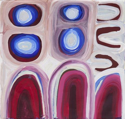
Tuwa (sandhills) in Puntawarri

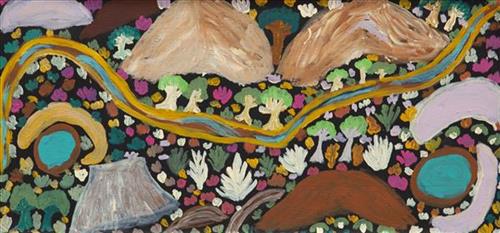
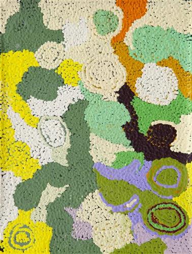
“I do tuwa (sandhill) in my own style because that’s our Country. That’s a sandhill, that’s the Dreaming- the Jukurrpa. That’s our culture.

They stay there and we go through the sandhills at Puntawarri in the car. We go first tuwa, then the second tuwa, looking for the waterholes. Go up, up, up- ‘nother tuwa, ‘nother tuwa.

Long time [ago] in Puntawarri, when I was a little girl [with] my Nana and Pop [Dadda Samson and Yanjimi Peter Rowlands] we went climbing up the sandhill. And when I went up my Nana and Pop were at the bottom under a tree and I came down running then rolling, rolling right down to the ground! But I was ok- he right!”

– Judith Anya Samson

Puntawarri is an important cultural area located on the middle stretches of the Canning Stock Route and east of the Jigalong Mission (now Jigalong Aboriginal community), where Anya grew up with her grandmother and renowned Martumili Artist, Dadda Samson (dec.). Puntawarri is also the site of an abandoned community, a waterhole, creek and lake. Puntawarri’s close proximity to Jigalong Mission made it a popular site for Martu to visit during the ‘mission days’. While growing up at Jigalong Mission in the 1960’s, Dadda would return to Puntawarri every weekend to hunt and camp. 

For many Martu, like Anya’s family, Jigalong Mission was the site where their pujiman (traditional, desert dwelling) lifestyle came to an end from the late 1940s as they transitioned to a life as stockmen and women working in cattle stations in the Pilbara region and beyond. In the wake of the extreme and prolonged drought of the 1960s, the last of the remaining pujimanpa (desert dwellers) were forced to move to missions like Jigalong, where a supply of food and water was assured. There, many Martu were reunited with family members that had already moved in from the desert.

The traditional lands of the Martu people encompass the Great Sandy Desert and Rudall River regions of Western Australia, an enormous tract dominated by distinctive red tali, or tuwa (sandhills). These sandhills present an unforgiving landscape; sparse vegetation covers a seemingly never ending expanse of dunes, and yet these lands and the location of resources within them was known intimately by its pujiman inhabitants.


111582175525


Karlamilyi

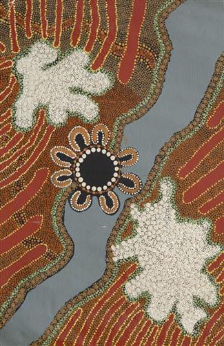
Karlamilyi (Rudall River region) and its surrounds are Warnman Country, located in the very heart of the Martu homelands. The region is situated southwest of the Great Sandy Desert and northeast of the Little Sandy Desert. Spanning through the region is the epic Karlamilyi River, which runs north into Nyayartakujarra (Ngayarta Kujarra, Lake Dora), a large salt lake. The Broadhurst and Fingoon Ranges extend diagonally across the river’s path. The landscape is striking for its abundance of gorges and valleys carved by ice age glaciers, rugged cliffs, red tali (sand dunes), grasslands, sandstone and quartz rocky outcrops, and salt lakes. 

Across the whole region are hundreds of water sources; including waterholes, creeks, soaks, lakes, pools and rockholes. Lining the rivers are coolabah, walyji (river gum), yulbah (bats wing coral tree), and several species of acacia and hakea. Jalkuran (paperbark), kurrulyu/ mijarrpa (bloodwood) and jawirli (quandong) are found in the region’s valleys, and wikirrpa (desert oaks) and grasses in the sandplains. The area is abundant with bird species, jila (snakes), maruntu (goannas), red kangaroos and warlpaju (rock wallabies). The region is also home to remote aboriginal communities Punmu and Parnngurr.

According to two of the central Martu Jukurrpa (Dreaming) narratives, the Karlamilyi River and its surrounds were created by the ancestral beings Jila Kujarra (Two Snakes) and the Wati Kujarra (Two Goanna Men) as they travelled across the lands.

111582175524


Karlamilyi

Karlamilyi (Rudall River region) and its surrounds are Warnman Country, located in the very heart of the Martu homelands. The region is situated southwest of the Great Sandy Desert and northeast of the Little Sandy Desert. Spanning through the region is the epic Karlamilyi River, which runs north into Nyayartakujarra (Ngayarta Kujarra, Lake Dora), a large salt lake. The Broadhurst and Fingoon Ranges extend diagonally across the river’s path. The landscape is striking for its abundance of gorges and valleys carved by ice age glaciers, rugged cliffs, red tali (sand dunes), grasslands, sandstone and quartz rocky outcrops, and salt lakes. 

Across the whole region are hundreds of water sources; including waterholes, creeks, soaks, lakes, pools and rockholes. Lining the rivers are coolabah, walyji (river gum), yulbah (bats wing coral tree), and several species of acacia and hakea. Jalkuran (paperbark), kurrulyu/ mijarrpa (bloodwood) and jawirli (quandong) are found in the region’s valleys, and wikirrpa (desert oaks) and grasses in the sandplains. The area is abundant with bird species, jila (snakes), maruntu (goannas), red kangaroos and warlpaju (rock wallabies). The region is also home to remote aboriginal communities Punmu and Parnngurr.

According to two of the central Martu Jukurrpa (Dreaming) narratives, the Karlamilyi River and its surrounds were created by the ancestral beings Jila Kujarra (Two Snakes) and the Wati Kujarra (Two Goanna Men) as they travelled across the lands.

111582175523


Bush Medicine

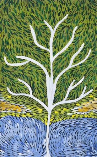
Traditional Martu knowledge of plant properties was encyclopedic, and saw plants used for purposes as diverse as food resources, carving implements, tobacco, firewood, shelter construction, and bush medicines. Depicted in this work are types of bush medicines, their habitats, and the processes used in their preparation. 

Physical ailments treated with plant based poltices, body washes, drinks, rubs and pastes included fever, congestion, headache, skin sores, aching limbs, and digestive problems. More serious health issues were often treated with a combination of bush medicine and maparn (magic healing/ healer).

Plants still prepared to make bush medicines today include warlji (desert bloodwood), kalpari (Dysphania Kalpari) and nayju (green crumbweed), which can be soaked in a water solution to make a skin wash. One of the most popular types of bush medicine still used today is wanta (red sap), collected from the mijarrpa (bloodwood) tree and brewed as a tea to ease heart pains and other body aches.

111582175504


Rawa

Rawa is a soak and spring located along the eastern edge of the large salt lake, Nyayartakujarra (Lake Dora), and at the western edge of Punmu Aboriginal community, 670km northeast of Newman. Surrounding Rawa are numerous fresh water soaks and the permanent red tali (sandhills) typical of the area. 

During the pujiman (traditional, desert dwelling) period, Martu would traverse very large distances annually in small family groups, moving seasonally from water source to water source, and hunting and gathering bush tucker as they went. At this time knowledge of water sources was critical for survival, and today Martu Country is still defined in terms of the location and type of water. Each of the hundreds of claypans, rockholes, waterholes, soaks and springs found in the Martu desert homelands is known by name, location, quality and seasonal availability through real life experience and the recounting of Jukurrpa (Dreaming) narratives.

Rawa features as a resting place for the Minyipuru (Jakulyukulyu, Seven Sisters) during the Jukurrpa period. Minyipuru is a central Jukurrpa narrative for Martu, Ngaanyatjarra, Pitjantjatjara and Yankunytjatjara people that is associated with the seasonal Pleiades star constellation. Relayed in song, dance, stories and paintings, Minyipuru serves as a creation narrative, a source of information relating to the physical properties of the land, and an embodiment of Aboriginal cultural laws. Beginning in Roebourne on the west coast of Western Australia, the story morphs in its movement eastward across the land, following the women as they walk, dance, and even fly from waterhole to waterhole. As they travel the women camp, sing, wash, dance and gather food, leaving markers in the landscape and creating landforms that remain to this day, such as groupings of rocks and trees, grinding stones and seeds. During the entirety of their journey the women are pursued by a lustful old man, Yurla, although interactions with other animals, groups of men, and spirit beings are also chronicled in the narrative.

111582175503


Untitled

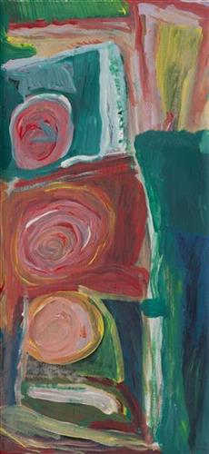
This is Wurta Amy French’s Country- her ‘ngurra’ (home Country, camp). People identify with their ngurra in terms of specific rights and responsibilities, and the possession of intimate knowledge of the physical and cultural properties of one’s Country. Painting ngurra, and in so doing sharing the Jukurrpa (Dreaming) stories and physical characteristics of that place, has today become an important means of cultural maintenance. 

Wurta’s ngurra encompasses the Country that she and her family walked in the pujiman (traditional, desert-dwelling) era. At this time Wurta travelled nomadically with her own and other family groups. The Country they traversed encompassed an enormous tract of land, all around the Karlamily (Rudall River) region and through to Tiwa (Canning Stock Route Well 26) .

Wurta was born at Wantili (Warntili, Canning Stock Route Well 25). She grew up, walked and hunted primarily around water sources Pangkartal, Yalpalpa, Walirrlirri, Yanytikuji, Wartararra, Tintinmarran, Pimurlu, Raarki (Canning Stock Route Well 27), and Tiwa. Her family continued to live nomadically before eventually deciding to move to Jigalong Mission along with many other relatives following an extreme and prolonged drought in the 1960s. 

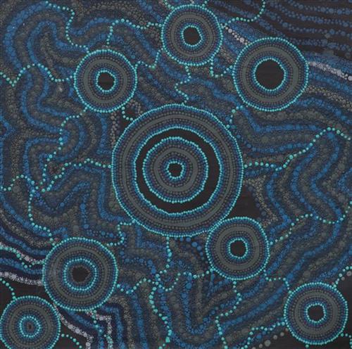
Portrayed in this work are features of Wurta’s ngurra, such as the hills, gorges and valleys, warta (trees, vegetation), and the individually named water sources she and her family camped at. Rock holes, waterholes, soaks and springs were all extremely important sites for Martu people during the pujiman period, and are generally depicted with circular forms. 

The encyclopaedic knowledge of the location, quality and seasonal availability of the hundreds of water bodies found in one’s Country sustained Martu as they travelled across their Country, hunting and gathering, visiting family, and fulfilling ceremonial obligations. They would traverse very large distances annually, visiting specific areas in the dry and wet season depending on the availability of water and the corresponding cycles of plant and animal life on which hunting and gathering bush tucker was reliant. As they travelled and hunted they would also burn areas of Country, generating a greater diversity of plant and animal life.

111582175501


Untitled

The traditional lands of the Martu people encompass the Great Sandy Desert and Rudall River regions of Western Australia, and include speakers of Manyjilyjarra, Warnman, Kartujarra, Putijarra and Martu Wangka languages. Martumili Artists work in the Newman based gallery and studio spaces, as well as within remote Aboriginal communities Punmu, Parnngurr, Kunawarritji, Jigalong, Irrungadji (Nullagine), and Warralong. Recognised for their diverse, energetic and unmediated painting styles, their works reflect the dramatic geography and scale of their homelands. The artists are predominantly painters, working in acrylics and oils, though many also weave baskets from gathered grasses and wool. Popular mediums among younger Martu artists include photography and animation. The group proudly maintain their creative practices whilst pursuing social and cultural obligations across the Martu homelands.

111582175499


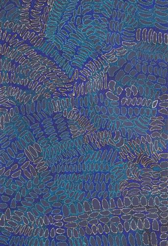
Bush Medicine

“I used to walk around Patjarr with my grandmother collecting bush medicine.  We would grab the leaves, the roots, make a fire and boil it up in a big pot.  Then we would put it in a little container, you rub it on when you are sick.  Helps with boils, scabies, wounds, cold sick.  Good for everything, you can drink it too. This one is called Warlparriny.”

 – Mary Larry 

Traditional Martu knowledge of plant properties was encyclopedic, and saw plants used for purposes as diverse as food resources, carving implements, tobacco, firewood, shelter construction, and bush medicines. Depicted in this work are types of bush medicines, their habitats, and the processes used in their preparation. 

Physical ailments treated with plant based poltices, body washes, drinks, rubs and pastes included fever, congestion, headache, skin sores, aching limbs, and digestive problems. More serious health issues were often treated with a combination of bush medicine and maparn (magic healing/ healer).

Plants still prepared to make bush medicines today include warlji (desert bloodwood), kalpari (Dysphania Kalpari) and nayju (green crumbweed), which can be soaked in a water solution to make a skin wash. One of the most popular types of bush medicine still used today is wanta (red sap), collected from the mijarrpa (bloodwood) tree and brewed as a tea to ease heart pains and other body aches.

111582175497


Punmu Waterholes

Punmu refers to a region and an Aboriginal community within its vicinity, located 670km North-East of Newman. Created during the return to Country movement of the 1980s, with the recognition of Martu land rights and native title, the community was named after a nearby Jukurrpa (Dreaming) story.

Punmu community sits on the edge of a large salt lake known as Nyayartakujarra, or Lake Dora. The lake runs south into Karlamilyi River (Rudall River). Surrounding Punmu are numerous fresh water soaks and the red tali (sandhills) typical of the area. The most frequently visited water sources around Punmu include Wirlarra, Rawa, Yilyara, Jila-jila, Tuu-tuu, Pirrkili, Jurnu, Wilurr, and Wala- Wala. Further south are Juturrpa, Wawul, and Tarl. 

During the pujiman (traditional, desert dwelling) period, Martu would traverse very large distances annually in small family groups, moving seasonally from water source to water source, and hunting and gathering bush tucker as they went. At this time knowledge of water sources was critical for survival, and today Martu Country is still defined in terms of the location and type of water. Each of the hundreds of claypans, rockholes, waterholes, soaks and springs found in the Martu desert homelands is known by name, location, quality and seasonal availability through real life experience and the recounting of Jukurrpa narratives.

111582175496


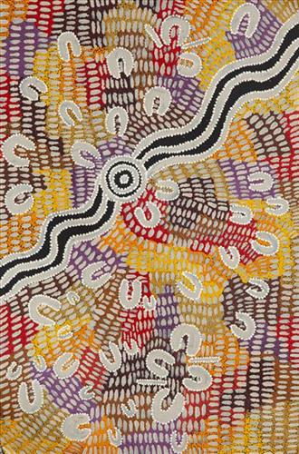
Wantili (Warntili, Canning Stock Route Well 25)

“Wantili (Warntili, Canning Stock Route Well 25) area, close to Parnngurr. My ngurra (home Country, camp), my jamu’s (grandfather’s) Country, my father’s daddy, Jakayu [Biljabu’s] daddy and my daddy’s Country. Jakayu been bury her father there. In pujiman (traditional, desert dwelling) days, my family and Jakayu’s family been walking round there together. Big sandhills here. Sandhill, sandhill, sandhill everywhere. Claypan there, in the middle. Good place for swimming and drinking, for hunting little kangaroo. When no water [we would] go to [the adjacent Canning Stock Route] well. When there [was] rain we stay there at Wantili. Everywhere, we been walking everywhere.       

Near to Wantili, road [Canning Stock Route] going kayili (north). Long time [ago] only horses and cattle [travelled along that road], going Meekatharra and back in the cold time, gone right up to GJ (Georgia) Bore. Half way, when he see water at Wantili, that mob would camp one night, bullock eating all the grass and men’s drinking water. One Martu been working with that mob, droving bullock. Every time he been give us meat, all the pujimanpa (desert dwellers).”

– Ngamaru Bidu


Wantili is a large round jurnu (soak) and linyji (claypan) near Well 25 on the Canning Stock Route. The Wantili region is dominated by claypans surrounded by tuwa (sandhills), and Nyilangkurr, a prominent yapu (hill) is located close to the eastern edge of the claypan. Following rain the typically dry claypans are filled with water, with the overflow from nearby waterholes flowing to Wantili. At that time, Wantili becomes an important place for obtaining fresh water for drinking and bathing. Wantili is significant for the fact that at this site Kartujarra, Manyjilyjarra, Putijarra and Warnman people would all come together for ceremonies during the pujiman era. Many jiwa (stones used by women for grinding seeds) from these times, including those used by Ngamaru’s family, can still be found there today.

Wantili lies within Ngamaru’s ngurra (home Country, camp) through her grandfather and father. As described in her account, Wantili was one of the sites Ngamaru knew intimately and travelled extensively with her family and other family groups, such as the Biljabu family. During the pujiman period Martu would traverse very large distances annually, moving seasonally from water source to water source, and hunting and gathering bush tucker as they went. Knowledge of water sources was critical for survival, and today Martu Country is still defined in terms of the location and type of water. 

As Ngamaru recounts, Wantili also held significance for her as a site of contact between her family and kartiya (white people); drovers with their cattle travelling along the Canning Stock Route. The establishment of the route by Alfred Canning and his team in 1910 resulted in first contact with Europeans for many Martu, including Ngamaru and her family. Increasingly, Martu followed the route to newly established ration depots, mission and pastoral stations. They were drawn to the route in search of food, by a sense of curiosity, or by loneliness. By the late 1950s and early 1960s, most of the desert family groups had left the desert. Eventually, these factors combined with an extreme and prolonged drought in the 1960s to prompt the few remaining pujimanpa to move in from the desert. 

Culturally, Wantili is an incredibly important site in two central Jukurrpa (Dreaming) stories. The first relates to the world’s creation. In this narrative, the world was initially dark, and people were like rocks, with no arms or legs. Following the sun’s first rising, life-forms become increasingly complex while particular features in the land are created. Beyond these details much of the narrative is ngurlu (sacred, taboo), and only for Martu, but the site is open, and anyone can go there. 

Wantili is also one of the many sites featured in the epic Minyipuru (Jakulyukulyu, Seven Sisters) Jukurrpa story. Minyipuru is a central Jukurrpa narrative for Martu, Ngaanyatjarra, Pitjantjatjara and Yankunytjatjara people that is associated with the seasonal Pleiades star constellation. Relayed in song, dance, stories and paintings, Minyipuru serves as a creation narrative, a source of information relating to the physical properties of the land, and an embodiment of Aboriginal cultural laws. The story follows the movement of a group of women travelling all the way across the desert, beginning at Roebourne on the coast of Western Australia, as they are pursued by Yurla, a lustful old man. As the women travelled, they stopped to rest at many sites to eat, dance, rest and sing, on the way leaving behind an assortment of articles that became formations in the land, such as groupings of rocks and trees, grinding stones and seeds. The sisters rested at Wantili before throwing seeds, then continued their journey far to the east and beyond Martu Country, stopping at various sites through central and South Australia.