
222082249809

Auntys In The Studio
Auntys in the studio on a Thursday are the best day of the week
116482249802
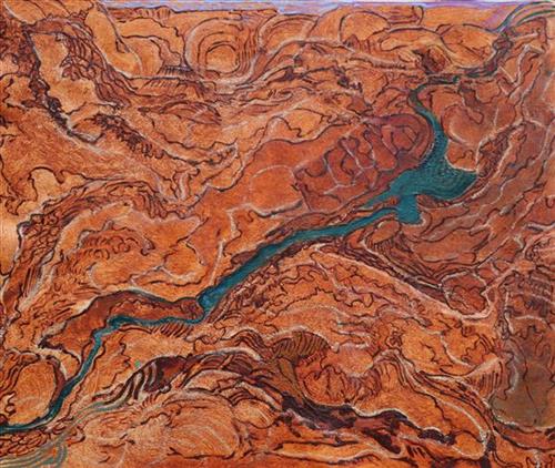
Rugged Country Table Land
In the early years living out on country our ancestors walked freely from one place to another, always visiting families nearby. They knew where to go and never lost direction or place. Once our country was so rugged hills and valleys with hidden pools lay far away. Caves were used for shelter during cyclones and big rains and still lay untouched by those who walk the land. As we continue our journey we see caves but never enter because of our culture and respect not to enter or go anywhere near. Just left are the stories and memories that was tell to our children.
116482246007
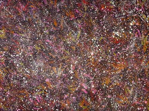
Autumn Colours
This painting represents the colours of the leaves during the autumn season. The leaves tend to lose their green color and turn into beautiful purples and oranges. Melissa has used eucalyptus leaves to print on her work before using her signature style over the top.
115682248934
Dhawurr/batjbarra fish trap
Fish traps are placed into the river to face the oncoming fish. The woven tunnel traps the fish and prevents their escape. The traps are tapered so when they are submerged in the water, the water pressure wedges them into place. Traditionally, the fish traps are operated at night time.
115682248933
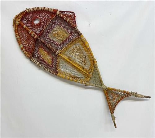
fish
115682248932
Nawarlah (Brown River Stingray)
Aboriginal art in Ramingining, Central Arnhem Land is commonly illustrated through designs and images of animals, plants, and landscape. These motifs commonly reflect the artists ancestral inheritance and their dreamings and are referred to as totems.
For this, Serena has woven a stingray.
115682248930
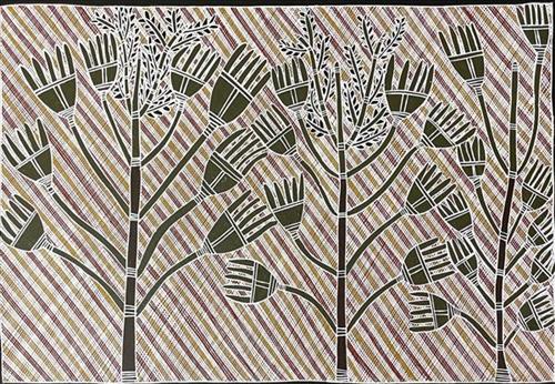
Wurrutjara (Sand Palm)
Seen in and around Ramingining, the sand palm is a small, slender palm, growing to about 7 m tall. It is fire tolerant and usually grows in environments where it is exposed to frequent fires. Aboriginal people use this palm as the fruits are edible and the heart can be eaten, either raw or roasted. The core of the stem is pounded and made into a drink which was used to treat coughs, colds, chest infections, diarrhoea, and tuberculosis.
111582248950
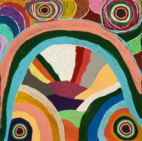
Tuwa (sandhills) in Puntawarri
“I do tuwa (sandhill) in my own style because that’s our Country. That’s a sandhill, that’s the Dreaming- the Jukurrpa. That’s our culture.
They stay there and we go through the sandhills at Puntawarri in the car. We go first tuwa, then the second tuwa, looking for the waterholes. Go up, up, up- ‘nother tuwa, ‘nother tuwa.
Long time [ago] in Puntawarri, when I was a little girl [with] my Nana and Pop [Dadda Samson and Yanjimi Peter Rowlands] we went climbing up the sandhill. And when I went up my Nana and Pop were at the bottom under a tree and I came down running then rolling, rolling right down to the ground! But I was ok- he right!”
– Judith Anya Samson
Puntawarri is an important cultural area located on the middle stretches of the Canning Stock Route and east of the Jigalong Mission (now Jigalong Aboriginal community), where Anya grew up with her grandmother and renowned Martumili Artist, Dadda Samson (dec.). Puntawarri is also the site of an abandoned community, a waterhole, creek and lake. Puntawarri’s close proximity to Jigalong Mission made it a popular site for Martu to visit during the ‘mission days’. While growing up at Jigalong Mission in the 1960’s, Dadda would return to Puntawarri every weekend to hunt and camp.
For many Martu, like Anya’s family, Jigalong Mission was the site where their pujiman (traditional, desert dwelling) lifestyle came to an end from the late 1940s as they transitioned to a life as stockmen and women working in cattle stations in the Pilbara region and beyond. In the wake of the extreme and prolonged drought of the 1960s, the last of the remaining pujimanpa (desert dwellers) were forced to move to missions like Jigalong, where a supply of food and water was assured. There, many Martu were reunited with family members that had already moved in from the desert.
The traditional lands of the Martu people encompass the Great Sandy Desert and Rudall River regions of Western Australia, an enormous tract dominated by distinctive red tali, or tuwa (sandhills). These sandhills present an unforgiving landscape; sparse vegetation covers a seemingly never ending expanse of dunes, and yet these lands and the location of resources within them was known intimately by its pujiman inhabitants.
116482249285
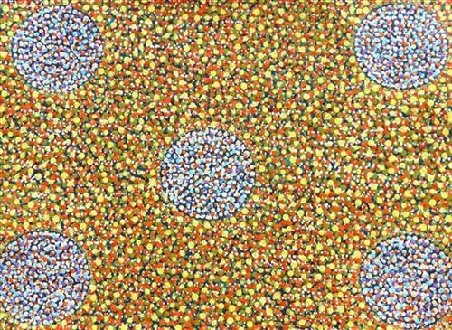
Wild Flowers in Full Bloom
Pilbara wildflowers are beautiful, especially when they are in full bloom. Going out bush at this time of the year is always a treat . To be able to gaze at the colours always gives me inspiration for my paintings.