111582280692


Parnngurr

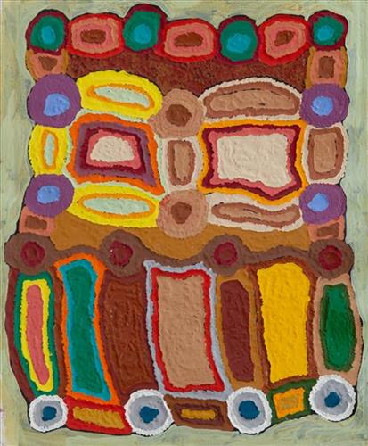
Parnngurr rockhole is located just south of Parnngurr Aboriginal community. At the junction of three linguistic groups; Manyjilyjarra, Kartujarra, and Warnman, it was a critical and permanent source of water during the pujiman (traditional, desert born) era that supported many ritual large gatherings. During this nomadic period families stopped and camped here depending on the seasonal availability of water and the corresponding cycles of plant and animal life on which hunting and gathering bush tucker was reliant. At Parnngurr and other similarly important camp sites families would meet for a time before moving to their next destination. Parnngurr and its surrounds are physically dominated by distinctively red tali (sandhills), covered sparingly with spinifex and low lying shrub. Parnngurr forms part of Betty’s ngurra (home Country, camp) through her parents and through renowned fellow Martumili Artist and aunt Bugai Whyoulter. 

Parnngurr Aboriginal community was created during the return to Country movement of the 1980s, and named after Parnngurr rockhole, its original primary water source. However, until recently the community was widely known as Cotton Creek, after the European name for the ephemeral creek running alongside the community. 

Parnngurr is an important site chronicled in the epic Jukurrpa (Dreaming) story of the Minyipuru (Jakulyukulyu, Seven Sisters). The sisters stopped to rest on Parnngurr Hill before continuing on their long journey east. Minyipuru is a central Jukurrpa narrative for Martu, Ngaanyatjarra, Pitjantjatjara and Yankunytjatjara people that is associated with the seasonal Pleiades star constellation. Relayed in song, dance, stories and paintings, Minyipuru serves as a creation narrative, a source of information relating to the physical properties of the land, and an embodiment of Aboriginal cultural laws. Beginning in Roebourne on the west coast of Western Australia, the story morphs in its movement eastward across the land, following the women as they walk, dance, and even fly from waterhole to waterhole. As they travel the women camp, sing, wash, dance and gather food, leaving markers in the landscape and creating landforms that remain to this day, such as groupings of rocks and trees, grinding stones and seeds. During the entirety of their journey the women are pursued by a lustful old man, Yurla, although interactions with other animals, groups of men, and spirit beings are also chronicled in the narrative. 

For many Martu, Parnngurr also signifies the location at which their nomadic bush life came to an end. It was here that a group of 29 Martu were picked up by the Native Welfare Department to be taken to Jigalong Mission in 1963. Collectively the group had come to the decision to move to the mission as a result of an extended drought, which had caused a scarcity in food and water resources. The group also wanted to join their families, who had already moved to Jigalong. Among them were Martumili artists Jakayu Biljabu, Kumpaya Girgirba, Bugai Whyoulter and Ngamaru Bidu.

111582280691


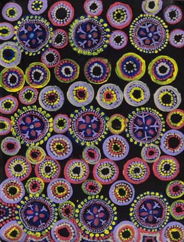
Parnngurr

Parnngurr rockhole is located just south of Parnngurr Aboriginal community. At the junction of three linguistic groups; Manyjilyjarra, Kartujarra, and Warnman, it was a critical and permanent source of water during the pujiman (traditional, desert born) era that supported many ritual large gatherings. During this nomadic period families stopped and camped here depending on the seasonal availability of water and the corresponding cycles of plant and animal life on which hunting and gathering bush tucker was reliant. At Parnngurr and other similarly important camp sites families would meet for a time before moving to their next destination. Parnngurr and its surrounds are physically dominated by distinctively red tali (sandhills), covered sparingly with spinifex and low lying shrub. Parnngurr forms part of Betty’s ngurra (home Country, camp) through her parents and through renowned fellow Martumili Artist and aunt Bugai Whyoulter. 

Parnngurr Aboriginal community was created during the return to Country movement of the 1980s, and named after Parnngurr rockhole, its original primary water source. However, until recently the community was widely known as Cotton Creek, after the European name for the ephemeral creek running alongside the community. 

Parnngurr is an important site chronicled in the epic Jukurrpa (Dreaming) story of the Minyipuru (Jakulyukulyu, Seven Sisters). The sisters stopped to rest on Parnngurr Hill before continuing on their long journey east. Minyipuru is a central Jukurrpa narrative for Martu, Ngaanyatjarra, Pitjantjatjara and Yankunytjatjara people that is associated with the seasonal Pleiades star constellation. Relayed in song, dance, stories and paintings, Minyipuru serves as a creation narrative, a source of information relating to the physical properties of the land, and an embodiment of Aboriginal cultural laws. Beginning in Roebourne on the west coast of Western Australia, the story morphs in its movement eastward across the land, following the women as they walk, dance, and even fly from waterhole to waterhole. As they travel the women camp, sing, wash, dance and gather food, leaving markers in the landscape and creating landforms that remain to this day, such as groupings of rocks and trees, grinding stones and seeds. During the entirety of their journey the women are pursued by a lustful old man, Yurla, although interactions with other animals, groups of men, and spirit beings are also chronicled in the narrative. 

For many Martu, Parnngurr also signifies the location at which their nomadic bush life came to an end. It was here that a group of 29 Martu were picked up by the Native Welfare Department to be taken to Jigalong Mission in 1963. Collectively the group had come to the decision to move to the mission as a result of an extended drought, which had caused a scarcity in food and water resources. The group also wanted to join their families, who had already moved to Jigalong. Among them were Martumili artists Jakayu Biljabu, Kumpaya Girgirba, Bugai Whyoulter and Ngamaru Bidu.

111582280690


Puntawarri

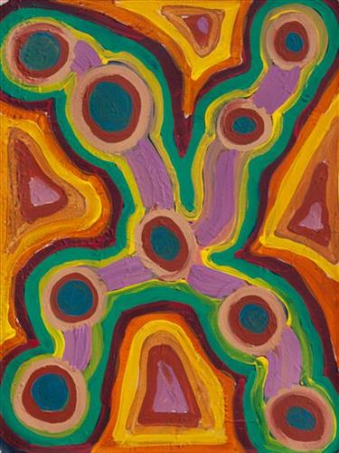
“We drink water at Puntawarri. We clean and dig that waterhole. This Country is Puntawarri. My nanna, Dadda, taught me to paint this Country. Puntawarri is important because it is my pop’s, my nannas’ husband’s, place. They camped there and went hunting for goanna or anything, kangaroo or turkey. At Puntawarri there are all the waterholes. Good hunting this Country. There is still some Rabbit Proof Fence there.”

 – Judith Anya Samson

Puntawarri is an important cultural area located on the middle stretches of the Canning Stock Route and east of the Jigalong Mission (now Jigalong Aboriginal community), where Judith grew up with her grandmother and renowned Martumili Artist, Dadda Samson (dec.). Puntawarri is also the site of an abandoned community, a waterhole, creek and lake. Puntawarri’s close proximity to Jigalong Mission made it a popular site for Martu to visit during the ‘mission days’.

While growing up at Jigalong Mission in the 1960’s, Dadda would return to Puntawarri every weekend to hunt and camp. Dadda has been teaching Judith to paint for a number of years, sharing the knowledge and Jukurrpa (Dreaming) stories associated with her ngurra (home Country, camp). 

For many Martu, like Dadda and her family, Jigalong Mission was the site where their pujiman (traditional, desert dwelling) lifestyle came to an end from the late 1940s as they transitioned to a life as stockmen and women working in cattle stations in the Pilbara region and beyond. In the wake of the extreme and prolonged drought of the 1960s, the last of the remaining pujimanpa (desert dwellers) were forced to move to missions like Jigalong, where a supply of food and water was assured. There, many Martu were reunited with family members that had already moved in from the desert.

The waterhole at Puntawarri is said to be populated by several kinds of ancestral jila (snake), however the site is best known for its association with the Ngayurnangalku, fearsome ancestral cannibal beings. During the Jukurrpa the Ngayurnangalku came together from all over the desert, first stopping near Puntawarri on their travels to Kumpupirntily (Kumpupintily, Lake Disappointment). At Kumpupirntily, they had a big meeting to debate whether or not they would continue to live as cannibals, and eventually came to the decision to stop eating people. That night, a female baby cannibal was born to the eastern Ngayurnangalku on the red sandhills at Puntawarri, where she continues to live today as the ‘big mummy’ Ngayurnangalku. Following protocol, the baby also had to be consulted by the group. She determined that the Ngayurnangalku should continue to eat people. Her decision divided the group, and from this point the group from the east continued to live as ‘bad’ cannibals at Kumpupirntily, while the group from the west became ‘good’, thereafter consuming only animals.

111582280689


Bush Tucker

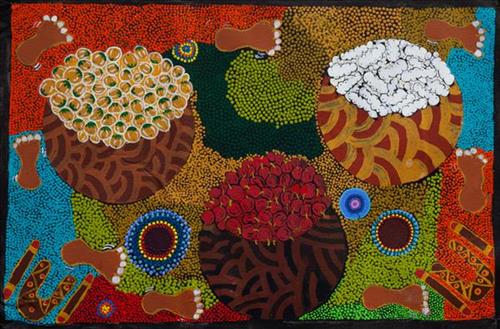
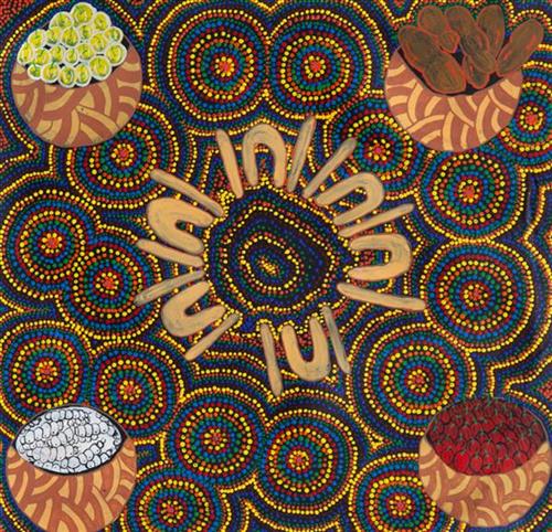
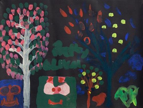
Depicted in this work are traditional types of bush tucker, their habitats, and their related hunting and gathering methods. During the pujiman (traditional, desert dwelling) period, Martu would traverse very large distances annually in small family groups, moving seasonally from water source to water source, and hunting and gathering bush tucker as they went. Whilst desert life has moved away from mobile hunter-gatherer subsistence throughout the course of the twentieth century, bush tucker continues to be a significant component of the modern Martu diet. Hunting and gathering bush tucker remains equally valuable as an important cultural practice that is passed on intergenerationally. Though hunting and gathering implements have been modernised, methods of harvesting, tracking and the use of fire burning to drive animals from their retreats are still commonly practiced today. 

Typically, animals hunted for their kuwiyi (meat) include kirti-kirti (euro kangaroo) and marlu (plains kangaroo), parnajarrpa (sand goanna), kipara (Australian bustard, bush turkey) and karlaya (emu). Lunki (witchetty grub) and wuukurta (honey ants) are dug from tree and bush trunks, or from underground nests. Popular mayi (plant food) includes minyarra (bush onion), collected from small, grass like plants; root vegetables dug from underground such as kulyu and mata (types of bush potato); and seeds such as kalaru (samphire, salt bush), yuwinyji, and marnkalpa (spinifex species). Jawirli (quondong), wamurla (bush tomatoes), jinyjiwirrily (wild gooseberry), ngaputa (melon), and karlkula (bush banana) are some of the most popular bush fruits. These are often collected in the wantajarra (cool season) and tuulpara (spring) months, along with juri (sweet) botanical gums and wama (nectar), obtained from various plant species. 

Traditional tools used for hunting and gathering bush tucker were carved from wanari (mulga), mulunturu (desert oak), yurungkura (river red gum) and mijarrpa (bloodwoods), and included kurlata (spears), jurna (hitting stick), karli (boomerangs), wana (digging-sticks), piti (timber bowls used for carrying food and water), and jiwa (grinding stones for grinding seeds into flour). While carved objects retain enormous social and ceremonial importance in Martu life, they are no longer used for hunting and gathering.

111582280688


Bush Tucker

Depicted in this work are traditional types of bush tucker, their habitats, and their related hunting and gathering methods. During the pujiman (traditional, desert dwelling) period, Martu would traverse very large distances annually in small family groups, moving seasonally from water source to water source, and hunting and gathering bush tucker as they went. Whilst desert life has moved away from mobile hunter-gatherer subsistence throughout the course of the twentieth century, bush tucker continues to be a significant component of the modern Martu diet. Hunting and gathering bush tucker remains equally valuable as an important cultural practice that is passed on intergenerationally. Though hunting and gathering implements have been modernised, methods of harvesting, tracking and the use of fire burning to drive animals from their retreats are still commonly practiced today. 

Typically, animals hunted for their kuwiyi (meat) include kirti-kirti (euro kangaroo) and marlu (plains kangaroo), parnajarrpa (sand goanna), kipara (Australian bustard, bush turkey) and karlaya (emu). Lunki (witchetty grub) and wuukurta (honey ants) are dug from tree and bush trunks, or from underground nests. Popular mayi (plant food) includes minyarra (bush onion), collected from small, grass like plants; root vegetables dug from underground such as kulyu and mata (types of bush potato); and seeds such as kalaru (samphire, salt bush), yuwinyji, and marnkalpa (spinifex species). Jawirli (quondong), wamurla (bush tomatoes), jinyjiwirrily (wild gooseberry), ngaputa (melon), and karlkula (bush banana) are some of the most popular bush fruits. These are often collected in the wantajarra (cool season) and tuulpara (spring) months, along with juri (sweet) botanical gums and wama (nectar), obtained from various plant species. 

Traditional tools used for hunting and gathering bush tucker were carved from wanari (mulga), mulunturu (desert oak), yurungkura (river red gum) and mijarrpa (bloodwoods), and included kurlata (spears), jurna (hitting stick), karli (boomerangs), wana (digging-sticks), piti (timber bowls used for carrying food and water), and jiwa (grinding stones for grinding seeds into flour). While carved objects retain enormous social and ceremonial importance in Martu life, they are no longer used for hunting and gathering.

111582280686


Parnngurr

Parnngurr rockhole is located just south of Parnngurr Aboriginal community. At the junction of three linguistic groups; Manyjilyjarra, Kartujarra, and Warnman, it was a critical and permanent source of water during the pujiman (traditional, desert born) era that supported many ritual large gatherings. During this nomadic period families stopped and camped here depending on the seasonal availability of water and the corresponding cycles of plant and animal life on which hunting and gathering bush tucker was reliant. At Parnngurr and other similarly important camp sites families would meet for a time before moving to their next destination. Parnngurr and its surrounds are physically dominated by distinctively red tali (sandhills), covered sparingly with spinifex and low lying shrub. Parnngurr forms part of Betty’s ngurra (home Country, camp) through her parents and through renowned fellow Martumili Artist and aunt Bugai Whyoulter. 

Parnngurr Aboriginal community was created during the return to Country movement of the 1980s, and named after Parnngurr rockhole, its original primary water source. However, until recently the community was widely known as Cotton Creek, after the European name for the ephemeral creek running alongside the community. 

Parnngurr is an important site chronicled in the epic Jukurrpa (Dreaming) story of the Minyipuru (Jakulyukulyu, Seven Sisters). The sisters stopped to rest on Parnngurr Hill before continuing on their long journey east. Minyipuru is a central Jukurrpa narrative for Martu, Ngaanyatjarra, Pitjantjatjara and Yankunytjatjara people that is associated with the seasonal Pleiades star constellation. Relayed in song, dance, stories and paintings, Minyipuru serves as a creation narrative, a source of information relating to the physical properties of the land, and an embodiment of Aboriginal cultural laws. Beginning in Roebourne on the west coast of Western Australia, the story morphs in its movement eastward across the land, following the women as they walk, dance, and even fly from waterhole to waterhole. As they travel the women camp, sing, wash, dance and gather food, leaving markers in the landscape and creating landforms that remain to this day, such as groupings of rocks and trees, grinding stones and seeds. During the entirety of their journey the women are pursued by a lustful old man, Yurla, although interactions with other animals, groups of men, and spirit beings are also chronicled in the narrative. 

For many Martu, Parnngurr also signifies the location at which their nomadic bush life came to an end. It was here that a group of 29 Martu were picked up by the Native Welfare Department to be taken to Jigalong Mission in 1963. Collectively the group had come to the decision to move to the mission as a result of an extended drought, which had caused a scarcity in food and water resources. The group also wanted to join their families, who had already moved to Jigalong. Among them were Martumili artists Jakayu Biljabu, Kumpaya Girgirba, Bugai Whyoulter and Ngamaru Bidu.
111582280685


Untitled

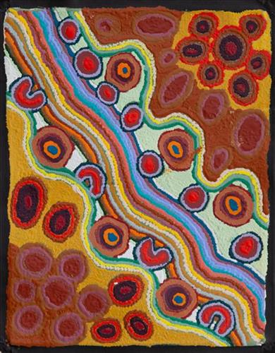
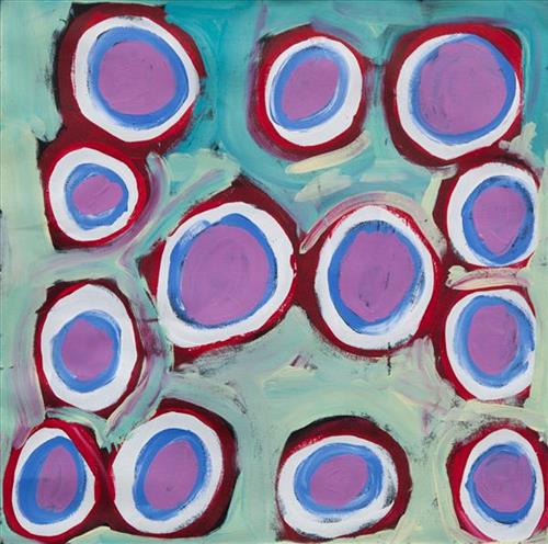
This is Yikartu’s Country- her ‘ngurra’ (home Country, camp). People identify with their ngurra in terms of specific rights and responsibilities, and the possession of intimate knowledge of the physical and cultural properties of one’s Country. Painting ngurra, and in so doing sharing the Jukurrpa (Dreaming) stories and physical characteristics of that place, has today become an important means of cultural maintenance. 

Yikartu’s ngurra encompasses the Country that she and her family walked in the pujiman (traditional, desert-dwelling) era. Yikartu was born at Lalyipuka. She grew up, walked and hunted primarily within Yulparija Country, north of Manyjilyjarra Country, and through to the Percival Lakes area, at the northern boundary of the Martu homelands. She continued to live nomadically before eventually deciding to move to Jigalong Mission along with many other relatives following an extreme and prolonged drought in the 1960s. 

Portrayed in this work are features of Yikartu’s ngurra, such as the dominant permanent red tali (sandhills), warta (trees, vegetation), and the individually named water sources she and her family camped at. These include Yulpu, Yimiri, Kupankurlu, Kurturrara, Wirnpa, Jurnpanja, Rulu-rulu, Taparl-taparl, Wirrkujapayi, Tayiku and Puntita. Rock holes, waterholes, soaks and springs were all extremely important sites for Martu people during the pujiman period, and are generally depicted with circular forms. 

The encyclopaedic knowledge of the location, quality and seasonal availability of the hundreds of water bodies found in one’s Country sustained Martu as they travelled across their Country, hunting and gathering, visiting family, and fulfilling ceremonial obligations. They would traverse very large distances annually, visiting specific areas in the dry and wet season depending on the availability of water and the corresponding cycles of plant and animal life on which hunting and gathering bush tucker was reliant. As they travelled and hunted they would also burn areas of Country, generating a greater diversity of plant and animal life.

111582280683


Mungili Claypan

“When I was young, walk around, play around, slide around on the mud. Big one [claypan] and little ones on the side. And the white gums, [where] we would get witchetty grubs”

– Marlene Anderson

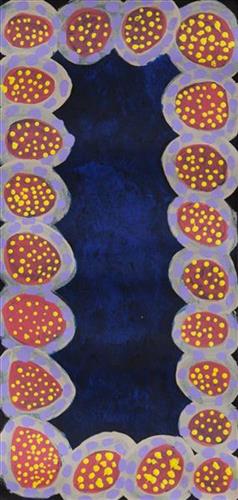
In this work Marlene depicts a claypan located in Mungili, the small outstation community located just off the Eagle Highway in Western Australia, approximately 430 kilometres northeast of Wiluna and 250 kilometres north of Warburton. Marlene grew up in Mungili, and as such it forms a significant part of her ‘ngurra’ (home Country, camp). Typically Marlene depicts this site with a central large circular form that represents the main claypan, surrounded by smaller circular forms representing satellite water bodies.

During the pujiman (traditional, desert dwelling) period, knowledge of water sources was critical for survival, and today Martu Country is still defined in terms of the location and type of water. Each of the hundreds of claypans, rockholes, waterholes, soaks and springs found in the Martu desert homelands is known through real life experience and the recounting of Jukurrpa (Dreaming) narratives by name, location, quality and seasonal availability. This encyclopedic knowledge extends even to the nature and movement of arterial waterways, and sustained Martu as they travelled across their Country, hunting and gathering, visiting family, and fulfilling ceremonial obligations. They would traverse very large distances annually, visiting specific areas in the dry and wet season depending on the availability of water and the corresponding cycles of plant and animal life on which hunting and gathering bush tucker was reliant.

111582280680


Mungili Claypan

“When I was young, walk around, play around, slide around on the mud. Big one [claypan] and little ones on the side. And the white gums, [where] we would get witchetty grubs”

– Marlene Anderson

In this work Marlene depicts a claypan located in Mungili, the small outstation community located just off the Eagle Highway in Western Australia, approximately 430 kilometres northeast of Wiluna and 250 kilometres north of Warburton. Marlene grew up in Mungili, and as such it forms a significant part of her ‘ngurra’ (home Country, camp). Typically Marlene depicts this site with a central large circular form that represents the main claypan, surrounded by smaller circular forms representing satellite water bodies.

During the pujiman (traditional, desert dwelling) period, knowledge of water sources was critical for survival, and today Martu Country is still defined in terms of the location and type of water. Each of the hundreds of claypans, rockholes, waterholes, soaks and springs found in the Martu desert homelands is known through real life experience and the recounting of Jukurrpa (Dreaming) narratives by name, location, quality and seasonal availability. This encyclopedic knowledge extends even to the nature and movement of arterial waterways, and sustained Martu as they travelled across their Country, hunting and gathering, visiting family, and fulfilling ceremonial obligations. They would traverse very large distances annually, visiting specific areas in the dry and wet season depending on the availability of water and the corresponding cycles of plant and animal life on which hunting and gathering bush tucker was reliant.

111582280679


Mungili Claypan

“When I was young, walk around, play around, slide around on the mud. Big one [claypan] and little ones on the side. And the white gums, [where] we would get witchetty grubs”

– Marlene Anderson

In this work Marlene depicts a claypan located in Mungili, the small outstation community located just off the Eagle Highway in Western Australia, approximately 430 kilometres northeast of Wiluna and 250 kilometres north of Warburton. Marlene grew up in Mungili, and as such it forms a significant part of her ‘ngurra’ (home Country, camp). Typically Marlene depicts this site with a central large circular form that represents the main claypan, surrounded by smaller circular forms representing satellite water bodies.

During the pujiman (traditional, desert dwelling) period, knowledge of water sources was critical for survival, and today Martu Country is still defined in terms of the location and type of water. Each of the hundreds of claypans, rockholes, waterholes, soaks and springs found in the Martu desert homelands is known through real life experience and the recounting of Jukurrpa (Dreaming) narratives by name, location, quality and seasonal availability. This encyclopedic knowledge extends even to the nature and movement of arterial waterways, and sustained Martu as they travelled across their Country, hunting and gathering, visiting family, and fulfilling ceremonial obligations. They would traverse very large distances annually, visiting specific areas in the dry and wet season depending on the availability of water and the corresponding cycles of plant and animal life on which hunting and gathering bush tucker was reliant.