111582334940


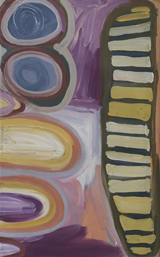
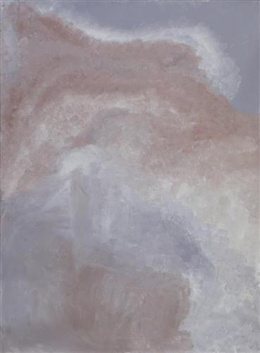
Untitled

Martumili Artists work with over three hundred artists from remote Martu Aboriginal communities, including Punmu, Parnngurr, Kunawarritji, Jigalong, Irrungadji (Nullagine), and Warralong, as well as from the Parnpajinya (Newman) gallery and studio spaces. Known for their diverse, energetic, and unmediated painting styles, their works reflect the dramatic geography and scale of their homelands. Each artist, however, brings a unique approach to their craft.

Younger Martu artists often start painting alongside their parents, grandparents, and extended family, which fosters an organic learning process. This not only involves mastering painting techniques but also understanding specific locations, family histories, traditional ways of life, bush tucker, and Jukurrpa (Dreaming). Over time, with encouragement from their peers, they develop their own distinct styles and explore unique painting techniques and subject matter. In this work the artist brings a contemporary, evolving perspective to their work.

111582334939


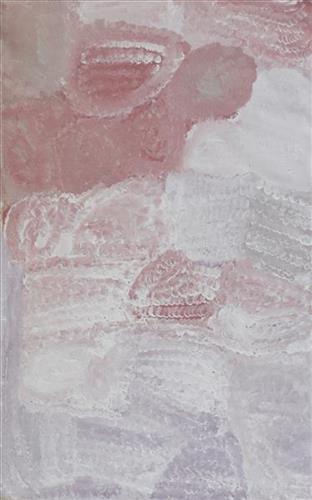
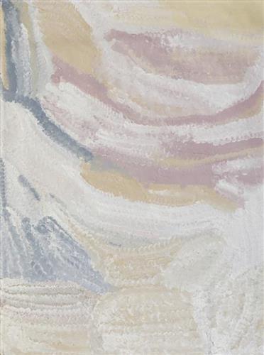
Untitled

Martumili Artists work with over three hundred artists from remote Martu Aboriginal communities, including Punmu, Parnngurr, Kunawarritji, Jigalong, Irrungadji (Nullagine), and Warralong, as well as from the Parnpajinya (Newman) gallery and studio spaces. Known for their diverse, energetic, and unmediated painting styles, their works reflect the dramatic geography and scale of their homelands. Each artist, however, brings a unique approach to their craft.

Younger Martu artists often start painting alongside their parents, grandparents, and extended family, which fosters an organic learning process. This not only involves mastering painting techniques but also understanding specific locations, family histories, traditional ways of life, bush tucker, and Jukurrpa (Dreaming). Over time, with encouragement from their peers, they develop their own distinct styles and explore unique painting techniques and subject matter. In this work the artist brings a contemporary, evolving perspective to their work.

111582334936


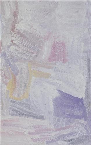
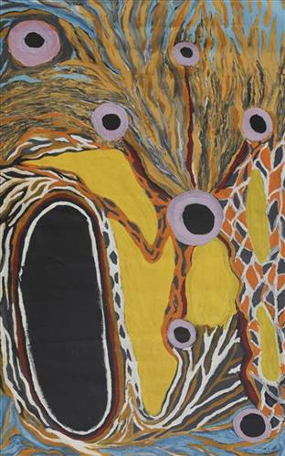
Rabbit Proof Fence

“I painted the Rabbit Proof Fence and the tracks of the emus. They can’t get through because the gate is closed. If they can’t get through they go back to the sand hills. We still see that Rabbit Proof Fence out there, it goes to Jilakurru then to Jigalong, long one, and it’s a bit broken now. The three girls passed through Jilakurru going to Jigalong. Everybody likes that story in Jigalong, I like painting that story.” 

– Judith Anya Samson

In 1931 sisters Molly Craig, Daisy Kadibil and Gracie Fields were taken from their families, like many other Aboriginal children at that time, and transported to Moore River Native Settlement, north of Perth. They were taken away in the belief that part-Aboriginal children should be trained as domestic servants. 

The three girls escaped the next day and, incredibly, walked 1600 kilometres home to Jigalong using the Rabbit-Proof Fence to navigate. The Rabbit Proof Fence remains the world’s longest fence, and was built in the early 1900s to separate rabbits from pasture. For nine weeks, the girls followed its length in order to be reunited with their family. They crossed a flooded river, sand dunes, heathlands, wheatbelts and plains, claypans and salt lakes. They slept in dug-out rabbit burrows, and caught and cooked rabbits, along with other plant based bush tucker. For the duration of their journey they were pursued by policeman and an Aboriginal police tracker.

The girls’ story has been immortalised in the novel “Follow the Rabbit-Proof Fence” by Doris Pilkington (Nugi Garimara, 1996), and was adapted into the film “Rabbit Proof Fence” (2002). This story retains special significance for the Martu, and in particular those inhabitants of Jigalong Aboriginal community. The three girls were Martu, and their children and grandchildren continue to live in the Martu homelands today. Judith grew up with her grandparents in Jigalong. 

111582334935


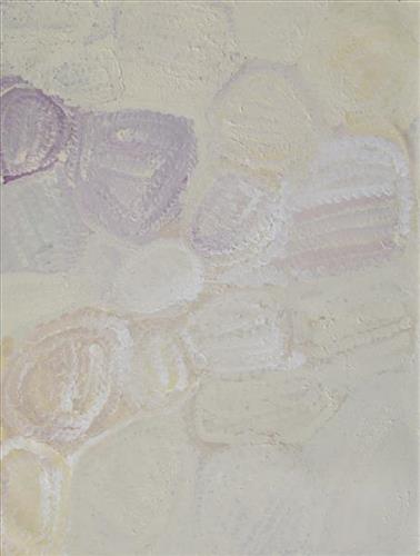
Parnngurr

“We were climbing Parnngurr hill; we were frightened. Kartiya (Europeans) would walk around, trying to catch Martu people. We would run up the hill and hide. We watched them catch people. We were eating flour that white people gave us. It was horrible. From [Parnngurr rockhole], we got in the truck and went with the white people to Jigalong. Kumpaya [Girgirba], Jakayu [Biljabu] and Ngamaru [Bidu], we were all on top of the hill looking at the white people.”

– Bugai Whyoulter


Parnngurr rockhole is located 370km east of Newman. This site lies within Bugai’s ngurra (home Country, camp), the area which she knew intimately and travelled extensively with her family in her youth. For many Martu, including Bugai, Parnngurr also signifies the location at which their nomadic bush life came to an end. Poignantly described here by Bugai, it was here that a group of 29 Martu were picked up by the Native Welfare Department to be taken to Jigalong Mission in 1963. Collectively the group had come to the decision to move to the mission as a result of an extended drought, which had caused a scarcity in food and water resources. The group also wanted to join their families, who had already moved to Jigalong.

At the junction of three linguistic groups; Manyjilyjarra, Kartujarra, and Warnman, Parnngurr rockhole was a critical and permanent source of water during the pujiman (traditional, desert born) era, supporting many ritual large gatherings. During this nomadic period families stopped and camped here depending on the seasonal availability of water and the corresponding cycles of plant and animal life on which hunting and gathering bush tucker was reliant. At Parnngurr and other similarly important camp sites families would meet for a time before moving to their next destination. Parnngurr rockhole and its surrounds are physically dominated by distinctively red tali (sandhills), covered sparingly with spinifex and low lying shrub. 

Parnngurr community, just north of Parnngurr rockhole, was created during the Return to Country movement of the 1980s, coinciding with the recognition of Aboriginal land rights and native title. The community was named after its’ original primary water source. Until recently the community was widely known as Cotton Creek, after the European name for the ephemeral creek running alongside the community.

111582334934


Parnngurr

“We were climbing Parnngurr hill; we were frightened. Kartiya (Europeans) would walk around, trying to catch Martu people. We would run up the hill and hide. We watched them catch people. We were eating flour that white people gave us. It was horrible. From [Parnngurr rockhole], we got in the truck and went with the white people to Jigalong. Kumpaya [Girgirba], Jakayu [Biljabu] and Ngamaru [Bidu], we were all on top of the hill looking at the white people.”

– Bugai Whyoulter


Parnngurr rockhole is located 370km east of Newman. This site lies within Bugai’s ngurra (home Country, camp), the area which she knew intimately and travelled extensively with her family in her youth. For many Martu, including Bugai, Parnngurr also signifies the location at which their nomadic bush life came to an end. Poignantly described here by Bugai, it was here that a group of 29 Martu were picked up by the Native Welfare Department to be taken to Jigalong Mission in 1963. Collectively the group had come to the decision to move to the mission as a result of an extended drought, which had caused a scarcity in food and water resources. The group also wanted to join their families, who had already moved to Jigalong.

At the junction of three linguistic groups; Manyjilyjarra, Kartujarra, and Warnman, Parnngurr rockhole was a critical and permanent source of water during the pujiman (traditional, desert born) era, supporting many ritual large gatherings. During this nomadic period families stopped and camped here depending on the seasonal availability of water and the corresponding cycles of plant and animal life on which hunting and gathering bush tucker was reliant. At Parnngurr and other similarly important camp sites families would meet for a time before moving to their next destination. Parnngurr rockhole and its surrounds are physically dominated by distinctively red tali (sandhills), covered sparingly with spinifex and low lying shrub. 

Parnngurr community, just north of Parnngurr rockhole, was created during the Return to Country movement of the 1980s, coinciding with the recognition of Aboriginal land rights and native title. The community was named after its’ original primary water source. Until recently the community was widely known as Cotton Creek, after the European name for the ephemeral creek running alongside the community.

111582334933


Wantili (Warntili, Canning Stock Route Well 25)

“Bugai always tells about Wantili (Warntili, Canning Stock Route Well 25) because she grew up around Wantili. Her family would travel between Wantili, Kaalpa, Juntu-juntu, Raarki, and Wuranu Wells along the Canning Stock Route. She paints around Wantili. She saw whitefellas there for the first time, Canning mob when they were travelling up and down the stock route with the bullock. She was a young girl walking around at Wantili. Big mob of people they been walking around there. Canning and his drovers were travelling, making the road. They were running away from those whitefellas, watching them from a long distance. She was a teenager when she was travelling around there with her four mothers and one daddy. They used to travel around in family groups, Bugai and Jakayu [Biljabu], and Jakayu’s nyupa (partner) Phillip Biljabu.” 

– Bugai Whyoulter, as translated by her grandson, Cyril Whyoulter


“I was just becoming a teenager, still travelling around with my mother and father. We were at Juntu-juntu, Wuranu, Raarki, Tiwa and Wantili. At Wantili we killed a cow, they were bringing cattle through from Kunawarritji … Wantili was a good place to make yakapiri (woven bark sandals).”

– Bugai Whyoulter as translated by Ngalangka Nola Taylor


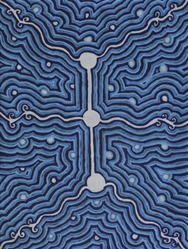
Wantili, which forms the focus of much of Bugai’s work, is a large round jurnu (soak) and linyji (claypan) near Well 25 on the Canning Stock Route. The Wantili region is dominated by claypans surrounded by tuwa (sandhills), and Nyilangkurr, a prominent yapu (hill) is located close to the eastern edge of the claypan. Following rain the typically dry claypans are filled with water, with the overflow from nearby waterholes flowing to Wantili. At that time, Wantili becomes an important place for obtaining fresh water for drinking and bathing. Wantili is significant for the fact that at this site Kartujarra, Manyjilyjarra, Putijarra and Warnman people would all come together for ceremonies during the pujiman (traditional, desert dwelling) era. Many jiwa (stones used by women for grinding seeds) from these times can still be found there today.

Wantili lies within Bugai’s ngurra (home Country, camp). As described in her account, Wantili was one of the sites she knew intimately and travelled extensively with her family and other family groups during the pujiman period. At this time, Martu would traverse very large distances annually, moving seasonally from water source to water source, and hunting and gathering bush tucker as they went. Knowledge of water sources was critical for survival, and today Martu Country is still defined in terms of the location and type of water. Each of the hundreds of claypans, rockholes, waterholes, soaks and springs found in the Martu desert homelands is known by name, location, quality and seasonal availability through real life experience and the recounting of Jukurrpa (Dreaming) narratives. 

Wantili is also especially significant to Bugai as it was here that she saw whitefellas for the first time; drovers with their cattle travelling along the Canning Stock Route. The establishment of the route by Alfred Canning and his team in 1910 resulted in first contact with Europeans for many Martu, including Bugai and her family, then living a pujiman life in the desert. Encounters occurred between Martu, Europeans, and other Martu working as cattle drovers as they travelled and down the Stock Route from water source to water source. Increasingly, Martu followed the route to newly established ration depots, mission and pastoral stations. They were drawn to the route in search of food, by a sense of curiosity, or by loneliness. By the late 1950s and early 1960s, most of the desert family groups had left the desert. Eventually, these factors combined with an extreme and prolonged drought in the 1960s to prompt the few remaining pujiman to move in from the desert. Bugai returned to the Wantili area as a young woman, when she herself drove cattle along the Stock Route.

Culturally, Wantili is an incredibly important site, ‘where the creation started.’ (Cyril Whyoulter). In this creation story, the world was initially dark, and people were like rocks, with no arms or legs. Following the sun’s first rising, life-forms become increasingly complex while particular features in the land are created. Beyond these details much of the Jukurrpa narrative relating to Wantili is ngurlu (sacred, taboo), and only for Martu, but the site is open, and anyone can go there. 

Wantili is also one of the many sites featured in the epic Minyipuru (Jakulyukulyu, Seven Sisters) Jukurrpa story. Minyipuru is a central Jukurrpa narrative for Martu, Ngaanyatjarra, Pitjantjatjara and Yankunytjatjara people that is associated with the seasonal Pleiades star constellation. Relayed in song, dance, stories and paintings, Minyipuru serves as a creation narrative, a source of information relating to the physical properties of the land, and an embodiment of Aboriginal cultural laws. The story follows the movement of a group of women travelling all the way across the desert, beginning at Roebourne on the coast of Western Australia, as they are pursued by Yurla, a lustful old man. As the women travelled, they stopped to rest at many sites to eat, dance, rest and sing, on the way leaving behind an assortment of articles that became formations in the land, such as groupings of rocks and trees, grinding stones and seeds. The sisters rested at Wantili before throwing seeds, then continued their journey far to the east and beyond Martu Country, stopping at various sites through central and South Australia.

111582334932


Wantili (Warntili, Canning Stock Route Well 25)

“Bugai always tells about Wantili (Warntili, Canning Stock Route Well 25) because she grew up around Wantili. Her family would travel between Wantili, Kaalpa, Juntu-juntu, Raarki, and Wuranu Wells along the Canning Stock Route. She paints around Wantili. She saw whitefellas there for the first time, Canning mob when they were travelling up and down the stock route with the bullock. She was a young girl walking around at Wantili. Big mob of people they been walking around there. Canning and his drovers were travelling, making the road. They were running away from those whitefellas, watching them from a long distance. She was a teenager when she was travelling around there with her four mothers and one daddy. They used to travel around in family groups, Bugai and Jakayu [Biljabu], and Jakayu’s nyupa (partner) Phillip Biljabu.” 

– Bugai Whyoulter, as translated by her grandson, Cyril Whyoulter


“I was just becoming a teenager, still travelling around with my mother and father. We were at Juntu-juntu, Wuranu, Raarki, Tiwa and Wantili. At Wantili we killed a cow, they were bringing cattle through from Kunawarritji … Wantili was a good place to make yakapiri (woven bark sandals).”

– Bugai Whyoulter as translated by Ngalangka Nola Taylor


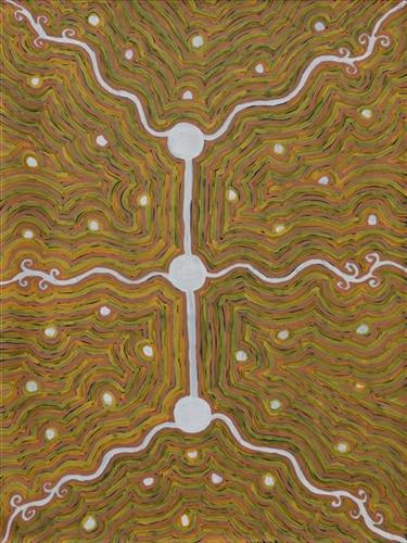
Wantili, which forms the focus of much of Bugai’s work, is a large round jurnu (soak) and linyji (claypan) near Well 25 on the Canning Stock Route. The Wantili region is dominated by claypans surrounded by tuwa (sandhills), and Nyilangkurr, a prominent yapu (hill) is located close to the eastern edge of the claypan. Following rain the typically dry claypans are filled with water, with the overflow from nearby waterholes flowing to Wantili. At that time, Wantili becomes an important place for obtaining fresh water for drinking and bathing. Wantili is significant for the fact that at this site Kartujarra, Manyjilyjarra, Putijarra and Warnman people would all come together for ceremonies during the pujiman (traditional, desert dwelling) era. Many jiwa (stones used by women for grinding seeds) from these times can still be found there today.

Wantili lies within Bugai’s ngurra (home Country, camp). As described in her account, Wantili was one of the sites she knew intimately and travelled extensively with her family and other family groups during the pujiman period. At this time, Martu would traverse very large distances annually, moving seasonally from water source to water source, and hunting and gathering bush tucker as they went. Knowledge of water sources was critical for survival, and today Martu Country is still defined in terms of the location and type of water. Each of the hundreds of claypans, rockholes, waterholes, soaks and springs found in the Martu desert homelands is known by name, location, quality and seasonal availability through real life experience and the recounting of Jukurrpa (Dreaming) narratives. 

Wantili is also especially significant to Bugai as it was here that she saw whitefellas for the first time; drovers with their cattle travelling along the Canning Stock Route. The establishment of the route by Alfred Canning and his team in 1910 resulted in first contact with Europeans for many Martu, including Bugai and her family, then living a pujiman life in the desert. Encounters occurred between Martu, Europeans, and other Martu working as cattle drovers as they travelled and down the Stock Route from water source to water source. Increasingly, Martu followed the route to newly established ration depots, mission and pastoral stations. They were drawn to the route in search of food, by a sense of curiosity, or by loneliness. By the late 1950s and early 1960s, most of the desert family groups had left the desert. Eventually, these factors combined with an extreme and prolonged drought in the 1960s to prompt the few remaining pujiman to move in from the desert. Bugai returned to the Wantili area as a young woman, when she herself drove cattle along the Stock Route.

Culturally, Wantili is an incredibly important site, ‘where the creation started.’ (Cyril Whyoulter). In this creation story, the world was initially dark, and people were like rocks, with no arms or legs. Following the sun’s first rising, life-forms become increasingly complex while particular features in the land are created. Beyond these details much of the Jukurrpa narrative relating to Wantili is ngurlu (sacred, taboo), and only for Martu, but the site is open, and anyone can go there. 

Wantili is also one of the many sites featured in the epic Minyipuru (Jakulyukulyu, Seven Sisters) Jukurrpa story. Minyipuru is a central Jukurrpa narrative for Martu, Ngaanyatjarra, Pitjantjatjara and Yankunytjatjara people that is associated with the seasonal Pleiades star constellation. Relayed in song, dance, stories and paintings, Minyipuru serves as a creation narrative, a source of information relating to the physical properties of the land, and an embodiment of Aboriginal cultural laws. The story follows the movement of a group of women travelling all the way across the desert, beginning at Roebourne on the coast of Western Australia, as they are pursued by Yurla, a lustful old man. As the women travelled, they stopped to rest at many sites to eat, dance, rest and sing, on the way leaving behind an assortment of articles that became formations in the land, such as groupings of rocks and trees, grinding stones and seeds. The sisters rested at Wantili before throwing seeds, then continued their journey far to the east and beyond Martu Country, stopping at various sites through central and South Australia.

111582334931


Wantili (Warntili, Canning Stock Route Well 25)

“Bugai always tells about Wantili (Warntili, Canning Stock Route Well 25) because she grew up around Wantili. Her family would travel between Wantili, Kaalpa, Juntu-juntu, Raarki, and Wuranu Wells along the Canning Stock Route. She paints around Wantili. She saw whitefellas there for the first time, Canning mob when they were travelling up and down the stock route with the bullock. She was a young girl walking around at Wantili. Big mob of people they been walking around there. Canning and his drovers were travelling, making the road. They were running away from those whitefellas, watching them from a long distance. She was a teenager when she was travelling around there with her four mothers and one daddy. They used to travel around in family groups, Bugai and Jakayu [Biljabu], and Jakayu’s nyupa (partner) Phillip Biljabu.” 

– Bugai Whyoulter, as translated by her grandson, Cyril Whyoulter


“I was just becoming a teenager, still travelling around with my mother and father. We were at Juntu-juntu, Wuranu, Raarki, Tiwa and Wantili. At Wantili we killed a cow, they were bringing cattle through from Kunawarritji … Wantili was a good place to make yakapiri (woven bark sandals).”

– Bugai Whyoulter as translated by Ngalangka Nola Taylor


Wantili, which forms the focus of much of Bugai’s work, is a large round jurnu (soak) and linyji (claypan) near Well 25 on the Canning Stock Route. The Wantili region is dominated by claypans surrounded by tuwa (sandhills), and Nyilangkurr, a prominent yapu (hill) is located close to the eastern edge of the claypan. Following rain the typically dry claypans are filled with water, with the overflow from nearby waterholes flowing to Wantili. At that time, Wantili becomes an important place for obtaining fresh water for drinking and bathing. Wantili is significant for the fact that at this site Kartujarra, Manyjilyjarra, Putijarra and Warnman people would all come together for ceremonies during the pujiman (traditional, desert dwelling) era. Many jiwa (stones used by women for grinding seeds) from these times can still be found there today.

Wantili lies within Bugai’s ngurra (home Country, camp). As described in her account, Wantili was one of the sites she knew intimately and travelled extensively with her family and other family groups during the pujiman period. At this time, Martu would traverse very large distances annually, moving seasonally from water source to water source, and hunting and gathering bush tucker as they went. Knowledge of water sources was critical for survival, and today Martu Country is still defined in terms of the location and type of water. Each of the hundreds of claypans, rockholes, waterholes, soaks and springs found in the Martu desert homelands is known by name, location, quality and seasonal availability through real life experience and the recounting of Jukurrpa (Dreaming) narratives. 

Wantili is also especially significant to Bugai as it was here that she saw whitefellas for the first time; drovers with their cattle travelling along the Canning Stock Route. The establishment of the route by Alfred Canning and his team in 1910 resulted in first contact with Europeans for many Martu, including Bugai and her family, then living a pujiman life in the desert. Encounters occurred between Martu, Europeans, and other Martu working as cattle drovers as they travelled and down the Stock Route from water source to water source. Increasingly, Martu followed the route to newly established ration depots, mission and pastoral stations. They were drawn to the route in search of food, by a sense of curiosity, or by loneliness. By the late 1950s and early 1960s, most of the desert family groups had left the desert. Eventually, these factors combined with an extreme and prolonged drought in the 1960s to prompt the few remaining pujiman to move in from the desert. Bugai returned to the Wantili area as a young woman, when she herself drove cattle along the Stock Route.

Culturally, Wantili is an incredibly important site, ‘where the creation started.’ (Cyril Whyoulter). In this creation story, the world was initially dark, and people were like rocks, with no arms or legs. Following the sun’s first rising, life-forms become increasingly complex while particular features in the land are created. Beyond these details much of the Jukurrpa narrative relating to Wantili is ngurlu (sacred, taboo), and only for Martu, but the site is open, and anyone can go there. 

Wantili is also one of the many sites featured in the epic Minyipuru (Jakulyukulyu, Seven Sisters) Jukurrpa story. Minyipuru is a central Jukurrpa narrative for Martu, Ngaanyatjarra, Pitjantjatjara and Yankunytjatjara people that is associated with the seasonal Pleiades star constellation. Relayed in song, dance, stories and paintings, Minyipuru serves as a creation narrative, a source of information relating to the physical properties of the land, and an embodiment of Aboriginal cultural laws. The story follows the movement of a group of women travelling all the way across the desert, beginning at Roebourne on the coast of Western Australia, as they are pursued by Yurla, a lustful old man. As the women travelled, they stopped to rest at many sites to eat, dance, rest and sing, on the way leaving behind an assortment of articles that became formations in the land, such as groupings of rocks and trees, grinding stones and seeds. The sisters rested at Wantili before throwing seeds, then continued their journey far to the east and beyond Martu Country, stopping at various sites through central and South Australia.
111582334929


Kumpupirntily (Kumpupintily, Lake Disappointment)

Kumpupirntily (Kumpupintily, Lake Disappointment) is a stark, flat and unforgiving expanse of blinding salt lake surrounded by sand hills, located in the Little Sandy and Gibson Desert of Western Australia. Kumpupirntily translates to ‘bladder burst’; the lake was formed when the bladder of the Jila Kujarra (Two Snakes) burst here. Jila Kujarra is one of the key Jukurrpa (Dreaming) narratives for the Martu. Though the story belongs to Warnman people, it is shared across the Western Desert with several other language groups. The narrative centres on the travels of two snakes as they are pursued by the Niminjarra, spiritual ancestors of the Warnman people. 
Later in the Jukurrpa period the Ngayurnangalku (cannibal beings) made Kumpupirntily their home, where they continue to remain today. For this reason Kumpupirntily is considered one of the most sacred and dangerous sites of the Western Desert. The Ngayurnangalku are fearsome ancestral cannibal beings said to resemble people in their appearance, except for their fangs and long, curved, knife like fingernails they use to catch and hold their human victims. Coming from Natawalu (Canning Stock Route Well 40) in the north, Mundiwinti (Mundawindi) in the west, and from the Country around Kiwirrkurra in the east, the Ngayurnangalku travelled across the desert, stopping near Puntawarri, at Jilukurru (Killagurra Springs, Canning Stock Route Well 17) and at Kupayura (Savory Creek) before finally reaching Kumpupirntily.

At Kumpupirntily, the Ngayurnangalku had a meeting to debate whether or not they would continue to live as cannibals, and eventually came to the decision to stop eating people. That night, a female baby cannibal was born. Following protocol, the baby also had to be consulted by the group. She determined that the Ngayurnangalku should continue to eat people. Her decision divided the group, and from this point the group from the east continued to live as ‘bad’ cannibals at Kumpupirntily, while the group from the west became ‘good’, thereafter consuming only animals. 

The cannibal Ngayurnangalku still live beneath the crust of Kumpupirntily lake in an underground world lit by their own sun. They surface only to feed on human flesh, coming in and out of the world we see through a small hill that acts as a gateway between worlds; Yapu Maparnpa (magical hill). Stored with the Ngayurnangalku in their underground world is an arsenal of maparnpa (holding power for sorcery) weapons, as well as deposits of pujurrpa (red ochre) that the Ngayurnangalku use to paint themselves with when they dance.

Several phenomena at Kumpupirntily act as a warning of the imminent appearance of the Ngayurnangalku; still skies, wilany (boomerang-shaped clouds), and the emergence of the parla-parla (type of lizard), smacking their mouths. The vigilance of the Martu as they travel in the Country around Kumpupirntily is so great that several other precautions are followed; fires are not lit, planes and helicopters are not flown directly over the area, and digging in the lake is strongly discouraged. All of these activities are believed to disturb the Ngayurnangalku, causing them to rise from their underground world. 

22023973704


Status: Stock


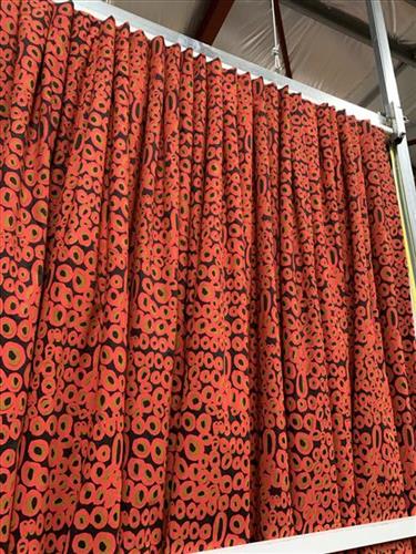
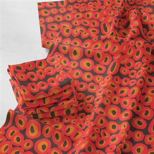
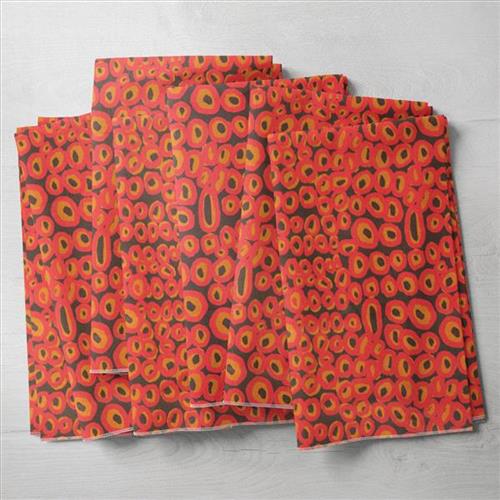
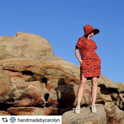
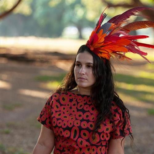
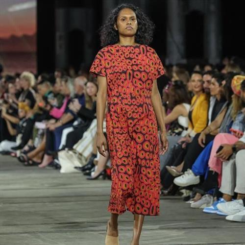
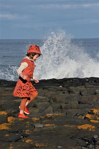
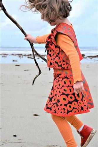
Tjilkamala Rockholes Fabric- Red and Orange on Brown (Cotton) 50cm

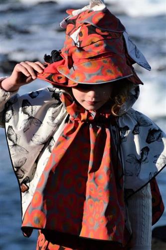
This design by Alice Nampitjinpa Dixon depicts Takupalangu west of Kintore. This is Uta Uta Tjangala’s country, which he has painted throughout his career. Nampitjinpa paints her father’s country of rockholes (puli) and sandhills (tali). There is plenty bushtucker – mangilpa, which are little black seeds around. The road to Kiwirrkurra passes Takupalangu on the side.
Alice describes the big swamp of Takupalangu, in her Fathers country. Takupalangu is filled up with bush vegetables called mungilpa. When Alice was a small girl she travelled this country with her family. Her mother used to collect mungilpa and pummel it into dough which she made into damper. It is also a good place for hunting bush meat as the swamp is surrounded by rock hills.

This fabric has been screen printed by hand by Publisher Textiles and Papers, ensuring the highest quality and longevity.

About the printers:

Publisher Textiles & Papers is one of Australia’s leading print houses. Focused on producing original patterns through traditional hand-screen printing methods we create bold and colourful textiles, hand printed wallpaper, clothing and fabric.

Our fabric is printed in small batches and is available in pre-cut lengths on the website, which we update regularly. For larger quantities, please email us to discuss pre-orders.

Fabric details:

This fabric is by continuous metreage going up in 50cm increments, priced at $110 per metre.

For 1m, please add 2 x 50cm to your cart and it will be cut as a continuous length ($110 for 1m).

For 2m, please add 4 x 50cm to your cart and it will be cut as a continuous length ($220 for 2m).

For 3m, please add 6 x 50cm to your cart and it will be cut as a continuous length ($330 for 3m).

Fabric care instructions (Trapper Drill): Gentle cold/ warm hand wash. Do not bleach, warm rinse well, do not tumble dry, line dry out of direct sunlight, warm iron, Wash dark colours separately.