111582336327


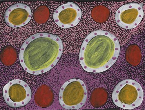
Parnngurr – Betty Whyoulter

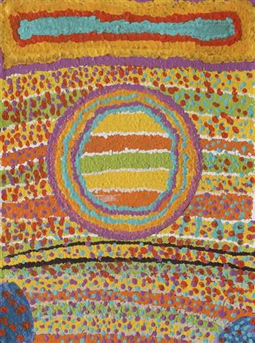
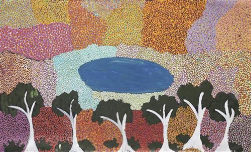
Parnngurr rockhole is located just south of Parnngurr Aboriginal community. At the junction of three linguistic groups; Manyjilyjarra, Kartujarra, and Warnman, it was a critical and permanent source of water during the pujiman (traditional, desert born) era that supported many ritual large gatherings. During this nomadic period families stopped and camped here depending on the seasonal availability of water and the corresponding cycles of plant and animal life on which hunting and gathering bush tucker was reliant. At Parnngurr and other similarly important camp sites families would meet for a time before moving to their next destination. Parnngurr and its surrounds are physically dominated by distinctively red tali (sandhills), covered sparingly with spinifex and low lying shrub. Parnngurr forms part of Betty’s ngurra (home Country, camp) through her parents and through renowned fellow Martumili Artist and aunt Bugai Whyoulter. 

Parnngurr Aboriginal community was created during the return to Country movement of the 1980s, and named after Parnngurr rockhole, its original primary water source. However, until recently the community was widely known as Cotton Creek, after the European name for the ephemeral creek running alongside the community. 

Parnngurr is an important site chronicled in the epic Jukurrpa (Dreaming) story of the Minyipuru (Jakulyukulyu, Seven Sisters). The sisters stopped to rest on Parnngurr Hill before continuing on their long journey east. Minyipuru is a central Jukurrpa narrative for Martu, Ngaanyatjarra, Pitjantjatjara and Yankunytjatjara people that is associated with the seasonal Pleiades star constellation. Relayed in song, dance, stories and paintings, Minyipuru serves as a creation narrative, a source of information relating to the physical properties of the land, and an embodiment of Aboriginal cultural laws. Beginning in Roebourne on the west coast of Western Australia, the story morphs in its movement eastward across the land, following the women as they walk, dance, and even fly from waterhole to waterhole. As they travel the women camp, sing, wash, dance and gather food, leaving markers in the landscape and creating landforms that remain to this day, such as groupings of rocks and trees, grinding stones and seeds. During the entirety of their journey the women are pursued by a lustful old man, Yurla, although interactions with other animals, groups of men, and spirit beings are also chronicled in the narrative. 

For many Martu, Parnngurr also signifies the location at which their nomadic bush life came to an end. It was here that a group of 29 Martu were picked up by the Native Welfare Department to be taken to Jigalong Mission in 1963. Collectively the group had come to the decision to move to the mission as a result of an extended drought, which had caused a scarcity in food and water resources. The group also wanted to join their families, who had already moved to Jigalong. Among them were Martumili artists Jakayu Biljabu, Kumpaya Girgirba, Bugai Whyoulter and Ngamaru Bidu.

111582336325


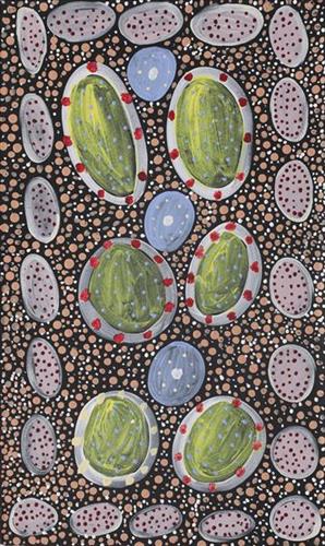
Parnngurr – Betty Whyoulter

Parnngurr rockhole is located just south of Parnngurr Aboriginal community. At the junction of three linguistic groups; Manyjilyjarra, Kartujarra, and Warnman, it was a critical and permanent source of water during the pujiman (traditional, desert born) era that supported many ritual large gatherings. During this nomadic period families stopped and camped here depending on the seasonal availability of water and the corresponding cycles of plant and animal life on which hunting and gathering bush tucker was reliant. At Parnngurr and other similarly important camp sites families would meet for a time before moving to their next destination. Parnngurr and its surrounds are physically dominated by distinctively red tali (sandhills), covered sparingly with spinifex and low lying shrub. Parnngurr forms part of Betty’s ngurra (home Country, camp) through her parents and through renowned fellow Martumili Artist and aunt Bugai Whyoulter. 

Parnngurr Aboriginal community was created during the return to Country movement of the 1980s, and named after Parnngurr rockhole, its original primary water source. However, until recently the community was widely known as Cotton Creek, after the European name for the ephemeral creek running alongside the community. 

Parnngurr is an important site chronicled in the epic Jukurrpa (Dreaming) story of the Minyipuru (Jakulyukulyu, Seven Sisters). The sisters stopped to rest on Parnngurr Hill before continuing on their long journey east. Minyipuru is a central Jukurrpa narrative for Martu, Ngaanyatjarra, Pitjantjatjara and Yankunytjatjara people that is associated with the seasonal Pleiades star constellation. Relayed in song, dance, stories and paintings, Minyipuru serves as a creation narrative, a source of information relating to the physical properties of the land, and an embodiment of Aboriginal cultural laws. Beginning in Roebourne on the west coast of Western Australia, the story morphs in its movement eastward across the land, following the women as they walk, dance, and even fly from waterhole to waterhole. As they travel the women camp, sing, wash, dance and gather food, leaving markers in the landscape and creating landforms that remain to this day, such as groupings of rocks and trees, grinding stones and seeds. During the entirety of their journey the women are pursued by a lustful old man, Yurla, although interactions with other animals, groups of men, and spirit beings are also chronicled in the narrative. 

For many Martu, Parnngurr also signifies the location at which their nomadic bush life came to an end. It was here that a group of 29 Martu were picked up by the Native Welfare Department to be taken to Jigalong Mission in 1963. Collectively the group had come to the decision to move to the mission as a result of an extended drought, which had caused a scarcity in food and water resources. The group also wanted to join their families, who had already moved to Jigalong. Among them were Martumili artists Jakayu Biljabu, Kumpaya Girgirba, Bugai Whyoulter and Ngamaru Bidu.

111582336324


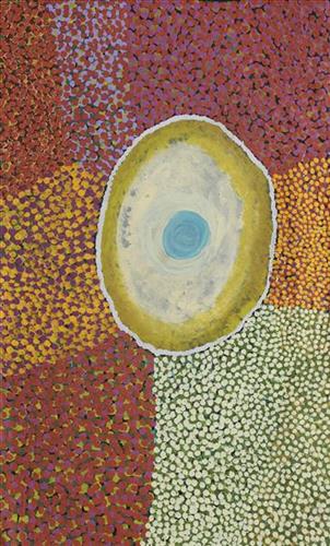
Yimiri

Yimiri comprises two freshwater soaks situated in the middle of a salt lake in the Percival Lakes area, within Western Australia’s Great Sandy Desert. Around these soaks the Country is dominated by permanent tuwa (sand hills). When visiting this site to drink water, the bulrushes surrounding the soaks are pushed back to access the kapi (water). 

Yimiri is home to an ancestral jila (snake). The Western Desert term jila is used interchangeably to describe springs considered to be ‘living’ waters and snakes, both of which play a central role in Martu culture and Jukurrpa (Dreaming). During the pujiman (traditional, desert dwelling) period, knowledge of water sources was critical for survival, and today Martu Country is still defined in terms of the location of water sources. Of the many permanent springs in Martu Country, very few are ‘living waters’; waters inhabited by jila. Before they became snakes, these beings were men who made rain, formed the land and introduced cultural practices like ceremonies and ritual songs. Some of the men travelled the desert together, visiting one another, but they all ended their journeys at their chosen spring alone, transformed into a snake. These important springs are named after their jila inhabitant, guarding their waters.

The region surrounding Yimiri was formed by Wirnpa, one of the most powerful of the ancestral jila (snake) men and the last to travel the desert during the Jukurrpa. Wirnpa is a rainmaking jila who lived and hunted in the Percival Lakes area. His travels are described in the songs and stories of many language groups across the Western Desert, even those far removed from his home site. In his epic travels, Wirnpa met and feasted with many other ancestral beings, exchanged ceremonial objects, and created a series of different laws and ceremonies. When he finally returned home, he searched for his many children only to discover that they had already died. They had laid down and become the salt springs of the Percival Lakes. Wirnpa wept for his children before himself transforming into a snake and entering the soak where he still resides. 

During the pujiman period, Martu would traverse very large distances annually in small family groups, moving seasonally from water source to water source, and hunting and gathering bush tucker as they went. At this time knowledge of water sources was critical for survival, and today Martu Country is still defined in terms of the location and type of water. Each of the hundreds of claypans, rockholes, waterholes, soaks and springs found in the Martu desert homelands is known by name, location, quality and seasonal availability through real life experience and the recounting of Jukurrpa narratives.

111582336319


Parnngurr – Bugai Whyoulter

“We were climbing Parnngurr hill; we were frightened. Kartiya (Europeans) would walk around, trying to catch Martu people. We would run up the hill and hide. We watched them catch people. We were eating flour that white people gave us. It was horrible. From [Parnngurr rockhole], we got in the truck and went with the white people to Jigalong. Kumpaya [Girgirba], Jakayu [Biljabu] and Ngamaru [Bidu], we were all on top of the hill looking at the white people.”

– Bugai Whyoulter


Parnngurr rockhole is located 370km east of Newman. This site lies within Bugai’s ngurra (home Country, camp), the area which she knew intimately and travelled extensively with her family in her youth. For many Martu, including Bugai, Parnngurr also signifies the location at which their nomadic bush life came to an end. Poignantly described here by Bugai, it was here that a group of 29 Martu were picked up by the Native Welfare Department to be taken to Jigalong Mission in 1963. Collectively the group had come to the decision to move to the mission as a result of an extended drought, which had caused a scarcity in food and water resources. The group also wanted to join their families, who had already moved to Jigalong.

At the junction of three linguistic groups; Manyjilyjarra, Kartujarra, and Warnman, Parnngurr rockhole was a critical and permanent source of water during the pujiman (traditional, desert born) era, supporting many ritual large gatherings. During this nomadic period families stopped and camped here depending on the seasonal availability of water and the corresponding cycles of plant and animal life on which hunting and gathering bush tucker was reliant. At Parnngurr and other similarly important camp sites families would meet for a time before moving to their next destination. Parnngurr rockhole and its surrounds are physically dominated by distinctively red tali (sandhills), covered sparingly with spinifex and low lying shrub. 

Parnngurr community, just north of Parnngurr rockhole, was created during the Return to Country movement of the 1980s, coinciding with the recognition of Aboriginal land rights and native title. The community was named after its’ original primary water source. Until recently the community was widely known as Cotton Creek, after the European name for the ephemeral creek running alongside the community.

111582336314


Country

“When Martu paint, it’s like a map. Martu draw story on the ground and on the canvas, and all the circle and line there are the hunting areas and different waters and tracks where people used to walk, and [some you] can’t cross, like boundaries. So nowadays you see a colourful painting and wonder what it is, but that’s how Martu tell story long ago. It’s not just a lovely painting, it’s a story and a songline and a history and everything that goes with it.” 

– Ngalangka Nola Taylor and Joshua Booth

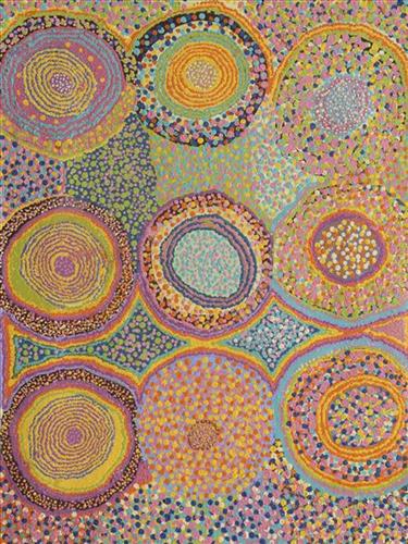
This work portrays an area of Country that can be interpreted in multiple ways. Firstly, the image may be read as an aerial representation of a particular location known to the artist- either land that they or their family travelled, from the pujiman (traditional, desert dwelling) era to now. During the pujiman period, Martu would traverse very large distances annually in small family groups, moving seasonally from water source to water source, and hunting and gathering bush tucker as they went. At this time, one’s survival depended on their intimate knowledge of the location of resources; thus physical elements of Country, such as sources of kapi (water), tali (sandhills), different varieties of warta (trees, vegetation), ngarrini (camps), and jina (tracks) are typically recorded with the use of a use of a system of iconographic forms universally shared across the desert. 

An additional layer of meaning in the work relates to more intangible concepts; life cycles based around kalyu (rain, water) and waru (fire) are also often evident. A thousands of year old practice, fire burning continues to be carried out as both an aid for hunting and a means of land management today. As the Martu travelled and hunted they would burn tracts of land, ensuring plant and animal biodiversity and reducing the risk of unmanageable, spontaneous bush fires. The patchwork nature of regrowth is evident in many landscape works, with each of the five distinctive phases of fire burning visually described with respect to the cycle of burning and regrowth.  

Finally, metaphysical information relating to a location may also be recorded; Jukurrpa (Dreaming) narratives chronicle the creation of physical landmarks, and can be referenced through depictions of ceremonial sites, songlines, and markers left in the land. Very often, however, information relating to Jukurrpa is censored by omission, or alternatively painted over with dotted patterns.

111582336313


Untitled

“When Martu paint, it’s like a map. Martu draw story on the ground and on the canvas, and all the circle and line there are the hunting areas and different waters and tracks where people used to walk, and [some you] can’t cross, like boundaries. So nowadays you see a colourful painting and wonder what it is, but that’s how Martu tell story long ago. It’s not just a lovely painting, it’s a story and a songline and a history and everything that goes with it.” 

– Ngalangka Nola Taylor and Joshua Booth

This work portrays an area of Country that can be interpreted in multiple ways. Firstly, the image may be read as an aerial representation of a particular location known to the artist- either land that they or their family travelled, from the pujiman (traditional, desert dwelling) era to now. During the pujiman period, Martu would traverse very large distances annually in small family groups, moving seasonally from water source to water source, and hunting and gathering bush tucker as they went. At this time, one’s survival depended on their intimate knowledge of the location of resources; thus physical elements of Country, such as sources of kapi (water), tali (sandhills), different varieties of warta (trees, vegetation), ngarrini (camps), and jina (tracks) are typically recorded with the use of a use of a system of iconographic forms universally shared across the desert. 

An additional layer of meaning in the work relates to more intangible concepts; life cycles based around kalyu (rain, water) and waru (fire) are also often evident. A thousands of year old practice, fire burning continues to be carried out as both an aid for hunting and a means of land management today. As the Martu travelled and hunted they would burn tracts of land, ensuring plant and animal biodiversity and reducing the risk of unmanageable, spontaneous bush fires. The patchwork nature of regrowth is evident in many landscape works, with each of the five distinctive phases of fire burning visually described with respect to the cycle of burning and regrowth.  

Finally, metaphysical information relating to a location may also be recorded; Jukurrpa (Dreaming) narratives chronicle the creation of physical landmarks, and can be referenced through depictions of ceremonial sites, songlines, and markers left in the land. Very often, however, information relating to Jukurrpa is censored by omission, or alternatively painted over with dotted patterns.

111582336311


Percival Lakes

The Percival Lakes form a string of ephemeral salt lakes in the north of Western Australia, extending across a distance of 350km. They lie at the southern region of the Great Sandy Desert and east of the Karlamilyi (Rudall River) region. The Canning Stock Route runs in close proximity to some of the lakes, and crosses the salt pan of Tobin Lake near the eastern end. 

This region was formed by Wirnpa, one of the most powerful of the ancestral jila (snake) men and the last to travel the desert during the Jukurrpa (Dreaming). Wirnpa is a rainmaking jila who lived and hunted in the Percival Lakes area. His travels are described in the songs and stories of many language groups across the Western Desert, even those far removed from his home site. In his epic travels, Wirnpa met and feasted with many other ancestral beings, exchanged ceremonial objects, and created a series of different laws and ceremonies. When he finally returned home, he searched for his many children only to discover that they had already died. They had laid down and become the salt springs of the Percival Lakes. Wirnpa wept for his children before himself transforming into a snake and entering the soak where he still resides.

111582336310


Percival Lakes

The Percival Lakes form a string of ephemeral salt lakes in the north of Western Australia, extending across a distance of 350km. They lie at the southern region of the Great Sandy Desert and east of the Karlamilyi (Rudall River) region. The Canning Stock Route runs in close proximity to some of the lakes, and crosses the salt pan of Tobin Lake near the eastern end. 

This region was formed by Wirnpa, one of the most powerful of the ancestral jila (snake) men and the last to travel the desert during the Jukurrpa (Dreaming). Wirnpa is a rainmaking jila who lived and hunted in the Percival Lakes area. His travels are described in the songs and stories of many language groups across the Western Desert, even those far removed from his home site. In his epic travels, Wirnpa met and feasted with many other ancestral beings, exchanged ceremonial objects, and created a series of different laws and ceremonies. When he finally returned home, he searched for his many children only to discover that they had already died. They had laid down and become the salt springs of the Percival Lakes. Wirnpa wept for his children before himself transforming into a snake and entering the soak where he still resides.

111582336308


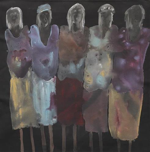
Powerhouse Wanti 2

“It’s pretty much the line of thought of my family. So that’s my daughter and then my granny- ‘Nan Nan’ they call her- and then my mum, SW. And that’s my nanna Lorna. It’s pretty much the line of where I’m from. That connection and family tree.”

– Sylvia Wilson

This work is one of a series by Sylvia Wilson entitled ‘Mum, The Boss, My Daughter and the Wanti (Woman, Girl).’ As Sylvia explains, the work is both a depiction of, and attribute to, the women in her family heritage.

The Martu term for family, walytja, encapsulates a broader idea of relatedness that permeates every aspect of life. The Martu four-section kinship system determines a person as belonging to either the Purungu, Milangka, Panaka or Karrimarra skin group, and was created by the Jukurrpa (Dreaming) ancestors.

This system not only defines relationships, it also establishes a framework for expectations and obligations, and extends the importance of family far beyond mere blood or marriage ties. Family is not limited to blood connections; it encompasses all relationships within the entire community, forming a network of relationships that was crucial to survival during the pujiman (traditional, desert dwelling) era, and that remains fundamental to Martu life today. The kinship system allows everyone to know what expectations one person can have in relation to another, and means that familial terms and relationships are present between any two individuals, whether or not they are related by blood.

111582336307


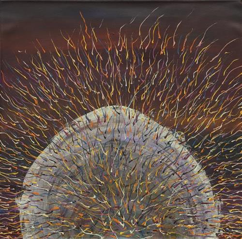
Spinifex

“When I went back to County, I thought how beautiful the spinifex was. How the sun glazed against the spinifex. The County that I speak of is Jilukurru, my grandfather’s country.”

– Kathleen Maree Sorenson

Martu Country is dominated by striking permanent tali (sandhills) covered with spinifex, gums, and other trees and shrubs. Spinifex is a pale green, spiky grass that grows in clumps throughout the Central and Western Deserts of Australia. Some varieties yield edible seeds and another contains a resin.