114182386671


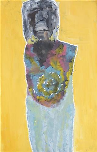
Sharon Doolan – My Grandfather’s Country

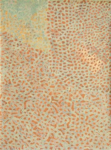
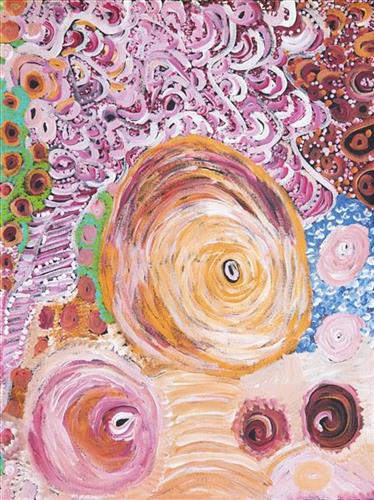
This painting depicts Sharon’s Grandfather’s country. This place is in the Witura National Park on the Northern Territory and South Australia border just south of Finke. This area is a beautiful place with plenty of water. There are many trees, lakes and swimming holes.

111582386670


Mum, The Boss, My Daughter and the Wanti (Woman, Girl)

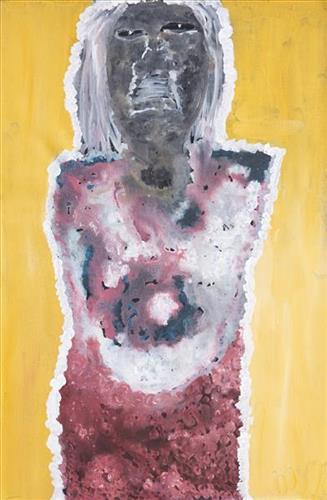
“It’s pretty much the line of thought of my family. So that’s my daughter and then my granny- ‘Nan Nan’ they call her- and then my mum, SW. And that’s my nanna Lorna. It’s pretty much the line of where I’m from. That connection and family tree.”

– Sylvia Wilson

This work is one of a series by Sylvia Wilson entitled ‘Mum, The Boss, My Daughter and the Wanti (Woman, Girl).’ As Sylvia explains, the work is both a depiction of, and attribute to, the women in her family heritage.

The Martu term for family, walytja, encapsulates a broader idea of relatedness that permeates every aspect of life. The Martu four-section kinship system determines a person as belonging to either the Purungu, Milangka, Panaka or Karrimarra skin group, and was created by the Jukurrpa (Dreaming) ancestors.

This system not only defines relationships, it also establishes a framework for expectations and obligations, and extends the importance of family far beyond mere blood or marriage ties. Family is not limited to blood connections; it encompasses all relationships within the entire community, forming a network of relationships that was crucial to survival during the pujiman (traditional, desert dwelling) era, and that remains fundamental to Martu life today. The kinship system allows everyone to know what expectations one person can have in relation to another, and means that familial terms and relationships are present between any two individuals, whether or not they are related by blood.

114182386669


Kapi Tjukurla (Tjukurla Rock holes)

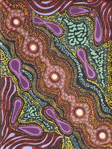
Kapi Tjukurla is a sacred women’s site where the sisters came to drink water from the rock hole. Knowledge of where to find Kapi Tjukurla was handed down through generations as it is a significant source in times of drought.

The kapi across the lands vary in size from as large as a car to as small as a deep kitchen sink. They can be found buried in the flat rock surface on the ground, at the bottom of a waterfall or among the ranges where there is an expanse of flat rock surface. Yarnangu kept these rock holes clear of dirt build up, dead animals and debris so the water can remain drinkable. These rock holes are still only used specifically for drinking and cooking when people go out on country. 

The circles in the painting represent Kapi Tjukurla. The lines connecting the circles are the creeks, streams or paths the water takes when it rains.

111582386667


Mum, The Boss, My Daughter and the Wanti (Woman, Girl)

“It’s pretty much the line of thought of my family. So that’s my daughter and then my granny- ‘Nan Nan’ they call her- and then my mum, SW. And that’s my nanna Lorna. It’s pretty much the line of where I’m from. That connection and family tree.”

– Sylvia Wilson

This work is one of a series by Sylvia Wilson entitled ‘Mum, The Boss, My Daughter and the Wanti (Woman, Girl).’ As Sylvia explains, the work is both a depiction of, and attribute to, the women in her family heritage.

The Martu term for family, walytja, encapsulates a broader idea of relatedness that permeates every aspect of life. The Martu four-section kinship system determines a person as belonging to either the Purungu, Milangka, Panaka or Karrimarra skin group, and was created by the Jukurrpa (Dreaming) ancestors.

This system not only defines relationships, it also establishes a framework for expectations and obligations, and extends the importance of family far beyond mere blood or marriage ties. Family is not limited to blood connections; it encompasses all relationships within the entire community, forming a network of relationships that was crucial to survival during the pujiman (traditional, desert dwelling) era, and that remains fundamental to Martu life today. The kinship system allows everyone to know what expectations one person can have in relation to another, and means that familial terms and relationships are present between any two individuals, whether or not they are related by blood.

111582386666


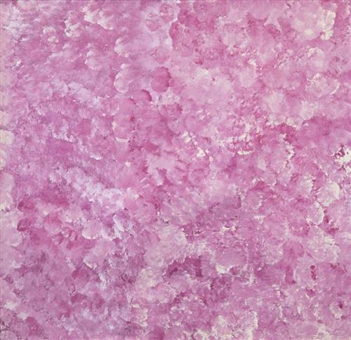
Gunbarrel Highway – Pink Lake

This work depicts a warla (lake) within the artists’ ngurra (home Country, camp), typically represented with circular forms. As a reliable source of water in the often harsh and arid Martu lands, warla represented important sites not only for camping throughout the year, but also in terms of their creation as described through Jukurrpa (dreaming) narratives.

During the pujiman (traditional, desert dwelling) period, knowledge of water sources was critical for survival, and today Martu Country is still defined in terms of the location and type of water. Each of the hundreds of claypans, rockholes, waterholes, soaks and springs found in the Martu desert homelands is known through real life experience and the recounting of Jukurrpa narratives by name, location, quality and seasonal availability. This encyclopedic knowledge extends even to the nature and movement of arterial waterways, and sustained Martu as they travelled across their Country, hunting and gathering, visiting family, and fulfilling ceremonial obligations. They would traverse very large distances annually, visiting specific areas in the dry and wet season depending on the availability of water and the corresponding cycles of plant and animal life on which hunting and gathering bush tucker was reliant.

111582386663


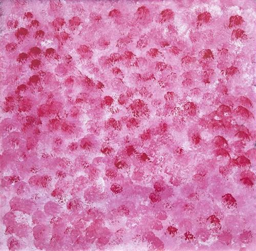
Red Lake

This work depicts a warla (lake) within the artists’ ngurra (home Country, camp), typically represented with circular forms. As a reliable source of water in the often harsh and arid Martu lands, warla represented important sites not only for camping throughout the year, but also in terms of their creation as described through Jukurrpa (dreaming) narratives.

During the pujiman (traditional, desert dwelling) period, knowledge of water sources was critical for survival, and today Martu Country is still defined in terms of the location and type of water. Each of the hundreds of claypans, rockholes, waterholes, soaks and springs found in the Martu desert homelands is known through real life experience and the recounting of Jukurrpa narratives by name, location, quality and seasonal availability. This encyclopedic knowledge extends even to the nature and movement of arterial waterways, and sustained Martu as they travelled across their Country, hunting and gathering, visiting family, and fulfilling ceremonial obligations. They would traverse very large distances annually, visiting specific areas in the dry and wet season depending on the availability of water and the corresponding cycles of plant and animal life on which hunting and gathering bush tucker was reliant.

111582386660


Untitled

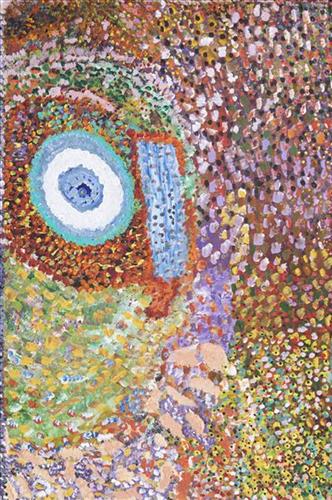
This is Muuki’s Country- his ‘ngurra’ (home Country, camp). People identify with their ngurra in terms of specific rights and responsibilities, and the possession of intimate knowledge of the physical and cultural properties of one’s Country. Painting ngurra, and in so doing sharing the Jukurrpa (Dreaming) stories and physical characteristics of that place, has today become an important means of cultural maintenance. 

Muuki’s ngurra encompasses the Country that he and his family walked in the pujiman (traditional, desert-dwelling) era. Muuki was born at Wayinkurangu, a soak located within the Percival Lakes region of the Great Sandy Desert. In his youth Muuki’s family travelled hundreds of kilometres on foot, from the northern boundary of the Martu homelands through to Parrngurr, at the southern end of the Karlamily (Rudall River) region. They continued to live a pujiman lifestyle until being collected from Balfour Downs Station and taken to Jigalong Mission in the 1960s. They were one of the last Martu families to leave the desert. 

Portrayed in this work are features of Muuki’s ngurra, such as the dominant permanent red tali (sandhills), warta (trees, vegetation), and the individually named water sources he and his family camped at. These include Nyayartakujarra (Lake Dora), Nyukuwarta, Parnngurr, Paru, Matakurlu, Munkakulu, Wungungarlkulu, Jawalirli, Wirnpa, Yukuri, Matakurlu, and Ngaral. Rock holes, waterholes, soaks and springs were all extremely important sites for Martu people during the pujiman period, and are generally depicted with circular forms. 

The encyclopaedic knowledge of the location, quality and seasonal availability of the hundreds of water bodies found in one’s Country sustained Martu as they travelled across their Country, hunting and gathering, visiting family, and fulfilling ceremonial obligations. They would traverse very large distances annually, visiting specific areas in the dry and wet season depending on the availability of water and the corresponding cycles of plant and animal life on which hunting and gathering bush tucker was reliant. As they travelled and hunted they would also burn areas of Country, generating a greater diversity of plant and animal life.
111582386658


Canning Stock Route Well 1-5

“When they were laying out the Canning Stock Route, whitefellas used to get Martu people to show them where the permanent water was. The whitefellas was asking Martu people to show them permanent water, like soaks and rockholes, for a shortcut from Wiluna to Billiluna. When the whitefellas found out where the permanent water was, they made wells in every place and they called it the Canning Stock Route. That was how they went cut-across.”

– Yanjimi Peter Rowlands (dec.)


Western Australia’s gold rush, beginning in 1885, created a huge demand for beef from mines located between Halls Creek and Wiluna. At that time, most of Western Australia’s cattle came from the Kimberley, though an infestation of tropical ticks among the East Kimberley herds gave the West Kimberley pastoralists a monopoly on the beef trade — causing prices to soar. A Royal Commission in 1904 proposed the construction of a stock route through Western Australia’s desert country to eliminate the ticks through exposure to its hot, dry conditions, resulting in the near 2000 kilometre Canning Stock Route. The proposal was successful insofar as the eradication of ticks was concerned; however, the establishment of the Canning Stock Route was to have far reaching repercussions for Western Australia’s Aboriginal population. 

The construction of the route by Alfred Canning and his team in 1910 resulted in first contact with Europeans for many Martu then living a pujiman (traditional, desert dwelling) life in the desert. This contact began with Canning’s use of Aboriginal guides to lead him to the sources of water that would be transformed into 48 stock route wells. Acts of cruelty toward these guides included, amongst other things, chaining them at night to prevent their escape and giving them salt water to drink, thereby ensuring their thirst and subsequent necessity to lead the party to water sources.

Following the construction of the Canning Stock Route, Martu encountered Europeans and other Martu working as cattle drovers as they would travel up and down the Stock Route from water source to water source. Increasingly, pujiman followed the route to newly established ration depots, mission and pastoral stations. They were drawn to the route in search of food, by a sense of curiosity, or by loneliness. By the late 1950s and early 1960s, most of the desert family groups had left the desert. Eventually, these factors combined with an extreme and prolonged drought in the 1960s to prompt the few remaining pujiman to move in from the desert. One of the last major migrations of Martu people occurred in 1963, when many of the pujiman born Martumili Artists moved to Jigalong.

Patterns of movement which had defined Aboriginal people’s relationships to Country were forever changed by the Canning Stock Route, but the Martu relationship with Country remains strong through the maintenance of physical and cultural ties to desert life and knowledge.

111582386656


Untitled

This is Dale’s Country- her ‘ngurra’ (home Country, camp). People identify with their ngurra in terms of specific rights and responsibilities, and the possession of intimate knowledge of the physical and cultural properties of one’s Country. Painting ngurra, and in so doing sharing the Jukurrpa (Dreaming) stories and physical characteristics of that place, has today become an important means of cultural maintenance. Dale’s ngurra encompasses her birthplace, Jigalong, and the Country that her family walked in the pujiman (traditional, desert-dwelling) era, including Puntawarri, Raarki (Canning Stock Route Well 27), Kularti, Kumpupirntily , Mirtikanya, (Kumpupintily, Lake Disappointment), and Mukurtu.

Portrayed in this work are features of Dale’s family’s ngurra, such as the striking salt lakes, dominant permanent red tali (sandhills), warta (trees, vegetation), and the individually named water sources they camped at. Rock holes, waterholes, soaks and springs were all extremely important sites for Martu people during the pujiman period, and are generally depicted with circular forms. 

The encyclopaedic knowledge of the location, quality and seasonal availability of the hundreds of water bodies found in one’s Country sustained Martu as they travelled across their Country, hunting and gathering, visiting family, and fulfilling ceremonial obligations. They would traverse very large distances annually, visiting specific areas in the dry and wet season depending on the availability of water and the corresponding cycles of plant and animal life on which hunting and gathering bush tucker was reliant. As they travelled and hunted they would also burn areas of Country, generating a greater diversity of plant and animal life.
111582386655


Untitled

This is Dale’s Country- her ‘ngurra’ (home Country, camp). People identify with their ngurra in terms of specific rights and responsibilities, and the possession of intimate knowledge of the physical and cultural properties of one’s Country. Painting ngurra, and in so doing sharing the Jukurrpa (Dreaming) stories and physical characteristics of that place, has today become an important means of cultural maintenance. Dale’s ngurra encompasses her birthplace, Jigalong, and the Country that her family walked in the pujiman (traditional, desert-dwelling) era, including Puntawarri, Raarki (Canning Stock Route Well 27), Kularti, Kumpupirntily , Mirtikanya, (Kumpupintily, Lake Disappointment), and Mukurtu.

Portrayed in this work are features of Dale’s family’s ngurra, such as the striking salt lakes, dominant permanent red tali (sandhills), warta (trees, vegetation), and the individually named water sources they camped at. Rock holes, waterholes, soaks and springs were all extremely important sites for Martu people during the pujiman period, and are generally depicted with circular forms. 

The encyclopaedic knowledge of the location, quality and seasonal availability of the hundreds of water bodies found in one’s Country sustained Martu as they travelled across their Country, hunting and gathering, visiting family, and fulfilling ceremonial obligations. They would traverse very large distances annually, visiting specific areas in the dry and wet season depending on the availability of water and the corresponding cycles of plant and animal life on which hunting and gathering bush tucker was reliant. As they travelled and hunted they would also burn areas of Country, generating a greater diversity of plant and animal life.