114182421463


The Ngaanyatjarra Lands

‘The Ngaanyatjarra Lands’, Craig Morrison is predominantly a landscape artist depicting vibrant scenes from across the Ngaanyatjarra Lands. Craig is a self taught landscape painter taking inspiration from the Hermannsburg movement. Craig’s paintings are a celebration of the seasonal changes which bring vast site of sandhills and hills in the summer and lush foliage coming into spring. Craig enjoys exploring the lands, studying the elements of his environment with close detail. He is a great role model for younger male artists in the community.


Dimensions: 40 x 61cm

114182421729


Wati kutjara – The goanna men

This is the story of two powerful magicians who came to the Ngaanyatjarra Lands from far away to the west;

‘These two men are always together, always camping together. They do all sorts of tricks when they travel across the lands as they stop from place to place. When they reached ‘Wirtapi Wara’ (Long Black or Blackstone Range) they argued about which way to go around. One went around the south side and the other the north side.

At a distance it seemed they didn’t recognise each other or perhaps they were just pretending not to recognise each other! It is also said that at Papulankutja they tricked each other by changing their appearance at the same time so they had no chance to recognise each other. The name Papulankutja comes from the Ngaanyatjarra word meaning, ‘to stare without recognising each other’.


Dimensions: 40 x 40cm

114182421727


Minyma Kutjarra – (Two Sisters)

‘Minyma Kutjara’ (Two Ladies), is a popularly depicted story by women from the Ngaanyatjarra Lands. The painting has different chapters depending on where the artist is from and the inherited story of their ancestors.  we see the ladies sitting together at their camp situated among the sand hills. They are surrounded by an abundance of desert flowers and fruits. The painting is a reflection on the lush nature of the land that was so many years ago. When there is rain coming to the lands it makes everyone so pleased as it indicates good foraging and hunting.


Dimensions: 61 x 61cm

114182422032


Yirmangka – Yirmangka ( Bush Medicine)

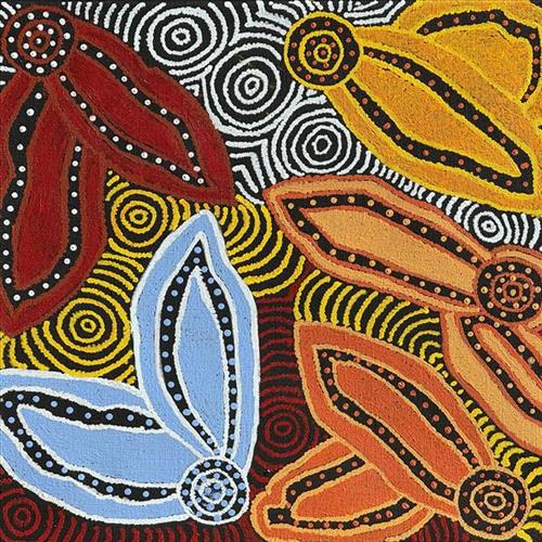
This is from a series of small works from our main artists depiocting the love of collecting from the bush traditional medicines and tucker.

Dimensions: 40 x 40cm

111582423519


Bugaimili ngurra (Bugai’s homeland)

This is Bugai’s Country- her ‘ngurra’ (home Country, camp). People identify with their ngurra in terms of specific rights and responsibilities, and the possession of intimate knowledge of the physical and cultural properties of one’s Country. Painting ngurra, and in so doing sharing the Jukurrpa (Dreaming) stories and physical characteristics of that place, has today become an important means of cultural maintenance. 

Bugai’s ngurra encompasses the Country that she and her family walked in the pujiman (traditional, desert-dwelling) era. At this time Bugai travelled nomadically with her own and other family groups, most notably the Bidu family. The Country they traversed encompassed an enormous tract of land, with an aerial distance of more than 600 kilometres, from present day Balfour Downs Station to Kunawarritji (Canning Stock Route Well 33). Bugai was born at Pulkinya. She grew up, walked and hunted primarily around Parnngurr, Punmu, Kun Kun (Kuny-kuny) and Kunawarritji. As a young woman Bugai travelled with her husband through the Karlamilyi (Rudall River) region and up and down the Canning Stock Route, where she first met cattle drovers. She continued to live nomadically before eventually deciding to move to Jigalong Mission along with many other relatives following an extreme and prolonged drought in the 1960s. 

Portrayed in this work are features of Bugai’s ngurra, such as the striking salt lakes, dominant permanent red tali (sandhills), warta (trees, vegetation), and the individually named water sources Bugai and her family camped at. These include Parnngurr, Martilirri, Wangkakalu, Kurta-kurta (Camel Rock), Pimurlu, Jilkupuka (Canning Stock Route Well 21), Kaalpa (Canning Stock Route Well 23), Kartarru (Canning Stock Route Well 24), Wantili (Warntili, Canning Stock Route Well 25), Tiwa (Canning Stock Route Well 26), Partujarrapirri, Raarki (Canning Stock Route Well 27), Wuranu (Canning Stock Route Well 29), Juntu- juntu (Canning Stock Route Well 30), and Kunawarritji. Rock holes, waterholes, soaks and springs were all extremely important sites for Martu people during the pujiman period, and are generally depicted with circular forms. 

The encyclopaedic knowledge of the location, quality and seasonal availability of the hundreds of water bodies found in one’s Country sustained Martu as they travelled across their Country, hunting and gathering, visiting family, and fulfilling ceremonial obligations. They would traverse very large distances annually, visiting specific areas in the dry and wet season depending on the availability of water and the corresponding cycles of plant and animal life on which hunting and gathering bush tucker was reliant. As they travelled and hunted they would also burn areas of Country, generating a greater diversity of plant and animal life.


Dimensions: 91 x 122 cm

111582423518


Bugaimili ngurra (Bugai’s homeland)

This is Bugai’s Country- her ‘ngurra’ (home Country, camp). People identify with their ngurra in terms of specific rights and responsibilities, and the possession of intimate knowledge of the physical and cultural properties of one’s Country. Painting ngurra, and in so doing sharing the Jukurrpa (Dreaming) stories and physical characteristics of that place, has today become an important means of cultural maintenance. 

Bugai’s ngurra encompasses the Country that she and her family walked in the pujiman (traditional, desert-dwelling) era. At this time Bugai travelled nomadically with her own and other family groups, most notably the Bidu family. The Country they traversed encompassed an enormous tract of land, with an aerial distance of more than 600 kilometres, from present day Balfour Downs Station to Kunawarritji (Canning Stock Route Well 33). Bugai was born at Pulkinya. She grew up, walked and hunted primarily around Parnngurr, Punmu, Kun Kun (Kuny-kuny) and Kunawarritji. As a young woman Bugai travelled with her husband through the Karlamilyi (Rudall River) region and up and down the Canning Stock Route, where she first met cattle drovers. She continued to live nomadically before eventually deciding to move to Jigalong Mission along with many other relatives following an extreme and prolonged drought in the 1960s. 

Portrayed in this work are features of Bugai’s ngurra, such as the striking salt lakes, dominant permanent red tali (sandhills), warta (trees, vegetation), and the individually named water sources Bugai and her family camped at. These include Parnngurr, Martilirri, Wangkakalu, Kurta-kurta (Camel Rock), Pimurlu, Jilkupuka (Canning Stock Route Well 21), Kaalpa (Canning Stock Route Well 23), Kartarru (Canning Stock Route Well 24), Wantili (Warntili, Canning Stock Route Well 25), Tiwa (Canning Stock Route Well 26), Partujarrapirri, Raarki (Canning Stock Route Well 27), Wuranu (Canning Stock Route Well 29), Juntu- juntu (Canning Stock Route Well 30), and Kunawarritji. Rock holes, waterholes, soaks and springs were all extremely important sites for Martu people during the pujiman period, and are generally depicted with circular forms. 

The encyclopaedic knowledge of the location, quality and seasonal availability of the hundreds of water bodies found in one’s Country sustained Martu as they travelled across their Country, hunting and gathering, visiting family, and fulfilling ceremonial obligations. They would traverse very large distances annually, visiting specific areas in the dry and wet season depending on the availability of water and the corresponding cycles of plant and animal life on which hunting and gathering bush tucker was reliant. As they travelled and hunted they would also burn areas of Country, generating a greater diversity of plant and animal life.


Dimensions: 91 x 91 cm

111582423517


Bugaimili ngurra (Bugai’s homeland)

This is Bugai’s Country- her ‘ngurra’ (home Country, camp). People identify with their ngurra in terms of specific rights and responsibilities, and the possession of intimate knowledge of the physical and cultural properties of one’s Country. Painting ngurra, and in so doing sharing the Jukurrpa (Dreaming) stories and physical characteristics of that place, has today become an important means of cultural maintenance. 

Bugai’s ngurra encompasses the Country that she and her family walked in the pujiman (traditional, desert-dwelling) era. At this time Bugai travelled nomadically with her own and other family groups, most notably the Bidu family. The Country they traversed encompassed an enormous tract of land, with an aerial distance of more than 600 kilometres, from present day Balfour Downs Station to Kunawarritji (Canning Stock Route Well 33). Bugai was born at Pulkinya. She grew up, walked and hunted primarily around Parnngurr, Punmu, Kun Kun (Kuny-kuny) and Kunawarritji. As a young woman Bugai travelled with her husband through the Karlamilyi (Rudall River) region and up and down the Canning Stock Route, where she first met cattle drovers. She continued to live nomadically before eventually deciding to move to Jigalong Mission along with many other relatives following an extreme and prolonged drought in the 1960s. 

Portrayed in this work are features of Bugai’s ngurra, such as the striking salt lakes, dominant permanent red tali (sandhills), warta (trees, vegetation), and the individually named water sources Bugai and her family camped at. These include Parnngurr, Martilirri, Wangkakalu, Kurta-kurta (Camel Rock), Pimurlu, Jilkupuka (Canning Stock Route Well 21), Kaalpa (Canning Stock Route Well 23), Kartarru (Canning Stock Route Well 24), Wantili (Warntili, Canning Stock Route Well 25), Tiwa (Canning Stock Route Well 26), Partujarrapirri, Raarki (Canning Stock Route Well 27), Wuranu (Canning Stock Route Well 29), Juntu- juntu (Canning Stock Route Well 30), and Kunawarritji. Rock holes, waterholes, soaks and springs were all extremely important sites for Martu people during the pujiman period, and are generally depicted with circular forms. 

The encyclopaedic knowledge of the location, quality and seasonal availability of the hundreds of water bodies found in one’s Country sustained Martu as they travelled across their Country, hunting and gathering, visiting family, and fulfilling ceremonial obligations. They would traverse very large distances annually, visiting specific areas in the dry and wet season depending on the availability of water and the corresponding cycles of plant and animal life on which hunting and gathering bush tucker was reliant. As they travelled and hunted they would also burn areas of Country, generating a greater diversity of plant and animal life.


Dimensions: 91 x 91 cm

111582423516


Bugaimili ngurra (Bugai’s homeland)

This is Bugai’s Country- her ‘ngurra’ (home Country, camp). People identify with their ngurra in terms of specific rights and responsibilities, and the possession of intimate knowledge of the physical and cultural properties of one’s Country. Painting ngurra, and in so doing sharing the Jukurrpa (Dreaming) stories and physical characteristics of that place, has today become an important means of cultural maintenance. 

Bugai’s ngurra encompasses the Country that she and her family walked in the pujiman (traditional, desert-dwelling) era. At this time Bugai travelled nomadically with her own and other family groups, most notably the Bidu family. The Country they traversed encompassed an enormous tract of land, with an aerial distance of more than 600 kilometres, from present day Balfour Downs Station to Kunawarritji (Canning Stock Route Well 33). Bugai was born at Pulkinya. She grew up, walked and hunted primarily around Parnngurr, Punmu, Kun Kun (Kuny-kuny) and Kunawarritji. As a young woman Bugai travelled with her husband through the Karlamilyi (Rudall River) region and up and down the Canning Stock Route, where she first met cattle drovers. She continued to live nomadically before eventually deciding to move to Jigalong Mission along with many other relatives following an extreme and prolonged drought in the 1960s. 

Portrayed in this work are features of Bugai’s ngurra, such as the striking salt lakes, dominant permanent red tali (sandhills), warta (trees, vegetation), and the individually named water sources Bugai and her family camped at. These include Parnngurr, Martilirri, Wangkakalu, Kurta-kurta (Camel Rock), Pimurlu, Jilkupuka (Canning Stock Route Well 21), Kaalpa (Canning Stock Route Well 23), Kartarru (Canning Stock Route Well 24), Wantili (Warntili, Canning Stock Route Well 25), Tiwa (Canning Stock Route Well 26), Partujarrapirri, Raarki (Canning Stock Route Well 27), Wuranu (Canning Stock Route Well 29), Juntu- juntu (Canning Stock Route Well 30), and Kunawarritji. Rock holes, waterholes, soaks and springs were all extremely important sites for Martu people during the pujiman period, and are generally depicted with circular forms. 

The encyclopaedic knowledge of the location, quality and seasonal availability of the hundreds of water bodies found in one’s Country sustained Martu as they travelled across their Country, hunting and gathering, visiting family, and fulfilling ceremonial obligations. They would traverse very large distances annually, visiting specific areas in the dry and wet season depending on the availability of water and the corresponding cycles of plant and animal life on which hunting and gathering bush tucker was reliant. As they travelled and hunted they would also burn areas of Country, generating a greater diversity of plant and animal life.


Dimensions: 46 x 61 cm

111582423515


Bugaimili ngurra (Bugai’s homeland)

This is Bugai’s Country- her ‘ngurra’ (home Country, camp). People identify with their ngurra in terms of specific rights and responsibilities, and the possession of intimate knowledge of the physical and cultural properties of one’s Country. Painting ngurra, and in so doing sharing the Jukurrpa (Dreaming) stories and physical characteristics of that place, has today become an important means of cultural maintenance. 

Bugai’s ngurra encompasses the Country that she and her family walked in the pujiman (traditional, desert-dwelling) era. At this time Bugai travelled nomadically with her own and other family groups, most notably the Bidu family. The Country they traversed encompassed an enormous tract of land, with an aerial distance of more than 600 kilometres, from present day Balfour Downs Station to Kunawarritji (Canning Stock Route Well 33). Bugai was born at Pulkinya. She grew up, walked and hunted primarily around Parnngurr, Punmu, Kun Kun (Kuny-kuny) and Kunawarritji. As a young woman Bugai travelled with her husband through the Karlamilyi (Rudall River) region and up and down the Canning Stock Route, where she first met cattle drovers. She continued to live nomadically before eventually deciding to move to Jigalong Mission along with many other relatives following an extreme and prolonged drought in the 1960s. 

Portrayed in this work are features of Bugai’s ngurra, such as the striking salt lakes, dominant permanent red tali (sandhills), warta (trees, vegetation), and the individually named water sources Bugai and her family camped at. These include Parnngurr, Martilirri, Wangkakalu, Kurta-kurta (Camel Rock), Pimurlu, Jilkupuka (Canning Stock Route Well 21), Kaalpa (Canning Stock Route Well 23), Kartarru (Canning Stock Route Well 24), Wantili (Warntili, Canning Stock Route Well 25), Tiwa (Canning Stock Route Well 26), Partujarrapirri, Raarki (Canning Stock Route Well 27), Wuranu (Canning Stock Route Well 29), Juntu- juntu (Canning Stock Route Well 30), and Kunawarritji. Rock holes, waterholes, soaks and springs were all extremely important sites for Martu people during the pujiman period, and are generally depicted with circular forms. 

The encyclopaedic knowledge of the location, quality and seasonal availability of the hundreds of water bodies found in one’s Country sustained Martu as they travelled across their Country, hunting and gathering, visiting family, and fulfilling ceremonial obligations. They would traverse very large distances annually, visiting specific areas in the dry and wet season depending on the availability of water and the corresponding cycles of plant and animal life on which hunting and gathering bush tucker was reliant. As they travelled and hunted they would also burn areas of Country, generating a greater diversity of plant and animal life.


Dimensions: 91 x 122 cm

111582423522


Untitled

This work portrays an area known to the artist, painted here from memory. During the pujiman (traditional, desert dwelling) era one’s survival depended on their intimate knowledge of the location of resources; thus physical elements of Country, such as sources of kapi (water), tali (sandhills), and different varieties of warta (trees, vegetation) were carefully observed and remembered. Today, this relationship with Country remains equally strong, despite the movement of Martu out of the desert and into remote Aboriginal communities, towns and cities.

Also visible may be traces of life cycles based around kalyu (rain, water) and waru (fire). A thousands of year old practice, fire burning continues to be carried out as both an aid for hunting and a means of land management today. As the Martu travelled and hunted they would burn tracts of land, ensuring plant and animal biodiversity and reducing the risk of unmanageable, spontaneous bush fires. The patchwork nature of regrowth is visible in many landscape works, with each of the five distinctive phases of fire burning visually described with respect to the cycle of burning and regrowth.  

Finally, metaphysical information relating to a location may also be recorded; Jukurrpa (Dreaming) narratives chronicle the creation of physical landmarks, and can be referenced through depictions of ceremonial sites, songlines, and markers left in the land. 


Dimensions: 30 x 30 cm: acrylic on canvas