111581944257
Untitled
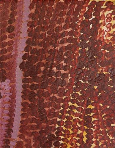
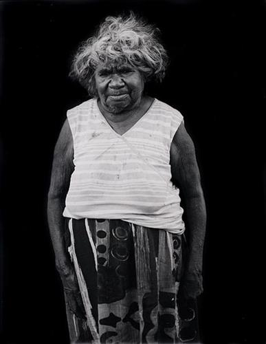
This is Bugai’s Country- her ‘ngurra’ (home Country, camp). People identify with their ngurra in terms of specific rights and responsibilities, and the possession of intimate knowledge of the physical and cultural properties of one’s Country. Painting ngurra, and in so doing sharing the Jukurrpa (Dreaming) stories and physical characteristics of that place, has today become an important means of cultural maintenance.
Bugai’s ngurra encompasses the Country that she and her family walked in the pujiman (traditional, desert-dwelling) era. At this time Bugai travelled nomadically with her own and other family groups, most notably the Bidu family. The Country they traversed encompassed an enormous tract of land, with an aerial distance of more than 600 kilometres, from present day Balfour Downs Station to Kunawarritji (Canning Stock Route Well 33). Bugai was born at Pulkinya. She grew up, walked and hunted primarily around Parnngurr, Punmu, Kun Kun (Kuny-kuny) and Kunawarritji. As a young woman Bugai travelled with her husband through the Karlamily (Rudall River) region and up and down the Canning Stock Route, where she first met cattle drovers. She continued to live nomadically before eventually deciding to move to Jigalong Mission along with many other relatives following an extreme and prolonged drought in the 1960s.
Portrayed in this work are features of Bugai’s ngurra, such as the striking salt lakes, dominant permanent red tali (sandhills), warta (trees, vegetation), and the individually named water sources Bugai and her family camped at. These include Parnngurr, Martilirri, Wangkakalu, Kurta-kurta (Camel Rock), Pimurlu, Jilkupuka (Canning Stock Route Well 21), Kaalpa (Canning Stock Route Well 23), Kartarru (Canning Stock Route Well 24), Wantili (Warntili, Canning Stock Route Well 25), Tiwa (Canning Stock Route Well 26), Partujarrapirri, Raarki (Canning Stock Route Well 27), Wuranu (Canning Stock Route Well 29), Juntu- juntu (Canning Stock Route Well 30), and Kunawarritji. Rock holes, waterholes, soaks and springs were all extremely important sites for Martu people during the pujiman period, and are generally depicted with circular forms.
The encyclopaedic knowledge of the location, quality and seasonal availability of the hundreds of water bodies found in one’s Country sustained Martu as they travelled across their Country, hunting and gathering, visiting family, and fulfilling ceremonial obligations. They would traverse very large distances annually, visiting specific areas in the dry and wet season depending on the availability of water and the corresponding cycles of plant and animal life on which hunting and gathering bush tucker was reliant. As they travelled and hunted they would also burn areas of Country, generating a greater diversity of plant and animal life.


