111582083809


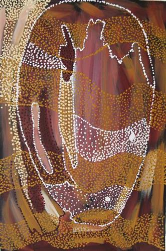
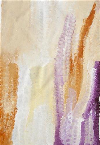
Kaalpa (Kalypa, Canning Stock Route Well 23)

“From Tiwa (Canning Stock Route Well 26) we used to travel to Kaalpa (Kalypa, Canning Stock Route Well 23), mummy and daddy used to take us around there, [my sister] Pinyirr and me. From Kaalpa we would go to Jilkupuka (Canning Stock Route Well 21), then to Wangkakalu.”

 – Bugai Whyoulter, as translated by Ngalangka Nola Taylor

Kaalpa is a permanent water source located northeast of Kumpupirntily (Kumpupintily, Lake Disappointment). This site lies within Bugai’s ngurra (home Country, camp), the area which she travelled extensively around with her family as a young woman. Kaalpa is also Bugai’s mother’s Country. In her account, Bugai describes the seasonal movement of Martu family groups from water source to water source during the pujiman (traditional, desert dwelling) era. At this time knowledge of water sources was critical for survival, and today Martu Country is still defined in terms of the location and type of water. Each of the hundreds of claypans, rockholes, waterholes, soaks and springs found in the Martu desert homelands is known by name, location, quality and seasonal availability through real life experience and the recounting of Jukurrpa (Dreaming) narratives.  

Kaalpa is a place of great cultural significance, and is also known for good hunting. Adjacent to the waterhole is a hill of the same name. The landscape around Kaalpa is parlkarra (flat country), bordered by tali (sandhills) stretching as far as Windy Corner, northeast and towards the border of Western Australia and the Northern Territory. The Jukurrpa mosquito and fly beings partially created the landforms in this area and continue to live underground. These beings are very large and dangerous; it is imperative that this area is not mined since the consequences may be severe.

Kaalpa also features in the Minyipuru (Jakulyukulyu, Seven Sisters) Jukurrpa, a central creation narrative for Martu, Ngaanyatjarra, Pitjantjatjara and Yankunytjatjara people that is associated with the seasonal Pleiades star constellation. At Kaalpa the Minyipuru met a group of men; it was the first time either group had seen members of the opposite sex. The men tried to grab the women, but the Minyipuru chased them, hitting them with their digging sticks leaving them lying there as they continued travelling east.

Minyipuru is Relayed in song, dance, stories and paintings, Minyipuru serves as a creation narrative, a source of information relating to the physical properties of the land, and an embodiment of Aboriginal cultural laws. Beginning in Roebourne on the west coast of Western Australia, the story morphs in its movement eastward across the land, following the women as they walk, dance, and even fly from waterhole to waterhole. As they travel the women camp, sing, wash, dance and gather food, leaving markers in the landscape and creating landforms that remain to this day, such as groupings of rocks and trees, grinding stones and seeds. During the entirety of their journey the women are pursued by a lustful old man, Yurla, although interactions with other animals, groups of men, and spirit beings are also chronicled in the narrative.

The intersection of the Canning Stock Route with Kaalpa also made this a site of early contact with Europeans for many Martu then living a pujiman life in the desert. Following the route’s construction, Martu encountered Europeans and other Martu working as cattle drovers as they would travel up and down the Stock Route from water source to water source. Increasingly, pujimanpa (desert dwellers) followed the route to newly established ration depots, mission and pastoral stations. They were drawn to the route in search of food, by a sense of curiosity, or by loneliness. By the late 1950s and early 1960s, most of the desert family groups had left the desert. Eventually, these factors combined with an extreme and prolonged drought in the 1960s to prompt the few remaining pujimanpa to move in from the desert.

111582083808


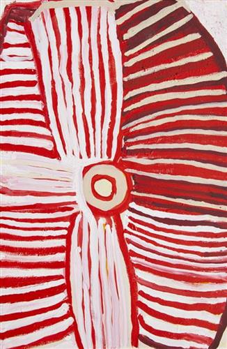
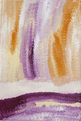
Kartarru (Blue Hills Station, Canning Stock Route Well 24)

“This Country is Bugai’s mother’s Country where they would stay for periods of time because they could hunt there and there was good, permanent kapi (water). Kartarru is Well 24 on the Canning Stock Route.“

– Bugai Whyoulter, as translated by Bugai’s grandson, Cyril Whyoulter

At Kartarru (Blue Hills Station, Canning Stock Route Well 24), located northeast of Kumpupirntily (Kumpupintily, Lake Disappointment), good drinking water is reliably available, and minyarra (bush onion) grows in seasonal abundance. For these reasons the site was a popular camping area during the pujiman (traditional, desert dwelling) era. Kartarru is also significant as a site in two important Jukurrpa (Dreaming) narratives, Wati Kujarra (Two Goanna Men) and Minyipuru (Jakulyukulyu, or Seven Sisters). 

Kartarru was a regular camp site for Bugai in her youth. At this time Bugai travelled nomadically with her own and other family groups, most notably the Bidu family. The Country they traversed encompassed an enormous tract of land, with an aerial distance of more than 600 kilometres, from present day Balfour Downs Station to Kunawarritji. Typically, families would travel together for a time before arranging to meet further along at another camp site. When they arrived at the meeting place, they would light a large waru (fire) so that the others would know where they were.

111582083806


Karlamilyi

“This Karlamilyi area, big land. That’s a ngurra (home Country, camp) belonging to our old people, Warnman people. We talk for our land, our jila (snake). I grew up in this Country, my Country. This land belongs to our father. In pujiman (traditional, desert dwelling) days I walked around here, used to walk up and down tuwa (sandhill) and back to the main camp belonging to Martu. 

That river running through, he called Pirnpi. Whitefella way is Rudall River. There’s a bird, karuwarlkun (magpie), flying and singing everywhere in the Rudall River there. The river is flowing to Lake Dora, it has five waterholes in the river system. Outside of the river are creeks and gullies, the salt lake, Lake Dora, and the sand dunes.

There’s a claypan there too, big claypan, close to Walirrlirri. Pangkartal we call him. There’s a big rain there, rain time. Fill him up water when the rain time comes. Snake living there in Pangkartal, big one. He [the snake] going to listen to the owner of the land. When we sing out to him in a Warnman way, we tell him “Stop, don’t get cheeky. We coming in [to the land].” He not cheeky, he a good one. Quiet snake.

At Nyayartakujarra (Lake Dora), [in the north east of the region,] two snakes been killed. Right here they got crook in the Dreamtime. All the men, Ngaanyatjarra and Warnman, they were singing. One young fella, he threw a spear into the snake. That snake felt something there, got killed and burned.

[West of Nyayartakujarra is] Yanytikuji, red hill over there. They working, doing the mining there now [at Yandicoogina Mine]. Next to Yanytikuji is a big claypan, Yalpalpa, main camp and a water. That’s a hunting place. Plenty of bush tucker round there; kanyjamarra (yam, bush carrot), like a carrot growing in the ground in the river bed there. You pull it out, just like a carrot! Lunki (witchetty grub), and jatarrpa, that’s like a seed, you gotta clean him up and grind it to make a flour wheat, make a damper in the waru (fire). We gonna get that seed and show you fellas. Minyarra (bush onion) there, and ngaputa (sweet, patterned green melon), they all grow in the river banks.

In the middle is Putarrluu, a yinta (permanent spring) where there are two snakes, a man and a woman snake. They are nyupa (partners), they stop here, it is their yinta. You can’t camp right at the big yinta because of the snakes. You have to get your water from the little soak. When we want to get water we talk to the snakes in Warnman, their language, and the snakes send the water to them.  

This one Wartararra area, [south of Yanytikuji,] but you can’t go through there. This one Pulikati [Hill] area, we used to go through a gap here. There is quicksand here. People don’t go there. We used to sing out for this water, from this side. The old people used to sing out to “Come on, send the water for me.” You can’t go through there, quicksand, not allowed.

Tintinmarran, bottom end of Rudall River [and southeast of Pulikati. There is a januku (waterfall) there, a big yapu (hill), two tuwa (sandhills), and jawirli (quondong) trees. All of the rivers run down through Tintinmarran before joining Rudall River. After all the kapi (water) joins the Rudall River it runs to Warnanjarra where it disappears underground and goes all the way up north to Derby.

I [Jatarr Lily Long] was born there in Karlamilyi River, that’s my Country. [I was born in] Jatarrngara, that’s the name for the place and that’s my name. That’s the living water place.

We are Warnman ladies, painting Kintyre and Karlamilyi. We can share this Country.”

 –Sisters Wurta Amy French and Jatarr Lily Long

Karlamilyi (Rudall River) is Warnman Country, located in the very heart of the Martu homelands. The Karlamilyi region is ngurra for sisters Wurta Amy French and Jatarr Lily Long. They travelled and camped extensively around this area with their family in their youth, and possess a great deal of knowledge of the region’s physical elements, resource distribution, and Jukurrpa (Dreaming) narratives.

The region is situated southwest of the Great Sandy Desert and northeast of the Little Sandy Desert. Spanning through the region is the epic Karlamilyi River, which runs north into Nyayartakujarra (Ngayarta Kujarra, Lake Dora), a large salt lake. The Broadhurst and Fingoon Ranges extend diagonally across the river’s path. The landscape is striking for its abundance of gorges and valleys carved by ice age glaciers, rugged cliffs, red tali (sand dunes), grasslands, sandstone and quartz rocky outcrops, and salt lakes. 

Across the whole region are hundreds of water sources; including waterholes, creeks, soaks, lakes, pools and rockholes. Lining the rivers are coolabah, walyji (river gum), yulbah (bats wing coral tree), and several species of acacia and hakea. Jalkuran (paperbark), kurrulyu/ mijarrpa (bloodwood) and jawirli (quandong) are found in the region’s valleys, and wikirrpa (desert oaks) and grasses in the sandplains. The area is abundant with bird species, jila, maruntu (goannas), red kangaroos and warlpaju (rock wallabies). The region is also home to remote aboriginal communities Punmu and Parnngurr.

According to two of the central Martu Jukurrpa narratives, the Karlamilyi River and its surrounds were created by the ancestral beings Jila Kujarra (Two Snakes) and the Wati Kujarra (Two Goanna Men) as they travelled across the lands.

111582083804


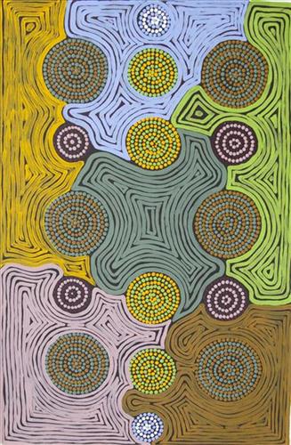
Untitled

This is Kumpaya’s Country- her ‘ngurra’ (home Country, camp). People identify with their ngurra in terms of specific rights and responsibilities, and the possession of intimate knowledge of the physical and cultural properties of one’s Country. Painting ngurra, and in so doing sharing the Jukurrpa (Dreaming) stories and physical characteristics of that place, has today become an important means of cultural maintenance. 

Kumpaya’s ngurra encompasses the Country that she and her family walked in the pujiman (traditional, desert-dwelling) era. At this time she travelled nomadically with her own and other family groups, traversing an enormous tract of land around the middle section of the Canning Stock Route, and between Punmu Aboriginal community and Kiwirrkura, more than 500 kilometres eastward. 

Kumpaya was born close to Kiwirrkurra, a rockhole located in the Gibson Desert and to the south west of Lake McKay. She grew up, walked and hunted primarily around this area. As a young woman Kumpaya travelled westward, through to Kunawarritji (Canning Stock Route Well 33). She continued to live nomadically before eventually deciding to move to Jigalong Mission along with many other relatives following an extreme and prolonged drought in the 1960s. 

Portrayed in this work are features of Kumpaya’s ngurra, such as the striking salt lakes, dominant permanent red tali (sandhills), warta (trees, vegetation), and the individually named water sources she and her family camped at. These include Luurnkurangu, Karingkarra , Katarta, Pinkari, Pintu-pintu, Yanjiwara, Kunalimpi, Juntu-juntu (Canning Stock Route Well 30), Warla-warla (Canning Stock Route Well 31), Kunawarritji, Kinyu (Canning Stock Route Well 35), Natawalu (Canning Stock Route Well 40), and Kupankurlu. Rock holes, waterholes, soaks and springs were all extremely important sites for Martu people during the pujiman period, and are generally depicted with circular forms. 

The encyclopaedic knowledge of the location, quality and seasonal availability of the hundreds of water bodies found in one’s Country sustained Martu as they travelled across their Country, hunting and gathering, visiting family, and fulfilling ceremonial obligations. They would traverse very large distances annually, visiting specific areas in the dry and wet season depending on the availability of water and the corresponding cycles of plant and animal life on which hunting and gathering bush tucker was reliant. As they travelled and hunted they would also burn areas of Country, generating a greater diversity of plant and animal life.

111582083803


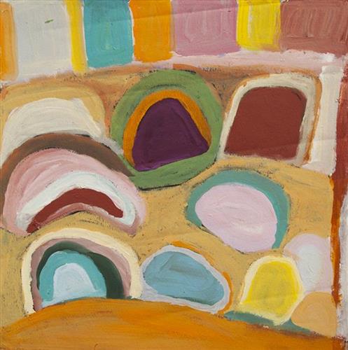
Wildflowers

This work portrays an area known intimately to the artist, painted here in exquisite detail from memory. During the pujiman (traditional, desert dwelling) era one’s survival depended on their intimate knowledge of the location of resources; thus physical elements of Country, such as sources of kapi (water), tali (sandhills), and different varieties of warta (trees, vegetation) were carefully observed and remembered. Today, this relationship with Country remains equally strong, despite the movement of Martu out of the desert and into remote Aboriginal Communities, towns and cities.

Also visible may be traces of life cycles based around kalyu (rain, water) and waru (fire). A thousands of year old practice, fire burning continues to be carried out as both an aid for hunting and a means of land management today. As the Martu travelled and hunted they would burn tracts of land, ensuring plant and animal biodiversity and reducing the risk of unmanageable, spontaneous bush fires. The patchwork nature of regrowth is visible in many landscape works, with each of the five distinctive phases of fire burning visually described with respect to the cycle of burning and regrowth.  

Finally, metaphysical information relating to a location may also be recorded; Jukurrpa (Dreaming) narratives chronicle the creation of physical landmarks, and can be referenced through depictions of ceremonial sites, songlines, and markers left in the land. 

111582083797


Wantili (Warntili, Canning Stock Route Well 25)

“This is my Grandmother’s [Bugai Whyoulter’s] Country, my Country. Wantili (Warntili, Canning Stock Route Well 25) is old Law Grounds from Dreaming days and very important to Martu people. My grandmother always tells me about Wantili because she grew up around Wantili. It is close to her birthplace and is her ngurra (home Country, camp). She was a young girl walking around at Wantili. Her family would travel between Wantili, Kaalpa, Juntu-juntu, Raarki, and Wuranu Wells along the Canning Stock Route. Big mob of people they been walking around there. She saw whitefellas there for the first time, Canning mob when they were traveling up and down the stock route with the bullock. They were running away from those whitefellas, watching them from a distance. She was a teenager when she was travelling around there with her four mothers and one daddy. They used to travel around in family groups, Bugai and Jakayu [Biljabu], and Jakayu’s nyupa (partner) Phillip Biljabu. They met Kumpaya [Girgirba] coming from Kun Kun (Kuny-Kuny), Kunawarritji area. Bugai returned to the Wantili area as a young woman, when she worked driving cattle along the Stock Route. 

Wantili is good for painting and telling stories. Our stories are still strong. I wanted to take Bugai back to Wantili. It is an important place; she hadn’t been there for a long time. My nana [Pinyirr] Nancy took me there as a young boy. Bugai is the older sister of Nancy. I been… three times going there. It’s important that place, out a long way from Newman… Those old people like going to Wantili, where the creation started. Jakayu and Kumpaya… them two aunties told me a story about Dreamtime, and how important Wantili was. People from different tribes…from all over the place could come there for the initiation ceremony. The Jukurrpa (Dreaming) stories from Wantili are just for Martu but the site is open, and anyone can go there. 

It’s a lovely part of the Country to take the kids for a swim. The place has changed. The water used to be muddy like chocolate, now the water is clear. Maybe from climate change, maybe from mining, maybe from something else. The changes don’t have to be bad; the landscape is always changing, same way as Martu people. It’s good to make work sitting out in Country, but I can make these paintings anywhere, just like those old people. Wherever I am, painting Country takes me back there in my head, back to Jukurrpa times, back to pujiman (traditional, desert dwelling) days when my grandmother walked around there, and back to days going there for a swim as a kid. I hope this painting carries people there too. I’m proud to be able to share my culture and stories with younger Martu people and whitefellas.”

111582083796


Untitled

This is Kumpaya’s Country- her ‘ngurra’ (home Country, camp). People identify with their ngurra in terms of specific rights and responsibilities, and the possession of intimate knowledge of the physical and cultural properties of one’s Country. Painting ngurra, and in so doing sharing the Jukurrpa (Dreaming) stories and physical characteristics of that place, has today become an important means of cultural maintenance. 

Kumpaya’s ngurra encompasses the Country that she and her family walked in the pujiman (traditional, desert-dwelling) era. At this time she travelled nomadically with her own and other family groups, traversing an enormous tract of land around the middle section of the Canning Stock Route, and between Punmu Aboriginal community and Kiwirrkura, more than 500 kilometres eastward. 

Kumpaya was born close to Kiwirrkurra, a rockhole located in the Gibson Desert and to the south west of Lake McKay. She grew up, walked and hunted primarily around this area. As a young woman Kumpaya travelled westward, through to Kunawarritji (Canning Stock Route Well 33). She continued to live nomadically before eventually deciding to move to Jigalong Mission along with many other relatives following an extreme and prolonged drought in the 1960s. 

Portrayed in this work are features of Kumpaya’s ngurra, such as the striking salt lakes, dominant permanent red tali (sandhills), warta (trees, vegetation), and the individually named water sources she and her family camped at. These include Luurnkurangu, Karingkarra , Katarta, Pinkari, Pintu-pintu, Yanjiwara, Kunalimpi, Juntu-juntu (Canning Stock Route Well 30), Warla-warla (Canning Stock Route Well 31), Kunawarritji, Kinyu (Canning Stock Route Well 35), Natawalu (Canning Stock Route Well 40), and Kupankurlu. Rock holes, waterholes, soaks and springs were all extremely important sites for Martu people during the pujiman period, and are generally depicted with circular forms. 

The encyclopaedic knowledge of the location, quality and seasonal availability of the hundreds of water bodies found in one’s Country sustained Martu as they travelled across their Country, hunting and gathering, visiting family, and fulfilling ceremonial obligations. They would traverse very large distances annually, visiting specific areas in the dry and wet season depending on the availability of water and the corresponding cycles of plant and animal life on which hunting and gathering bush tucker was reliant. As they travelled and hunted they would also burn areas of Country, generating a greater diversity of plant and animal life.

111582083795


Karlamilyi

“This Karlamilyi area, big land. That’s a ngurra (home Country, camp) belonging to our old people, Warnman people. We talk for our land, our jila (snake). I grew up in this Country, my Country. This land belongs to our father. In pujiman (traditional, desert dwelling) days I walked around here, used to walk up and down tuwa (sandhill) and back to the main camp belonging to Martu. 

That river running through, he called Pirnpi. Whitefella way is Rudall River. There’s a bird, karuwarlkun (magpie), flying and singing everywhere in the Rudall River there. The river is flowing to Lake Dora, it has five waterholes in the river system. Outside of the river are creeks and gullies, the salt lake, Lake Dora, and the sand dunes.

There’s a claypan there too, big claypan, close to Walirrlirri. Pangkartal we call him. There’s a big rain there, rain time. Fill him up water when the rain time comes. Snake living there in Pangkartal, big one. He [the snake] going to listen to the owner of the land. When we sing out to him in a Warnman way, we tell him “Stop, don’t get cheeky. We coming in [to the land].” He not cheeky, he a good one. Quiet snake.

At Nyayartakujarra (Lake Dora), [in the north east of the region,] two snakes been killed. Right here they got crook in the Dreamtime. All the men, Ngaanyatjarra and Warnman, they were singing. One young fella, he threw a spear into the snake. That snake felt something there, got killed and burned.

[West of Nyayartakujarra is] Yanytikuji, red hill over there. They working, doing the mining there now [at Yandicoogina Mine]. Next to Yanytikuji is a big claypan, Yalpalpa, main camp and a water. That’s a hunting place. Plenty of bush tucker round there; kanyjamarra (yam, bush carrot), like a carrot growing in the ground in the river bed there. You pull it out, just like a carrot! Lunki (witchetty grub), and jatarrpa, that’s like a seed, you gotta clean him up and grind it to make a flour wheat, make a damper in the waru (fire). We gonna get that seed and show you fellas. Minyarra (bush onion) there, and ngaputa (sweet, patterned green melon), they all grow in the river banks.

In the middle is Putarrluu, a yinta (permanent spring) where there are two snakes, a man and a woman snake. They are nyupa (partners), they stop here, it is their yinta. You can’t camp right at the big yinta because of the snakes. You have to get your water from the little soak. When we want to get water we talk to the snakes in Warnman, their language, and the snakes send the water to them.  

This one Wartararra area, [south of Yanytikuji,] but you can’t go through there. This one Pulikati [Hill] area, we used to go through a gap here. There is quicksand here. People don’t go there. We used to sing out for this water, from this side. The old people used to sing out to “Come on, send the water for me.” You can’t go through there, quicksand, not allowed.

Tintinmarran, bottom end of Rudall River [and southeast of Pulikati. There is a januku (waterfall) there, a big yapu (hill), two tuwa (sandhills), and jawirli (quondong) trees. All of the rivers run down through Tintinmarran before joining Rudall River. After all the kapi (water) joins the Rudall River it runs to Warnanjarra where it disappears underground and goes all the way up north to Derby.

I [Jatarr Lily Long] was born there in Karlamilyi River, that’s my Country. [I was born in] Jatarrngara, that’s the name for the place and that’s my name. That’s the living water place.

We are Warnman ladies, painting Kintyre and Karlamilyi. We can share this Country.”

 –Sisters Wurta Amy French and Jatarr Lily Long

Karlamilyi (Rudall River) is Warnman Country, located in the very heart of the Martu homelands. The Karlamilyi region is ngurra for sisters Wurta Amy French and Jatarr Lily Long. They travelled and camped extensively around this area with their family in their youth, and possess a great deal of knowledge of the region’s physical elements, resource distribution, and Jukurrpa (Dreaming) narratives.

The region is situated southwest of the Great Sandy Desert and northeast of the Little Sandy Desert. Spanning through the region is the epic Karlamilyi River, which runs north into Nyayartakujarra (Ngayarta Kujarra, Lake Dora), a large salt lake. The Broadhurst and Fingoon Ranges extend diagonally across the river’s path. The landscape is striking for its abundance of gorges and valleys carved by ice age glaciers, rugged cliffs, red tali (sand dunes), grasslands, sandstone and quartz rocky outcrops, and salt lakes. 

Across the whole region are hundreds of water sources; including waterholes, creeks, soaks, lakes, pools and rockholes. Lining the rivers are coolabah, walyji (river gum), yulbah (bats wing coral tree), and several species of acacia and hakea. Jalkuran (paperbark), kurrulyu/ mijarrpa (bloodwood) and jawirli (quandong) are found in the region’s valleys, and wikirrpa (desert oaks) and grasses in the sandplains. The area is abundant with bird species, jila, maruntu (goannas), red kangaroos and warlpaju (rock wallabies). The region is also home to remote aboriginal communities Punmu and Parnngurr.

According to two of the central Martu Jukurrpa narratives, the Karlamilyi River and its surrounds were created by the ancestral beings Jila Kujarra (Two Snakes) and the Wati Kujarra (Two Goanna Men) as they travelled across the lands.

111582083794


Untitled

This is Bugai’s Country- her ‘ngurra’ (home Country, camp). People identify with their ngurra in terms of specific rights and responsibilities, and the possession of intimate knowledge of the physical and cultural properties of one’s Country. Painting ngurra, and in so doing sharing the Jukurrpa (Dreaming) stories and physical characteristics of that place, has today become an important means of cultural maintenance. 

Bugai’s ngurra encompasses the Country that she and her family walked in the pujiman (traditional, desert-dwelling) era. At this time Bugai travelled nomadically with her own and other family groups, most notably the Bidu family. The Country they traversed encompassed an enormous tract of land, with an aerial distance of more than 600 kilometres, from present day Balfour Downs Station to Kunawarritji (Canning Stock Route Well 33). Bugai was born at Pulkinya. She grew up, walked and hunted primarily around Parnngurr, Punmu, Kun Kun (Kuny-kuny) and Kunawarritji. As a young woman Bugai travelled with her husband through the Karlamilyi (Rudall River) region and up and down the Canning Stock Route, where she first met cattle drovers. She continued to live nomadically before eventually deciding to move to Jigalong Mission along with many other relatives following an extreme and prolonged drought in the 1960s. 

Portrayed in this work are features of Bugai’s ngurra, such as the striking salt lakes, dominant permanent red tali (sandhills), warta (trees, vegetation), and the individually named water sources Bugai and her family camped at. These include Parnngurr, Martilirri, Wangkakalu, Kurta-kurta (Camel Rock), Pimurlu, Jilkupuka (Canning Stock Route Well 21), Kaalpa (Canning Stock Route Well 23), Kartarru (Canning Stock Route Well 24), Wantili (Warntili, Canning Stock Route Well 25), Tiwa (Canning Stock Route Well 26), Partujarrapirri, Raarki (Canning Stock Route Well 27), Wuranu (Canning Stock Route Well 29), Juntu- juntu (Canning Stock Route Well 30), and Kunawarritji. Rock holes, waterholes, soaks and springs were all extremely important sites for Martu people during the pujiman period, and are generally depicted with circular forms. 

The encyclopaedic knowledge of the location, quality and seasonal availability of the hundreds of water bodies found in one’s Country sustained Martu as they travelled across their Country, hunting and gathering, visiting family, and fulfilling ceremonial obligations. They would traverse very large distances annually, visiting specific areas in the dry and wet season depending on the availability of water and the corresponding cycles of plant and animal life on which hunting and gathering bush tucker was reliant. As they travelled and hunted they would also burn areas of Country, generating a greater diversity of plant and animal life.

111582083791


Wantili (Warntili, Canning Stock Route Well 25)

 “Wantili is my place, where I was born. It’s a place where everyone was living- its all of their ngurra (home).It’s the Jukurrpa (Dreaming) of that place. All those claypans, a place where everyone comes together for ceremony and gatherings, all meeting with different families. I went there with my aunt [Jakayu Biljabu]  and my sister [Kumpaya Girgirba]- they told me the story of where I was born, in pujiman (traditional, desert dwelling) times. We walked all over the place, I was just a little one.”

-Glady Bidu Kuru

Wantili (Warntili, Canning Stock Route Well 25) is a large round jurnu (soak) and linyji (claypan) near Well 25 on the Canning Stock Route. The area is dominated by claypans surrounded by tuwa (sandhills), and Nyilangkurr, a prominent yapu (hill) is located on the edge of the claypan. Following rain the typically dry claypans are filled with water, with the overflow from nearby waterholes flowing to Wantili. At that time, Wantili becomes an important place for obtaining fresh water for drinking and bathing. Wantili is significant for the fact that at this site Kartujarra, Manyjilyjarra, Putijarra and Warnman people would all come together for ceremonies during the pujiman (traditional, desert dwelling) era. Many jiwa (stones used by women for grinding seeds) from these times can still be found there today. 

Wantili is an incredibly important cultural site, ‘where the creation started.’ (Cyril Whyoulter). In this creation story, the world was initially dark, and people were like rocks, with no arms or legs. Following the sun’s first rising, life-forms become increasingly complex while particular features in the land were created. Beyond these details much of the Jukurrpa (Dreaming) narrative relating to Wantili is ngurlu (sacred, taboo), and only for Martu, but the site is open, and anyone can go there. 

Wantili is also one of the many sites featured in the epic Minyipuru (Jakulyukulyu, Seven Sisters) Jukurrpa story. Minyipuru is a central Jukurrpa narrative for Martu, Ngaanyatjarra, Pitjantjatjara and Yankunytjatjara people that is associated with the seasonal Pleiades star constellation. Relayed in song, dance, stories and paintings, Minyipuru serves as a creation narrative, a source of information relating to the physical properties of the land, and an embodiment of Aboriginal cultural laws. The story follows the movement of a group of women travelling all the way across the desert, beginning at Roebourne on the coast of Western Australia, as they are pursued by Yurla, a lustful old man. As the women travelled, they stopped to rest at many sites to eat, dance, rest and sing, on the way leaving behind an assortment of articles that became formations in the land, such as groupings of rocks and trees, grinding stones and seeds. The sisters rested at Wantili before throwing seeds, then continued their journey far to the east and beyond Martu Country, stopping at various sites through central and South Australia.

The intersection of the Canning Stock Route with Wantili also made this a site of early contact with Europeans for many Martu then living a pujiman life in the desert. Following the route’s construction, Martu encountered Europeans and other Martu working as cattle drovers as they would travel up and down the Stock Route from water source to water source. Increasingly, pujimanpa (desert dwellers) followed the route to newly established ration depots, mission and pastoral stations. They were drawn to the route in search of food, by a sense of curiosity, or by loneliness. By the late 1950s and early 1960s, most of the desert family groups had left the desert. Eventually, these factors combined with an extreme and prolonged drought in the 1960s to prompt the few remaining pujimanpa to move in from the desert.