377815582367275


Seven Sisters

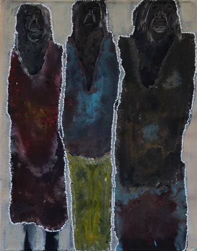
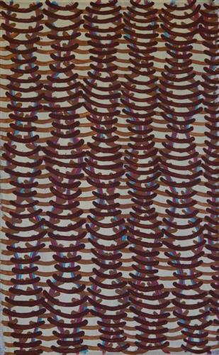
‘There were seven sisters, who was looking for food, wandering everywhere, then the youngest sister got lost, and the old man was watching her, trying to make her his wife. Then the other sisters tried calling her name, then late at night was behind them, trying to reach them going together but she was the last one behind calling out to her sisters.’

– Agnes Frank

114182367462


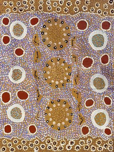
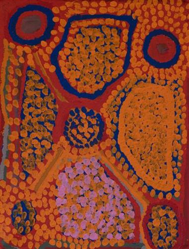
Kungkarrangkalpa (Seven Sisters)

‘Kungkarrangkalpa’ (The Seven Sisters or Pleaides) is significant Tjukurrpa (dreamtime). Its origins you may be familiar with in astronomy and its connection to ‘Wati Nyiru’ (Magic Man or Orion).  The roots of this dreaming stems across indigenous groups around the world. The Australian Aboriginal songline is one part to the whole dreaming which can be traced all around the world. The ladies of the Ngaanyatjarra Lands depict their significant chapter and understanding of the journey of the sisters. The different versions of this story depend on where you live and the significance’s of local Tjukurrpa places.

Nyiru fell in love with the sisters but he was of the wrong skin group to marry, but he still pursued them on their journey. The sisters travel across the land to escape Nyiru’s unwanted attentions, but he is persistent and always finds them. There are significant land forms which can be sited today that evidence this dreaming. As Nyiru is chasing the sisters he tries to catch them by using magic to turn into the most tempting kampurarrpa (bush tomato) and the most beautiful Yirli (wild fig tree), for them to eat and camp under. However, the sisters are knowledgeable of his magic and too clever for Nyiru who they outwit again and again. They go hungry and run through the night rather than be caught by him. As the journey continues, Nyiru gets so frustrated at the wit of the sisters that he uses his magic to make the oldest sister sick to try and get closer to her. The other sisters rescue the big sister and nurse her back to health. It is said he also captures the youngest sister, but with the help of the oldest sister, she escapes back to her sisters who are waiting for her. Eventually, the sisters fly into the sky to escape Nyiru, forming the constellation. Nyiru felt lonely, longing for the sisters who were so far away. Nyiru used his magic to go to the sky, forever in pursuit.

114182367461


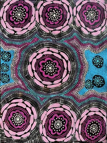
Kungkarrangkalpa (Seven Sisters)

‘Kungkarrangkalpa’ (The Seven Sisters or Pleaides) is significant Tjukurrpa (dreamtime). Its origins you may be familiar with in astronomy and its connection to ‘Wati Nyiru’ (Magic Man or Orion).  The roots of this dreaming stems across indigenous groups around the world. The Australian Aboriginal songline is one part to the whole dreaming which can be traced all around the world. The ladies of the Ngaanyatjarra Lands depict their significant chapter and understanding of the journey of the sisters. The different versions of this story depend on where you live and the significance’s of local Tjukurrpa places.

Nyiru fell in love with the sisters but he was of the wrong skin group to marry, but he still pursued them on their journey. The sisters travel across the land to escape Nyiru’s unwanted attentions, but he is persistent and always finds them. There are significant land forms which can be sited today that evidence this dreaming. As Nyiru is chasing the sisters he tries to catch them by using magic to turn into the most tempting kampurarrpa (bush tomato) and the most beautiful Yirli (wild fig tree), for them to eat and camp under. However, the sisters are knowledgeable of his magic and too clever for Nyiru who they outwit again and again. They go hungry and run through the night rather than be caught by him. As the journey continues, Nyiru gets so frustrated at the wit of the sisters that he uses his magic to make the oldest sister sick to try and get closer to her. The other sisters rescue the big sister and nurse her back to health. It is said he also captures the youngest sister, but with the help of the oldest sister, she escapes back to her sisters who are waiting for her. Eventually, the sisters fly into the sky to escape Nyiru, forming the constellation. Nyiru felt lonely, longing for the sisters who were so far away. Nyiru used his magic to go to the sky, forever in pursuit.

111582367457


Untitled

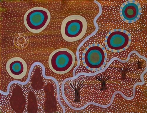
This is Kumpaya’s Country- her ‘ngurra’ (home Country, camp). People identify with their ngurra in terms of specific rights and responsibilities, and the possession of intimate knowledge of the physical and cultural properties of one’s Country. Painting ngurra, and in so doing sharing the Jukurrpa (Dreaming) stories and physical characteristics of that place, has today become an important means of cultural maintenance. 

Kumpaya’s ngurra encompasses the Country that she and her family walked in the pujiman (traditional, desert-dwelling) era. At this time she travelled nomadically with her own and other family groups, traversing an enormous tract of land around the middle section of the Canning Stock Route, and between Punmu Aboriginal community and Kiwirrkura, more than 500 kilometres eastward. 

Kumpaya was born close to Kiwirrkurra, a rockhole located in the Gibson Desert and to the south west of Lake McKay. She grew up, walked and hunted primarily around this area. As a young woman Kumpaya travelled westward, through to Kunawarritji (Canning Stock Route Well 33). She continued to live nomadically before eventually deciding to move to Jigalong Mission along with many other relatives following an extreme and prolonged drought in the 1960s. 

Portrayed in this work are features of Kumpaya’s ngurra, such as the striking salt lakes, dominant permanent red tali (sandhills), warta (trees, vegetation), and the individually named water sources she and her family camped at. These include Luurnkurangu, Karingkarra , Katarta, Pinkari, Pintu-pintu, Yanjiwara, Kunalimpi, Juntu-juntu (Canning Stock Route Well 30), Warla-warla (Canning Stock Route Well 31), Kunawarritji, Kinyu (Canning Stock Route Well 35), Natawalu (Canning Stock Route Well 40), and Kupankurlu. Rock holes, waterholes, soaks and springs were all extremely important sites for Martu people during the pujiman period, and are generally depicted with circular forms. 

The encyclopaedic knowledge of the location, quality and seasonal availability of the hundreds of water bodies found in one’s Country sustained Martu as they travelled across their Country, hunting and gathering, visiting family, and fulfilling ceremonial obligations. They would traverse very large distances annually, visiting specific areas in the dry and wet season depending on the availability of water and the corresponding cycles of plant and animal life on which hunting and gathering bush tucker was reliant. As they travelled and hunted they would also burn areas of Country, generating a greater diversity of plant and animal life.
111582367456


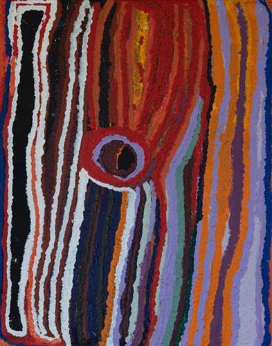
Jurnpanja

“This Jurnpanja rockhole. Kayili (north) from Yungkajul. Always kapi (water) there. Pujimanpa (desert dwellers) would drink from there. All bush-tucker there, wamurla (bush tomato), and minyarra (bush-onion). [My daughter] Barli was little one walking around that place. Pujiman (traditional, desert dwelling) time. 

This one rockhole, Jurnpanja, and that’s a claypan, Wirrkujapayi. Water here, big one. This one we get water, then go another place, then another place. We’re walking around people you know?”

– Yikartu Bumba

Jurnpanja is a series of rockholes located kakarra (east) of Kunawarritji Aboriginal Community, and one of the water sources she would stop and camp at as a young woman. Jurnpanja lies within Yikartu’s ngurra (home Country, camp), the area which she knew intimately and travelled extensively in her youth.

As described in her account, Yikartu moved around this area seasonally with her family, walking between water sources, and hunting and gathering bush tucker as they went. At this time knowledge of water sources was critical for survival, and today Martu Country is still defined in terms of the location and type of water. Each of the hundreds of claypans, rockholes, waterholes, soaks and springs found in the Martu desert homelands is known by name, location, quality and seasonal availability through real life experience and the recounting of Jukurrpa (Dreaming) narratives.

111582367455


Untitled

This is Kumpaya’s Country- her ‘ngurra’ (home Country, camp). People identify with their ngurra in terms of specific rights and responsibilities, and the possession of intimate knowledge of the physical and cultural properties of one’s Country. Painting ngurra, and in so doing sharing the Jukurrpa (Dreaming) stories and physical characteristics of that place, has today become an important means of cultural maintenance. 

Kumpaya’s ngurra encompasses the Country that she and her family walked in the pujiman (traditional, desert-dwelling) era. At this time she travelled nomadically with her own and other family groups, traversing an enormous tract of land around the middle section of the Canning Stock Route, and between Punmu Aboriginal community and Kiwirrkura, more than 500 kilometres eastward. 

Kumpaya was born close to Kiwirrkurra, a rockhole located in the Gibson Desert and to the south west of Lake McKay. She grew up, walked and hunted primarily around this area. As a young woman Kumpaya travelled westward, through to Kunawarritji (Canning Stock Route Well 33). She continued to live nomadically before eventually deciding to move to Jigalong Mission along with many other relatives following an extreme and prolonged drought in the 1960s. 

Portrayed in this work are features of Kumpaya’s ngurra, such as the striking salt lakes, dominant permanent red tali (sandhills), warta (trees, vegetation), and the individually named water sources she and her family camped at. These include Luurnkurangu, Karingkarra , Katarta, Pinkari, Pintu-pintu, Yanjiwara, Kunalimpi, Juntu-juntu (Canning Stock Route Well 30), Warla-warla (Canning Stock Route Well 31), Kunawarritji, Kinyu (Canning Stock Route Well 35), Natawalu (Canning Stock Route Well 40), and Kupankurlu. Rock holes, waterholes, soaks and springs were all extremely important sites for Martu people during the pujiman period, and are generally depicted with circular forms. 

The encyclopaedic knowledge of the location, quality and seasonal availability of the hundreds of water bodies found in one’s Country sustained Martu as they travelled across their Country, hunting and gathering, visiting family, and fulfilling ceremonial obligations. They would traverse very large distances annually, visiting specific areas in the dry and wet season depending on the availability of water and the corresponding cycles of plant and animal life on which hunting and gathering bush tucker was reliant. As they travelled and hunted they would also burn areas of Country, generating a greater diversity of plant and animal life.

111582367454


Power Wanti

How did you get to this style of painting?

“Do you mean, what have I done with my life? (chuckles to herself) To me these paintings are a sense of energy. So if I see someone and they’re happy, I paint a happy vibe. Cos their spirit is happy. And sometimes it’s hard because on the outside they’re real happy but on the inside they’re real sad. Sometimes you do stuff (like a painting) and it adds up later on. But I still don’t know what it means and don’t know where my style comes from because it’s both the path I walk on and the cracks in the dirt. It’s like looking at a landscape but I haven’t been there yet. Maybe I’ll get there one day. I believe things happen for a reason.”

– Sylvia Wilson

111582367453


Granites

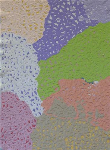
This work portrays an area known to the artist, painted here from memory. During the pujiman (traditional, desert dwelling) era one’s survival depended on their intimate knowledge of the location of resources; thus physical elements of Country, such as sources of kapi (water), tali (sandhills), and different varieties of warta (trees, vegetation) were carefully observed and remembered. Today, this relationship with Country remains equally strong, despite the movement of Martu out of the desert and into remote Aboriginal communities, towns and cities.

Also visible may be traces of life cycles based around kalyu (rain, water) and waru (fire). A thousands of year old practice, fire burning continues to be carried out as both an aid for hunting and a means of land management today. As the Martu travelled and hunted they would burn tracts of land, ensuring plant and animal biodiversity and reducing the risk of unmanageable, spontaneous bush fires. The patchwork nature of regrowth is visible in many landscape works, with each of the five distinctive phases of fire burning visually described with respect to the cycle of burning and regrowth.  

Finally, metaphysical information relating to a location may also be recorded; Jukurrpa (Dreaming) narratives chronicle the creation of physical landmarks, and can be referenced through depictions of ceremonial sites, songlines, and markers left in the land. 

111582367445


Rabbit Proof Fence

“When I was a little girl, my sister and I would visit our nanna [Molly Craig]. We really looked after her and checked if she had any food and sometimes she would say ” I’m hungry one.” We would race home to make damper and cook some meat and take it back to her before it got dark. She was a caring and beautiful lady but she never told her story about what happened when she was young because my sister and I were part of welfare. That’s why my sister and I had a great connection with our nanna, an unspoken connection.”

– Kathleen Sorenson

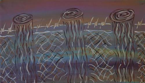
In 1931 sisters Molly Craig, Daisy Kadibil and Gracie Fields were taken from their families, like many other Aboriginal children at that time, and transported to Moore River Native Settlement, north of Perth. They were taken away in the belief that part-Aboriginal children should be trained as domestic servants. 

The three girls escaped the next day and, incredibly, walked 1600 kilometres home to Jigalong using the Rabbit-Proof Fence to navigate. The Rabbit Proof Fence remains the world’s longest fence, and was built in the early 1900s to separate rabbits from pasture. For nine weeks, the girls followed its length in order to be reunited with their family. They crossed a flooded river, sand dunes, heathlands, wheatbelts and plains, claypans and salt lakes. They slept in dug-out rabbit burrows, and caught and cooked rabbits, along with other plant based bush tucker. For the duration of their journey they were pursued by policeman and an Aboriginal police tracker.

The girls’ story has been immortalised in the novel “Follow the Rabbit-Proof Fence” by Doris Pilkington (Nugi Garimara, 1996), and was adapted into the film “Rabbit Proof Fence” (2002). This story retains special significance for the Martu, and in particular those inhabitants of Jigalong Aboriginal community. The three girls were Martu, and their children and grandchildren continue to live in the Martu homelands today.

111582367444


Tuwa (Sandhills)

‘’Went with Martumili. Old Jigalong. Judith’s nanna Country, where Judith nanna was born. Went from old Jigalong to Jigalong to right through Parnngurr, Camped the night and then Judith’s pop went to pick him up. His name is Mr Rowlands and I call him brother. He showing me where my nanna’s Country started from Parnngurr towards Lake Disappointment. We camped the night. Judith’s nanna was getting cheeky bossing him (Mr Rowland) around; “we not married anymore that’s why I left him.” Between Lake Disappointment and Durba Springs (Pinpi) there were these beautiful rolling sand hills, we winding through them over top, we stopped half way and I looked out to the sunset saw all the glistening spinifex. The orange from the sunset lit the sand dunes up. When I do the Tuwa paintings I think of that day.’’

– Kathleen Sorensen

The traditional lands of the Martu people encompass the Great Sandy Desert and Rudall River regions of Western Australia, an enormous tract dominated by distinctive red tali, or tuwa (sandhills). These sandhills present an unforgiving landscape; sparse vegetation covers a seemingly never ending expanse of dunes, and yet these lands and the location of resources within them was known intimately by its pujiman (traditional, desert dwelling) inhabitants. At this time, Martu traversed very large distances annually in small family groups, moving from water source to water source through the harsh desert landscape with incredible stamina and resourcefulness. Travel was often undertaken at night, and when travelling during the day, Martu wore yakipiri (woven bark sandals) to protect their feet from the hot desert sand.