111582319526


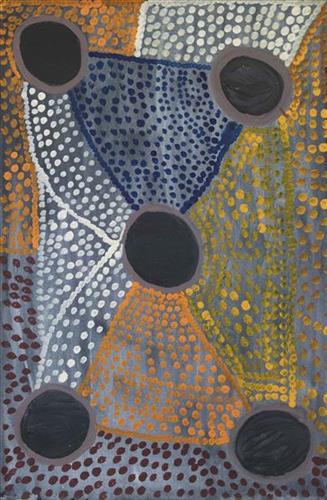
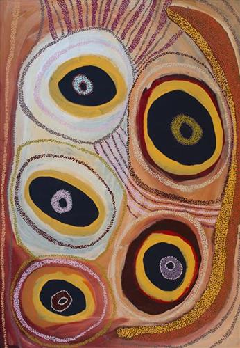
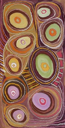
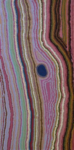
Jupurrl

“Two yintas (permanent springs) in my ngurra (home Country, camp); the yintas are Yirtal and Jupurrl. They are kakarra (east) of Kulyakartu and kayili (north) side of Wirnpa. I was a married woman when I was walking around this place, pujiman (traditional, desert dwelling) time. I married a good man. There’s lots of kapi (water) there. Lots of yukari (green grass, vegetation). Plenty of bushtucker, pussycat and goanna. There’s no kapi when you first get there, but you dig him up and then there’s lots of kapi. We’ve got to take all the kids to that ngurra. Show them my daddy’s ngurra. There’s another waterhole, not far from there called Jakapinka. A jila (snake) made that kapi. It’s my brother’s Country. Not far from these yintas.”

– Yikartu Bumba

Yirtal is a soak located within the Percival Lakes region. The site is surrounded by a vegetation that needs to be cleared before accessing the water there. Yirtal is Yikartu’s ngurra through her father. As she recount, nearby water sources include Jupurl and Jakapinka.

During the pujiman (traditional, desert dwelling) days, Yikartu and her family travelled extensively through this Country. At this time Martu would traverse very large distances annually in small family groups, moving seasonally from water source to water source, and hunting and gathering bush tucker as they went. Knowledge of water sources was critical for survival, and today Martu Country is still defined in terms of the location and type of water. Each of the hundreds of claypans, rockholes, waterholes, soaks and springs found in the Martu desert homelands is known by name, location, quality and seasonal availability through real life experience and the recounting of Jukurrpa (Dreaming) narratives. 

The region surrounding Yurlpu was formed by Wirnpa, one of the most powerful of the ancestral jila (snake) men and the last to travel the desert during the Jukurrpa. Wirnpa is a rainmaking jila who lived and hunted in the Percival Lakes area. His travels are described in the songs and stories of many language groups across the Western Desert, even those far removed from his home site. In his epic travels, Wirnpa met and feasted with many other ancestral beings, exchanged ceremonial objects, and created a series of different laws and ceremonies. When he finally returned home, he searched for his many children only to discover that they had already died. They had laid down and become the salt springs of the Percival Lakes. Wirnpa wept for his children before himself transforming into a snake and entering the soak where he still resides.
111582319525


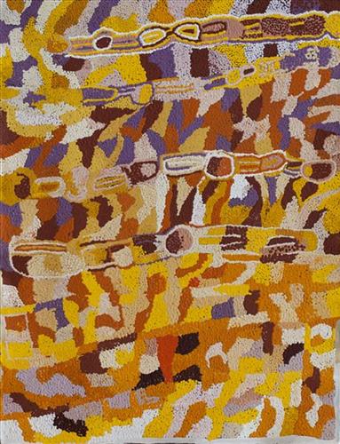
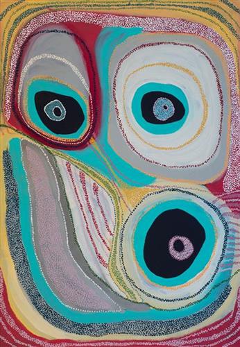
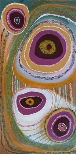
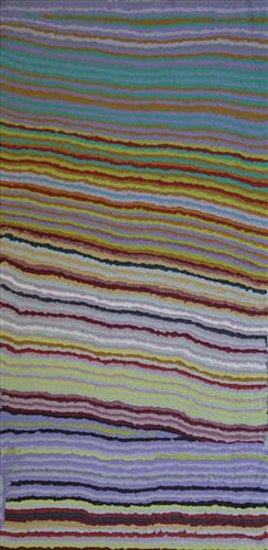
Jilji

“This one near my countryside. It’s kayili (north) of my Country. Big one Jilji. Lots of tuwa (sandhills). My nana mili (denotes ownership) Country, mama mili, daddy mili Country. They walk around there, get kuwiyi (meat). The old people would cook ’em up! This a pujiman (traditional, desert dwelling) place. I was a young girl with my nana and mama, walking around there. I been loose them. They finished.” 

– Yikartu Bumba

Jilji is a water source north of Wirnpa and in Juwaliny Country- Yikartu’s ngurra (home Country, camp). Her ngurra lies at the northern boundary of Martu Country, around the Percival Lakes region and further northward. Jilji is one of the water sources Yikartu would stop and camp at as a young woman. 

As described in her account, Yikartu moved around this area seasonally with her family, walking between water sources, and hunting and gathering bush tucker as they went. At this time knowledge of water sources was critical for survival, and today Martu Country is still defined in terms of the location and type of water. Each of the hundreds of claypans, rockholes, waterholes, soaks and springs found in the Martu desert homelands is known by name, location, quality and seasonal availability through real life experience and the recounting of Jukurrpa (Dreaming) narratives.

111582319524


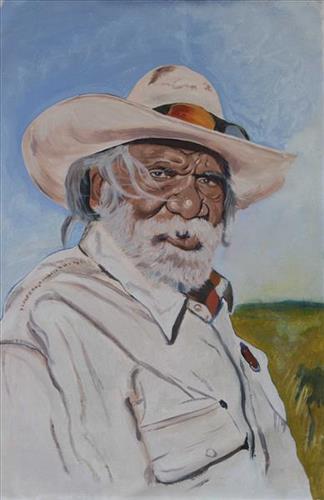
Muuki Taylor

This artwork represents Muuki Taylor, an important Martu elder and an established artist at Martumili. The artist, Owen John (OJ) Biljabu is a proud Martu man from the Western Deserts, which range from Newman to Kunawarritji. Traditionally, Martu artists are not known for portraiture, however OJ has chosen to use traditional acrylic painting techniques to depict his community, other Martu artists and important figures in his life. He is currently the only member of Martumili Artists to do this, and is forging his own path with his self-taught techniques The traditional lands of the Martu people encompass the Great Sandy Desert and Rudall River regions of Western Australia, and include speakers of Manyjilyjarra, Warnman, Kartujarra, Putijarra and Martu Wangka languages. Martumili Artists work in the Newman based gallery and studio spaces, as well as within remote Aboriginal communities Punmu, Parnngurr, Kunawarritji, Jigalong, Irrungadji (Nullagine), and Warralong. Recognised for their diverse, energetic and unmediated painting styles, their works reflect the dramatic geography and scale of their homelands. The artists are predominantly painters, working in acrylics and oils, though many also weave baskets from gathered grasses and wool. Popular mediums among younger Martu artists include photography and animation. The group proudly maintain their creative practices whilst pursuing social and cultural obligations across the Martu homelands

111582319499


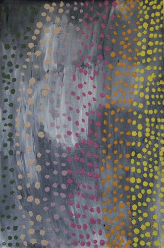
Parnngurr

Parnngurr rockhole is located just south of Parnngurr Aboriginal community. At the junction of three linguistic groups; Manyjilyjarra, Kartujarra, and Warnman, it was a critical and permanent source of water during the pujiman (traditional, desert born) era that supported many ritual large gatherings. During this nomadic period families stopped and camped here depending on the seasonal availability of water and the corresponding cycles of plant and animal life on which hunting and gathering bush tucker was reliant. At Parnngurr and other similarly important camp sites families would meet for a time before moving to their next destination. Parnngurr and its surrounds are physically dominated by distinctively red tali (sandhills), covered sparingly with spinifex and low lying shrub. Parnngurr forms part of Betty’s ngurra (home Country, camp) through her parents and through renowned fellow Martumili Artist and aunt Bugai Whyoulter. 

Parnngurr Aboriginal community was created during the return to Country movement of the 1980s, and named after Parnngurr rockhole, its original primary water source. However, until recently the community was widely known as Cotton Creek, after the European name for the ephemeral creek running alongside the community. 

Parnngurr is an important site chronicled in the epic Jukurrpa (Dreaming) story of the Minyipuru (Jakulyukulyu, Seven Sisters). The sisters stopped to rest on Parnngurr Hill before continuing on their long journey east. Minyipuru is a central Jukurrpa narrative for Martu, Ngaanyatjarra, Pitjantjatjara and Yankunytjatjara people that is associated with the seasonal Pleiades star constellation. Relayed in song, dance, stories and paintings, Minyipuru serves as a creation narrative, a source of information relating to the physical properties of the land, and an embodiment of Aboriginal cultural laws. Beginning in Roebourne on the west coast of Western Australia, the story morphs in its movement eastward across the land, following the women as they walk, dance, and even fly from waterhole to waterhole. As they travel the women camp, sing, wash, dance and gather food, leaving markers in the landscape and creating landforms that remain to this day, such as groupings of rocks and trees, grinding stones and seeds. During the entirety of their journey the women are pursued by a lustful old man, Yurla, although interactions with other animals, groups of men, and spirit beings are also chronicled in the narrative. 

For many Martu, Parnngurr also signifies the location at which their nomadic bush life came to an end. It was here that a group of 29 Martu were picked up by the Native Welfare Department to be taken to Jigalong Mission in 1963. Collectively the group had come to the decision to move to the mission as a result of an extended drought, which had caused a scarcity in food and water resources. The group also wanted to join their families, who had already moved to Jigalong. Among them were Martumili artists Jakayu Biljabu, Kumpaya Girgirba, Bugai Whyoulter and Ngamaru Bidu.

111582319498


Parnngurr

Parnngurr rockhole is located just south of Parnngurr Aboriginal community. At the junction of three linguistic groups; Manyjilyjarra, Kartujarra, and Warnman, it was a critical and permanent source of water during the pujiman (traditional, desert born) era that supported many ritual large gatherings. During this nomadic period families stopped and camped here depending on the seasonal availability of water and the corresponding cycles of plant and animal life on which hunting and gathering bush tucker was reliant. At Parnngurr and other similarly important camp sites families would meet for a time before moving to their next destination. Parnngurr and its surrounds are physically dominated by distinctively red tali (sandhills), covered sparingly with spinifex and low lying shrub. Parnngurr forms part of Betty’s ngurra (home Country, camp) through her parents and through renowned fellow Martumili Artist and aunt Bugai Whyoulter. 

Parnngurr Aboriginal community was created during the return to Country movement of the 1980s, and named after Parnngurr rockhole, its original primary water source. However, until recently the community was widely known as Cotton Creek, after the European name for the ephemeral creek running alongside the community. 

Parnngurr is an important site chronicled in the epic Jukurrpa (Dreaming) story of the Minyipuru (Jakulyukulyu, Seven Sisters). The sisters stopped to rest on Parnngurr Hill before continuing on their long journey east. Minyipuru is a central Jukurrpa narrative for Martu, Ngaanyatjarra, Pitjantjatjara and Yankunytjatjara people that is associated with the seasonal Pleiades star constellation. Relayed in song, dance, stories and paintings, Minyipuru serves as a creation narrative, a source of information relating to the physical properties of the land, and an embodiment of Aboriginal cultural laws. Beginning in Roebourne on the west coast of Western Australia, the story morphs in its movement eastward across the land, following the women as they walk, dance, and even fly from waterhole to waterhole. As they travel the women camp, sing, wash, dance and gather food, leaving markers in the landscape and creating landforms that remain to this day, such as groupings of rocks and trees, grinding stones and seeds. During the entirety of their journey the women are pursued by a lustful old man, Yurla, although interactions with other animals, groups of men, and spirit beings are also chronicled in the narrative. 

For many Martu, Parnngurr also signifies the location at which their nomadic bush life came to an end. It was here that a group of 29 Martu were picked up by the Native Welfare Department to be taken to Jigalong Mission in 1963. Collectively the group had come to the decision to move to the mission as a result of an extended drought, which had caused a scarcity in food and water resources. The group also wanted to join their families, who had already moved to Jigalong. Among them were Martumili artists Jakayu Biljabu, Kumpaya Girgirba, Bugai Whyoulter and Ngamaru Bidu.

111581426513


Pitu (Separation Well)

“Pitu, soak, big one. Water there all the time. Pitu, the place for our whole family. [As a young girl] I walked around and went east back to my dad’s area, to Pitu and Kulilu, Nakaly and Kunapila. Then I was a teenager. My Country is Pitu and Nakaly, that’s my Country.

This man here, he came through here in the Dreamtime, walking right up through here and then he flew. Other one, a man and a woman, coming behind him, following him right up through here and then finish, I don’t know where they’ve gone. There is one more woman, going across here. Those three people walked through this Country and disappeared when they flew somewhere. They went forever. That was in the Dreamtime when they were walking around.”

 – Ngamaru Bidu, as translated by Ngalangka Nola Taylor

Pitu (Separation Well) is an important cultural site and large soak located yulparirra (south) of Wuranu (Canning Stock Route Well 29) and Kulilu rockhole and soak. As a site where fresh water was available all year, Pitu was an important camp and a meeting place for Kartujarra and Manyjilyjarra people during the pujiman (traditional, desert dwelling) era. At this time, knowledge of water sources was critical for survival, and today Martu Country is still defined in terms of the location and type of water. Each of the hundreds of claypans, rockholes, waterholes, soaks and springs found in the Martu desert homelands is known by name, location, quality and seasonal availability through real life experience and the recounting of Jukurrpa (Dreaming) narratives. 

Pitu lies within Ngamaru’s ngurra (home Country, camp), the area which she knew intimately and travelled extensively with her family in her youth. Ngamaru’s family name, ‘Bidu’, derives from this place name. In her account of the area, Ngamaru relates a Jukurrpa narrative that occurred in and around Pitu. The term Jukurrpa is often translated in English as the ‘Dreaming’, or ‘Dreamtime’. It refers generally to the period in which the world was created by ancestral beings, who assumed both human and nonhuman forms. These beings shaped what had been a formless landscape; creating waters, plants, animals, and people. At the same time they provided cultural protocols for the people they created, as well as rules for interacting with the natural environment. At their journey’s end, the ancestral beings transformed themselves into important waters, hills, rocks, and even constellations.

111582316976


Kaalpa (Kalypa, Canning Stock Route Well 23)

“Kaalpa (Kalypa, Canning Stock Route Well 23) is my grandfather’s Country. There’s a waterhole there, Kaalpa waterhole. It’s my two pops’ Country. They been walking around, hunting around Kaalpa. You can see a yapu (rock), warla (lake), claypans, karru (creek) and tuwa (sandhills) there. It’s on the [Canning] Stock Route, it’s Well 23.  

In pujiman (traditional, desert dwelling) days, pujimanpa (desert born people) walking around all this Country. My pops told me about that place, a big flat area, parlkarra (flat country) good for hunting parnajarrpa (goanna), lunki (witchetty grub), lungkurta (blue tongue lizard), wamurla (bush tomato), jinyjiwirrilyi (wild gooseberry). Kaalpa is a busy place for emus getting a drink. 

I went [to Kaalpa] for the first time [in 2018] on a Martumili KJ [Kanyirninpa Jukurrpa] trip. I went hunting there, got a parnajarrpa. When I went there, I was pukurlpa (happy). It made you open up your spirit, it feels like home.”

 – Corban Clause Williams

Kaalpa is a permanent water source located northeast of Kumpupirntily (Kumpupintily, Lake Disappointment). This site is a place of great cultural significance, and is also known for good hunting. Adjacent to the waterhole is a hill of the same name. The landscape around Kaalpa is parlkarra (flat country), bordered by tali (sandhills) stretching as far as Windy Corner, northeast and towards the border of Western Australia and the Northern Territory. The large and dangerous Jukurrpa (Dreamtime) mosquito and fly beings partially created the landforms in this area and continue to live underground here.

Kaalpa also features in the Minyipuru (Jakulyukulyu, Seven Sisters) Jukurrpa, a central creation narrative for Martu, Ngaanyatjarra, Pitjantjatjara and Yankunytjatjara people that is associated with the seasonal Pleiades star constellation. At Kaalpa the Minyipuru met a group of men; it was the first time either group had seen members of the opposite sex. The men tried to grab the women, but the Minyipuru chased them, hitting them with their digging sticks and leaving them lying there as they continued travelling east.

Relayed in song, dance, stories and paintings, Minyipuru serves as a creation narrative, a source of information relating to the physical properties of the land, and an embodiment of Aboriginal cultural laws. Beginning in Roebourne on the west coast of Western Australia, the story morphs in its movement eastward across the land, following the women as they walk, dance, and even fly from waterhole to waterhole. As they travel the women camp, sing, wash, dance and gather food, leaving markers in the landscape and creating landforms that remain to this day, such as groupings of rocks and trees, grinding stones and seeds. During the entirety of their journey the women are pursued by a lustful old man, Yurla, although interactions with other animals, groups of men, and spirit beings are also chronicled in the narrative.

The intersection of the Canning Stock Route with Kaalpa also made this a site of early contact with Europeans for many Martu then living a pujiman life in the desert. Following the route’s construction, Martu encountered Europeans and other Martu working as cattle drovers as they would travel up and down the Stock Route from water source to water source. Increasingly, pujimanpa followed the route to newly established ration depots, mission and pastoral stations. They were drawn to the route in search of food, by a sense of curiosity, or by loneliness. By the late 1950s and early 1960s, most of the desert family groups had left the desert. Eventually, these factors combined with an extreme and prolonged drought in the 1960s to prompt the few remaining pujimanpa to move in from the desert.

111582316975


Kaalpa (Kalypa, Canning Stock Route Well 23)

“Kaalpa (Kalypa, Canning Stock Route Well 23) is my grandfather’s Country. There’s a waterhole there, Kaalpa waterhole. It’s my two pops’ Country. They been walking around, hunting around Kaalpa. You can see a yapu (rock), warla (lake), claypans, karru (creek) and tuwa (sandhills) there. It’s on the [Canning] Stock Route, it’s Well 23.  

In pujiman (traditional, desert dwelling) days, pujimanpa (desert born people) walking around all this Country. My pops told me about that place, a big flat area, parlkarra (flat country) good for hunting parnajarrpa (goanna), lunki (witchetty grub), lungkurta (blue tongue lizard), wamurla (bush tomato), jinyjiwirrilyi (wild gooseberry). Kaalpa is a busy place for emus getting a drink. 

I went [to Kaalpa] for the first time [in 2018] on a Martumili KJ [Kanyirninpa Jukurrpa] trip. I went hunting there, got a parnajarrpa. When I went there, I was pukurlpa (happy). It made you open up your spirit, it feels like home.”

 – Corban Clause Williams

Kaalpa is a permanent water source located northeast of Kumpupirntily (Kumpupintily, Lake Disappointment). This site is a place of great cultural significance, and is also known for good hunting. Adjacent to the waterhole is a hill of the same name. The landscape around Kaalpa is parlkarra (flat country), bordered by tali (sandhills) stretching as far as Windy Corner, northeast and towards the border of Western Australia and the Northern Territory. The large and dangerous Jukurrpa (Dreamtime) mosquito and fly beings partially created the landforms in this area and continue to live underground here.

Kaalpa also features in the Minyipuru (Jakulyukulyu, Seven Sisters) Jukurrpa, a central creation narrative for Martu, Ngaanyatjarra, Pitjantjatjara and Yankunytjatjara people that is associated with the seasonal Pleiades star constellation. At Kaalpa the Minyipuru met a group of men; it was the first time either group had seen members of the opposite sex. The men tried to grab the women, but the Minyipuru chased them, hitting them with their digging sticks and leaving them lying there as they continued travelling east.

Relayed in song, dance, stories and paintings, Minyipuru serves as a creation narrative, a source of information relating to the physical properties of the land, and an embodiment of Aboriginal cultural laws. Beginning in Roebourne on the west coast of Western Australia, the story morphs in its movement eastward across the land, following the women as they walk, dance, and even fly from waterhole to waterhole. As they travel the women camp, sing, wash, dance and gather food, leaving markers in the landscape and creating landforms that remain to this day, such as groupings of rocks and trees, grinding stones and seeds. During the entirety of their journey the women are pursued by a lustful old man, Yurla, although interactions with other animals, groups of men, and spirit beings are also chronicled in the narrative.

The intersection of the Canning Stock Route with Kaalpa also made this a site of early contact with Europeans for many Martu then living a pujiman life in the desert. Following the route’s construction, Martu encountered Europeans and other Martu working as cattle drovers as they would travel up and down the Stock Route from water source to water source. Increasingly, pujimanpa followed the route to newly established ration depots, mission and pastoral stations. They were drawn to the route in search of food, by a sense of curiosity, or by loneliness. By the late 1950s and early 1960s, most of the desert family groups had left the desert. Eventually, these factors combined with an extreme and prolonged drought in the 1960s to prompt the few remaining pujimanpa to move in from the desert.

111582316974


Kaalpa (Kalypa, Canning Stock Route Well 23)

“Kaalpa (Kalypa, Canning Stock Route Well 23) is my grandfather’s Country. There’s a waterhole there, Kaalpa waterhole. It’s my two pops’ Country. They been walking around, hunting around Kaalpa. You can see a yapu (rock), warla (lake), claypans, karru (creek) and tuwa (sandhills) there. It’s on the [Canning] Stock Route, it’s Well 23.  

In pujiman (traditional, desert dwelling) days, pujimanpa (desert born people) walking around all this Country. My pops told me about that place, a big flat area, parlkarra (flat country) good for hunting parnajarrpa (goanna), lunki (witchetty grub), lungkurta (blue tongue lizard), wamurla (bush tomato), jinyjiwirrilyi (wild gooseberry). Kaalpa is a busy place for emus getting a drink. 

I went [to Kaalpa] for the first time [in 2018] on a Martumili KJ [Kanyirninpa Jukurrpa] trip. I went hunting there, got a parnajarrpa. When I went there, I was pukurlpa (happy). It made you open up your spirit, it feels like home.”

 – Corban Clause Williams

Kaalpa is a permanent water source located northeast of Kumpupirntily (Kumpupintily, Lake Disappointment). This site is a place of great cultural significance, and is also known for good hunting. Adjacent to the waterhole is a hill of the same name. The landscape around Kaalpa is parlkarra (flat country), bordered by tali (sandhills) stretching as far as Windy Corner, northeast and towards the border of Western Australia and the Northern Territory. The large and dangerous Jukurrpa (Dreamtime) mosquito and fly beings partially created the landforms in this area and continue to live underground here.

Kaalpa also features in the Minyipuru (Jakulyukulyu, Seven Sisters) Jukurrpa, a central creation narrative for Martu, Ngaanyatjarra, Pitjantjatjara and Yankunytjatjara people that is associated with the seasonal Pleiades star constellation. At Kaalpa the Minyipuru met a group of men; it was the first time either group had seen members of the opposite sex. The men tried to grab the women, but the Minyipuru chased them, hitting them with their digging sticks and leaving them lying there as they continued travelling east.

Relayed in song, dance, stories and paintings, Minyipuru serves as a creation narrative, a source of information relating to the physical properties of the land, and an embodiment of Aboriginal cultural laws. Beginning in Roebourne on the west coast of Western Australia, the story morphs in its movement eastward across the land, following the women as they walk, dance, and even fly from waterhole to waterhole. As they travel the women camp, sing, wash, dance and gather food, leaving markers in the landscape and creating landforms that remain to this day, such as groupings of rocks and trees, grinding stones and seeds. During the entirety of their journey the women are pursued by a lustful old man, Yurla, although interactions with other animals, groups of men, and spirit beings are also chronicled in the narrative.

The intersection of the Canning Stock Route with Kaalpa also made this a site of early contact with Europeans for many Martu then living a pujiman life in the desert. Following the route’s construction, Martu encountered Europeans and other Martu working as cattle drovers as they would travel up and down the Stock Route from water source to water source. Increasingly, pujimanpa followed the route to newly established ration depots, mission and pastoral stations. They were drawn to the route in search of food, by a sense of curiosity, or by loneliness. By the late 1950s and early 1960s, most of the desert family groups had left the desert. Eventually, these factors combined with an extreme and prolonged drought in the 1960s to prompt the few remaining pujimanpa to move in from the desert.

111582316973


Kaalpa (Kalypa, Canning Stock Route Well 23)

“Kaalpa (Kalypa, Canning Stock Route Well 23) is my grandfather’s Country. There’s a waterhole there, Kaalpa waterhole. It’s my two pops’ Country. They been walking around, hunting around Kaalpa. You can see a yapu (rock), warla (lake), claypans, karru (creek) and tuwa (sandhills) there. It’s on the [Canning] Stock Route, it’s Well 23.  

In pujiman (traditional, desert dwelling) days, pujimanpa (desert born people) walking around all this Country. My pops told me about that place, a big flat area, parlkarra (flat country) good for hunting parnajarrpa (goanna), lunki (witchetty grub), lungkurta (blue tongue lizard), wamurla (bush tomato), jinyjiwirrilyi (wild gooseberry). Kaalpa is a busy place for emus getting a drink. 

I went [to Kaalpa] for the first time [in 2018] on a Martumili KJ [Kanyirninpa Jukurrpa] trip. I went hunting there, got a parnajarrpa. When I went there, I was pukurlpa (happy). It made you open up your spirit, it feels like home.”

 – Corban Clause Williams

Kaalpa is a permanent water source located northeast of Kumpupirntily (Kumpupintily, Lake Disappointment). This site is a place of great cultural significance, and is also known for good hunting. Adjacent to the waterhole is a hill of the same name. The landscape around Kaalpa is parlkarra (flat country), bordered by tali (sandhills) stretching as far as Windy Corner, northeast and towards the border of Western Australia and the Northern Territory. The large and dangerous Jukurrpa (Dreamtime) mosquito and fly beings partially created the landforms in this area and continue to live underground here.

Kaalpa also features in the Minyipuru (Jakulyukulyu, Seven Sisters) Jukurrpa, a central creation narrative for Martu, Ngaanyatjarra, Pitjantjatjara and Yankunytjatjara people that is associated with the seasonal Pleiades star constellation. At Kaalpa the Minyipuru met a group of men; it was the first time either group had seen members of the opposite sex. The men tried to grab the women, but the Minyipuru chased them, hitting them with their digging sticks and leaving them lying there as they continued travelling east.

Relayed in song, dance, stories and paintings, Minyipuru serves as a creation narrative, a source of information relating to the physical properties of the land, and an embodiment of Aboriginal cultural laws. Beginning in Roebourne on the west coast of Western Australia, the story morphs in its movement eastward across the land, following the women as they walk, dance, and even fly from waterhole to waterhole. As they travel the women camp, sing, wash, dance and gather food, leaving markers in the landscape and creating landforms that remain to this day, such as groupings of rocks and trees, grinding stones and seeds. During the entirety of their journey the women are pursued by a lustful old man, Yurla, although interactions with other animals, groups of men, and spirit beings are also chronicled in the narrative.

The intersection of the Canning Stock Route with Kaalpa also made this a site of early contact with Europeans for many Martu then living a pujiman life in the desert. Following the route’s construction, Martu encountered Europeans and other Martu working as cattle drovers as they would travel up and down the Stock Route from water source to water source. Increasingly, pujimanpa followed the route to newly established ration depots, mission and pastoral stations. They were drawn to the route in search of food, by a sense of curiosity, or by loneliness. By the late 1950s and early 1960s, most of the desert family groups had left the desert. Eventually, these factors combined with an extreme and prolonged drought in the 1960s to prompt the few remaining pujimanpa to move in from the desert.