111582258932


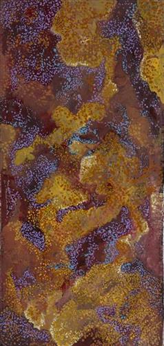
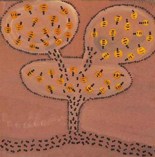
Wuukurta (Honey Ants)

Wuukurta (honey ants) are found in a variety of arid or semiarid environments, with nests of up to two metres deep and more than two metres across. Wuukurta are a highly sought after bush tucker, known otherwise as ‘bush lollies’ due to their sweet, honey like taste. They are eaten whilst still alive by holding the head and legs between two fingers and biting off the thorax. Martu dig for wuukurta nests through the seasons, but they are known to be especially abundant following the rains.

During the pujiman (traditional, desert dwelling) period, Martu would traverse very large distances annually in small family groups, moving seasonally from water source to water source, and hunting and gathering bush tucker as they went. Whilst desert life has moved away from mobile hunter-gatherer subsistence throughout the course of the twentieth century, bush tucker continues to be a significant component of the modern Martu diet. Hunting and gathering bush tucker remains equally valuable as an important cultural practice that is passed on intergenerationally. Though hunting and gathering implements have been modernised, methods of harvesting, tracking and the use of fire burning to drive animals from their retreats are still commonly practiced today.

111582258931


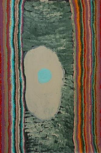
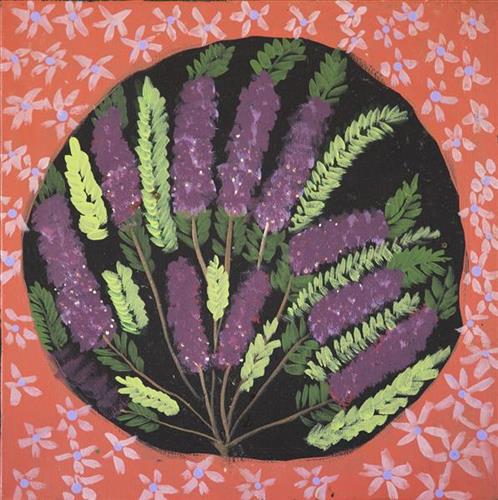
Mulla mulla

“It’s their home for them, real ngurra (home Country, camp). Real ngurra is where they been born and grow up.”

– Corban Clause Williams

The Western Desert term ‘ngurra’ is hugely versatile in application. Broadly denoting birthplace and belonging, ngurra can refer to a body of water, a camp site, a large area of Country, or even a modern house. People identify with their ngurra in terms of specific rights and responsibilities, and the possession of intimate knowledge of the physical and cultural properties of one’s Country. This knowledge is traditionally passed intergenerationally through family connections. Country for Martu is full of memory; not just the memory of their own movement through it, but also of their family. As summarised by Ngalangka Nola Taylor, “painting the ngurra, they do it to remember their connections.” 

Painting ngurra, and in so doing sharing the Jukurrpa (Dreaming) stories and physical characteristics of that place, has today become an important means of cultural maintenance. Physical maintenance of one’s ngurra, like cultural maintenance, ensures a site’s wellbeing, and is a responsibility of the people belonging to that area.  

111582258929


Murtikajarra

Murtikajarra is a soak located in the Percival Lakes region. This site lies within Ngarga’s ngurra (home Country, camp), the area which she knew intimately and travelled extensively with her family in her youth.

The Percival Lakes form a string of ephemeral salt lakes in the north of Western Australia, extending across a distance of 350km. They lie at the southern region of the Great Sandy Desert and east of Karlamilyi National Park. The Canning Stock Route runs in close proximity to some of the lakes, and crosses the salt pan of Tobin Lake near the eastern end.

This region was formed by Wirnpa, one of the most powerful of the ancestral jila (snake) men and the last to travel the desert during the Jukurrpa (Dreaming). Wirnpa is a rainmaking jila who lived and hunted in the Percival Lakes area. His travels are described in the songs and stories of many language groups across the Western Desert, even those far removed from his home site. In his epic travels, Wirnpa met and feasted with many other ancestral beings, exchanged ceremonial objects, and created a series of different laws and ceremonies. When he finally returned home, he searched for his many children only to discover that they had already died. They had laid down and become the salt springs of the Percival Lakes. Wirnpa wept for his children before himself transforming into a snake and entering the soak where he still resides.

111582258928


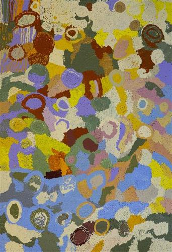
Wantili (Warntili, Canning Stock Route Well 25)

“Wantili (Warntili, Canning Stock Route Well 25) area, close to Parnngurr. My ngurra (home Country, camp), my jamu’s (grandfather’s) Country, my father’s daddy, Jakayu [Biljabu’s] daddy and my daddy’s Country. Jakayu been bury her father there. In pujiman (traditional, desert dwelling) days, my family and Jakayu’s family been walking round there together. Big sandhills here. Sandhill, sandhill, sandhill everywhere. Claypan there, in the middle. Good place for swimming and drinking, for hunting little kangaroo. When no water [we would] go to [the adjacent Canning Stock Route] well. When there [was] rain we stay there at Wantili. Everywhere, we been walking everywhere.       

Near to Wantili, road [Canning Stock Route] going kayili (north). Long time [ago] only horses and cattle [travelled along that road], going Meekatharra and back in the cold time, gone right up to GJ (Georgia) Bore. Half way, when he see water at Wantili, that mob would camp one night, bullock eating all the grass and men’s drinking water. One Martu been working with that mob, droving bullock. Every time he been give us meat, all the pujimanpa (desert dwellers).”

– Ngamaru Bidu


Wantili is a large round jurnu (soak) and linyji (claypan) near Well 25 on the Canning Stock Route. The Wantili region is dominated by claypans surrounded by tuwa (sandhills), and Nyilangkurr, a prominent yapu (hill) is located close to the eastern edge of the claypan. Following rain the typically dry claypans are filled with water, with the overflow from nearby waterholes flowing to Wantili. At that time, Wantili becomes an important place for obtaining fresh water for drinking and bathing. Wantili is significant for the fact that at this site Kartujarra, Manyjilyjarra, Putijarra and Warnman people would all come together for ceremonies during the pujiman era. Many jiwa (stones used by women for grinding seeds) from these times, including those used by Ngamaru’s family, can still be found there today.

Wantili lies within Ngamaru’s ngurra (home Country, camp) through her grandfather and father. As described in her account, Wantili was one of the sites Ngamaru knew intimately and travelled extensively with her family and other family groups, such as the Biljabu family. During the pujiman period Martu would traverse very large distances annually, moving seasonally from water source to water source, and hunting and gathering bush tucker as they went. Knowledge of water sources was critical for survival, and today Martu Country is still defined in terms of the location and type of water. 

As Ngamaru recounts, Wantili also held significance for her as a site of contact between her family and kartiya (white people); drovers with their cattle travelling along the Canning Stock Route. The establishment of the route by Alfred Canning and his team in 1910 resulted in first contact with Europeans for many Martu, including Ngamaru and her family. Increasingly, Martu followed the route to newly established ration depots, mission and pastoral stations. They were drawn to the route in search of food, by a sense of curiosity, or by loneliness. By the late 1950s and early 1960s, most of the desert family groups had left the desert. Eventually, these factors combined with an extreme and prolonged drought in the 1960s to prompt the few remaining pujimanpa to move in from the desert. 

Culturally, Wantili is an incredibly important site in two central Jukurrpa (Dreaming) stories. The first relates to the world’s creation. In this narrative, the world was initially dark, and people were like rocks, with no arms or legs. Following the sun’s first rising, life-forms become increasingly complex while particular features in the land are created. Beyond these details much of the narrative is ngurlu (sacred, taboo), and only for Martu, but the site is open, and anyone can go there. 

Wantili is also one of the many sites featured in the epic Minyipuru (Jakulyukulyu, Seven Sisters) Jukurrpa story. Minyipuru is a central Jukurrpa narrative for Martu, Ngaanyatjarra, Pitjantjatjara and Yankunytjatjara people that is associated with the seasonal Pleiades star constellation. Relayed in song, dance, stories and paintings, Minyipuru serves as a creation narrative, a source of information relating to the physical properties of the land, and an embodiment of Aboriginal cultural laws. The story follows the movement of a group of women travelling all the way across the desert, beginning at Roebourne on the coast of Western Australia, as they are pursued by Yurla, a lustful old man. As the women travelled, they stopped to rest at many sites to eat, dance, rest and sing, on the way leaving behind an assortment of articles that became formations in the land, such as groupings of rocks and trees, grinding stones and seeds. The sisters rested at Wantili before throwing seeds, then continued their journey far to the east and beyond Martu Country, stopping at various sites through central and South Australia.

111582258927


Wantili (Warntili, Canning Stock Route Well 25)

“Wantili (Warntili, Canning Stock Route Well 25) area, close to Parnngurr. My ngurra (home Country, camp), my jamu’s (grandfather’s) Country, my father’s daddy, Jakayu [Biljabu’s] daddy and my daddy’s Country. Jakayu been bury her father there. In pujiman (traditional, desert dwelling) days, my family and Jakayu’s family been walking round there together. Big sandhills here. Sandhill, sandhill, sandhill everywhere. Claypan there, in the middle. Good place for swimming and drinking, for hunting little kangaroo. When no water [we would] go to [the adjacent Canning Stock Route] well. When there [was] rain we stay there at Wantili. Everywhere, we been walking everywhere.       

Near to Wantili, road [Canning Stock Route] going kayili (north). Long time [ago] only horses and cattle [travelled along that road], going Meekatharra and back in the cold time, gone right up to GJ (Georgia) Bore. Half way, when he see water at Wantili, that mob would camp one night, bullock eating all the grass and men’s drinking water. One Martu been working with that mob, droving bullock. Every time he been give us meat, all the pujimanpa (desert dwellers).”

– Ngamaru Bidu


Wantili is a large round jurnu (soak) and linyji (claypan) near Well 25 on the Canning Stock Route. The Wantili region is dominated by claypans surrounded by tuwa (sandhills), and Nyilangkurr, a prominent yapu (hill) is located close to the eastern edge of the claypan. Following rain the typically dry claypans are filled with water, with the overflow from nearby waterholes flowing to Wantili. At that time, Wantili becomes an important place for obtaining fresh water for drinking and bathing. Wantili is significant for the fact that at this site Kartujarra, Manyjilyjarra, Putijarra and Warnman people would all come together for ceremonies during the pujiman era. Many jiwa (stones used by women for grinding seeds) from these times, including those used by Ngamaru’s family, can still be found there today.

Wantili lies within Ngamaru’s ngurra (home Country, camp) through her grandfather and father. As described in her account, Wantili was one of the sites Ngamaru knew intimately and travelled extensively with her family and other family groups, such as the Biljabu family. During the pujiman period Martu would traverse very large distances annually, moving seasonally from water source to water source, and hunting and gathering bush tucker as they went. Knowledge of water sources was critical for survival, and today Martu Country is still defined in terms of the location and type of water. 

As Ngamaru recounts, Wantili also held significance for her as a site of contact between her family and kartiya (white people); drovers with their cattle travelling along the Canning Stock Route. The establishment of the route by Alfred Canning and his team in 1910 resulted in first contact with Europeans for many Martu, including Ngamaru and her family. Increasingly, Martu followed the route to newly established ration depots, mission and pastoral stations. They were drawn to the route in search of food, by a sense of curiosity, or by loneliness. By the late 1950s and early 1960s, most of the desert family groups had left the desert. Eventually, these factors combined with an extreme and prolonged drought in the 1960s to prompt the few remaining pujimanpa to move in from the desert. 

Culturally, Wantili is an incredibly important site in two central Jukurrpa (Dreaming) stories. The first relates to the world’s creation. In this narrative, the world was initially dark, and people were like rocks, with no arms or legs. Following the sun’s first rising, life-forms become increasingly complex while particular features in the land are created. Beyond these details much of the narrative is ngurlu (sacred, taboo), and only for Martu, but the site is open, and anyone can go there. 

Wantili is also one of the many sites featured in the epic Minyipuru (Jakulyukulyu, Seven Sisters) Jukurrpa story. Minyipuru is a central Jukurrpa narrative for Martu, Ngaanyatjarra, Pitjantjatjara and Yankunytjatjara people that is associated with the seasonal Pleiades star constellation. Relayed in song, dance, stories and paintings, Minyipuru serves as a creation narrative, a source of information relating to the physical properties of the land, and an embodiment of Aboriginal cultural laws. The story follows the movement of a group of women travelling all the way across the desert, beginning at Roebourne on the coast of Western Australia, as they are pursued by Yurla, a lustful old man. As the women travelled, they stopped to rest at many sites to eat, dance, rest and sing, on the way leaving behind an assortment of articles that became formations in the land, such as groupings of rocks and trees, grinding stones and seeds. The sisters rested at Wantili before throwing seeds, then continued their journey far to the east and beyond Martu Country, stopping at various sites through central and South Australia.

111582258926


Wantili (Warntili, Canning Stock Route Well 25)

“Wantili (Warntili, Canning Stock Route Well 25) area, close to Parnngurr. My ngurra (home Country, camp), my jamu’s (grandfather’s) Country, my father’s daddy, Jakayu [Biljabu’s] daddy and my daddy’s Country. Jakayu been bury her father there. In pujiman (traditional, desert dwelling) days, my family and Jakayu’s family been walking round there together. Big sandhills here. Sandhill, sandhill, sandhill everywhere. Claypan there, in the middle. Good place for swimming and drinking, for hunting little kangaroo. When no water [we would] go to [the adjacent Canning Stock Route] well. When there [was] rain we stay there at Wantili. Everywhere, we been walking everywhere.       

Near to Wantili, road [Canning Stock Route] going kayili (north). Long time [ago] only horses and cattle [travelled along that road], going Meekatharra and back in the cold time, gone right up to GJ (Georgia) Bore. Half way, when he see water at Wantili, that mob would camp one night, bullock eating all the grass and men’s drinking water. One Martu been working with that mob, droving bullock. Every time he been give us meat, all the pujimanpa (desert dwellers).”

– Ngamaru Bidu


Wantili is a large round jurnu (soak) and linyji (claypan) near Well 25 on the Canning Stock Route. The Wantili region is dominated by claypans surrounded by tuwa (sandhills), and Nyilangkurr, a prominent yapu (hill) is located close to the eastern edge of the claypan. Following rain the typically dry claypans are filled with water, with the overflow from nearby waterholes flowing to Wantili. At that time, Wantili becomes an important place for obtaining fresh water for drinking and bathing. Wantili is significant for the fact that at this site Kartujarra, Manyjilyjarra, Putijarra and Warnman people would all come together for ceremonies during the pujiman era. Many jiwa (stones used by women for grinding seeds) from these times, including those used by Ngamaru’s family, can still be found there today.

Wantili lies within Ngamaru’s ngurra (home Country, camp) through her grandfather and father. As described in her account, Wantili was one of the sites Ngamaru knew intimately and travelled extensively with her family and other family groups, such as the Biljabu family. During the pujiman period Martu would traverse very large distances annually, moving seasonally from water source to water source, and hunting and gathering bush tucker as they went. Knowledge of water sources was critical for survival, and today Martu Country is still defined in terms of the location and type of water. 

As Ngamaru recounts, Wantili also held significance for her as a site of contact between her family and kartiya (white people); drovers with their cattle travelling along the Canning Stock Route. The establishment of the route by Alfred Canning and his team in 1910 resulted in first contact with Europeans for many Martu, including Ngamaru and her family. Increasingly, Martu followed the route to newly established ration depots, mission and pastoral stations. They were drawn to the route in search of food, by a sense of curiosity, or by loneliness. By the late 1950s and early 1960s, most of the desert family groups had left the desert. Eventually, these factors combined with an extreme and prolonged drought in the 1960s to prompt the few remaining pujimanpa to move in from the desert. 

Culturally, Wantili is an incredibly important site in two central Jukurrpa (Dreaming) stories. The first relates to the world’s creation. In this narrative, the world was initially dark, and people were like rocks, with no arms or legs. Following the sun’s first rising, life-forms become increasingly complex while particular features in the land are created. Beyond these details much of the narrative is ngurlu (sacred, taboo), and only for Martu, but the site is open, and anyone can go there. 

Wantili is also one of the many sites featured in the epic Minyipuru (Jakulyukulyu, Seven Sisters) Jukurrpa story. Minyipuru is a central Jukurrpa narrative for Martu, Ngaanyatjarra, Pitjantjatjara and Yankunytjatjara people that is associated with the seasonal Pleiades star constellation. Relayed in song, dance, stories and paintings, Minyipuru serves as a creation narrative, a source of information relating to the physical properties of the land, and an embodiment of Aboriginal cultural laws. The story follows the movement of a group of women travelling all the way across the desert, beginning at Roebourne on the coast of Western Australia, as they are pursued by Yurla, a lustful old man. As the women travelled, they stopped to rest at many sites to eat, dance, rest and sing, on the way leaving behind an assortment of articles that became formations in the land, such as groupings of rocks and trees, grinding stones and seeds. The sisters rested at Wantili before throwing seeds, then continued their journey far to the east and beyond Martu Country, stopping at various sites through central and South Australia.
111582258925


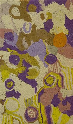
Kulyakartu

“Long time ago I been there. It is my grandmother’s, grandfather’s, father’s, [and] mother’s country, Kulyakartu.  I am painting this particular place. It keeps me connected, [gives me a] sense of belonging [to] tell my grandmother’s story through my art.  Where she was born, I’m a part of that. 

It makes me feel proud painting.  Most important is telling the story behind the painting so people can understand where I am coming from.  Kulyakartu is our ngurra (home Country, camp).  I will continue telling the story through my art.”

– Derrick Butt

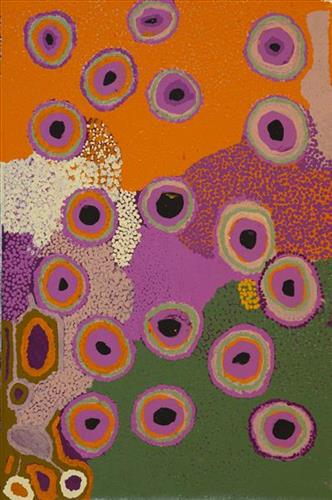
This painting depicts Kulyakartu, Derrick’s ancestral ngurra (home Country, camp). Kulyakartu is a large area in the far north of the Martu homelands, near the Percival Lakes region of Western Australia’s Great Sandy Desert. Kulyakartu is mostly flat grass Country, and is known as a good hunting area. In particular, parnajarrpa (goanna), wild cats, and lunki (witchetty grub) are found in abundance here. In the wantajarra (wet season) the dry lakes in the region fill with water.

111582258924


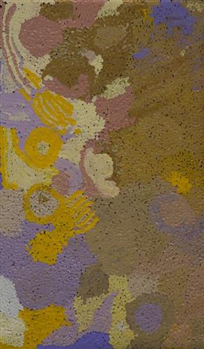
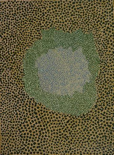
Kalaru (Samphire, salt bush) – Nola Taylor

“Kalaru grows on the claypan – [it’s a] salt bush. And it’s got a lovely black seed. People used to harvest and collect it in the clay pan and hit the bush so the seeds come out. Then take it to [the] water place and rinse it because its salty, and then put it out in the sun to dry. Once its dry- put it in a bowl and take it home and grind it up and make yumpal [damper]. Nice damper too. Tasty.”

– Nola Taylor

Kalaru (samphire, salt bush) is a salt tolerant succulent shrub, endemic to Western Australia, that grows plentifully around salt lakes and linyji (claypans). In the pujiman (traditional, desert dwelling) era, the black kalaru seeds were seasonally harvested in the yalijarra (hot dry months). Once collected a labour intensive process began to produce damper, a type of flat bread. The kalaru seeds were first washed several times before being ground with a jiwa (stones used by women for grinding seeds) to make a type of flour, which was then mixed with water to create a dough that was finally cooked in the ashes of a fire. Kalaru seeds are still collected for producing traditional damper on special occasions. 

During the pujiman period, Martu would traverse very large distances annually in small family groups, moving seasonally from water source to water source, and hunting and gathering bush tucker as they went. Whilst desert life has moved away from mobile hunter-gatherer subsistence throughout the course of the twentieth century, bush tucker continues to be a significant component of the modern Martu diet. Hunting and gathering bush tucker remains equally valuable as an important cultural practice that is passed on intergenerationally. Though hunting and gathering implements have been modernised, methods of harvesting, tracking and the use of fire burning to drive animals from their retreats are still commonly practiced today.

111582258923


Kinyu

“In pujiman (traditional, desert dwelling) time there were giant jarntu (dogs) walking around Kunawarritji (Canning Stock Route Well 33). Like I can see you, you can see me, real life those jarntu showed themselves. Those jarntu would go under ground. Under the parna (ground, earth). There was a male and female dog. The wanti (woman, girl) jarntu was juri (beautiful, good) one. The male jarntu wanted to be nyupa- nyupa (partners). The wanti jarntu say, no, paki (nothing). The male jarntu was young and claimed that female jarntu.”

– Kumpaya Girgirba as translated by Ignatius Taylor

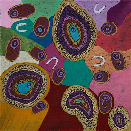
Kinyu (Canning Stock Route Well 35) is a small yinta (permanent spring) that was a popular camping site during the pujiman (traditional, desert dwelling) era. Kinyu forms part of Kumpaya’s ngurra (home Country, camp), the area which she knew intimately and travelled extensively with her family in her youth.

As alluded to in Kumpaya’s account, the site is home to the ancestral mother dingo, a generous provider and fierce protector of her Martu countrymen. Kinyu is so revered that the site and its associated ancestral being are often deferentially called jarntu (dog) in place of uttering the actual name. The site is believed to possess healing and magical powers, and children born here are said to inherit these same powers. 

During the Jukurrpa (Dreaming), Kinyu was the home for a family of dingoes; a mother, father, and their litter of pups. Originally the family had travelled to Wirlarra, following the call of the moon. At Wirlarra the moon cared for them and created a windbreak for the family to shelter. The dingoes stayed for a time at Wirlarra, scratching into the earth to create several distinctive small salt water pools which are still visited by the Martu for their healing properties. After a time, the dingoes continued travelling eastward toward the rising moon until they reached Kinyu, where they remained until all of the dingo pups had grown up. From Kinyu the family travelled further east. 

The intersection of the Canning Stock Route with Kinyu also made this a site of early contact with Europeans for many Martu then living a pujiman life in the desert. Following the route’s construction, Martu encountered Europeans and other Martu working as cattle drovers as they would travel up and down the Stock Route from water source to water source. Increasingly, pujimanpa (desert dwellers) followed the route to newly established ration depots, mission and pastoral stations. They were drawn to the route in search of food, by a sense of curiosity, or by loneliness. By the late 1950s and early 1960s, most of the desert family groups had left the desert. Eventually, these factors combined with an extreme and prolonged drought in the 1960s to prompt the few remaining pujimanpa to move in from the desert.

111582257864


Mungili Waterholes and Rock Holes – Marlene Anderson

“I was swimming there. Yeah, we go visit them a long time [ago]. We drink it, rain water from the rain. Big waterhole. It’s a fresh water, when the rain comes, fills it up. One for swimming and another rock hole for drinking.”

– Marlene Anderson

In this work Marlene depicts a waterhole and rock hole located in Mungili, the small outstation community located just off the Eagle Highway in Western Australia, approximately 430 kilometres northeast of Wiluna and 250 kilometres north of Warburton. Marlene grew up in Mungili, and as such it forms a significant part of her ‘ngurra’ (home Country, camp). Typically Marlene depicts this site with a central large circular form that represents the main waterhole, surrounded by smaller circular forms representing satellite water bodies.

During the pujiman (traditional, desert dwelling) period, knowledge of water sources was critical for survival, and today Martu Country is still defined in terms of the location and type of water. Each of the hundreds of claypans, rockholes, waterholes, soaks and springs found in the Martu desert homelands is known through real life experience and the recounting of Jukurrpa (Dreaming) narratives by name, location, quality and seasonal availability. This encyclopedic knowledge extends even to the nature and movement of arterial waterways, and sustained Martu as they travelled across their Country, hunting and gathering, visiting family, and fulfilling ceremonial obligations. They would traverse very large distances annually, visiting specific areas in the dry and wet season depending on the availability of water and the corresponding cycles of plant and animal life on which hunting and gathering bush tucker was reliant.