111582257863


Mungili Waterholes and Rock Holes – Marlene Anderson

“I was swimming there. Yeah, we go visit them a long time [ago]. We drink it, rain water from the rain. Big waterhole. It’s a fresh water, when the rain comes, fills it up. One for swimming and another rock hole for drinking.”

– Marlene Anderson

In this work Marlene depicts a waterhole and rock hole located in Mungili, the small outstation community located just off the Eagle Highway in Western Australia, approximately 430 kilometres northeast of Wiluna and 250 kilometres north of Warburton. Marlene grew up in Mungili, and as such it forms a significant part of her ‘ngurra’ (home Country, camp). Typically Marlene depicts this site with a central large circular form that represents the main waterhole, surrounded by smaller circular forms representing satellite water bodies.

During the pujiman (traditional, desert dwelling) period, knowledge of water sources was critical for survival, and today Martu Country is still defined in terms of the location and type of water. Each of the hundreds of claypans, rockholes, waterholes, soaks and springs found in the Martu desert homelands is known through real life experience and the recounting of Jukurrpa (Dreaming) narratives by name, location, quality and seasonal availability. This encyclopedic knowledge extends even to the nature and movement of arterial waterways, and sustained Martu as they travelled across their Country, hunting and gathering, visiting family, and fulfilling ceremonial obligations. They would traverse very large distances annually, visiting specific areas in the dry and wet season depending on the availability of water and the corresponding cycles of plant and animal life on which hunting and gathering bush tucker was reliant.

111582257862


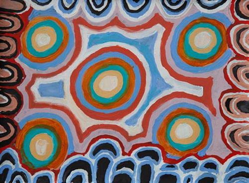
Mungili Waterholes and Rock Holes

“I was swimming there. Yeah, we go visit them a long time [ago]. We drink it, rain water from the rain. Big waterhole. It’s a fresh water, when the rain comes, fills it up. One for swimming and another rock hole for drinking.”

– Marlene Anderson

In this work Marlene depicts a waterhole and rock hole located in Mungili, the small outstation community located just off the Eagle Highway in Western Australia, approximately 430 kilometres northeast of Wiluna and 250 kilometres north of Warburton. Marlene grew up in Mungili, and as such it forms a significant part of her ‘ngurra’ (home Country, camp). Typically Marlene depicts this site with a central large circular form that represents the main waterhole, surrounded by smaller circular forms representing satellite water bodies.

During the pujiman (traditional, desert dwelling) period, knowledge of water sources was critical for survival, and today Martu Country is still defined in terms of the location and type of water. Each of the hundreds of claypans, rockholes, waterholes, soaks and springs found in the Martu desert homelands is known through real life experience and the recounting of Jukurrpa (Dreaming) narratives by name, location, quality and seasonal availability. This encyclopedic knowledge extends even to the nature and movement of arterial waterways, and sustained Martu as they travelled across their Country, hunting and gathering, visiting family, and fulfilling ceremonial obligations. They would traverse very large distances annually, visiting specific areas in the dry and wet season depending on the availability of water and the corresponding cycles of plant and animal life on which hunting and gathering bush tucker was reliant.

111582257861


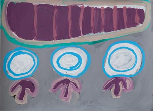
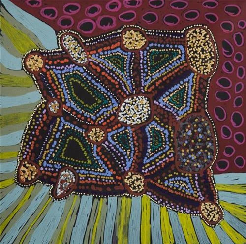
Mungili Waterholes and Rock Holes

“I was swimming there. Yeah, we go visit them a long time [ago]. We drink it, rain water from the rain. Big waterhole. It’s a fresh water, when the rain comes, fills it up. One for swimming and another rock hole for drinking.”

– Marlene Anderson

In this work Marlene depicts a waterhole and rock hole located in Mungili, the small outstation community located just off the Eagle Highway in Western Australia, approximately 430 kilometres northeast of Wiluna and 250 kilometres north of Warburton. Marlene grew up in Mungili, and as such it forms a significant part of her ‘ngurra’ (home Country, camp). Typically Marlene depicts this site with a central large circular form that represents the main waterhole, surrounded by smaller circular forms representing satellite water bodies.

During the pujiman (traditional, desert dwelling) period, knowledge of water sources was critical for survival, and today Martu Country is still defined in terms of the location and type of water. Each of the hundreds of claypans, rockholes, waterholes, soaks and springs found in the Martu desert homelands is known through real life experience and the recounting of Jukurrpa (Dreaming) narratives by name, location, quality and seasonal availability. This encyclopedic knowledge extends even to the nature and movement of arterial waterways, and sustained Martu as they travelled across their Country, hunting and gathering, visiting family, and fulfilling ceremonial obligations. They would traverse very large distances annually, visiting specific areas in the dry and wet season depending on the availability of water and the corresponding cycles of plant and animal life on which hunting and gathering bush tucker was reliant.
111582257860


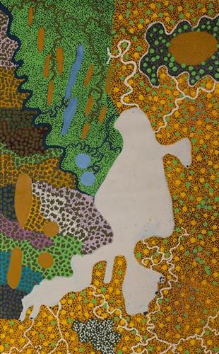
Tuwa (sandhills) in Puntawarri – Judith Anya Samson

“I do tuwa (sandhill) in my own style because that’s our Country. That’s a sandhill, that’s the Dreaming- the Jukurrpa. That’s our culture.

They stay there and we go through the sandhills at Puntawarri in the car. We go first tuwa, then the second tuwa, looking for the waterholes. Go up, up, up- ‘nother tuwa, ‘nother tuwa.

Long time [ago] in Puntawarri, when I was a little girl [with] my Nana and Pop [Dadda Samson and Yanjimi Peter Rowlands] we went climbing up the sandhill. And when I went up my Nana and Pop were at the bottom under a tree and I came down running then rolling, rolling right down to the ground! But I was ok- he right!”

– Judith Anya Samson

Puntawarri is an important cultural area located on the middle stretches of the Canning Stock Route and east of the Jigalong Mission (now Jigalong Aboriginal community), where Anya grew up with her grandmother and renowned Martumili Artist, Dadda Samson (dec.). Puntawarri is also the site of an abandoned community, a waterhole, creek and lake. Puntawarri’s close proximity to Jigalong Mission made it a popular site for Martu to visit during the ‘mission days’. While growing up at Jigalong Mission in the 1960’s, Dadda would return to Puntawarri every weekend to hunt and camp. 

For many Martu, like Anya’s family, Jigalong Mission was the site where their pujiman (traditional, desert dwelling) lifestyle came to an end from the late 1940s as they transitioned to a life as stockmen and women working in cattle stations in the Pilbara region and beyond. In the wake of the extreme and prolonged drought of the 1960s, the last of the remaining pujimanpa (desert dwellers) were forced to move to missions like Jigalong, where a supply of food and water was assured. There, many Martu were reunited with family members that had already moved in from the desert.

The traditional lands of the Martu people encompass the Great Sandy Desert and Rudall River regions of Western Australia, an enormous tract dominated by distinctive red tali, or tuwa (sandhills). These sandhills present an unforgiving landscape; sparse vegetation covers a seemingly never ending expanse of dunes, and yet these lands and the location of resources within them was known intimately by its pujiman inhabitants.


111582257859


Tuwa (sandhills) in Puntawarri – Judith Anya Samson

“I do tuwa (sandhill) in my own style because that’s our Country. That’s a sandhill, that’s the Dreaming- the Jukurrpa. That’s our culture.

They stay there and we go through the sandhills at Puntawarri in the car. We go first tuwa, then the second tuwa, looking for the waterholes. Go up, up, up- ‘nother tuwa, ‘nother tuwa.

Long time [ago] in Puntawarri, when I was a little girl [with] my Nana and Pop [Dadda Samson and Yanjimi Peter Rowlands] we went climbing up the sandhill. And when I went up my Nana and Pop were at the bottom under a tree and I came down running then rolling, rolling right down to the ground! But I was ok- he right!”

– Judith Anya Samson

Puntawarri is an important cultural area located on the middle stretches of the Canning Stock Route and east of the Jigalong Mission (now Jigalong Aboriginal community), where Anya grew up with her grandmother and renowned Martumili Artist, Dadda Samson (dec.). Puntawarri is also the site of an abandoned community, a waterhole, creek and lake. Puntawarri’s close proximity to Jigalong Mission made it a popular site for Martu to visit during the ‘mission days’. While growing up at Jigalong Mission in the 1960’s, Dadda would return to Puntawarri every weekend to hunt and camp. 

For many Martu, like Anya’s family, Jigalong Mission was the site where their pujiman (traditional, desert dwelling) lifestyle came to an end from the late 1940s as they transitioned to a life as stockmen and women working in cattle stations in the Pilbara region and beyond. In the wake of the extreme and prolonged drought of the 1960s, the last of the remaining pujimanpa (desert dwellers) were forced to move to missions like Jigalong, where a supply of food and water was assured. There, many Martu were reunited with family members that had already moved in from the desert.

The traditional lands of the Martu people encompass the Great Sandy Desert and Rudall River regions of Western Australia, an enormous tract dominated by distinctive red tali, or tuwa (sandhills). These sandhills present an unforgiving landscape; sparse vegetation covers a seemingly never ending expanse of dunes, and yet these lands and the location of resources within them was known intimately by its pujiman inhabitants.


111582257858


Kun Kun (Kuny-Kuny)

Kun Kun (Kuny-kuny) is a soak accessing a large body of underground water, located southeast of Kunawarritji (Canning Stock Route Well 33). The site is sacred for its association with the marlu (kangaroo) Jukurrpa (Dreaming), and was an important ceremonial site during the pujiman (traditional, desert dwelling) period.

At this time, Martu would traverse very large distances annually in small family groups, moving seasonally from water source to water source, and hunting and gathering bush tucker as they went. Knowledge of water sources was critical for survival, and today Martu Country is still defined in terms of the location and type of water. Each of the hundreds of claypans, rockholes, waterholes, soaks and springs found in the Martu desert homelands is known by name, location, quality and seasonal availability through real life experience and the recounting of Jukurrpa narratives.

Soaks, or soakwaters, derive their name from the manner in which their waters generally seep into the sand from below stores, sometimes as part of an ephemeral river or creek. Soaks were an especially important source of water during the pujiman era, being the most dependable water source in times of drought. Water was obtained from soaks by scooping away the sand with a piti (timber bowls used for carrying food and water) until clear water gathered at the base of the hole, sometimes at a depth of several metres.

111582257857


Tuwa (sandhills) in Puntawarri – Judith Anya Samson

“I do tuwa (sandhill) in my own style because that’s our Country. That’s a sandhill, that’s the Dreaming- the Jukurrpa. That’s our culture.

They stay there and we go through the sandhills at Puntawarri in the car. We go first tuwa, then the second tuwa, looking for the waterholes. Go up, up, up- ‘nother tuwa, ‘nother tuwa.

Long time [ago] in Puntawarri, when I was a little girl [with] my Nana and Pop [Dadda Samson and Yanjimi Peter Rowlands] we went climbing up the sandhill. And when I went up my Nana and Pop were at the bottom under a tree and I came down running then rolling, rolling right down to the ground! But I was ok- he right!”

– Judith Anya Samson

Puntawarri is an important cultural area located on the middle stretches of the Canning Stock Route and east of the Jigalong Mission (now Jigalong Aboriginal community), where Anya grew up with her grandmother and renowned Martumili Artist, Dadda Samson (dec.). Puntawarri is also the site of an abandoned community, a waterhole, creek and lake. Puntawarri’s close proximity to Jigalong Mission made it a popular site for Martu to visit during the ‘mission days’. While growing up at Jigalong Mission in the 1960’s, Dadda would return to Puntawarri every weekend to hunt and camp. 

For many Martu, like Anya’s family, Jigalong Mission was the site where their pujiman (traditional, desert dwelling) lifestyle came to an end from the late 1940s as they transitioned to a life as stockmen and women working in cattle stations in the Pilbara region and beyond. In the wake of the extreme and prolonged drought of the 1960s, the last of the remaining pujimanpa (desert dwellers) were forced to move to missions like Jigalong, where a supply of food and water was assured. There, many Martu were reunited with family members that had already moved in from the desert.

The traditional lands of the Martu people encompass the Great Sandy Desert and Rudall River regions of Western Australia, an enormous tract dominated by distinctive red tali, or tuwa (sandhills). These sandhills present an unforgiving landscape; sparse vegetation covers a seemingly never ending expanse of dunes, and yet these lands and the location of resources within them was known intimately by its pujiman inhabitants.


111582257856


Rabbit Proof Fence – Judith Anya Samson

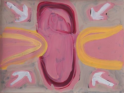
“I painted the Rabbit Proof Fence and the tracks of the emus. They can’t get through because the gate is closed. If they can’t get through they go back to the sand hills. We still see that Rabbit Proof Fence out there, it goes to Jilakurru then to Jigalong, long one, and it’s a bit broken now. The three girls passed through Jilakurru going to Jigalong. Everybody likes that story in Jigalong, I like painting that story.” 

– Judith Anya Samson

In 1931 sisters Molly Craig, Daisy Kadibil and Gracie Fields were taken from their families, like many other Aboriginal children at that time, and transported to Moore River Native Settlement, north of Perth. They were taken away in the belief that part-Aboriginal children should be trained as domestic servants. 

The three girls escaped the next day and, incredibly, walked 1600 kilometres home to Jigalong using the Rabbit-Proof Fence to navigate. The Rabbit Proof Fence remains the world’s longest fence, and was built in the early 1900s to separate rabbits from pasture. For nine weeks, the girls followed its length in order to be reunited with their family. They crossed a flooded river, sand dunes, heathlands, wheatbelts and plains, claypans and salt lakes. They slept in dug-out rabbit burrows, and caught and cooked rabbits, along with other plant based bush tucker. For the duration of their journey they were pursued by policeman and an Aboriginal police tracker.

The girls’ story has been immortalised in the novel “Follow the Rabbit-Proof Fence” by Doris Pilkington (Nugi Garimara, 1996), and was adapted into the film “Rabbit Proof Fence” (2002). This story retains special significance for the Martu, and in particular those inhabitants of Jigalong Aboriginal community. The three girls were Martu, and their children and grandchildren continue to live in the Martu homelands today. Judith grew up with her grandparents in Jigalong. 

111582257855


Mungkulu – Miriam Atkins

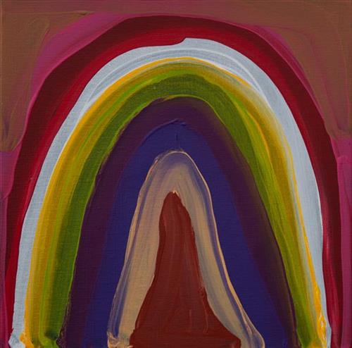
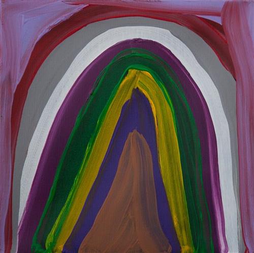
“Mungkulu, down at the Canning Stock Route. It’s a rockhole place. That’s where Dadda [Samson] and her family come from. Nyarru (shame, poor thing), old lady.”

– Miriam Atkins

Mungkulu is a rockhole located south east of Kumpupirntily (Kumpupintily, Lake Disappointment). This site lies within Miriam’s ngurra (home Country, camp) through her family. As Miriam recounts here, the site was also the home Country for fellow Martumili Artist Dadda Samson (dec.)

During the pujiman (traditional, desert dwelling) period, Martu would traverse very large distances annually in small family groups, moving seasonally from water source to water source, and hunting and gathering bush tucker as they went. At this time knowledge of water sources was critical for survival, and today Martu Country is still defined in terms of the location and type of water. Each of the hundreds of claypans, rockholes, waterholes, soaks and springs found in the Martu desert homelands is known by name, location, quality and seasonal availability through real life experience and the recounting of Jukurrpa (Dreaming) narratives.

111582257438


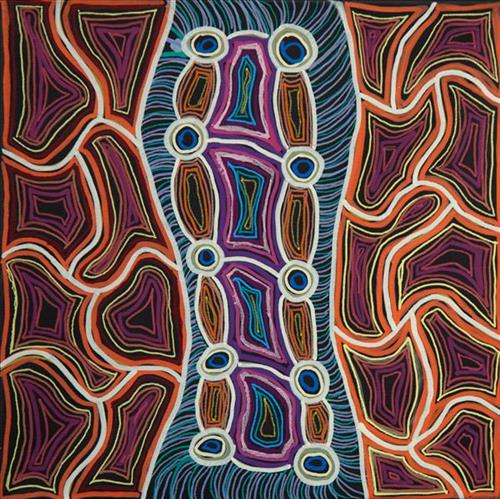
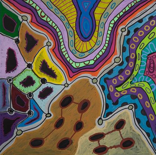
Nyayartakujarra

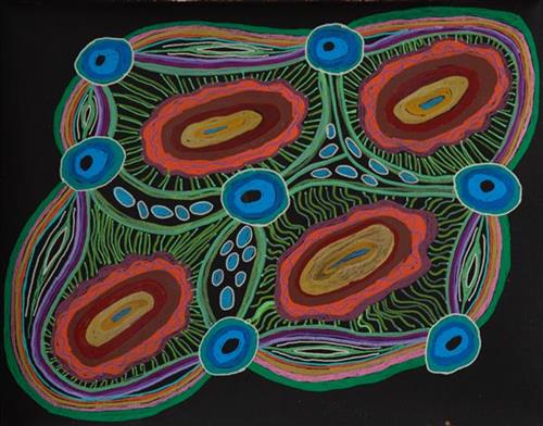
 “Just like your on a plane looking down. This one here lake Nyayartakujarra connecting with this one here.

Water comes from Karlamilyi. Water flows to the lake and Jamparri, Jintirripalangu and Pinangu claypan. This one here Tarl, Wawul water next to lake. Blue dots water Rawa next to Punmu and this one Jilla Jilla This is Rudal River. Wilurr is the water there its a soak there. Green over here grasses and Spinifex. Orange one Parna (ground). All the purple ones Kalaru (bush damper seed). 

If you go on the plane to Newman you see this one here, its a creek. You can see from the air water flowing from creek to claypans. This all area my family being walking here. Warnman country my father country and grandmother and grandfather”. 

– Damien Miller 

This work portrays an area of Country that can be interpreted in multiple ways. Firstly, the image may be read as an aerial representation of a particular location known to the artist- either land that they or their family travelled, from the pujiman (traditional, desert dwelling) era to now. During the pujiman period, Martu would traverse very large distances annually in small family groups, moving seasonally from water source to water source, and hunting and gathering bush tucker as they went. At this time, one’s survival depended on their intimate knowledge of the location of resources; thus physical elements of Country, such as sources of kapi (water), tali (sandhills), different varieties of warta (trees, vegetation), ngarrini (camps), and jina (tracks) are typically recorded with the use of a use of a system of iconographic forms universally shared across the desert. 

An additional layer of meaning in the work relates to more intangible concepts; life cycles based around kalyu (rain, water) and waru (fire) are also often evident. A thousands of year old practice, fire burning continues to be carried out as both an aid for hunting and a means of land management today. As the Martu travelled and hunted they would burn tracts of land, ensuring plant and animal biodiversity and reducing the risk of unmanageable, spontaneous bush fires. The patchwork nature of regrowth is evident in many landscape works, with each of the five distinctive phases of fire burning visually described with respect to the cycle of burning and regrowth.