111581692882


Jilukurru (Killagurra Springs, Canning Stock Route, Well 17)

“We were there long time as kid, playing around. I been walking around here, young fella. There’s big water there, running water. Water there belongs to that jila (snake), he belongs to there. That jila makes you scared if you’re a stranger messing around in the water. The water will go right up, and you better get out from there!

Wati Kujarra (Two Goanna Men). Youngfella, poor bugger. [Here at] Jilukurru, sitting down this side you can see their ngarnkurrpa (beards) right in the hill there. That’s their main place. He been youngfella them two, chasing all the kangaroo. They gone away from Jilukurru Country, long way away, right to Roebourne, to that lake there. They not coming back, they gone one way.

This is my Country, good Country. Long way away on the Canning Stock Route. We used to stop there [and] go hunting. No road then, we walking around. No car, only camels.”

– Yunkurra Billy Atkins

Yunkurra’s Country encompasses some of the most important and dangerous sites in the Western Desert, including Jilukurru (Killagurra Springs, Canning Stock Route Well 17) and Kumpupirntily (Kumpupintily, Lake Disappointment). Jilukurru is a yinta (permanent spring) located in a complex of gorges and valleys yapurra (west) of Kumpupirntily. Jilukurru lies in the heart of Yunkurra’s ngurra (home Country, camp); he grew up in this area. This spring was an important site for meetings during the pujiman (traditional, desert dwelling) era. 

As Yunkurra describes, Jilukurru is also sacred for its relation to the Jukurrpa (Dreaming) narrative of the Wati Kujarra. For this reason, access to the site is respectfully restricted. Wati Kujarra is one of the key foundational narratives for Western Desert people. Half men, half goanna, the Wati Kujarra were responsible for the creation of many land features in Martu Country and beyond as they travelled, hunted and burned Country together. Wati Kujarra is a ngurlu (sacred, taboo) men’s story, and much of the content is only shared with initiated men.

At Jilukurru, the Wati Kujarra lived for a time. Here they also trimmed their ngarnkurrpa. On one of the rocky headlands of the range system, the form of the two men can be seen, with their long beards rolling down the escarpment. After the Wati Kujarra left Jilukurru the site became home to an ancestral jila.

111581692878


Karlamilyi

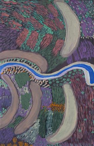
“This Karlamilyi area, big land. That’s a ngurra (home Country, camp) belonging to our old people, Warnman people. We talk for our land, our jila (snake). I grew up in this Country, my Country. This land belongs to our father. In pujiman (traditional, desert dwelling) days I walked around here, used to walk up and down tuwa (sandhill) and back to the main camp belonging to Martu. 

That river running through, he called Pirnpi. Whitefella way is Rudall River. There’s a bird, karuwarlkun (magpie), flying and singing everywhere in the Rudall River there. The river is flowing to Lake Dora, it has five waterholes in the river system. Outside of the river are creeks and gullies, the salt lake, Lake Dora, and the sand dunes.

There’s a claypan there too, big claypan, close to Walirrlirri. Pangkartal we call him. There’s a big rain there, rain time. Fill him up water when the rain time comes. Snake living there in Pangkartal, big one. He [the snake] going to listen to the owner of the land. When we sing out to him in a Warnman way, we tell him “Stop, don’t get cheeky. We coming in [to the land].” He not cheeky, he a good one. Quiet snake.

At Nyayartakujarra (Lake Dora), [in the north east of the region,] two snakes been killed. Right here they got crook in the Dreamtime. All the men, Ngaanyatjarra and Warnman, they were singing. One young fella, he threw a spear into the snake. That snake felt something there, got killed and burned.

[West of Nyayartakujarra is] Yanytikuji, red hill over there. They working, doing the mining there now [at Yandicoogina Mine]. Next to Yanytikuji is a big claypan, Yalpalpa, main camp and a water. That’s a hunting place. Plenty of bush tucker round there; kanyjamarra (yam, bush carrot), like a carrot growing in the ground in the river bed there. You pull it out, just like a carrot! Lunki (witchetty grub), and jatarrpa, that’s like a seed, you gotta clean him up and grind it to make a flour wheat, make a damper in the waru (fire). We gonna get that seed and show you fellas. Minyarra (bush onion) there, and ngaputa (sweet, patterned green melon), they all grow in the river banks.

In the middle is Putarrluu, a yinta (permanent spring) where there are two snakes, a man and a woman snake. They are nyupa (partners), they stop here, it is their yinta. You can’t camp right at the big yinta because of the snakes. You have to get your water from the little soak. When we want to get water we talk to the snakes in Warnman, their language, and the snakes send the water to them.  

This one Wartararra area, [south of Yanytikuji,] but you can’t go through there. This one Pulikati [Hill] area, we used to go through a gap here. There is quicksand here. People don’t go there. We used to sing out for this water, from this side. The old people used to sing out to “Come on, send the water for me.” You can’t go through there, quicksand, not allowed.

Tintinmarran, bottom end of Rudall River [and southeast of Pulikati. There is a januku (waterfall) there, a big yapu (hill), two tuwa (sandhills), and jawirli (quondong) trees. All of the rivers run down through Tintinmarran before joining Rudall River. After all the kapi (water) joins the Rudall River it runs to Warnanjarra where it disappears underground and goes all the way up north to Derby.

I [Jatarr Lily Long] was born there in Karlamilyi River, that’s my Country. [I was born in] Jatarrngara, that’s the name for the place and that’s my name. That’s the living water place.

We are Warnman ladies, painting Kintyre and Karlamilyi. We can share this Country.”

 –Sisters Wurta Amy French and Jatarr Lily Long

Karlamilyi (Rudall River) is Warnman Country, located in the very heart of the Martu homelands. The Karlamilyi region is ngurra for sisters Wurta Amy French and Jatarr Lily Long. They travelled and camped extensively around this area with their family in their youth, and possess a great deal of knowledge of the region’s physical elements, resource distribution, and Jukurrpa (Dreaming) narratives.

The region is situated southwest of the Great Sandy Desert and northeast of the Little Sandy Desert. Spanning through the region is the epic Karlamilyi River, which runs north into Nyayartakujarra (Lake Dora), a large salt lake. The Broadhurst and Fingoon Ranges extend diagonally across the river’s path. The landscape is striking for its abundance of gorges and valleys carved by ice age glaciers, rugged cliffs, red tali (sand dunes), grasslands, sandstone and quartz rocky outcrops, and salt lakes. 

Across the whole region are hundreds of water sources; including waterholes, creeks, soaks, lakes, pools and rockholes. Lining the rivers are coolabah, walyji (river gum), yulbah (bats wing coral tree), and several species of acacia and hakea. Jalkuran (paperbark), kurrulyu/ mijarrpa (bloodwood) and jawirli (quandong) are found in the region’s valleys, and wikirrpa (desert oaks) and grasses in the sandplains. The area is abundant with bird species, jila, maruntu (goannas), red kangaroos and warlpaju (rock wallabies). The region is also home to remote aboriginal communities Punmu and Parnngurr.

According to two of the central Martu Jukurrpa narratives, the Karlamilyi River and its surrounds were created by the ancestral beings Jila Kujarra (Two Snakes) and the Wati Kujarra (Two Goanna Men) as they travelled across the lands.
111581692877


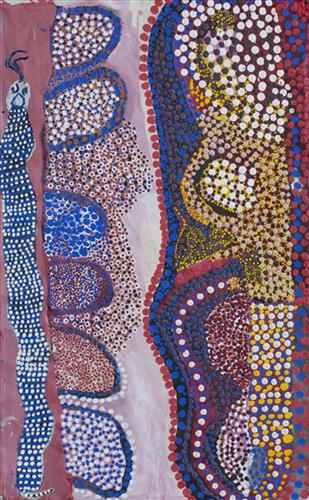
Nyurnma near Punmu

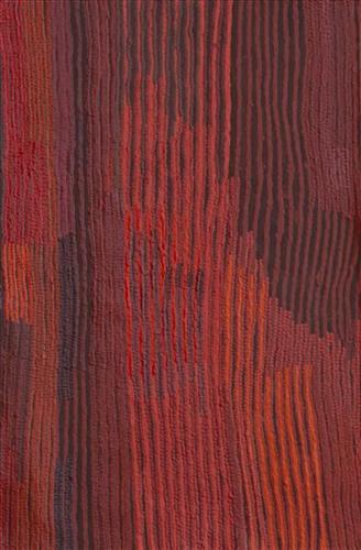
“Nyurnma- burnt area North from Punmu, sandhill Country.

One big one no yukuri (green) left. Last year [2018] no rain yet. Big area from lighting did it, it started that waru (fire). It kept burning from the westerly wind turning it Kakarra (East) [moves hands around gesturing the fire moving around].

That burning was moving around, no rocks only kurrmalyi (sandhill Country) tuwa, tuwa, tuwa (many sandhill) and waru (fire)

I went up in the helicopter from Punmu and saw that Country. That time the waru finished the country was clear- good for hunting, you can easily see the tracks. Plenty parnajarrpa (sand goanna) there. Big one nyurnma only. It was a no good feeling- really big one, out of control [The fire was burning a large area of country and became out of control]. Long time ago in pujiman (traditional, desert-dwelling) times same way- big fires would start from lighting. Here is the red dirt, marked little bit like the colours left after a camp fire, but from lighting here now.”

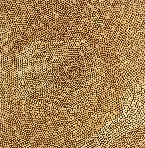
Martu artists paint Country in all it’s different seasonal stages. Important to Martu, and to Martu Country, is the practice of waru (fire burning); a practice that assists with hunting, regenerates growth, and encourages greater diversity in plant and animal life. When Martu Country burns, mosaic fire scars are left on the Country, and patches of regeneration form a kind of mosaic pattern across the land. This is called nyurnma – burnt Country.  Waru is typically burnt in small, controlled areas, leaving a defined patchwork pattern of nyurnma in the land, across tali (sand hills), linyji (clay pans), parulyukurru (spinifex country) and pila (sandy plains). This patterning is clearly visible in Martumili Artists works, where they paint Country from an aerial perspective.

111581692853


Untitled

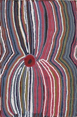
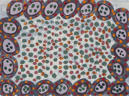
This is Kumpaya’s Country- her ‘ngurra’ (home Country, camp). People identify with their ngurra in terms of specific rights and responsibilities, and the possession of intimate knowledge of the physical and cultural properties of one’s Country. Painting ngurra, and in so doing sharing the Jukurrpa (Dreaming) stories and physical characteristics of that place, has today become an important means of cultural maintenance. 

Kumpaya’s ngurra encompasses the Country that she and her family walked in the pujiman (traditional, desert-dwelling) era. At this time she travelled nomadically with her own and other family groups, traversing an enormous tract of land around the middle section of the Canning Stock Route, and between Punmu Aboriginal community and Kiwirrkura, more than 500 kilometres eastward. 

Kumpaya was born close to Kiwirrkurra, a rockhole located in the Gibson Desert and to the south west of Lake McKay. She grew up, walked and hunted primarily around this area. As a young woman Kumpaya travelled westward, through to Kunawarritji (Canning Stock Route Well 33). She continued to live nomadically before eventually deciding to move to Jigalong Mission along with many other relatives following an extreme and prolonged drought in the 1960s. 

Portrayed in this work are features of Kumpaya’s ngurra, such as the striking salt lakes, dominant permanent red tali (sandhills), warta (trees, vegetation), and the individually named water sources she and her family camped at. These include Luurnkurangu, Karingkarra , Katarta, Pinkari, Pintu-pintu, Yanjiwara, Kunalimpi, Juntu-juntu (Canning Stock Route Well 30), Warla-warla (Canning Stock Route Well 31), Kunawarritji, Kinyu (Canning Stock Route Well 35), Natawalu (Canning Stock Route Well 40), and Kupankurlu. Rock holes, waterholes, soaks and springs were all extremely important sites for Martu people during the pujiman period, and are generally depicted with circular forms. 

The encyclopaedic knowledge of the location, quality and seasonal availability of the hundreds of water bodies found in one’s Country sustained Martu as they travelled across their Country, hunting and gathering, visiting family, and fulfilling ceremonial obligations. They would traverse very large distances annually, visiting specific areas in the dry and wet season depending on the availability of water and the corresponding cycles of plant and animal life on which hunting and gathering bush tucker was reliant. As they travelled and hunted they would also burn areas of Country, generating a greater diversity of plant and animal life.

111581692852


Untitled

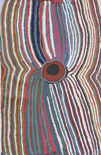
This is Kumpaya’s Country- her ‘ngurra’ (home Country, camp). People identify with their ngurra in terms of specific rights and responsibilities, and the possession of intimate knowledge of the physical and cultural properties of one’s Country. Painting ngurra, and in so doing sharing the Jukurrpa (Dreaming) stories and physical characteristics of that place, has today become an important means of cultural maintenance. 

Kumpaya’s ngurra encompasses the Country that she and her family walked in the pujiman (traditional, desert-dwelling) era. At this time she travelled nomadically with her own and other family groups, traversing an enormous tract of land around the middle section of the Canning Stock Route, and between Punmu Aboriginal community and Kiwirrkura, more than 500 kilometres eastward. 

Kumpaya was born close to Kiwirrkurra, a rockhole located in the Gibson Desert and to the south west of Lake McKay. She grew up, walked and hunted primarily around this area. As a young woman Kumpaya travelled westward, through to Kunawarritji (Canning Stock Route Well 33). She continued to live nomadically before eventually deciding to move to Jigalong Mission along with many other relatives following an extreme and prolonged drought in the 1960s. 

Portrayed in this work are features of Kumpaya’s ngurra, such as the striking salt lakes, dominant permanent red tali (sandhills), warta (trees, vegetation), and the individually named water sources she and her family camped at. These include Luurnkurangu, Karingkarra , Katarta, Pinkari, Pintu-pintu, Yanjiwara, Kunalimpi, Juntu-juntu (Canning Stock Route Well 30), Warla-warla (Canning Stock Route Well 31), Kunawarritji, Kinyu (Canning Stock Route Well 35), Natawalu (Canning Stock Route Well 40), and Kupankurlu. Rock holes, waterholes, soaks and springs were all extremely important sites for Martu people during the pujiman period, and are generally depicted with circular forms. 

The encyclopaedic knowledge of the location, quality and seasonal availability of the hundreds of water bodies found in one’s Country sustained Martu as they travelled across their Country, hunting and gathering, visiting family, and fulfilling ceremonial obligations. They would traverse very large distances annually, visiting specific areas in the dry and wet season depending on the availability of water and the corresponding cycles of plant and animal life on which hunting and gathering bush tucker was reliant. As they travelled and hunted they would also burn areas of Country, generating a greater diversity of plant and animal life.

111581692849


Bush Tucker

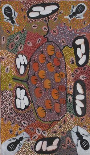
Depicted in this work are traditional types of bush tucker, their habitats, and their related hunting and gathering methods. During the pujiman (traditional, desert dwelling) period, Martu would traverse very large distances annually in small family groups, moving seasonally from water source to water source, and hunting and gathering bush tucker as they went. Whilst desert life has moved away from mobile hunter-gatherer subsistence throughout the course of the twentieth century, bush tucker continues to be a significant component of the modern Martu diet. Hunting and gathering bush tucker remains equally valuable as an important cultural practice that is passed on intergenerationally. Though hunting and gathering implements have been modernised, methods of harvesting, tracking and the use of fire burning to drive animals from their retreats are still commonly practiced today. 

Typically, animals hunted for their kuwiyi (meat) include kirti-kirti (euro kangaroo) and marlu (plains kangaroo), parnajarrpa (sand goanna), kipara (Australian bustard, bush turkey) and karlaya (emu). Lunki (witchetty grub) and wuukurta (honey ants) are dug from tree and bush trunks, or from underground nests. Popular mayi (plant food) includes minyarra (bush onion), collected from small, grass like plants; root vegetables dug from underground such as kulyu and mata (types of bush potato); and seeds such as kalaru (samphire, salt bush), yuwinyji, and marnkalpa (spinifex species). Jawirli (quondong), wamurla (bush tomatoes), jinyjiwirrily (wild gooseberry), ngaputa (melon), and karlkula (bush banana) are some of the most popular bush fruits. These are often collected in the wantajarra (cool season) and tuulpara (spring) months, along with juri (sweet) botanical gums and wama (nectar), obtained from various plant species. 

Traditional tools used for hunting and gathering bush tucker were carved from wanari (mulga), mulunturu (desert oak), yurungkura (river red gum) and mijarrpa (bloodwoods), and included kurlata (spears), jurna (hitting stick), karli (boomerangs), wana (digging-sticks), piti (timber bowls used for carrying food and water), and jiwa (grinding stones for grinding seeds into flour). While carved objects retain enormous social and ceremonial importance in Martu life, they are no longer used for hunting and gathering.

111581692847


Three Waterholes

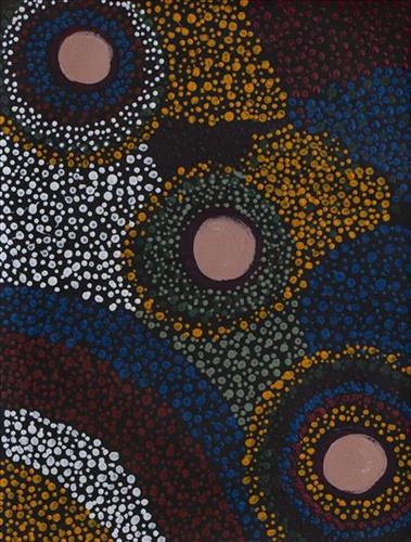
This work depicts three waterholes within the artists’ ngurra (home Country, camp), typically represented with circular forms. Waterholes are sites that require maintenance, including digging to increase flow, clearing out surrounding growth, and cleaning up after sullying by camels or cattle.

During the pujiman (traditional, desert dwelling) period, knowledge of water sources was critical for survival, and today Martu Country is still defined in terms of the location and type of water. Each of the hundreds of claypans, rockholes, waterholes, soaks and springs found in the Martu desert homelands is known through real life experience and the recounting of jukurrpa (dreamtime) narratives by name, location, quality and seasonal availability. This encyclopedic knowledge extends even to the nature and movement of arterial waterways, and sustained Martu as they travelled across their Country, hunting and gathering, visiting family, and fulfilling ceremonial obligations. They would traverse very large distances annually, visiting specific areas in the dry and wet season depending on the availability of water and the corresponding cycles of plant and animal life on which hunting and gathering bush tucker was reliant.

111581692839


Untitled

“When Martu paint, it’s like a map. Martu draw story on the ground and on the canvas, and all the circle and line there are the hunting areas and different waters and tracks where people used to walk, and [some you] can’t cross, like boundaries. So nowadays you see a colourful painting and wonder what it is, but that’s how Martu tell story long ago. It’s not just a lovely painting, it’s a story and a songline and a history and everything that goes with it.” 

– Ngalangka Nola Taylor and Joshua Booth

This work portrays an area of Country that can be interpreted in multiple ways. Firstly, the image may be read as an aerial representation of a particular location known to the artist- either land that they or their family travelled, from the pujiman (traditional, desert dwelling) era to now. During the pujiman period, Martu would traverse very large distances annually in small family groups, moving seasonally from water source to water source, and hunting and gathering bush tucker as they went. At this time, one’s survival depended on their intimate knowledge of the location of resources; thus physical elements of Country, such as sources of kapi (water), tali (sandhills), different varieties of warta (trees, vegetation), ngarrini (camps), and jina (tracks) are typically recorded with the use of a use of a system of iconographic forms universally shared across the desert. 

An additional layer of meaning in the work relates to more intangible concepts; life cycles based around kalyu (rain, water) and waru (fire) are also often evident. A thousands of year old practice, fire burning continues to be carried out as both an aid for hunting and a means of land management today. As the Martu travelled and hunted they would burn tracts of land, ensuring plant and animal biodiversity and reducing the risk of unmanageable, spontaneous bush fires. The patchwork nature of regrowth is evident in many landscape works, with each of the five distinctive phases of fire burning visually described with respect to the cycle of burning and regrowth.  

Finally, metaphysical information relating to a location may also be recorded; jukurrpa (dreaming) narratives chronicle the creation of physical landmarks, and can be referenced through depictions of ceremonial sites, songlines, and markers left in the land. Very often, however, information relating to jukurrpa is censored by omission, or alternatively painted over with dotted patterns.

111981694083


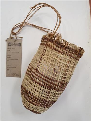
Burlupurr (Dilly Bag)

Burlupurr, or dilly bag, is a large woven collecting basket. These large bags are often made from the vine ‘Malasia scandens’, a strong pliable plant which grows along the floor and into the canopy of monsoon vine thickets. The bags are used to collect any kind of large numbers of heavy foods such as fish caught in conical fish traps or large collections of yams.

They can also be made from Pandanus spiralis, a plant which grows in many areas of Arnhem Land. These dilly bags are a tightly woven collecting basket, very finely made. These dilly bags are often used to collect sugarbag, the native honey 

As well as being of practical use, dilly bags are also of religious significance to Arnhem Land people. Dilly bags are said to be totemic objects and associated with particular sites in the landscape.

114881706316


Ngura Talitja – Sand Dune Country

Walka is Desert design and inextricably linked with Tjukurpa: the Law and way of life of Anangu (Central and Western Desert Aboriginal people). The symbols were traditionally used in cave, ground and body paintings, in story telling, teaching and signalling inheritance. Meaning of the designs depends on its subject and particular people are responsible for their re-creation and teaching according to the Tjukurpa. Highly experienced craftspeople have grown up making traditional tools and weapons under the instruction of their elders. They now apply this knowledge and express their world through art such as this.

Both the dot painting and etching techniques, where walka is burnt into the wood with wire heated on a wood fire, have become Centralian traditions, evolving with the adaptation of traditional design for public display and as a depiction of Tjukurpa and landscape.

This is ngura talitja or sand dune country. Series of curving lines are wind rippled sand dunes, sometimes intercut by the tracks of a Tjukuritja; the burrowings of animals; or the dry bed of a desert creek. By their very nature landforms mark sites related to the Creation Ancestors’ journeys across the country; the ‘dreaming tracks’ followed by countless generations of Anangu since. They created landforms and customs to be passed on and maintained over subsequent generations. The sites are linked through inma or ceremony – the singing, dancing and body painting which reveals the laws of nature and provides a blue print for life and a guiding map of country.