111981715647


Bush Jewellery – Bracelet

The women of Maningrida and surrounding homelands use a combination of locally found seeds, bone and shells to make a variety of jewellery including necklaces. earrings and bracelets.  Many of the artists use complex patterns and designs to make their beautiful creations.

111581715962


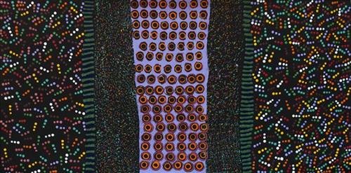
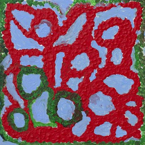
Untitled

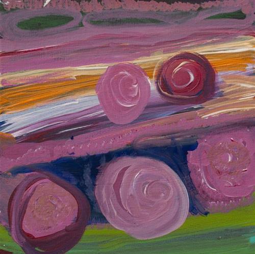
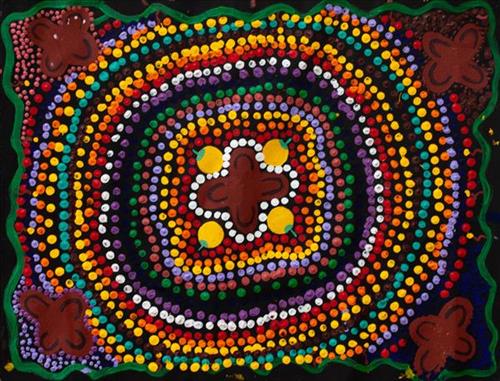
“When Martu paint, it’s like a map. Martu draw story on the ground and on the canvas, and all the circle and line there are the hunting areas and different waters and tracks where people used to walk, and [some you] can’t cross, like boundaries. So nowadays you see a colourful painting and wonder what it is, but that’s how Martu tell story long ago. It’s not just a lovely painting, it’s a story and a songline and a history and everything that goes with it.” 

– Ngalangka Nola Taylor and Joshua Booth

This work portrays an area of Country that can be interpreted in multiple ways. Firstly, the image may be read as an aerial representation of a particular location known to the artist- either land that they or their family travelled, from the pujiman (traditional, desert dwelling) era to now. During the pujiman period, Martu would traverse very large distances annually in small family groups, moving seasonally from water source to water source, and hunting and gathering bush tucker as they went. At this time, one’s survival depended on their intimate knowledge of the location of resources; thus physical elements of Country, such as sources of kapi (water), tali (sandhills), different varieties of warta (trees, vegetation), ngarrini (camps), and jina (tracks) are typically recorded with the use of a use of a system of iconographic forms universally shared across the desert. 

An additional layer of meaning in the work relates to more intangible concepts; life cycles based around kalyu (rain, water) and waru (fire) are also often evident. A thousands of year old practice, fire burning continues to be carried out as both an aid for hunting and a means of land management today. As the Martu travelled and hunted they would burn tracts of land, ensuring plant and animal biodiversity and reducing the risk of unmanageable, spontaneous bush fires. The patchwork nature of regrowth is evident in many landscape works, with each of the five distinctive phases of fire burning visually described with respect to the cycle of burning and regrowth.  

Finally, metaphysical information relating to a location may also be recorded; jukurrpa (dreaming) narratives chronicle the creation of physical landmarks, and can be referenced through depictions of ceremonial sites, songlines, and markers left in the land. Very often, however, information relating to jukurrpa is censored by omission, or alternatively painted over with dotted patterns.

111581715938


Tuwa around Western Desert

The traditional lands of the Martu people encompass the Great Sandy Desert and Rudall River regions of Western Australia, an enormous tract dominated by distinctive red tali, or tuwa (sandhills). These sandhills present an unforgiving landscape; sparse vegetation covers a seemingly never ending expanse of dunes, and yet these lands and the location of resources within them was known intimately by its pujiman (traditional, desert dwelling) inhabitants. At this time, Martu traversed very large distances annually in small family groups, moving from water source to water source through the harsh desert landscape with incredible stamina and resourcefulness. Travel was often undertaken at night, and when travelling during the day, Martu wore yakipiri (woven bark sandals) to protect their feet from the hot desert sand.

111581716139


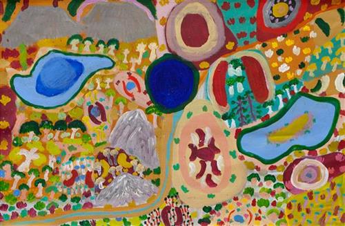
Untitled

This painting portrays physical elements of Martu Country, such as the dominant tali (sandhills), warta (trees, vegetation), and water sources. Rock holes, waterholes, soaks and springs were all extremely important sites for Martu people during the pujiman (nomadic bush) era, with many important jukurrpa (dreamtime stories) chronicling the creation of these landmarks. In the past the Martu lived nomadically, moving from water source to water source, and hunting and gathering bush tucker as they went. They would traverse very large distances annually, visiting specific areas in the dry and wet season depending on the availability of water. As they travelled and hunted they would also burn areas of country creating a larger diversity of plant and animal life.

111581716129


Untitled

“When Martu paint, it’s like a map. Martu draw story on the ground and on the canvas, and all the circle and line there are the hunting areas and different waters and tracks where people used to walk, and [some you] can’t cross, like boundaries. So nowadays you see a colourful painting and wonder what it is, but that’s how Martu tell story long ago. It’s not just a lovely painting, it’s a story and a songline and a history and everything that goes with it.” 

– Ngalangka Nola Taylor and Joshua Booth

This work portrays an area of Country that can be interpreted in multiple ways. Firstly, the image may be read as an aerial representation of a particular location known to the artist- either land that they or their family travelled, from the pujiman (traditional, desert dwelling) era to now. During the pujiman period, Martu would traverse very large distances annually in small family groups, moving seasonally from water source to water source, and hunting and gathering bush tucker as they went. At this time, one’s survival depended on their intimate knowledge of the location of resources; thus physical elements of Country, such as sources of kapi (water), tali (sandhills), different varieties of warta (trees, vegetation), ngarrini (camps), and jina (tracks) are typically recorded with the use of a system of symbols. 

An additional layer of meaning in the work relates to more intangible concepts; life cycles based around kalyu (rain, water) and waru (fire) are also often evident. A thousands of year old practice, fire burning continues to be carried out as both an aid for hunting and a means of land management today. As the Martu travelled and hunted they would burn tracts of land, ensuring plant and animal biodiversity and reducing the risk of unmanageable, spontaneous bush fires. The patchwork nature of regrowth is evident in many landscape works, with each of the five distinctive phases of fire burning visually described with respect to the cycle of burning and regrowth.  

Finally, metaphysical information relating to a location may also be recorded; jukurrpa (dreaming) narratives chronicle the creation of physical landmarks, and can be referenced through depictions of ceremonial sites, songlines, and markers left in the land. Very often, however, information relating to jukurrpa is censored by omission, or alternatively painted over with dotted patterns.

111581717394


Karlamilyi

“This Karlamilyi area, big land. That’s a ngurra (home camp) belonging to our old people, Warnman people. We talk for our land, our jila (dreamtime snake). At Nyayartakujarra (Lake Dora) two snakes been killed. Right here they got crook in the dreamtime. All the men, Nyanatjarra and Warnman, they were singing. One young fella, he threw a spear into the snake. That snake felt something there, got killed and burned.

There’s a big rain there, rain time. That river running through, he called Pirnpi. Whitefella way is Rudall River. There’s a bird, karuwarlkun (magpie), flying and singing everywhere in the Rudall River there. There’s a claypan there too, big claypan. Pangkartal we call him. Fill him up water when the rain time comes. Snake living there in Pangkartal, big one. He [the snake] going to listen to the owner of the land. When we sing out to him in a Warnman way, we tell him “Stop, don’t get cheeky. We coming in [to the land]”. He not cheeky, he a good one. Quiet snake.

The name for Kintyre is Yantikuji (Yandicoogina), red hill over there. They working, doing the mining there now. Next to Yantikuji is a big claypan, Wulpulpa, main camp and a water. That’s a hunting place. Plenty of bush tucker round there; kanjamarra (yam, bush carrot), like a carrot growing in the ground in the river bed there. You pull it out, just like a carrot! Lungki (witchedy grub), and jatarrpa, that’s like a seed, you gotta clean him up and grind it to make a flour wheat, make a damper in the waru (fire). We gonna get that seed and show you fellas. Minyarra (bush onion) there, and ngapurta (sweet, patterned green fruit, eaten raw), they all grow in the river banks.

I [Lily Long] was born there in Karlamilyi River, that’s my Country. Jartarr Ngarra, that’s the name for the place and that’s my name. That’s the living water place.”

– Lily Long and Amy French

This painting depicts Karlamilyi, also known as Rudall River National Park. It is situated in between the communities of Parnngurr and Punmu and is a very beautiful and important area. Rudall River runs through Karlamilyi into Nyayartakujarra, or Lake Dora, a very large salt warla (lake). Karlamilyi is Warnman country, and lies in the very heart of the Martu homelands. 
111581717379


Wamurla

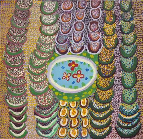
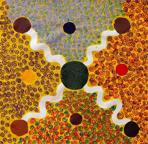
“That’s four wamurla (bush tomato) and all the lady’s sitting around near the wamurla. There’s all the tuwa (sandhills) near Puntawarri.”

This painting portrays physical elements of Martu Country, such as the dominant tali (sandhills), warta (trees, vegetation), and water sources. Rock holes, waterholes, soaks and springs were all extremely important sites for Martu people during the pujiman (nomadic bush) era, with many important jukurrpa (dreamtime stories) chronicling the creation of these landmarks. In the past the Martu lived nomadically, moving from water source to water source, and hunting and gathering bush tucker as they went. They would traverse very large distances annually, visiting specific areas in the dry and wet season depending on the availability of water. As they travelled and hunted they would also burn areas of country creating a larger diversity of plant and animal life.

111581717375


Country

“I paint the Kaalpa area. That’s my grandfather’s Country. When I paint it makes me feel right.”

– Robina Clause

Kaalpa is a place of great cultural significance, is also referred to as Well 23 on the Canning Stock Route. It is a good hunting place as there is permanent kapi.

This painting portrays physical elements of Martu Country, such as the dominant tali (sandhills), warta (trees, vegetation), and water sources. Rock holes, waterholes, soaks and springs were all extremely important sites for Martu people during the pujiman (nomadic bush) era, with many important jukurrpa (dreamtime stories) chronicling the creation of these landmarks. In the past the Martu lived nomadically, moving from water source to water source, and hunting and gathering bush tucker as they went. They would traverse very large distances annually, visiting specific areas in the dry and wet season depending on the availability of water. As they travelled and hunted they would also burn areas of country creating a larger diversity of plant and animal life.

111981717599


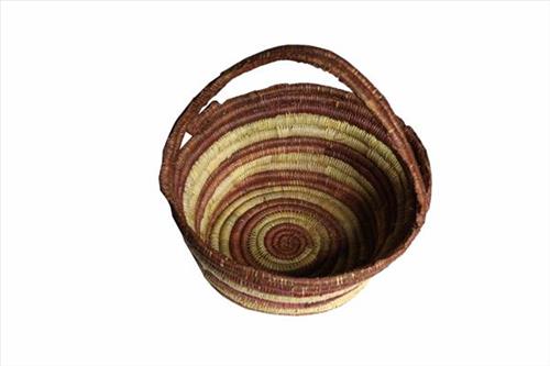
Coil Basket

Coiling technique was introduced in the 1920s at Goulburn Island to the Maung people by missionaries and quickly spread to the mainland. Many artists produce coiled baskets of varied shapes, ranging from small round baskets to large oval baby baskets made from dyed pandanus. Artists combine colours and patterns to obtain intricate new graphic patterns.