111981619361


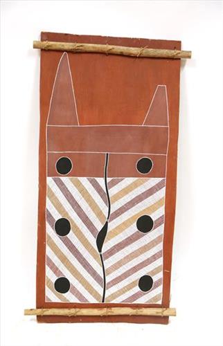
Wak Wak

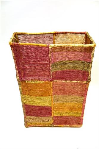
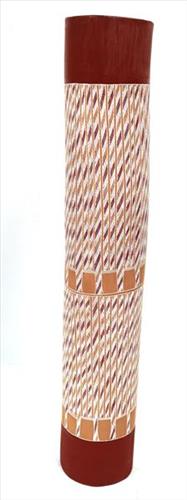
This lorrkon depicts a sacred site at ‘Kurrurldul’, an outstation south of Maningrida.

The ‘rarrk’, or abstract crosshatching, on this work represents the design for the crow totem ancestor called ‘Djimarr’. Today this being exists in the form of a rock, which is permanently submerged at the bottom of Kurrurldul Creek. The ‘Djimarr’ rock in the stream at Kurrurldul is said to move around and call out in a soft hooting tone at night. Both the stone itself and the area around it are considered sacred.

The imagery represents the rock mentioned above at the bottom of Kurrurldul creek, which is the final transmutation of the dreaming ancestor ‘Djimarr’. Finally, the pattern used here is also the crow design used in the sacred ‘Mardayin’ ceremony, which is a large regional patri-moiety ceremony now rarely conducted in central and eastern Arnhem Land.

111581619960


Wantili (Warntili, Canning Stock Route Well 25)

“Bugai always tells about Wantili (Warntili, Canning Stock Route Well 25) because she grew up around Wantili. Her family would travel between Wantili, Kaalpa, Juntu-juntu, Raarki, and Wuranu Wells along the Canning Stock Route. She paints around Wantili. She saw whitefellas there for the first time, Canning mob when they were travelling up and down the stock route with the bullock. She was a young girl walking around at Wantili. Big mob of people they been walking around there. Canning and his drovers were travelling, making the road. They were running away from those whitefellas, watching them from a long distance. She was a teenager when she was travelling around there with her four mothers and one daddy. They used to travel around in family groups, Bugai and Jakayu [Biljabu], and Jakayu’s nyupa (partner) Phillip Biljabu.” 

– Bugai Whyoulter, as translated by her grandson, Cyril Whyoulter


“I was just becoming a teenager, still travelling around with my mother and father. We were at Juntu-juntu, Wuranu, Raarki, Tiwa and Wantili. At Wantili we killed a cow, they were bringing cattle through from Kunawarritji … Wantili was a good place to make yakapiri (woven bark sandals).”

– Bugai Whyoulter as translated by Ngalangka Nola Taylor


Wantili, which forms the focus of much of Bugai’s work, is a large round jurnu (soak) and linyji (claypan) near Well 25 on the Canning Stock Route. The Wantili region is dominated by claypans surrounded by tuwa (sandhills), and Nyilangkurr, a prominent yapu (hill) is located close to the eastern edge of the claypan. Following rain the typically dry claypans are filled with water, with the overflow from nearby waterholes flowing to Wantili. At that time, Wantili becomes an important place for obtaining fresh water for drinking and bathing. Wantili is significant for the fact that at this site Kartujarra, Manyjilyjarra, Putijarra and Warnman people would all come together for ceremonies during the pujiman (traditional, desert dwelling) era. Many jiwa (stones used by women for grinding seeds) from these times can still be found there today.

Wantili lies within Bugai’s ngurra (home Country, camp). As described in her account, Wantili was one of the sites she knew intimately and travelled extensively with her family and other family groups during the pujiman period. At this time, Martu would traverse very large distances annually, moving seasonally from water source to water source, and hunting and gathering bush tucker as they went. Knowledge of water sources was critical for survival, and today Martu Country is still defined in terms of the location and type of water. Each of the hundreds of claypans, rockholes, waterholes, soaks and springs found in the Martu desert homelands is known by name, location, quality and seasonal availability through real life experience and the recounting of Jukurrpa (Dreaming) narratives. 

Wantili is also especially significant to Bugai as it was here that she saw whitefellas for the first time; drovers with their cattle travelling along the Canning Stock Route. The establishment of the route by Alfred Canning and his team in 1910 resulted in first contact with Europeans for many Martu, including Bugai and her family, then living a pujiman life in the desert. Encounters occurred between Martu, Europeans, and other Martu working as cattle drovers as they travelled and down the Stock Route from water source to water source. Increasingly, Martu followed the route to newly established ration depots, mission and pastoral stations. They were drawn to the route in search of food, by a sense of curiosity, or by loneliness. By the late 1950s and early 1960s, most of the desert family groups had left the desert. Eventually, these factors combined with an extreme and prolonged drought in the 1960s to prompt the few remaining pujiman to move in from the desert. Bugai returned to the Wantili area as a young woman, when she herself drove cattle along the Stock Route.

Culturally, Wantili is an incredibly important site, ‘where the creation started.’ (Cyril Whyoulter). In this creation story, the world was initially dark, and people were like rocks, with no arms or legs. Following the sun’s first rising, life-forms become increasingly complex while particular features in the land are created. Beyond these details much of the Jukurrpa narrative relating to Wantili is ngurlu (sacred, taboo), and only for Martu, but the site is open, and anyone can go there. 

Wantili is also one of the many sites featured in the epic Minyipuru (Jakulyukulyu, Seven Sisters) Jukurrpa story. Minyipuru is a central Jukurrpa narrative for Martu, Ngaanyatjarra, Pitjantjatjara and Yankunytjatjara people that is associated with the seasonal Pleiades star constellation. Relayed in song, dance, stories and paintings, Minyipuru serves as a creation narrative, a source of information relating to the physical properties of the land, and an embodiment of Aboriginal cultural laws. The story follows the movement of a group of women travelling all the way across the desert, beginning at Roebourne on the coast of Western Australia, as they are pursued by Yurla, a lustful old man. As the women travelled, they stopped to rest at many sites to eat, dance, rest and sing, on the way leaving behind an assortment of articles that became formations in the land, such as groupings of rocks and trees, grinding stones and seeds. The sisters rested at Wantili before throwing seeds, then continued their journey far to the east and beyond Martu Country, stopping at various sites through central and South Australia.
111581619929


Punmu Rockholes

“Punmu [community]- I went there when I was a young girl, a teenager with my mother and father before my mother passed. Big mob of people was there. No building, just little cubbie houses (bower shelters). Long time I been there.

These here are the waterholes around Punmu. In the middle is Rawa spring, Rawa means long time. On the right is Tuu Tuu, then Jila Jila, Wilarra and Yilyara up the top. That is my ngurra (home). We grew up in Punmu around all theses water holes. I still live here with my grand kids, same stories for all these places.”  

Marianne and her sister were brought up by their father, Martumili Artist Pukina Burton (dec.) She and her father would sit down together to paint, and Pukina would tells stories about his Country. Marianne is now often found painting in Newman and Punmu with her grandchildren, passing down stories about Country and culture.

Punmu is a community that sits on the edge of an important warla (lake) known as Lake Dora. The lake runs South into the area known as Karlamilyi (Rudall River National Park). Rock holes, waterholes, soaks and springs were important sites for Martu people during the pujiman (traditional, bush-dwelling) era, with many important jukurrpa (dreaming stories) chronicling the creation of these landmarks.

111581619853


Untitled

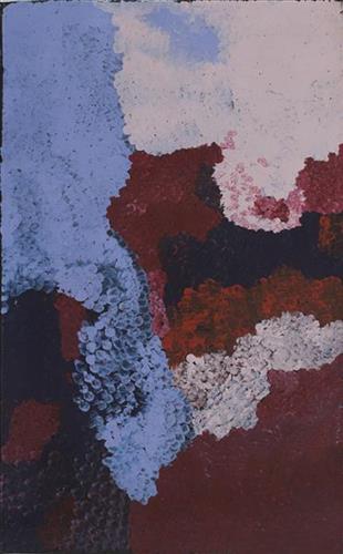
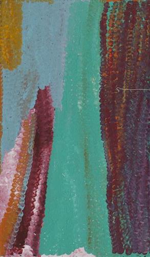
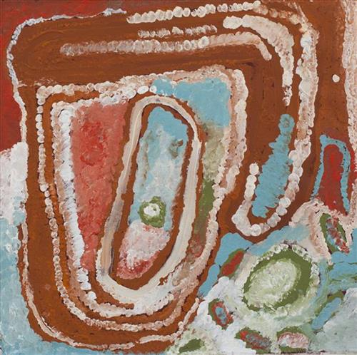
This painting represents an area in Bugai’s ngurra (home country), where she lived and travelled extensively throughout the pujiman (nomadic bush) era with her family. She travelled from what is now Balfour Downs Station, where she was born, all around the Parnngurr area and up and down the Canning Stock Route as far as Kunawarritji. Kunawarritji is also known as well 33 and is now her home community. Bugai has extensive knowledge of this large tract of land, and loves to paint and tell the stories for her country. Depicted are physical elements of Martu Country, such as the dominant tali (sandhills), warta (trees, vegetation), and water sources. Rock holes, waterholes, soaks and springs were all extremely important sites for Martu people during the pujiman period, with many important jukurrpa (dreamtime stories) chronicling the creation of these landmarks. In the past the Martu lived nomadically, moving from water source to water source, and hunting and gathering bush tucker as they went. They would traverse very large distances annually, visiting specific areas in the dry and wet season depending on the availability of water. As they travelled and hunted they would also burn areas of country creating a larger diversity of plant and animal life.

111581619847


Nyurnma Jurnpa

“After the waru (fire) the willi-willi (wind) comes through and blows all the jurnpa (black ashes). The rain comes and makes it wet. Jurnpa everywhere, ready for yukarri (green regrowth)”

– Ngamaru Bidu

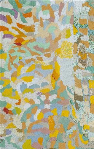
Martu artists paint Country in all it’s different seasonal stages. Important to Martu, and to Martu Country, is the practice of waru (fire burning); a practice that assists with hunting, regenerates growth, and encourages greater diversity in plant and animal life. When Martu Country burns, mosaic fire scars are left on the Country, and patches of regeneration form a kind of mosaic pattern across the land. This is called nyurnma – burnt Country.  Waru is typically burnt in small, controlled areas, leaving a defined patchwork pattern of nyurnma in the land, across tali (sand hills), linyji (clay pans), parulyukurru (spinifex country) and pila (sandy plains). This patterning is clearly visible in Ngamaru’s works, where she paints fire from an aerial perspective.

111581619844


Untitled

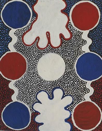
Jakayu primarily paints her country around the Canning Stock Route. In the pujiman (nomadic bush) era, she travelled with her family through the land collecting wilyki (seeds). The circular forms depicted here represent special areas where grasses and wiylki can be found, or they symbolise different waterholes or camps.

Rock holes, waterholes, soaks and springs were all extremely important sites for Martu people during the pujiman era, with many important jukurrpa (dreamtime stories) chronicling the creation of these landmarks. In the past the Martu lived nomadically, moving from water source to water source, and hunting and gathering bush tucker as they went. They would traverse very large distances annually, visiting specific areas in the dry and wet season depending on the availability of water.

111981620296


Jima Jima (Waterlily)

Jimi jima is one of Tommy Gondorra Steele’s personal dreamings. It is similar to what is commonly known as a waterlily (monochoria australasica). Jimi jima is mainly associated with a waterhole named Yalija, but also other sacred waterholes in the Wurdeja area. Tommy’s painting of jima jima depicts the lily as it exists naturally in wet water areas at Wurdeja. They have an edible root, which is brownish and bitter when raw, but once roasted on coals it is deliciously sweet. They are only found in sacred waterholes in the Wurdeja area, including Yalija, and humans and spirits live off them. They are a bright blue flowering plant.

Tommy Gondorra Steele is the last male member of the Garnawula Niya clan. He lives at Wurdeja outstation, about four kilometres east of the Blyth River. He is the traditional owner of that area. Wurdeja is surrounded by a series of sacred waterholes and it is these waterholes, which provide the subject matter for Steele’s art.

111581621058


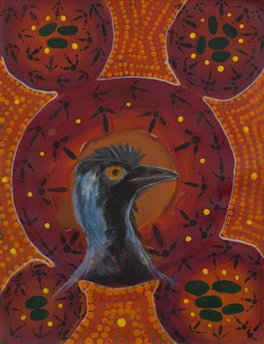
Emu

“This painting shows an emu, when they lay their eggs they leave tracks from their nests with their nail, tip toeing around. Their eggs are alright for eating, but they are hard to find.”

– Leon Cutter