377810582142945


Wakwak

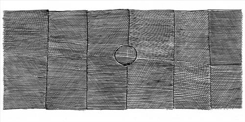
This screen print depicts a sacred site at Kurrurldul, an outstation south of Maningrida. The original screen print design was made in 2010 but continues to be printed at Babbarra Designs studio. 

The ‘rarrk’, or abstract crosshatching, on this work represents the design for the crow totem ancestor called Djimarr. Today this being exists in the form of a rock, which is permanently submerged at the bottom of Kurrurldul Creek. The Djimarr rock in the stream at Kurrurldul is said to move around and call out in a soft hooting tone at night. Both the stone itself and the area around it are considered sacred.

The imagery represents the Djimarr rock at the bottom of Kurrurldul creek – the final transmutation of the Djimarr ancestor being. It also references the crow design used in the sacred Mardayin ceremony, a large regional patrimoiety ceremony now rarely conducted in central and eastern Arnhem Land.

111582142657


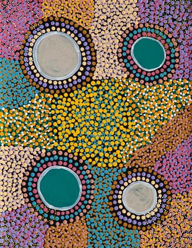
Warla (Lake)

“Lake and in the middle is water.”

– Julie-Anne Thomas

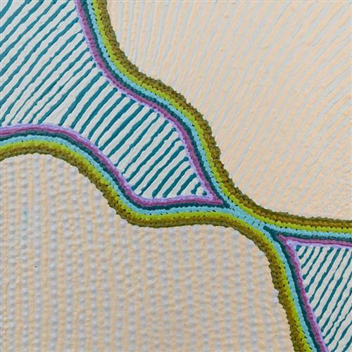
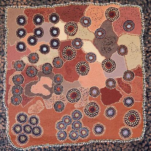
This work depicts a warla (lake) within the artists’ ngurra (home Country, camp), typically represented with circular forms. As a reliable source of water in the often harsh and arid Martu lands, warla represented important sites not only for camping throughout the year, but also in terms of their creation as described through Jukurrpa (dreaming) narratives.

During the pujiman (traditional, desert dwelling) period, knowledge of water sources was critical for survival, and today Martu Country is still defined in terms of the location and type of water. Each of the hundreds of claypans, rockholes, waterholes, soaks and springs found in the Martu desert homelands is known through real life experience and the recounting of Jukurrpa narratives by name, location, quality and seasonal availability. This encyclopedic knowledge extends even to the nature and movement of arterial waterways, and sustained Martu as they travelled across their Country, hunting and gathering, visiting family, and fulfilling ceremonial obligations. They would traverse very large distances annually, visiting specific areas in the dry and wet season depending on the availability of water and the corresponding cycles of plant and animal life on which hunting and gathering bush tucker was reliant.

111582142656


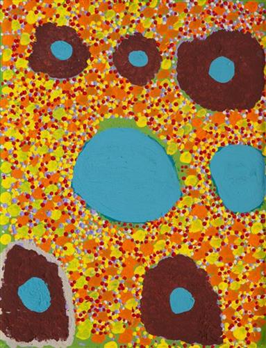
Punmu Tuwa (Sandhills)

Punmu refers to a region and an Aboriginal community within its vicinity, located 670km North-East of Newman. Created during the return to Country movement of the 1980s, with the recognition of Martu land rights and native title, the community was named after a nearby Jukurrpa (Dreaming) story.

The traditional lands of the Martu people encompass the Great Sandy Desert and Rudall River regions of Western Australia, an enormous tract dominated by distinctive red tali, or tuwa (sandhills). These sandhills present an unforgiving landscape; sparse vegetation covers a seemingly never ending expanse of dunes, and yet these lands and the location of resources within them was known intimately by its pujiman (traditional, desert dwelling) inhabitants. At this time, Martu traversed very large distances annually in small family groups, moving from water source to water source through the harsh desert landscape with incredible stamina and resourcefulness. Travel was often undertaken at night, and when travelling during the day, Martu wore yakipiri (woven bark sandals) to protect their feet from the hot desert sand.

377810582143108


Lorrkkon

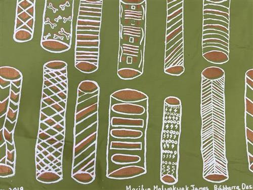
Marilyn’s first screen print design depicts the story of lorrkkon (hollow funeral logs). This the story of her great, great grandfather and grandmother who were bark painters, as well as also sacred lorrkkon painters.

When designing this screen print, Marilyn was remembering her childhood living in a small house on Liverpool river Ngar-wunja (Thompson hole) with other families.

Through the painting process, Marilyn remembered and relived the times when people still lived permanently on remote homelands, living off the land before balanda (non-indigenous people) arrived.

Marilyn recalls “it makes me think back, we did lots of things, some people was hunting, some was weaving, some was painting barks and lorrkkon. As my great, great grandfather and grandmother was painters, I painted this my story for them.”

377810582143105


Lorrkkon

Marilyn’s first screen print design depicts the story of lorrkkon (hollow funeral logs). This the story of her great, great grandfather and grandmother who were bark painters, as well as also sacred lorrkkon painters.

When designing this screen print, Marilyn was remembering her childhood living in a small house on Liverpool river Ngar-wunja (Thompson hole) with other families.

Through the painting process, Marilyn remembered and relived the times when people still lived permanently on remote homelands, living off the land before balanda (non-indigenous people) arrived.

Marilyn recalls “it makes me think back, we did lots of things, some people was hunting, some was weaving, some was painting barks and lorrkkon. As my great, great grandfather and grandmother was painters, I painted this my story for them.”

377810582142927


Sea Shells and Dilly Bags

‘Sometimes when we go down to the beach in Maningrida we pick all these shells up. Some family make necklaces and earrings. In the olden days they used to collect shells and put them in the dilly bags. The old people used to carry dilly bags when they went hunting. They used the dilly bag for bush food. My design shows mud muscle and long bum and cockles.’ Belinda Kernan 2022

Belinda’s mother is from Eastern Arrernte country near Alice Springs, the community of Ltyentye Apurte (Santa Teresa), and her father’s country is Maningrida. Belinda speaks languages from both sides of her family, as well as various languages belonging to Central Arnhem Land. She lives in Maningrida and prints lino at the women centre. Belinda is also a strong leader for young people in her community.

111582142861


Untitled

“When Martu paint, it’s like a map. Martu draw story on the ground and on the canvas, and all the circle and line there are the hunting areas and different waters and tracks where people used to walk, and [some you] can’t cross, like boundaries. So nowadays you see a colourful painting and wonder what it is, but that’s how Martu tell story long ago. It’s not just a lovely painting, it’s a story and a songline and a history and everything that goes with it.” 

– Ngalangka Nola Taylor and Joshua Booth

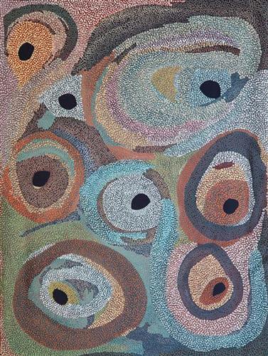
This work portrays an area of Country that can be interpreted in multiple ways. Firstly, the image may be read as an aerial representation of a particular location known to the artist- either land that they or their family travelled, from the pujiman (traditional, desert dwelling) era to now. During the pujiman period, Martu would traverse very large distances annually in small family groups, moving seasonally from water source to water source, and hunting and gathering bush tucker as they went. At this time, one’s survival depended on their intimate knowledge of the location of resources; thus physical elements of Country, such as sources of kapi (water), tali (sandhills), different varieties of warta (trees, vegetation), ngarrini (camps), and jina (tracks) are typically recorded with the use of a use of a system of iconographic forms universally shared across the desert. 

An additional layer of meaning in the work relates to more intangible concepts; life cycles based around kalyu (rain, water) and waru (fire) are also often evident. A thousands of year old practice, fire burning continues to be carried out as both an aid for hunting and a means of land management today. As the Martu travelled and hunted they would burn tracts of land, ensuring plant and animal biodiversity and reducing the risk of unmanageable, spontaneous bush fires. The patchwork nature of regrowth is evident in many landscape works, with each of the five distinctive phases of fire burning visually described with respect to the cycle of burning and regrowth.  

Finally, metaphysical information relating to a location may also be recorded; Jukurrpa (Dreaming) narratives chronicle the creation of physical landmarks, and can be referenced through depictions of ceremonial sites, songlines, and markers left in the land. Very often, however, information relating to Jukurrpa is censored by omission, or alternatively painted over with dotted patterns.

111582142854


Untitled

“When Martu paint, it’s like a map. Martu draw story on the ground and on the canvas, and all the circle and line there are the hunting areas and different waters and tracks where people used to walk, and [some you] can’t cross, like boundaries. So nowadays you see a colourful painting and wonder what it is, but that’s how Martu tell story long ago. It’s not just a lovely painting, it’s a story and a songline and a history and everything that goes with it.” 

– Ngalangka Nola Taylor and Joshua Booth

This work portrays an area of Country that can be interpreted in multiple ways. Firstly, the image may be read as an aerial representation of a particular location known to the artist- either land that they or their family travelled, from the pujiman (traditional, desert dwelling) era to now. During the pujiman period, Martu would traverse very large distances annually in small family groups, moving seasonally from water source to water source, and hunting and gathering bush tucker as they went. At this time, one’s survival depended on their intimate knowledge of the location of resources; thus physical elements of Country, such as sources of kapi (water), tali (sandhills), different varieties of warta (trees, vegetation), ngarrini (camps), and jina (tracks) are typically recorded with the use of a use of a system of iconographic forms universally shared across the desert. 

An additional layer of meaning in the work relates to more intangible concepts; life cycles based around kalyu (rain, water) and waru (fire) are also often evident. A thousands of year old practice, fire burning continues to be carried out as both an aid for hunting and a means of land management today. As the Martu travelled and hunted they would burn tracts of land, ensuring plant and animal biodiversity and reducing the risk of unmanageable, spontaneous bush fires. The patchwork nature of regrowth is evident in many landscape works, with each of the five distinctive phases of fire burning visually described with respect to the cycle of burning and regrowth.  

Finally, metaphysical information relating to a location may also be recorded; Jukurrpa (Dreaming) narratives chronicle the creation of physical landmarks, and can be referenced through depictions of ceremonial sites, songlines, and markers left in the land. Very often, however, information relating to Jukurrpa is censored by omission, or alternatively painted over with dotted patterns.
111582142851


Bush Tucker

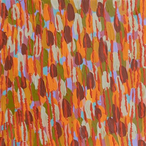
“That’s like a bush tomato and the Karlkula (bush banana) and the leaves. These bush foods are all around Wiluna area. Many kinds of fruit. The dots around it are bush potatoes and little flowers. And that the ladies sitting around.”

– Marlene Anderson


Depicted in this work are traditional types of bush tucker, their habitats, and their related hunting and gathering methods. During the pujiman (traditional, desert dwelling) period, Martu would traverse very large distances annually in small family groups, moving seasonally from water source to water source, and hunting and gathering bush tucker as they went. Whilst desert life has moved away from mobile hunter-gatherer subsistence throughout the course of the twentieth century, bush tucker continues to be a significant component of the modern Martu diet. Hunting and gathering bush tucker remains equally valuable as an important cultural practice that is passed on intergenerationally. Though hunting and gathering implements have been modernised, methods of harvesting, tracking and the use of fire burning to drive animals from their retreats are still commonly practiced today. 

Typically, animals hunted for their kuwiyi (meat) include kirti-kirti (euro kangaroo) and marlu (plains kangaroo), parnajarrpa (sand goanna), kipara (Australian bustard, bush turkey) and karlaya (emu). Lunki (witchetty grub) and wuukurta (honey ants) are dug from tree and bush trunks, or from underground nests. Popular mayi (plant food) includes minyarra (bush onion), collected from small, grass like plants; root vegetables dug from underground such as kulyu and mata (types of bush potato); and seeds such as kalaru (samphire, salt bush), yuwinyji, and marnkalpa (spinifex species). Jawirli (quondong), wamurla (bush tomatoes), jinyjiwirrily (wild gooseberry), ngaputa (melon), and karlkula (bush banana) are some of the most popular bush fruits. These are often collected in the wantajarra (cool season) and tuulpara (spring) months, along with juri (sweet) botanical gums and wama (nectar), obtained from various plant species. 

Traditional tools used for hunting and gathering bush tucker were carved from wanari (mulga), mulunturu (desert oak), yurungkura (river red gum) and mijarrpa (bloodwoods), and included kurlata (spears), jurna (hitting stick), karli (boomerangs), wana (digging-sticks), piti (timber bowls used for carrying food and water), and jiwa (grinding stones for grinding seeds into flour). While carved objects retain enormous social and ceremonial importance in Martu life, they are no longer used for hunting and gathering.

111582142849


Wirlarra (Wilarra)

Wirlarra, the site depicted in this painting, lies on the eastern edge of a large salt lake, Nyayartakujarra (Lake Dora), near Punmu Aboriginal community. A distinctive group of small salt water pools are clustered together here. The water from these pools is known for its’ powerful healing properties, and the pools are still visited today by Martu to bathe cuts and sores. 

Wirlarra is also a term for ‘moon’ in Manyjilyjarra, and through the site’s Jukurrpa (Dreaming) narrative, the site is united with the moon in significance. It is said that at Wirlarra, the moon called to a family of dingoes; a mother, father and their large litter of dingo pups. The dingoes gathered at Wirlarra, where the moon cared for them and created a windbreak for the family to shelter. Here the dingoes scratched at the surface of the salt lake and created the cluster of salt water pools located there today. They lay down there. After a time, the dingoes continued travelling eastward toward the rising moon until they reached Kinyu (Well 35 on the Canning Stock Route), where they remained until all of the dingo pups had grown up. From Kinyu the family travelled further east with the moon.