111582140343


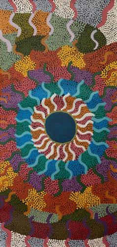
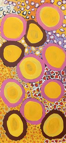
Pitu (Separation Well)

“I paint Pitu because my father come[s] from Pitu and all the rest of the family, they belong to there. Family hear the stories all the time from Jakayu [Biljabu]. It’s their connection to that place. All the old people were walking through that area, aunty Jakayu was born there. It’s a sad story, hers. We [went] there… to see it again. It’s a long, long way from Punmu. All the other family [saw] where their family is from and where they belong to.”


–       Kuru Gladys Bidu


Pitu (Separation Well) forms part of Kuru’s ngurra (home Country, camp) through her father. It is a significant cultural site and large soak located yulparirra (south) of Wuranu (Canning Stock Route Well 29) and Kulilu rockhole and soak. As a site where fresh water was available all year, Pitu was an important camp and a meeting place for Kartujarra and Manyjilyjarra people during the pujiman (traditional, desert dwelling) era. At this time, knowledge of water sources was critical for survival, and today Martu Country is still defined in terms of the location and type of water. Each of the hundreds of claypans, rockholes, waterholes, soaks and springs found in the Martu desert homelands is known by name, location, quality and seasonal availability through real life experience and the recounting of Jukurrpa (Dreaming) narratives. 


Soaks, or soakwaters, derive their name from the manner in which their waters generally seep into the sand from below stores, sometimes as part of an ephemeral river or creek. Soaks were an especially important source of water during the pujiman era, being the most dependable water source in times of drought. Water was obtained from soaks by scooping away the sand with a piti (timber bowls used for carrying food and water) until clear water gathered at the base of the hole, sometimes at a depth of several metres. Pitu is also surrounded by shrubs that need to be cleared to access its waters.
111582140342


Pitu (Separation Well)

“I paint Pitu because my father come[s] from Pitu and all the rest of the family, they belong to there. Family hear the stories all the time from Jakayu [Biljabu]. It’s their connection to that place. All the old people were walking through that area, aunty Jakayu was born there. It’s a sad story, hers. We [went] there… to see it again. It’s a long, long way from Punmu. All the other family [saw] where their family is from and where they belong to.”


–       Kuru Gladys Bidu


Pitu (Separation Well) forms part of Kuru’s ngurra (home Country, camp) through her father. It is a significant cultural site and large soak located yulparirra (south) of Wuranu (Canning Stock Route Well 29) and Kulilu rockhole and soak. As a site where fresh water was available all year, Pitu was an important camp and a meeting place for Kartujarra and Manyjilyjarra people during the pujiman (traditional, desert dwelling) era. At this time, knowledge of water sources was critical for survival, and today Martu Country is still defined in terms of the location and type of water. Each of the hundreds of claypans, rockholes, waterholes, soaks and springs found in the Martu desert homelands is known by name, location, quality and seasonal availability through real life experience and the recounting of Jukurrpa (Dreaming) narratives. 


Soaks, or soakwaters, derive their name from the manner in which their waters generally seep into the sand from below stores, sometimes as part of an ephemeral river or creek. Soaks were an especially important source of water during the pujiman era, being the most dependable water source in times of drought. Water was obtained from soaks by scooping away the sand with a piti (timber bowls used for carrying food and water) until clear water gathered at the base of the hole, sometimes at a depth of several metres. Pitu is also surrounded by shrubs that need to be cleared to access its waters.
111582140341


Pitu (Separation Well)

“I paint Pitu because my father come[s] from Pitu and all the rest of the family, they belong to there. Family hear the stories all the time from Jakayu [Biljabu]. It’s their connection to that place. All the old people were walking through that area, aunty Jakayu was born there. It’s a sad story, hers. We [went] there… to see it again. It’s a long, long way from Punmu. All the other family [saw] where their family is from and where they belong to.”


–       Kuru Gladys Bidu


Pitu (Separation Well) forms part of Kuru’s ngurra (home Country, camp) through her father. It is a significant cultural site and large soak located yulparirra (south) of Wuranu (Canning Stock Route Well 29) and Kulilu rockhole and soak. As a site where fresh water was available all year, Pitu was an important camp and a meeting place for Kartujarra and Manyjilyjarra people during the pujiman (traditional, desert dwelling) era. At this time, knowledge of water sources was critical for survival, and today Martu Country is still defined in terms of the location and type of water. Each of the hundreds of claypans, rockholes, waterholes, soaks and springs found in the Martu desert homelands is known by name, location, quality and seasonal availability through real life experience and the recounting of Jukurrpa (Dreaming) narratives. 


Soaks, or soakwaters, derive their name from the manner in which their waters generally seep into the sand from below stores, sometimes as part of an ephemeral river or creek. Soaks were an especially important source of water during the pujiman era, being the most dependable water source in times of drought. Water was obtained from soaks by scooping away the sand with a piti (timber bowls used for carrying food and water) until clear water gathered at the base of the hole, sometimes at a depth of several metres. Pitu is also surrounded by shrubs that need to be cleared to access its waters.
111582140340


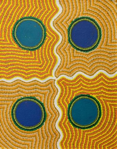
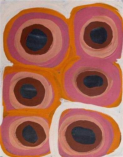
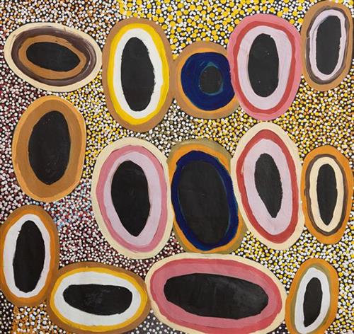
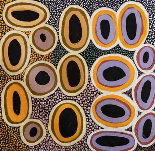
Waterhole

This work depicts a waterhole within the artists’ ngurra (home Country, camp), typically represented with circular forms. Waterholes are sites that require maintenance, including digging to increase flow, clearing out surrounding growth, and cleaning up after sullying by camels or cattle.

During the pujiman (traditional, desert dwelling) period, knowledge of water sources was critical for survival, and today Martu Country is still defined in terms of the location and type of water. Each of the hundreds of claypans, rockholes, waterholes, soaks and springs found in the Martu desert homelands is known through real life experience and the recounting of Jukurrpa (Dreaming) narratives by name, location, quality and seasonal availability. This encyclopedic knowledge extends even to the nature and movement of arterial waterways, and sustained Martu as they travelled across their Country, hunting and gathering, visiting family, and fulfilling ceremonial obligations. They would traverse very large distances annually, visiting specific areas in the dry and wet season depending on the availability of water and the corresponding cycles of plant and animal life on which hunting and gathering bush tucker was reliant.

111582140339


Wimba ‘My Mother’s Country”

“When Martu paint, it’s like a map. Martu draw story on the ground and on the canvas, and all the circle and line there are the hunting areas and different waters and tracks where people used to walk, and [some you] can’t cross, like boundaries. So nowadays you see a colourful painting and wonder what it is, but that’s how Martu tell story long ago. It’s not just a lovely painting, it’s a story and a songline and a history and everything that goes with it.” 

– Ngalangka Nola Taylor and Joshua Booth

This work portrays an area of Country that can be interpreted in multiple ways. Firstly, the image may be read as an aerial representation of a particular location known to the artist- either land that they or their family travelled, from the pujiman (traditional, desert dwelling) era to now. During the pujiman period, Martu would traverse very large distances annually in small family groups, moving seasonally from water source to water source, and hunting and gathering bush tucker as they went. At this time, one’s survival depended on their intimate knowledge of the location of resources; thus physical elements of Country, such as sources of kapi (water), tali (sandhills), different varieties of warta (trees, vegetation), ngarrini (camps), and jina (tracks) are typically recorded with the use of a use of a system of iconographic forms universally shared across the desert. 

An additional layer of meaning in the work relates to more intangible concepts; life cycles based around kalyu (rain, water) and waru (fire) are also often evident. A thousands of year old practice, fire burning continues to be carried out as both an aid for hunting and a means of land management today. As the Martu travelled and hunted they would burn tracts of land, ensuring plant and animal biodiversity and reducing the risk of unmanageable, spontaneous bush fires. The patchwork nature of regrowth is evident in many landscape works, with each of the five distinctive phases of fire burning visually described with respect to the cycle of burning and regrowth.  

Finally, metaphysical information relating to a location may also be recorded; Jukurrpa (Dreaming) narratives chronicle the creation of physical landmarks, and can be referenced through depictions of ceremonial sites, songlines, and markers left in the land. Very often, however, information relating to Jukurrpa is censored by omission, or alternatively painted over with dotted patterns.

111582140338


Pitu (Separation Well)

“I paint Pitu because my father come[s] from Pitu and all the rest of the family, they belong to there. Family hear the stories all the time from Jakayu [Biljabu]. It’s their connection to that place. All the old people were walking through that area, aunty Jakayu was born there. It’s a sad story, hers. We [went] there… to see it again. It’s a long, long way from Punmu. All the other family [saw] where their family is from and where they belong to.”


–       Kuru Gladys Bidu


Pitu (Separation Well) forms part of Kuru’s ngurra (home Country, camp) through her father. It is a significant cultural site and large soak located yulparirra (south) of Wuranu (Canning Stock Route Well 29) and Kulilu rockhole and soak. As a site where fresh water was available all year, Pitu was an important camp and a meeting place for Kartujarra and Manyjilyjarra people during the pujiman (traditional, desert dwelling) era. At this time, knowledge of water sources was critical for survival, and today Martu Country is still defined in terms of the location and type of water. Each of the hundreds of claypans, rockholes, waterholes, soaks and springs found in the Martu desert homelands is known by name, location, quality and seasonal availability through real life experience and the recounting of Jukurrpa (Dreaming) narratives. 


Soaks, or soakwaters, derive their name from the manner in which their waters generally seep into the sand from below stores, sometimes as part of an ephemeral river or creek. Soaks were an especially important source of water during the pujiman era, being the most dependable water source in times of drought. Water was obtained from soaks by scooping away the sand with a piti (timber bowls used for carrying food and water) until clear water gathered at the base of the hole, sometimes at a depth of several metres. Pitu is also surrounded by shrubs that need to be cleared to access its waters.
377810582140756


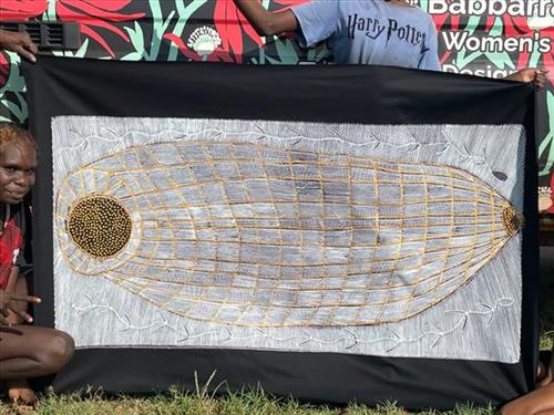
Mandjabu (Fish Trap) – Susan Marawarr

“In old times people would make these mandjabu (fish traps) to go fishing. They are made with vine we find in the jungle. That old man, Anchor Gulunba, he showed me how to make these fish traps. I would sit there and watch him making them. We catch barramundi, catfish, all kinds of fish.” – Helen Lanyinwanga

Kuninjku people traditionally make two sorts of conical fish traps. One called mandjabu made from a vine called milil, and another smaller one called manylik mandjabu, made from the grass manylik. The mandjabu conical fish trap is bigger and stronger and used in tidal reaches of creeks to catch large fish. The smaller, lighter manylik trap is used in freshwater flowing creeks to catch smaller fish and freshwater prawns. Traditionally, only men were involved in the construction of the large fish traps, but children would often crawl inside and assist.

To make fish traps and fish net fences artists firstly get vine (milil) from the jungle and they put it in water for one night to make it soft. Next they start weaving it; they make rings for the inside to keep the fish trap’s shape. Artists work for three or four weeks on the fish trap. They also make string from kurrajong (burdaga) to attach the hibiscus (bardainy) rings and to tie the conical end of the fish trap. This fish trap is used in saltwater and freshwater. People also use fish net fences called mun-dirra. A long time ago they would put the mun-dirra across rivers and creeks. In the middle they would place the an-gujechiya. They also used small things like sticks, rocks, mud and grass to block the fish from going through. People would then catch fish like saltwater barramundi rajarra, freshwater barramundi (janambal), small black freshwater catfish (buliya), bonefish (an-guwirrpiya), and sand bass (dalakan) in these fish traps.

377810582140410


Romolo

One of Lucy’s latest linocut designs, Romolo, green frog.

Lucy is an experienced textile artist at Bábbarra Women’s Centre. Lucy often references her ancestral stories in her textile work, including Bawaliba (Djinkarr spirit woman), with various lino and screen prints depicting this same narrative.

Lucy is from the Gurr.goni language group – one of the least commonly spoken languages in Arnhem Land. Lucy also speaks another eight Maningrida languages.

111582140788


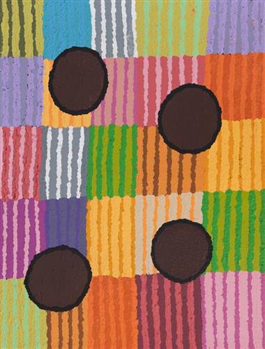
Wirlarra (Wilarra)

Wirlarra, the site depicted in this painting, lies on the eastern edge of a large salt lake, Nyayartakujarra (Lake Dora), near Punmu Aboriginal community. A distinctive group of small salt water pools are clustered together here. The water from these pools is known for its’ powerful healing properties, and the pools are still visited today by Martu to bathe cuts and sores. 

Wirlarra is also a term for ‘moon’ in Manyjilyjarra, and through the site’s Jukurrpa (Dreaming) narrative, the site is united with the moon in significance. It is said that at Wirlarra, the moon called to a family of dingoes; a mother, father and their large litter of dingo pups. The dingoes gathered at Wirlarra, where the moon cared for them and created a windbreak for the family to shelter. Here the dingoes scratched at the surface of the salt lake and created the cluster of salt water pools located there today. They lay down there. After a time, the dingoes continued travelling eastward toward the rising moon until they reached Kinyu (Well 35 on the Canning Stock Route), where they remained until all of the dingo pups had grown up. From Kinyu the family travelled further east with the moon.