111582414460


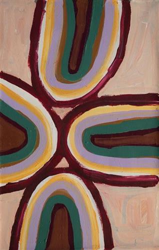
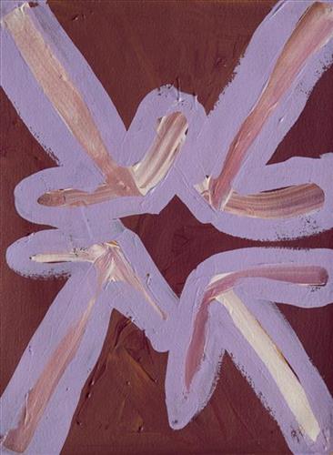
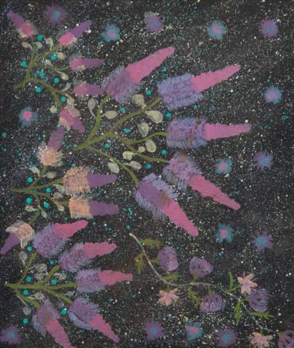
Bush Flowers

Martumili Artists work with over three hundred artists from remote Martu Aboriginal communities, including Punmu, Parnngurr, Kunawarritji, Jigalong, Irrungadji (Nullagine), and Warralong, as well as from the Parnpajinya (Newman) gallery and studio spaces. Known for their diverse, energetic, and unmediated painting styles, their works reflect the dramatic geography and scale of their homelands. Each artist, however, brings a unique approach to their craft.

Younger Martu artists often start painting alongside their parents, grandparents, and extended family, which fosters an organic learning process. This not only involves mastering painting techniques but also understanding specific locations, family histories, traditional ways of life, bush tucker, and Jukurrpa (Dreaming). Over time, with encouragement from their peers, they develop their own distinct styles and explore unique painting techniques and subject matter. In this work the artist brings a contemporary, evolving perspective to their work.

377810582414459


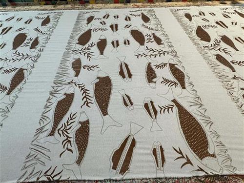
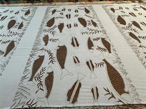
Murnun (dugong)

This design is murnun (dugong). Josephine grew up on the coastal area of Maningrida. She is a Kunibidji woman, a Gurgoni and Ndjébbana language speaker. 

‘In the olden times they used to go on canoe to look for murnun (dungong), fish (yokkara) ,turtle (makéddja) and stingray (marnan djupa (sp?)). They used a spear and net during the day and sometimes at night. The fishermen were mostly men. I remember my grandfather used to go hunting, that’s Joy’s (Garlbin)  father. HIs name was Jimmy. We used to go out with him on the boat to kill makéddja (turtle) and murnun (dugong) for yalaba (bush tucker). 


377810582414458


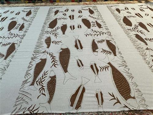
Murnun (dugong)

This design is murnun (dugong). Josephine grew up on the coastal area of Maningrida. She is a Kunibidji woman, a Gurgoni and Ndjébbana language speaker. 

‘In the olden times they used to go on canoe to look for murnun (dungong), fish (yokkara) ,turtle (makéddja) and stingray (marnan djupa (sp?)). They used a spear and net during the day and sometimes at night. The fishermen were mostly men. I remember my grandfather used to go hunting, that’s Joy’s (Garlbin)  father. HIs name was Jimmy. We used to go out with him on the boat to kill makéddja (turtle) and murnun (dugong) for yalaba (bush tucker). 


111582414457


Tuwa (sandhills)

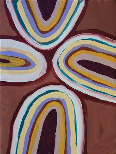
“I do tuwa (sandhill) in my own style because that’s our Country. That’s a sandhill, that’s the Dreaming- the Jukurrpa. That’s our culture.

They stay there and we go through the sandhills at Puntawarri in the car. We go first tuwa, then the second tuwa, looking for the waterholes. Go up, up, up- ‘nother tuwa, ‘nother tuwa.

Long time [ago] in Puntawarri, when I was a little girl [with] my Nana and Pop [Dadda Samson (dec.) and Yanjimi Peter Rowlands (dec.)] we went climbing up the sandhill. And when I went up my Nana and Pop were at the bottom under a tree and I came down running then rolling, rolling right down to the ground! But I was ok- he right!”

– Judith Anya Samson

Puntawarri is an important cultural area located on the middle stretches of the Canning Stock Route and east of the Jigalong Mission (now Jigalong Aboriginal community), where Anya grew up with her grandmother and renowned Martumili Artist, Dadda Samson (dec.). Puntawarri is also the site of an abandoned community, a waterhole, creek and lake. Puntawarri’s close proximity to Jigalong Mission made it a popular site for Martu to visit during the ‘mission days’. While growing up at Jigalong Mission in the 1960’s, Dadda would return to Puntawarri every weekend to hunt and camp. 

For many Martu, like Anya’s family, Jigalong Mission was the site where their pujiman (traditional, desert dwelling) lifestyle came to an end from the late 1940s as they transitioned to a life as stockmen and women working in cattle stations in the Pilbara region and beyond. In the wake of the extreme and prolonged drought of the 1960s, the last of the remaining pujimanpa (desert dwellers) were forced to move to missions like Jigalong, where a supply of food and water was assured. There, many Martu were reunited with family members that had already moved in from the desert.

The traditional lands of the Martu people encompass the Great Sandy Desert and Rudall River regions of Western Australia, an enormous tract dominated by distinctive red tali, or tuwa (sandhills). These sandhills present an unforgiving landscape; sparse vegetation covers a seemingly never ending expanse of dunes, and yet these lands and the location of resources within them was known intimately by its pujiman inhabitants.


377810582414456


Murnun (dugong)

This design is murnun (dugong). Josephine grew up on the coastal area of Maningrida. She is a Kunibidji woman, a Gurgoni and Ndjébbana language speaker. 

‘In the olden times they used to go on canoe to look for murnun (dungong), fish (yokkara) ,turtle (makéddja) and stingray (marnan djupa (sp?)). They used a spear and net during the day and sometimes at night. The fishermen were mostly men. I remember my grandfather used to go hunting, that’s Joy’s (Garlbin)  father. HIs name was Jimmy. We used to go out with him on the boat to kill makéddja (turtle) and murnun (dugong) for yalaba (bush tucker). 


111582414455


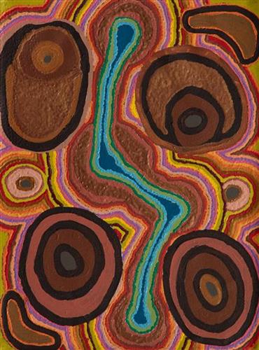
Mungili Waterholes

“No one goes there and sees that landscape. Only two, Mr and Mrs [refers to footsteps in painting]. They was walking to see if the water was in there. Walking on the creek sand, they see the colours and walk down to the water hole and dig where the waters been left. Dig the creek sand where there is still water. Little huts where they sit; move when it dries out. Leave remembrance behind. When the water fills up again; come back.

When the creek sand is still moist you can see the colours. You can see many colours – lovely colours come out. I do that in my mind [when painting], go and think about the rock colours there.

Different plants, water runs, and different plants are growing, different seeds. When it rains, all year round, when its overflowing. It’s all connected. The orange sand connects to one waterhole full of water, then flowing through the creek sand. This side down [pointing to one rock hole]; and it’s a bit up [pointing to another rock hole].

I was swimming there. Yeah, we go visit them a long time [ago]. We drink it, rainwater from the rain. Big waterhole. It’s a fresh water, when the rain comes, fills it up. One for swimming and another rock hole for drinking. 3 rock holes; another is special.”

– Marlene Anderson

In this work Marlene depicts a waterhole and rock hole located in Mungili, the small outstation community located just off the Eagle Highway in Western Australia, approximately 430 kilometres northeast of Wiluna and 250 kilometres north of Warburton. Marlene grew up in Mungili, and as such it forms a significant part of her ‘ngurra’ (home Country, camp). Typically Marlene depicts this site with a central large circular form that represents the main waterhole, surrounded by smaller circular forms representing satellite water bodies.

During the pujiman (traditional, desert dwelling) period, knowledge of water sources was critical for survival, and today Martu Country is still defined in terms of the location and type of water. Each of the hundreds of claypans, rockholes, waterholes, soaks and springs found in the Martu desert homelands is known through real life experience and the recounting of Jukurrpa (Dreaming) narratives by name, location, quality and seasonal availability. This encyclopedic knowledge extends even to the nature and movement of arterial waterways, and sustained Martu as they travelled across their Country, hunting and gathering, visiting family, and fulfilling ceremonial obligations. They would traverse very large distances annually, visiting specific areas in the dry and wet season depending on the availability of water and the corresponding cycles of plant and animal life on which hunting and gathering bush tucker was reliant.

111582414454


Emu Tracks

“Emu go to the springs to have a drink of water and then move on to the next one.”

– Judith Anya Samson

Puntawarri is an important cultural area, as well as the site of a now abandoned community, a waterhole, creek and lake. Puntawarri is located on the middle stretches of the Canning Stock Route and east of the Jigalong Aboriginal Community, where Judith grew up with her grandmother and senior Martumili Artist Dadda Samson (dec.). Anya continues to live between Jigalong and Newman today.

Puntawarri lies within Judith’s ngurra (home Country, camp) through her mother’s family, and as a young girl she frequently travelled and hunted with her family in this area, learning the stories for this Country. Depicted in this work are the tracks of a group of emus on their way to Puntawarri waterhole, searching for kapi (water). 

Karlaya (emu) were traditionally hunted during the pujiman (traditional, desert dwelling) era, and they continue to be a favoured bush tucker for Martu today. During the pujiman period, Martu would traverse very large distances annually in small family groups, moving seasonally from water source to water source, and hunting and gathering bush tucker as they went. Jina (tracks, footprints) are used by Martu people when tracking bush tucker. In the absence of an actual animal sighting, tracks act as an identifier that an animal was present, which can then be followed to the animal’s present location. Besides providing information on location, Martu are able to interpret from tracks the passage of time since the tracks were imprinted, as well as the corresponding animal species and its size.

The softer and more extensive the ground surface, the easier it is to locate and follow tracks, thus certain conditions are favoured for tracking. Tuulparra (spring) and yalijarra (hot time) are preferred over wantajarra (winter), when south easterly tradewinds blow strongly to obscure tracks. Tracks and burrows are also more readily visible in early growth lands, such as nyurnma (freshly burnt Country) and waru-waru (growth of new shoots and young plants). For this reason, fire burning is an important tool in animal tracking. Small burns are lit to clear vegetation, expose burrows, and to allow for access to walk and track readily in exposed sands, while simultaneously providing diverse regenerating habitats.

111582414452


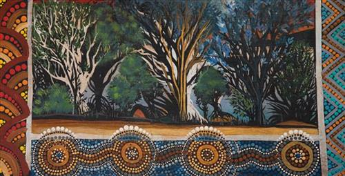
Untitled

Martumili Artists work with over three hundred artists from remote Martu Aboriginal communities, including Punmu, Parnngurr, Kunawarritji, Jigalong, Irrungadji (Nullagine), and Warralong, as well as from the Parnpajinya (Newman) gallery and studio spaces. Known for their diverse, energetic, and unmediated painting styles, their works reflect the dramatic geography and scale of their homelands. Each artist, however, brings a unique approach to their craft.

Younger Martu artists often start painting alongside their parents, grandparents, and extended family, which fosters an organic learning process. This not only involves mastering painting techniques but also understanding specific locations, family histories, traditional ways of life, bush tucker, and Jukurrpa (Dreaming). Over time, with encouragement from their peers, they develop their own distinct styles and explore unique painting techniques and subject matter. In this work the artist brings a contemporary, evolving perspective to their work.

377810582414451


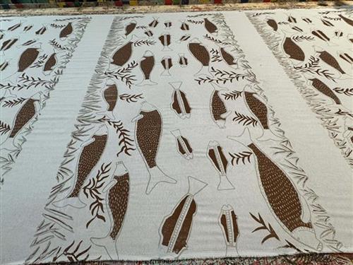
Murnun (dugong)

This design is murnun (dugong). Josephine grew up on the coastal area of Maningrida. She is a Kunibidji woman, a Gurgoni and Ndjébbana language speaker. 

‘In the olden times they used to go on canoe to look for murnun (dungong), fish (yokkara) ,turtle (makéddja) and stingray (marnan djupa (sp?)). They used a spear and net during the day and sometimes at night. The fishermen were mostly men. I remember my grandfather used to go hunting, that’s Joy’s (Garlbin)  father. HIs name was Jimmy. We used to go out with him on the boat to kill makéddja (turtle) and murnun (dugong) for yalaba (bush tucker). 


111582414450


Tuwa (sandhills)

“I do tuwa (sandhill) in my own style because that’s our Country. That’s a sandhill, that’s the Dreaming- the Jukurrpa. That’s our culture.

They stay there and we go through the sandhills at Puntawarri in the car. We go first tuwa, then the second tuwa, looking for the waterholes. Go up, up, up- ‘nother tuwa, ‘nother tuwa.

Long time [ago] in Puntawarri, when I was a little girl [with] my Nana and Pop [Dadda Samson (dec.) and Yanjimi Peter Rowlands (dec.)] we went climbing up the sandhill. And when I went up my Nana and Pop were at the bottom under a tree and I came down running then rolling, rolling right down to the ground! But I was ok- he right!”

– Judith Anya Samson

Puntawarri is an important cultural area located on the middle stretches of the Canning Stock Route and east of the Jigalong Mission (now Jigalong Aboriginal community), where Anya grew up with her grandmother and renowned Martumili Artist, Dadda Samson (dec.). Puntawarri is also the site of an abandoned community, a waterhole, creek and lake. Puntawarri’s close proximity to Jigalong Mission made it a popular site for Martu to visit during the ‘mission days’. While growing up at Jigalong Mission in the 1960’s, Dadda would return to Puntawarri every weekend to hunt and camp. 

For many Martu, like Anya’s family, Jigalong Mission was the site where their pujiman (traditional, desert dwelling) lifestyle came to an end from the late 1940s as they transitioned to a life as stockmen and women working in cattle stations in the Pilbara region and beyond. In the wake of the extreme and prolonged drought of the 1960s, the last of the remaining pujimanpa (desert dwellers) were forced to move to missions like Jigalong, where a supply of food and water was assured. There, many Martu were reunited with family members that had already moved in from the desert.

The traditional lands of the Martu people encompass the Great Sandy Desert and Rudall River regions of Western Australia, an enormous tract dominated by distinctive red tali, or tuwa (sandhills). These sandhills present an unforgiving landscape; sparse vegetation covers a seemingly never ending expanse of dunes, and yet these lands and the location of resources within them was known intimately by its pujiman inhabitants.